Bebside

Settlement in Northumberland

England

Bebside

Cemetery gates The entrance to Cowpen Cemetery.
Cemetery gates Credit: Richard Webb

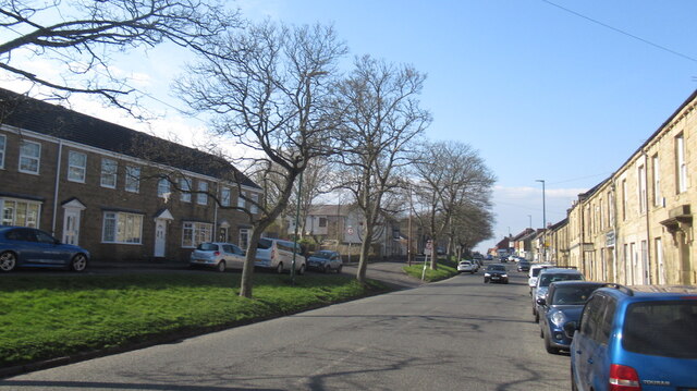
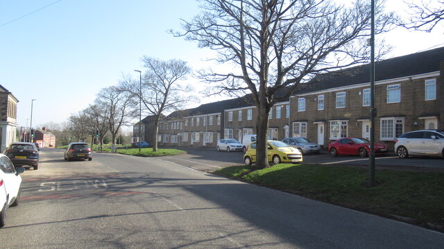
Bebside is a small village located in the county of Northumberland, England. Situated approximately 3 miles east of the town of Blyth, Bebside is nestled between the A189 road to the west and the River Blyth to the east. The village covers an area of around 0.6 square miles and has a population of just over 1,000 residents.

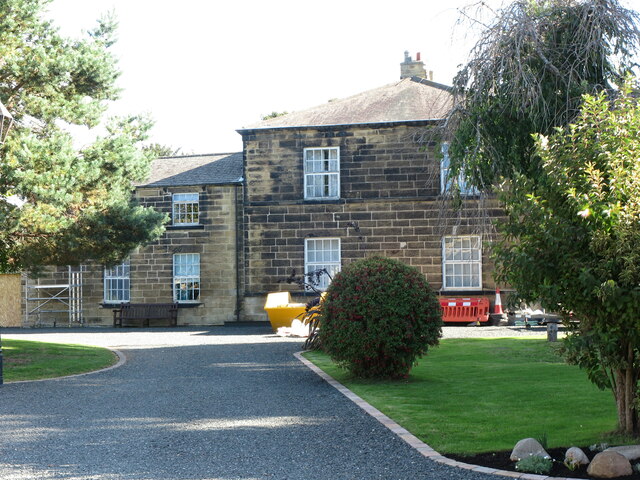
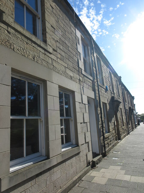
Bebside is known for its picturesque countryside, with rolling green hills and fields surrounding the village. The area is dotted with charming cottages and houses, giving it a quaint and rural feel. The village is primarily residential, with a mix of modern housing developments and older, traditional properties.

Despite its small size, Bebside benefits from its proximity to Blyth, which provides a range of amenities and services including shops, supermarkets, schools, and healthcare facilities. The village itself has a local pub, The Briardale, which serves as a popular gathering spot for residents.

The River Blyth, which borders Bebside to the east, offers opportunities for recreational activities such as fishing and boating. Additionally, the nearby coast provides stunning views and access to beautiful sandy beaches.

Transport links in Bebside are convenient, with the A189 road running through the village, connecting it to Blyth and other nearby towns. The village also has good bus connections, allowing residents to easily access surrounding areas.

Overall, Bebside is a charming and peaceful village, offering residents a close-knit community atmosphere, beautiful countryside, and convenient access to nearby amenities.

If you have any feedback on the listing, please let us know in the comments section below.
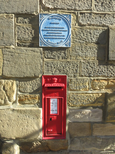
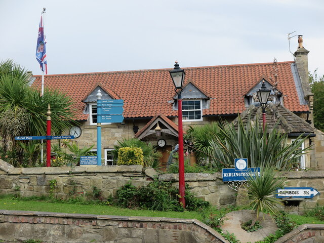
Bebside Images

Images are sourced within 2km of 55.125846/-1.559309 or Grid Reference NZ2881. Thanks to Geograph Open Source API. All images are credited.

Cemetery gates The entrance to Cowpen Cemetery.
Cemetery gates
The entrance to Cowpen Cemetery.
Ordnance Survey Cut Mark This OS cut mark can be found on the north face of Cowpen Cemetery Chapel. It marks a point 6.602m above mean sea level.
Ordnance Survey Cut Mark
This OS cut mark can be found on the north face of Cowpen Cemetery Chapel. It marks a point 6.602m above mean sea level.
A corner of Cowpen Cemetery
Chapels and Crematorium, Cowpen Cemetery The building housing the two chapels and crematorium in Cowpen Cemetery. The crematorium is the only one in Northumberland.
Chapels and Crematorium, Cowpen Cemetery
The building housing the two chapels and crematorium in Cowpen Cemetery. The crematorium is the only one in Northumberland.
Front Street East, Bedlington
Front Street East, Bedlington Taken from outside a hairdresser for dogs, looking towards Blyth.
Front Street East, Bedlington
Taken from outside a hairdresser for dogs, looking towards Blyth.
Power cables over the River Wansbeck They run from the North Sea Link Converter Station at East Sleekburn.
Power cables over the River Wansbeck
They run from the North Sea Link Converter Station at East Sleekburn.
Former Manager's House, Spring View, Bedlington This house, which is a Grade II Listed building, was once the home of the Manager of the Bedlington Iron Works which lay approximately 1 kilometre down stream. It was built in the early part of the 19th century of tooled-and-margined stone with a Welsh slate roof. It sits high above the River Blyth with excellent views eastwards.
Former Manager's House, Spring View, Bedlington
This house, which is a Grade II Listed building, was once the home of the Manager of the Bedlington Iron Works which lay approximately 1 kilometre down stream. It was built in the early part of the 19th century of tooled-and-margined stone with a Welsh slate roof. It sits high above the River Blyth with excellent views eastwards.
Victorian-Built Stone Terrace, Front Street East, Bedlington Whilst alterations have been made over time to this stretch of Front Street East, not least to the house nearest to the photographer which appears to have originally been a shop, the terrace retains much of its original charm.
Victorian-Built Stone Terrace, Front Street East, Bedlington
Whilst alterations have been made over time to this stretch of Front Street East, not least to the house nearest to the photographer which appears to have originally been a shop, the terrace retains much of its original charm.
Post Box, Front Street East, Bedlington This wall mounted box dating from the early part of the reign of Queen Victoria (1837-1901) is one of the oldest post boxes in Northumberland, and Bedlington is an important part of British postal history. The first adhesive stamp, the Penny Black, and the official stationery, the Mulready wrapper, came into official use on 6 May 1840, but had gone on sale on 1 May. On 2 May, a letter was sent to an A. W. Blenkinsop at the Bedlington Iron Works using a Mulready wrapper, making it the earliest known use of a pre-paid adhesive stamp in Britain. Ironically, Mr Blenkinsop had died 9 years earlier so the letter was forwarded, with a 4 May postmark to his family in Carlisle. Mulready stationery describes the postal stationery letter sheets and envelopes that were introduced as part of the British Post Office postal reforms of 1840. The Mulready name arises from the fact that William Mulready, a well-known artist of the time, was commissioned to illustrate the part of the letter sheets and envelopes which corresponded with the face area. The plaque above the post box forms part of the Bedlington Heritage Trail.
Post Box, Front Street East, Bedlington
This wall mounted box dating from the early part of the reign of Queen Victoria (1837-1901) is one of the oldest post boxes in Northumberland, and Bedlington is an important part of British postal history. The first adhesive stamp, the Penny Black, and the official stationery, the Mulready wrapper, came into official use on 6 May 1840, but had gone on sale on 1 May. On 2 May, a letter was sent to an A. W. Blenkinsop at the Bedlington Iron Works using a Mulready wrapper, making it the earliest known use of a pre-paid adhesive stamp in Britain. Ironically, Mr Blenkinsop had died 9 years earlier so the letter was forwarded, with a 4 May postmark to his family in Carlisle. Mulready stationery describes the postal stationery letter sheets and envelopes that were introduced as part of the British Post Office postal reforms of 1840. The Mulready name arises from the fact that William Mulready, a well-known artist of the time, was commissioned to illustrate the part of the letter sheets and envelopes which corresponded with the face area. The plaque above the post box forms part of the Bedlington Heritage Trail.
Entrance, Attlee Park, Bedlington The park, which forms part of the Bedlington Country Park and boasts this small stone and mosaic entrance, was named after Clement Richard Attlee, Labour Party Leader from 1935 to 1955, and Prime Minister between 1945 and 1951. For many years  the Northumberland Miners Picnic was held on a large grassed area close to this entrance.
Entrance, Attlee Park, Bedlington
The park, which forms part of the Bedlington Country Park and boasts this small stone and mosaic entrance, was named after Clement Richard Attlee, Labour Party Leader from 1935 to 1955, and Prime Minister between 1945 and 1951. For many years the Northumberland Miners Picnic was held on a large grassed area close to this entrance.
Bandstand, Attlee Park, Bedlington The bandstand occupies part of the large grassed area in Attlee Park which for many years hosted the Northumberland Miners Picnic. The bandstand was given a £60,000 makeover in 2014 with the colourful painted mural designed by young people from the area. The Wansbeck MP and former National Union of Mineworkers’ leader Ian Lavery, cut the red ribbon to officially open the refurbished bandstand on 21 June 2014.
Bandstand, Attlee Park, Bedlington
The bandstand occupies part of the large grassed area in Attlee Park which for many years hosted the Northumberland Miners Picnic. The bandstand was given a £60,000 makeover in 2014 with the colourful painted mural designed by young people from the area. The Wansbeck MP and former National Union of Mineworkers’ leader Ian Lavery, cut the red ribbon to officially open the refurbished bandstand on 21 June 2014.
Bedlington Bridge, Bedlington The original masonry bridge was replaced by a concrete slab and beam bridge in 1928, and in turn was modified when an arch was constructed in 1996.
Bedlington Bridge, Bedlington
The original masonry bridge was replaced by a concrete slab and beam bridge in 1928, and in turn was modified when an arch was constructed in 1996.
Weather Vane, Attlee Park Bandstand, Bedlington This very attractive weather vane sits on top of the Bandstand in Attlee Park <a title="https://www.geograph.org.uk/photo/7296805," href="https://www.geograph.org.uk/photo/7296805,">Link</a> and contains (appropriately) images of a miners lamp and a steam train with coal tender.
Weather Vane, Attlee Park Bandstand, Bedlington
This very attractive weather vane sits on top of the Bandstand in Attlee Park Link and contains (appropriately) images of a miners lamp and a steam train with coal tender.
River Blyth, Bedlington Country Park The River Blyth flows eastwards through southern Northumberland into the North Sea, and is 27 miles (44 km) long. At this point the river has just flowed beneath Bedlington Bridge <a title="https://www.geograph.org.uk/photo/7296811" href="https://www.geograph.org.uk/photo/7296811">Link</a>.
River Blyth, Bedlington Country Park
The River Blyth flows eastwards through southern Northumberland into the North Sea, and is 27 miles (44 km) long. At this point the river has just flowed beneath Bedlington Bridge Link.
Public Bridleway near Bedlington Bridge, Bedlington This public bridleway, which starts at Attlee Park <a title="https://www.geograph.org.uk/photo/7296800," href="https://www.geograph.org.uk/photo/7296800,">Link</a> follows the River Blyth downstream, to reach Furnace Bridge <a title="https://www.geograph.org.uk/photo/287924" href="https://www.geograph.org.uk/photo/287924">Link</a> and the site of the former Bedlington Iron Works after approximately 1 mile (1.58km).
Public Bridleway near Bedlington Bridge, Bedlington
This public bridleway, which starts at Attlee Park Link follows the River Blyth downstream, to reach Furnace Bridge Link and the site of the former Bedlington Iron Works after approximately 1 mile (1.58km).
House near Bedlington Bridge, Bedlington This rather eccentric property lies close to the entrance of the Bedlington Country Park, and is something of a surprise when passing this way. All of the signage, street furniture, clocks and other paraphernalia appear to bear little relevance to the property or its location.
House near Bedlington Bridge, Bedlington
This rather eccentric property lies close to the entrance of the Bedlington Country Park, and is something of a surprise when passing this way. All of the signage, street furniture, clocks and other paraphernalia appear to bear little relevance to the property or its location.
House near Bedlington Bridge, Bedlington When viewed from this angle, this house appears to be an ordinary two-storey stone-built property in a pleasant, partially wooded location. However, all is not what it seems when viewed head on from the south west and the entrance to the Bedlington Country Park <a title="https://www.geograph.org.uk/photo/7297536" href="https://www.geograph.org.uk/photo/7297536">Link</a>. To call it quirky is perhaps something of an understatement.
House near Bedlington Bridge, Bedlington
When viewed from this angle, this house appears to be an ordinary two-storey stone-built property in a pleasant, partially wooded location. However, all is not what it seems when viewed head on from the south west and the entrance to the Bedlington Country Park Link. To call it quirky is perhaps something of an understatement.
Show me another place!

Bebside is located at Grid Ref: NZ2881 (Lat: 55.125846, Lng: -1.559309)

Unitary Authority: Northumberland

Police Authority: Northumbria

What 3 Words

///earphones.dunes.palace. Near Bedlington, Northumberland

Nearby Locations

Bebside

Related Wikis

Bebside railway station

Bebside railway station was a railway station that served the village of Bebside in Northumberland, North East England from 1850 to 1964. It is proposed...

The Blyth Academy

The Blyth Academy is a mixed secondary school and sixth form located in Blyth, Northumberland, England. It was opened as Blyth Community College in 2000...

Bedlington Academy

Bedlington Academy (formerly Bedlingtonshire Community High School) is a coeducational secondary school and sixth form in Bedlington in the English county...

Cowpen

Cowpen is an area of Blyth and former civil parish, now in the parish of Blyth in the county of Northumberland, England. It is just east of the A189 road...

Nearby Amenities

Located within 500m of 55.125846,-1.559309
Bus: yes
Bus Bay: right
Public Transport: stop_position
Tactile Paving: yes
Lat/Long: 55.1272587/-1.5597196
Crossing
Crossing: traffic_signals
Crossing Ref: toucan
Lat/Long: 55.1275723/-1.554334
Give Way
Direction: forward
Lat/Long: 55.1253994/-1.552668
Bebside
Crossing Activation: automatic
Crossing Barrier: half
Crossing Light: yes
Railway: level_crossing
Lat/Long: 55.1275424/-1.5588188
Bebside
Place: village
Wikidata: Q659062
Lat/Long: 55.1266978/-1.5608237
Noexit: yes
Lat/Long: 55.1270427/-1.5559815
Crossing
Crossing: traffic_signals
Crossing Ref: toucan
Lat/Long: 55.1280267/-1.5552218
Crossing
Crossing: traffic_signals
Crossing Ref: toucan
Lat/Long: 55.1279314/-1.5551219
Crossing
Crossing: traffic_signals
Crossing Ref: toucan
Lat/Long: 55.1275659/-1.5543654
Post Box
Operator: Royal Mail
Postal Code: NE24 4JW
Ref: NE24 639
Lat/Long: 55.1265418/-1.5622224
Post Box
Postal Code: NE24 4LZ
Ref: NE24 700
Lat/Long: 55.1268588/-1.5544851
Motorway Junction
Lat/Long: 55.1250323/-1.5554416
Pharmacy
Asda Pharmacy
Addr City: Blyth
Addr Country: GB
Addr County: Northumberland
Addr Postcode: NE24 4LZ
Addr Street: Cowpen Road
Brand: Asda
Brand Wikidata: Q297410
Brand Wikipedia: en:Asda
Contact Phone: +44 1670 542710
Contact Website: https://storelocator.asda.com/north-east/blyth/cowpen-road/pharmacy
Operator: Asda Stores Ltd
Wheelchair: yes
Lat/Long: 55.1266747/-1.5551851
Green's Scaffolding Services LTD
Addr City: Blyth
Addr Country: GB
Addr Housename: Errington House
Addr Postcode: NE24 4HP
Addr Street: Errington Street
Addr Unit: 2
Contact Email: info@greenscaffolding.co.uk
Contact Phone: +44 1670 821385
Craft: scaffolder
Lat/Long: 55.1263372/-1.5613233
Marley Paul Smith Roofing Services LTD
Addr City: Blyth
Addr Country: GB
Addr Housename: Errington House
Addr Postcode: NE24 4HP
Addr Street: Errington Street
Addr Unit: 1
Contact Email: info@paulsmithroofing.co.uk
Contact Phone: +44 1670 828688
Craft: roofer
Lat/Long: 55.1264001/-1.5613414
Street Lamp
Lamp Type: led
Lat/Long: 55.1279288/-1.5558029
Cafe
Asda Cafe
Addr City: Blyth
Addr Country: GB
Addr County: Northumberland
Addr Postcode: NE24 4LZ
Addr Street: Cowpen Road
Brand: Asda
Brand Wikidata: Q297410
Brand Wikipedia: en:Asda
Contact Phone: +44 1670 540511
Contact Website: https://storelocator.asda.com/north-east/blyth/cowpen-road/cafe
Drinking Water Refill: yes
Drinking Water Refill Network: Refill
Fhrs Id: 451605
Internet Access: wlan
Internet Access Fee: no
Opening Hours Covid19: Mo-Su off
Operator: Asda Stores Ltd
Wheelchair: yes
Lat/Long: 55.1271353/-1.5545667
Bus Stop
Bebside, Interchange
Bench: yes
Bin: yes
Bus: yes
Departures Board: timetable
Naptan AtcoCode: 3100Z284815
Naptan CommonName: Interchange
Naptan Indicator: wb
Naptan Landmark: Asda
Naptan NaptanCode: nldgawpw
Naptan Street: A193 Cowpen Road
Naptan Verified: no
Public Transport: platform
Shelter: yes
Lat/Long: 55.1278122/-1.555632
Bus: yes
Bus Bay: left
Public Transport: stop_position
Lat/Long: 55.1278935/-1.5557477
Bus: yes
Bus Bay: left
Public Transport: stop_position
Lat/Long: 55.1280214/-1.5554978
Bus Stop
Interchange
Bench: yes
Bin: yes
Bus: yes
Departures Board: timetable
Naptan AtcoCode: 3100Z284816
Naptan CommonName: Interchange
Naptan Indicator: eb
Naptan Landmark: Asda
Naptan NaptanCode: nldatadw
Naptan Street: A193
Naptan Verified: no
Public Transport: platform
Shelter: yes
Lat/Long: 55.128098/-1.5555614
Noexit: yes
Lat/Long: 55.1259579/-1.5656931
Bus Stop
Heather Lea
Bench: yes
Bin: yes
Bus: yes
Naptan AtcoCode: 3100Z281815
Naptan CommonName: Heather Lea
Naptan Indicator: opp
Naptan Landmark: High House Farm
Naptan NaptanCode: nldgpjwt
Naptan Street: Front Street
Naptan Verified: no
Public Transport: platform
Shelter: yes
Tactile Paving: yes
Lat/Long: 55.1273233/-1.5597045
Bus: yes
Bus Bay: left
Public Transport: stop_position
Tactile Paving: yes
Lat/Long: 55.1272754/-1.5596654
Bus Stop
Heather Lea
Bench: yes
Bin: yes
Bus: yes
Naptan AtcoCode: 3100Z281814
Naptan CommonName: Heather Lea
Naptan Indicator: adj
Naptan Landmark: High House Farm
Naptan NaptanCode: nldgpmag
Naptan Street: Front Street
Naptan Verified: no
Public Transport: platform
Shelter: yes
Tactile Paving: yes
Lat/Long: 55.1271914/-1.5596643
Crossing
Crossing: unmarked
Lat/Long: 55.1275535/-1.5580709
Noexit: yes
Lat/Long: 55.1256942/-1.5654778
Noexit: yes
Lat/Long: 55.125937/-1.5643112
Brand: Asda
Brand Wikidata: Q297410
Brand Wikipedia: en:Asda
Contact Phone: +44 1670 719356
Contact Website: https://storelocator.asda.com/north-east/blyth/cowpen-road/opticians
Fixme: Location not accurate
Operator: Asda Stores Ltd
Shop: optician
Lat/Long: 55.1274161/-1.5547049
Bebside
Crossing Activation: automatic
Crossing Barrier: half
Crossing Light: yes
Railway: level_crossing
Lat/Long: 55.1275575/-1.55877
Direction: SSE
Generator Method: photovoltaic
Generator Output Electricity: yes
Generator Solar Modules: 10
Generator Source: solar
Generator Type: solar_photovoltaic_panel
Location: roof
Power: generator
Lat/Long: 55.1293491/-1.5555216
Direction: SSE
Generator Method: photovoltaic
Generator Output Electricity: yes
Generator Solar Modules: 7
Generator Source: solar
Generator Type: solar_photovoltaic_panel
Location: roof
Power: generator
Lat/Long: 55.1294128/-1.5552306
Direction: SSW
Generator Method: photovoltaic
Generator Output Electricity: yes
Generator Solar Modules: 7
Generator Source: solar
Generator Type: solar_photovoltaic_panel
Location: roof
Power: generator
Lat/Long: 55.1294365/-1.5550751
Direction: SSE
Generator Method: photovoltaic
Generator Output Electricity: yes
Generator Solar Modules: 7
Generator Source: solar
Generator Type: solar_photovoltaic_panel
Location: roof
Power: generator
Lat/Long: 55.1295623/-1.5557188
Direction: SSE
Generator Method: photovoltaic
Generator Output Electricity: yes
Generator Solar Modules: 10
Generator Source: solar
Generator Type: solar_photovoltaic_panel
Location: roof
Power: generator
Lat/Long: 55.1296374/-1.5553647
Direction: SSE
Generator Method: photovoltaic
Generator Output Electricity: yes
Generator Solar Modules: 10
Generator Source: solar
Generator Type: solar_photovoltaic_panel
Location: roof
Power: generator
Lat/Long: 55.1296175/-1.5554667
Direction: SSE
Generator Method: photovoltaic
Generator Output Electricity: yes
Generator Solar Modules: 12
Generator Source: solar
Generator Type: solar_photovoltaic_panel
Location: roof
Power: generator
Lat/Long: 55.1295945/-1.5555713
Direction: SSE
Generator Method: photovoltaic
Generator Output Electricity: yes
Generator Solar Modules: 18
Generator Source: solar
Generator Type: solar_photovoltaic_panel
Location: roof
Power: generator
Lat/Long: 55.1292517/-1.5559736
Direction: SSE
Generator Method: photovoltaic
Generator Output Electricity: yes
Generator Solar Modules: 12
Generator Source: solar
Generator Type: solar_photovoltaic_panel
Location: roof
Power: generator
Lat/Long: 55.1293859/-1.5565208
Direction: SSE
Generator Method: photovoltaic
Generator Output Electricity: yes
Generator Solar Modules: 10
Generator Source: solar
Generator Type: solar_photovoltaic_panel
Location: roof
Power: generator
Lat/Long: 55.1293276/-1.5568158
Direction: SSE
Generator Method: photovoltaic
Generator Output Electricity: yes
Generator Source: solar
Generator Type: solar_photovoltaic_panel
Location: roof
Power: generator
Lat/Long: 55.1259807/-1.5586156
Direction: SSE
Generator Method: photovoltaic
Generator Output Electricity: yes
Generator Solar Modules: 10
Generator Source: solar
Generator Type: solar_photovoltaic_panel
Location: roof
Power: generator
Lat/Long: 55.1294979/-1.5560554
Direction: SSE
Generator Method: photovoltaic
Generator Output Electricity: yes
Generator Solar Modules: 7
Generator Source: solar
Generator Type: solar_photovoltaic_panel
Location: roof
Power: generator
Lat/Long: 55.1294565/-1.5562123
Direction: SSE
Generator Method: photovoltaic
Generator Output Electricity: yes
Generator Source: solar
Generator Type: solar_photovoltaic_panel
Location: roof
Power: generator
Lat/Long: 55.1292226/-1.5561117
Direction: SSE
Generator Method: photovoltaic
Generator Output Electricity: yes
Generator Solar Modules: 8
Generator Source: solar
Generator Type: solar_photovoltaic_panel
Location: roof
Power: generator
Lat/Long: 55.1290754/-1.5568681
Direction: SSE
Generator Method: photovoltaic
Generator Output Electricity: yes
Generator Source: solar
Generator Type: solar_photovoltaic_panel
Location: roof
Power: generator
Lat/Long: 55.1290946/-1.5567407
Direction: SSE
Generator Method: photovoltaic
Generator Output Electricity: yes
Generator Solar Modules: 10
Generator Source: solar
Generator Type: solar_photovoltaic_panel
Location: roof
Power: generator
Lat/Long: 55.1291084/-1.556616
Street Lamp
Lat/Long: 55.1279436/-1.5562794
Street Lamp
Lat/Long: 55.1278585/-1.5564792
Bus Stop
Bus: yes
Naptan AtcoCode: 3100Z279814
Naptan NaptanCode: nldgpjwp
Public Transport: platform
Shelter: yes
Lat/Long: 55.1261542/-1.5634108
Bus Stop
Bench: no
Bus: yes
Public Transport: platform
Shelter: no
Lat/Long: 55.1260591/-1.5632738
Bebside
Historic Railway: station
Railway: site
Wikidata: Q28970486
Wikipedia: en:Bebside railway station
Lat/Long: 55.1273055/-1.5585969
Public Bookcase
Take One Leave One
Opening Hours: 24/7
Public Bookcase Type: wooden_cabinet
Lat/Long: 55.1265902/-1.5623254
Crossing
Crossing: unmarked
Lat/Long: 55.1278017/-1.5579178
Railway: crossing
Lat/Long: 55.1276063/-1.5588033
Railway: crossing
Lat/Long: 55.1275908/-1.5588518
Crossing
Crossing: unmarked
Lat/Long: 55.1274873/-1.5591737
Railway: crossing
Lat/Long: 55.1275094/-1.5587372
Railway: crossing
Lat/Long: 55.1274951/-1.5587857
Crossing
Crossing: unmarked
Lat/Long: 55.1273068/-1.5593196
Crossing
Crossing: unmarked
Lat/Long: 55.1256571/-1.5519223
Crossing
Crossing: unmarked
Lat/Long: 55.1256299/-1.5520316
Give Way
Direction: forward
Lat/Long: 55.1268836/-1.5607277
Give Way
Direction: forward
Lat/Long: 55.1264732/-1.5623493
Crossing
Crossing: unmarked
Lat/Long: 55.1254891/-1.5514711
Crossing
Crossing: unmarked
Lat/Long: 55.1255593/-1.5515081
Give Way
Direction: forward
Lat/Long: 55.125228/-1.5537711
Street Lamp
Lat/Long: 55.1278672/-1.5561875
Bicycle Parking
Bicycle Parking: stands
Covered: yes
Lat/Long: 55.1277257/-1.5555121
Give Way
Direction: forward
Lat/Long: 55.1252984/-1.5659222
Smoking Area
Bench: yes
Bin: yes
Shelter: yes
Lat/Long: 55.1276794/-1.5554853
The data included in this document is from www.openstreetmap.org. The data is made available under ODbL.

Have you been to Bebside?

Leave your review of Bebside below (or comments, questions and feedback).