Cerrig Duon

Coastal Marsh, Saltings in Caernarfonshire

Wales

Cerrig Duon

Gorsaf reilffordd Llandudno / Llandudno railway station
Gorsaf reilffordd Llandudno / Llandudno railway station Credit: Ceri Thomas

Cerrig Duon is a coastal marsh and saltings located in Caernarfonshire, a historic county in northwestern Wales. Nestled between the vibrant Irish Sea to the west and the majestic Snowdonia National Park to the east, it covers a vast expanse of approximately 500 acres.

This unique habitat is characterized by its diverse range of flora and fauna, making it a haven for wildlife enthusiasts and nature lovers. The marshland is composed of salt-tolerant grasses, reeds, and sedges, creating an intricate and delicate ecosystem. Its strategic location on the coast also attracts a variety of birds, including rare species such as the curlew, redshank, and lapwing.

Cerrig Duon is known for its rich biodiversity, with numerous species of insects, butterflies, and beetles thriving in its fertile soil. These insects serve as a vital food source for the birds that inhabit the area, contributing to the overall balance and health of the ecosystem.

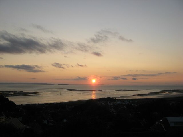
Visitors to Cerrig Duon can enjoy panoramic views of the surrounding landscape, with the rugged mountains of Snowdonia providing a majestic backdrop. Walking trails and birdwatching hides are available for those wishing to explore and observe the marshland's diverse wildlife.

As a protected area, Cerrig Duon is carefully managed to preserve its natural beauty and ecological significance. Conservation efforts focus on maintaining the delicate balance between human activity and the needs of the local wildlife, ensuring that future generations can continue to appreciate and cherish this unique coastal marsh and saltings.

If you have any feedback on the listing, please let us know in the comments section below.

Cerrig Duon Images

Images are sourced within 2km of 53.308009/-3.845422 or Grid Reference SH7780. Thanks to Geograph Open Source API. All images are credited.

Gorsaf reilffordd Llandudno / Llandudno railway station
Tweedledee and Tweedledum
Cysgodfan Penmorfa / West Shore shelter
Conwy Bay sunset A fine, clear sky for the first time in a couple of weeks made for a spectacular solar descent into terrain - and a reminder just how far the year  has advanced.
Conwy Bay sunset
A fine, clear sky for the first time in a couple of weeks made for a spectacular solar descent into terrain - and a reminder just how far the year has advanced.
Machlud dros Benmorfa / Sunset over West Shore
Conwy Quays Marina
Conwy Quays Marina
Conwy Quays Marina
Conwy Quays Marina
River Conwy shoreline at the Beacons The River Conway (Afon Conwy) rises on the Migneint Moors and flows northward for 27 miles to its mouth at Conwy.
Wikipedia: <span class="nowrap"><a title="http://en.wikipedia.org/wiki/River_Conwy" rel="nofollow ugc noopener" href="http://en.wikipedia.org/wiki/River_Conwy">Link</a><img style="margin-left:2px;" alt="External link" title="External link - shift click to open in new window" src="https://s1.geograph.org.uk/img/external.png" width="10" height="10"/></span>
River Conwy shoreline at the Beacons
The River Conway (Afon Conwy) rises on the Migneint Moors and flows northward for 27 miles to its mouth at Conwy. Wikipedia: LinkExternal link
River Conwy Looking across the River towards Deganwy.
River Conwy
Looking across the River towards Deganwy.
Conwy Sands at the mouth of the River Conwy The River Conway (Afon Conwy) rises on the Migneint Moors and flows northward for 27 miles to its mouth at Conwy.
Wikipedia: <span class="nowrap"><a title="http://en.wikipedia.org/wiki/River_Conwy" rel="nofollow ugc noopener" href="http://en.wikipedia.org/wiki/River_Conwy">Link</a><img style="margin-left:2px;" alt="External link" title="External link - shift click to open in new window" src="https://s1.geograph.org.uk/img/external.png" width="10" height="10"/></span>
Conwy Sands at the mouth of the River Conwy
The River Conway (Afon Conwy) rises on the Migneint Moors and flows northward for 27 miles to its mouth at Conwy. Wikipedia: LinkExternal link
Walking on Conwy Sands The River Conway (Afon Conwy) rises on the Migneint Moors and flows northward for 27 miles to its mouth at Conwy.
Wikipedia: <span class="nowrap"><a title="http://en.wikipedia.org/wiki/River_Conwy" rel="nofollow ugc noopener" href="http://en.wikipedia.org/wiki/River_Conwy">Link</a><img style="margin-left:2px;" alt="External link" title="External link - shift click to open in new window" src="https://s1.geograph.org.uk/img/external.png" width="10" height="10"/></span>
Walking on Conwy Sands
The River Conway (Afon Conwy) rises on the Migneint Moors and flows northward for 27 miles to its mouth at Conwy. Wikipedia: LinkExternal link
Conwy Sands at the mouth of the River Conwy The River Conway (Afon Conwy) rises on the Migneint Moors and flows northward for 27 miles to its mouth at Conwy.
Wikipedia: <span class="nowrap"><a title="http://en.wikipedia.org/wiki/River_Conwy" rel="nofollow ugc noopener" href="http://en.wikipedia.org/wiki/River_Conwy">Link</a><img style="margin-left:2px;" alt="External link" title="External link - shift click to open in new window" src="https://s1.geograph.org.uk/img/external.png" width="10" height="10"/></span>
Conwy Sands at the mouth of the River Conwy
The River Conway (Afon Conwy) rises on the Migneint Moors and flows northward for 27 miles to its mouth at Conwy. Wikipedia: LinkExternal link
Conwy Sands and the River Conwy The River Conway (Afon Conwy) rises on the Migneint Moors and flows northward for 27 miles to its mouth at Conwy.
Wikipedia: <span class="nowrap"><a title="http://en.wikipedia.org/wiki/River_Conwy" rel="nofollow ugc noopener" href="http://en.wikipedia.org/wiki/River_Conwy">Link</a><img style="margin-left:2px;" alt="External link" title="External link - shift click to open in new window" src="https://s1.geograph.org.uk/img/external.png" width="10" height="10"/></span>
Conwy Sands and the River Conwy
The River Conway (Afon Conwy) rises on the Migneint Moors and flows northward for 27 miles to its mouth at Conwy. Wikipedia: LinkExternal link
Shoreline at Conwy Sands
Old sea defences at Conwy Morfa
West Shore, Llandudno
West Beach, Llandudno With the Great Orme in the background.
West Beach, Llandudno
With the Great Orme in the background.
The Vadre, Deganwy A volcanic plug upon which Deganwy Castle once stood.
The Vadre, Deganwy
A volcanic plug upon which Deganwy Castle once stood.
Show me another place!

Cerrig Duon is located at Grid Ref: SH7780 (Lat: 53.308009, Lng: -3.845422)

Unitary Authority: Conwy

Police Authority: North Wales

What 3 Words

///haggling.either.embellish. Near Deganwy, Conwy

Nearby Locations

Cerrig Duon Tremlyd Point

Related Wikis

River Conwy

The River Conwy (Welsh pronunciation: [ˈkɔnʊɨ]; Welsh: Afon Conwy) is a river in north Wales. From its source to its discharge in Conwy Bay it is 55 kilometres...

Llandudno General Hospital

Llandudno General Hospital (Welsh: Ysbyty Cyffredinol Llandudno) is a general hospital in Llandudno, Wales. It is managed by the Betsi Cadwaladr University...

Maesdu Park

Maesdu Park (known as OPS Wind Arena for sponsorship reasons) is a multi-sport stadium in Llandudno, Wales. It is currently used mostly for football matches...

Llandudno F.C.

Llandudno Football Club (Welsh: Clwb Pêl-droed Llandudno) is a Welsh football club that currently play in the Cymru North. == History == Football in...

Nearby Amenities

Located within 500m of 53.308009,-3.845422
Source: PGS
Lat/Long: 53.3119754/-3.843485
Source: PGS
Lat/Long: 53.3114607/-3.843493
Source: PGS
Lat/Long: 53.3109801/-3.843465
Source: PGS
Lat/Long: 53.3102637/-3.843481
Source: PGS
Lat/Long: 53.309766/-3.843543
Source: PGS
Lat/Long: 53.3092912/-3.8437169
Source: PGS
Lat/Long: 53.3090644/-3.8439784
Source: PGS
Lat/Long: 53.3088429/-3.844772
Source: PGS
Lat/Long: 53.3087193/-3.8433552
Source: PGS
Lat/Long: 53.3086792/-3.8433401
Source: PGS
Lat/Long: 53.3085529/-3.8432022
Source: PGS
Lat/Long: 53.3083567/-3.842963
Source: PGS
Lat/Long: 53.308131/-3.8426585
Source: PGS
Lat/Long: 53.3078727/-3.8421077
Source: PGS
Lat/Long: 53.307488/-3.8416792
Source: PGS
Lat/Long: 53.3072836/-3.8415019
Source: PGS
Lat/Long: 53.3070921/-3.8413119
Source: PGS
Lat/Long: 53.30677/-3.8410814
Source: PGS
Lat/Long: 53.3062621/-3.840734
Source: PGS
Lat/Long: 53.3055073/-3.8403014
Source: PGS
Lat/Long: 53.3049724/-3.8400856
Cerrig Duon
Natural: rock
Lat/Long: 53.3086019/-3.8448243
Golf: pin
Lat/Long: 53.3074627/-3.8404148
Golf: pin
Lat/Long: 53.309886/-3.8422963
Golf: pin
Lat/Long: 53.3100719/-3.8416647
Golf: pin
Lat/Long: 53.3074513/-3.8392245
Golf: pin
Lat/Long: 53.3103406/-3.8411038
Golf: pin
Lat/Long: 53.3117238/-3.8415546
The data included in this document is from www.openstreetmap.org. The data is made available under ODbL.

Have you been to Cerrig Duon?

Leave your review of Cerrig Duon below (or comments, questions and feedback).