Ferryton Point

Coastal Marsh, Saltings in Cromartyshire

Scotland

Ferryton Point

Drilling Rig anchored in the Cromarty Firth Late afternoon looking West
Drilling Rig anchored in the Cromarty Firth Credit: murdoch sutherland

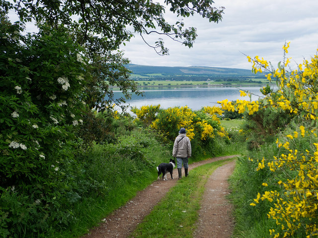
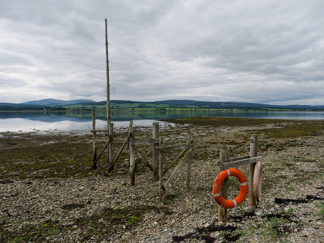
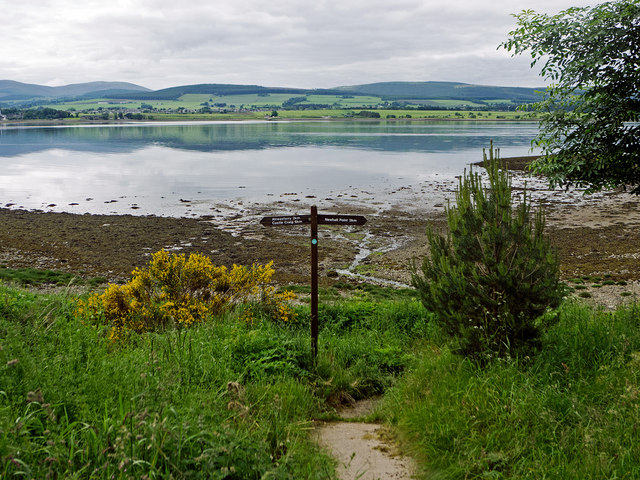
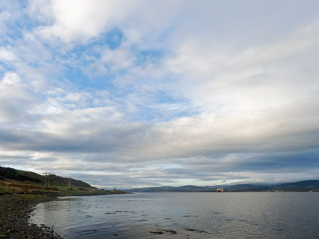
Ferryton Point, located in the coastal marshes of Cromartyshire, is a stunning natural landscape renowned for its unique blend of coastal features and diverse wildlife. Situated on the eastern coast of Scotland, this area falls within the larger region of the Cromarty Firth, offering visitors an enchanting experience.

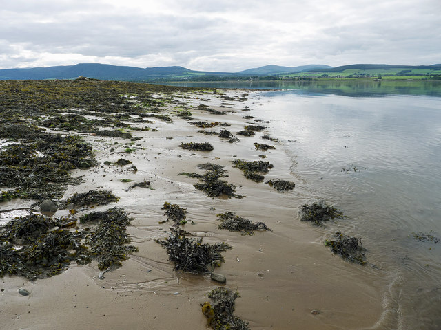
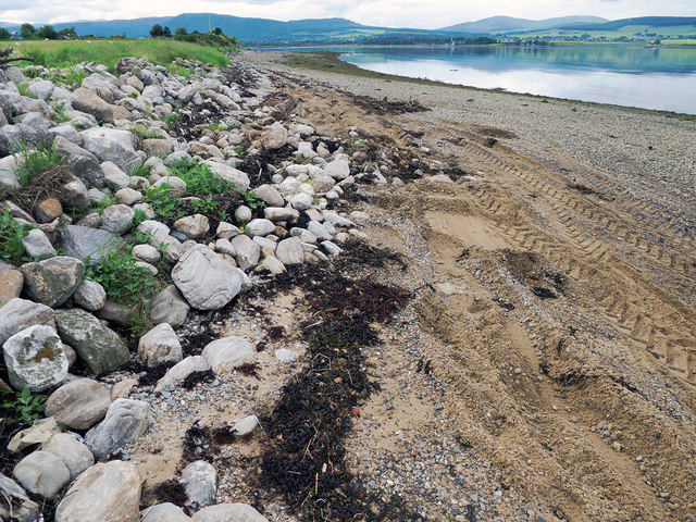
The main attraction of Ferryton Point is its picturesque saltings, which are expansive tidal marshes that stretch along the coast. These saltings serve as a crucial habitat for a wide range of plant and animal species, including various types of grasses, reeds, and wildflowers. Birdwatchers flock to this area as it is home to a rich bird population, with species such as curlews, oystercatchers, and plovers frequently spotted among the saltings.

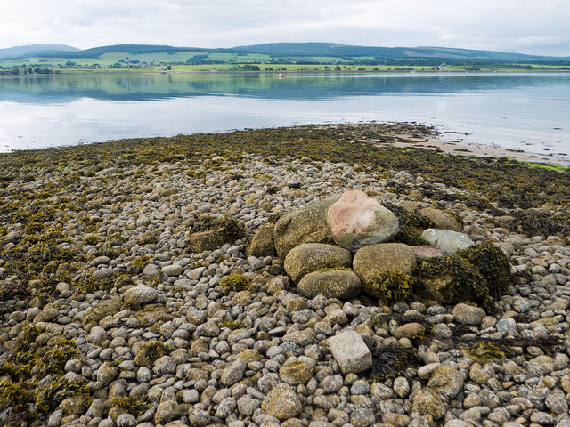
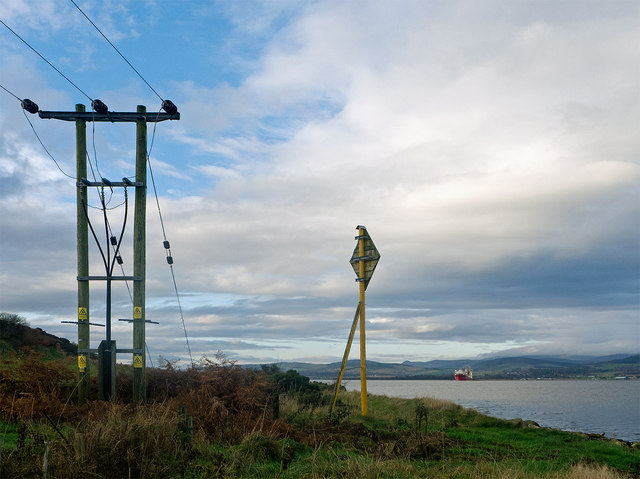
In addition to its ecological significance, Ferryton Point provides breathtaking views of the surrounding landscape. Visitors can enjoy panoramic vistas of the Cromarty Firth, with its tranquil waters and rolling hills in the background. The area is also known for its sandy beaches, where beachcombers can uncover an array of seashells and other marine treasures.

For those interested in history, Ferryton Point offers a fascinating glimpse into the past. The remains of an ancient Pictish settlement can be found nearby, reminding visitors of the area's long and storied history.

Overall, Ferryton Point is an idyllic coastal marshland that showcases the natural beauty and ecological diversity of Cromartyshire. Whether one is a nature enthusiast, a history buff, or simply seeking a peaceful escape, this captivating destination has something to offer for everyone.

If you have any feedback on the listing, please let us know in the comments section below.

Ferryton Point Images

Images are sourced within 2km of 57.674187/-4.2145031 or Grid Reference NH6867. Thanks to Geograph Open Source API. All images are credited.

Drilling Rig anchored in the Cromarty Firth Late afternoon looking West
Drilling Rig anchored in the Cromarty Firth
Late afternoon looking West
Slipway in early spring sunshine
Belleport Pier - disused
Belleport Pier, near Invergordon
Drive to Store House at Ferryton Point The drive provides the link to the waymarked route along the Cromarty Firth coastline of the Black Isle.
Drive to Store House at Ferryton Point
The drive provides the link to the waymarked route along the Cromarty Firth coastline of the Black Isle.
Near Ferryton Point Maybe this is the jetty marked on the maps.  It is the only structure on the beach.  If it is, this is the historic spot where travellers used the ferry at Ferryton Point to travel north across the Cromarty Firth.
Near Ferryton Point
Maybe this is the jetty marked on the maps. It is the only structure on the beach. If it is, this is the historic spot where travellers used the ferry at Ferryton Point to travel north across the Cromarty Firth.
Linking path to the shore by Ferryton Point The stretch of coast between Castle Craig and Newhall Point has a set of waymarkers although there is no footpath - just a coast to follow.  The watymarkers show where you can leave the coast and head back inland.
Linking path to the shore by Ferryton Point
The stretch of coast between Castle Craig and Newhall Point has a set of waymarkers although there is no footpath - just a coast to follow. The watymarkers show where you can leave the coast and head back inland.
Pile of stones on Ferryton Point Carefully arranged stones, but no reason for this mini-cairn was evident.  Only the top of this ridge was clear of seaweed.
Pile of stones on Ferryton Point
Carefully arranged stones, but no reason for this mini-cairn was evident. Only the top of this ridge was clear of seaweed.
Sand and seaweed at Ferryton Point Firm mud was easier to walk on than either the seaweed or the slippery shingle shore.
Sand and seaweed at Ferryton Point
Firm mud was easier to walk on than either the seaweed or the slippery shingle shore.
Rudimentary sea wall at Ferryton A few stones to delineate the land from the realm of the sea.  However a tractor with scoop was at work improving them while I walked the shore - witnessed by the tractor tyre marks.
Rudimentary sea wall at Ferryton
A few stones to delineate the land from the realm of the sea. However a tractor with scoop was at work improving them while I walked the shore - witnessed by the tractor tyre marks.
B817 heading east Towards Invergordon.
B817 heading east
Towards Invergordon.
Cottage at Resolis
Cottage at Resolis
Mud, sea and Oil Rigs Cromarty Firth near Rosskeen.
Mud, sea and Oil Rigs
Cromarty Firth near Rosskeen.
Alness - 1999 Alness, Highland Council, Ross and Cromarty, A9, Alness Bay, Cromarty Firth
Alness - 1999
Alness, Highland Council, Ross and Cromarty, A9, Alness Bay, Cromarty Firth
Where the high voltage cable crosses the Cromarty Firth The Black Isle is electrically connected to the National Grid by a subsea cable from Alness.  It comes ashore close to Alnessferry.  The cable sign and first small pylon lie beside each other.
Where the high voltage cable crosses the Cromarty Firth
The Black Isle is electrically connected to the National Grid by a subsea cable from Alness. It comes ashore close to Alnessferry. The cable sign and first small pylon lie beside each other.
Cromarty Firth near Alnessferry It is quite tiring walking on the slippery surface of the foreshore along this coast.
Cromarty Firth near Alnessferry
It is quite tiring walking on the slippery surface of the foreshore along this coast.
November Evening on the Cromarty Firth, Scotland A view of the Cromarty Firth from near Invergordon.
November Evening on the Cromarty Firth, Scotland
A view of the Cromarty Firth from near Invergordon.
View into the Cromarty Firth An image taken from a train heading towards Thurso and Wick on the Far North Line, and thus in need of extensive stewing in Photoshop to produce anything usable. The Far North Line offers good views of the Cromarty Firth, and northern Scotland in general. An oil rig, presumably undergoing maintenance at Invergordon can be seen in the middle distance, with snow covered hills in the Black Isle beyond.
View into the Cromarty Firth
An image taken from a train heading towards Thurso and Wick on the Far North Line, and thus in need of extensive stewing in Photoshop to produce anything usable. The Far North Line offers good views of the Cromarty Firth, and northern Scotland in general. An oil rig, presumably undergoing maintenance at Invergordon can be seen in the middle distance, with snow covered hills in the Black Isle beyond.
Show me another place!

Ferryton Point is located at Grid Ref: NH6867 (Lat: 57.674187, Lng: -4.2145031)

Unitary Authority: Highland

Police Authority: Highlands and Islands

What 3 Words

///increases.runners.expensive. Near Invergordon, Highland

Nearby Locations

Ferryton Point

Related Wikis

Rosskeen

Rosskeen is a parish in Ross and Cromarty on the Cromarty Firth in northern Scotland, containing the settlements of Invergordon, Bridgend and Saltburn...
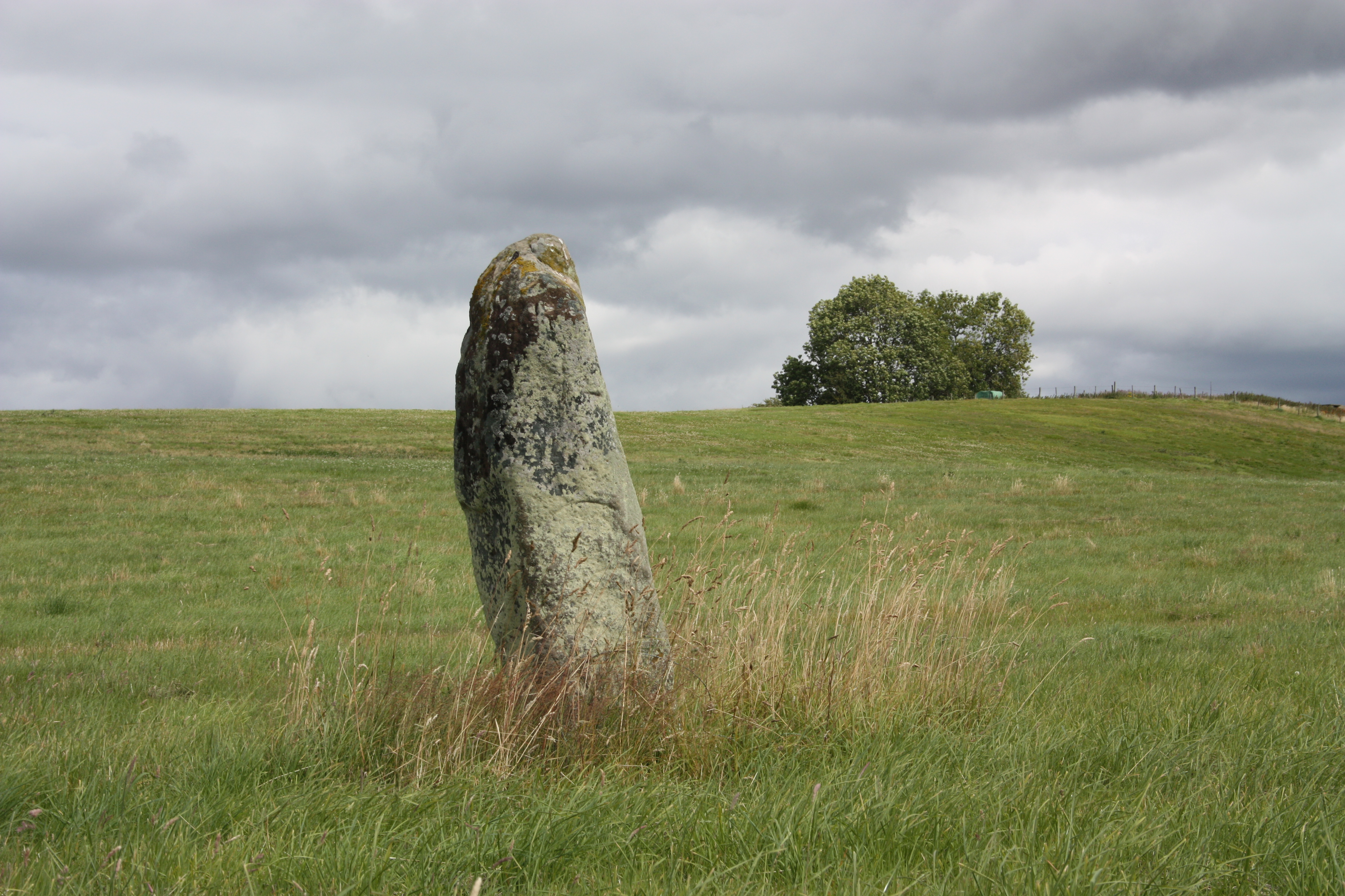
Clach a' Mheirlich

The Clach a' Mheirlich (literally, the "Thief's stone") or Rosskeen Stone is a standing stone in a field near Rosskeen, Easter Ross, Scotland. The stone...
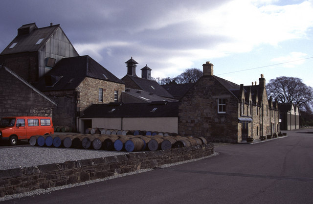
Dalmore distillery

Dalmore distillery is located in Alness, Scotland, 20 miles (32 km) north of Inverness. It sits on the banks of the Cromarty Firth overlooking the Black...

River Averon

The River Averon is a river in Easter Ross, north-east Scotland that flows into the Cromarty Firth from the north. It is also known as the River Alness...

Nearby Amenities

Located within 500m of 57.674187,-4.2145031
Source: PGS
Lat/Long: 57.6724489/-4.2071988
Source: PGS
Lat/Long: 57.6724975/-4.2076415
Source: PGS
Lat/Long: 57.6725797/-4.2083253
Source: PGS
Lat/Long: 57.6727942/-4.2088779
Source: PGS
Lat/Long: 57.6730427/-4.2100044
Source: PGS
Lat/Long: 57.6734098/-4.2114045
Source: PGS
Lat/Long: 57.6735676/-4.2122843
Source: PGS
Lat/Long: 57.6737275/-4.2129385
Source: PGS
Lat/Long: 57.6739735/-4.2139025
Source: PGS
Lat/Long: 57.6741163/-4.2146285
Source: PGS
Lat/Long: 57.6733429/-4.2157282
Source: PGS
Lat/Long: 57.6733782/-4.2165989
Source: PGS
Lat/Long: 57.673028/-4.2175629
Source: PGS
Lat/Long: 57.6729045/-4.2186455
Source: PGS
Lat/Long: 57.6726395/-4.2195925
Source: PGS
Lat/Long: 57.6723186/-4.220413
Source: PGS
Lat/Long: 57.6720069/-4.2211517
Source: PGS
Lat/Long: 57.6719664/-4.2218115
The data included in this document is from www.openstreetmap.org. The data is made available under ODbL.

Have you been to Ferryton Point?

Leave your review of Ferryton Point below (or comments, questions and feedback).