Carrick Neck

Coastal Marsh, Saltings in Kirkcudbrightshire

Scotland

Carrick Neck

Inlet, Knockbrex Bay Rock outcrops, almost covered by turf, at the side of an inlet on Knockbrex Bay. Knockbrex House can be seen over the coastal fields.
Inlet, Knockbrex Bay Credit: Jonathan Wilkins

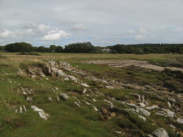
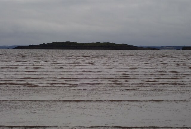
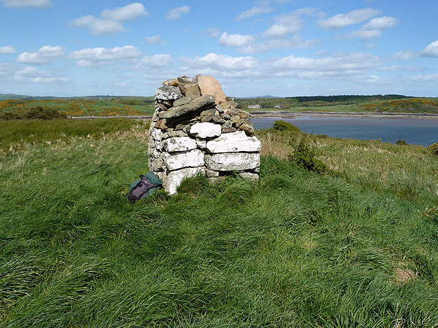
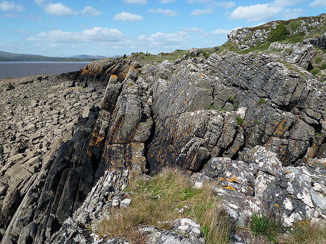
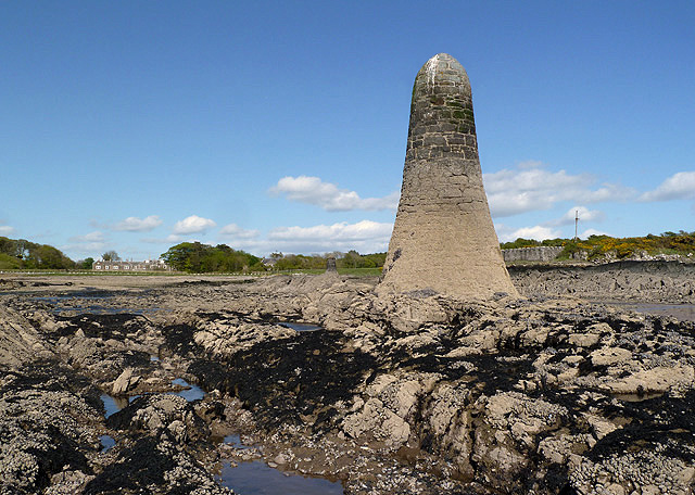
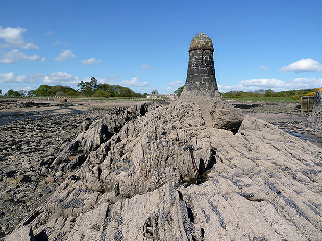
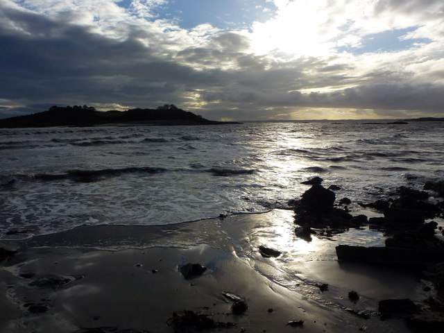
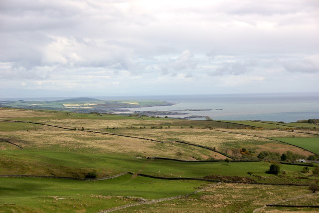
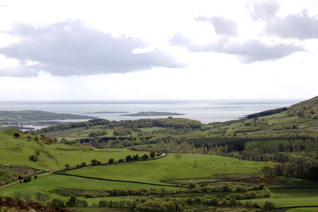
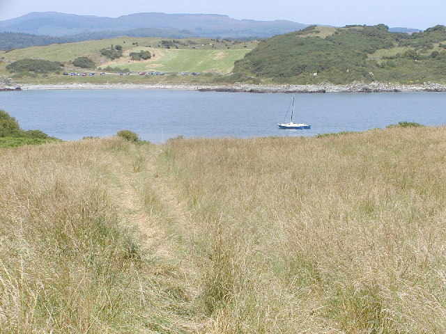
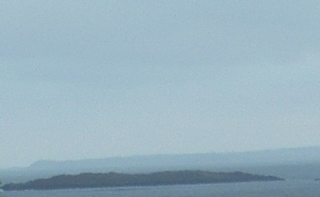
Carrick Neck is a coastal marsh and saltings located in Kirkcudbrightshire, Scotland. Nestled between the towns of Kirkcudbright and Gatehouse of Fleet, this area is renowned for its stunning natural beauty and diverse ecosystem.

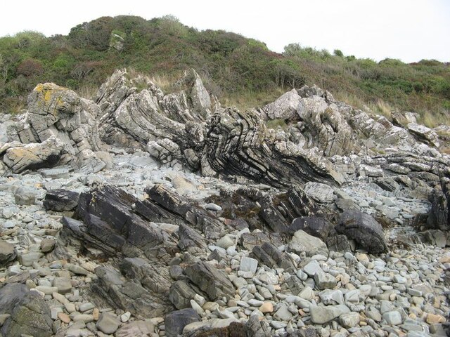
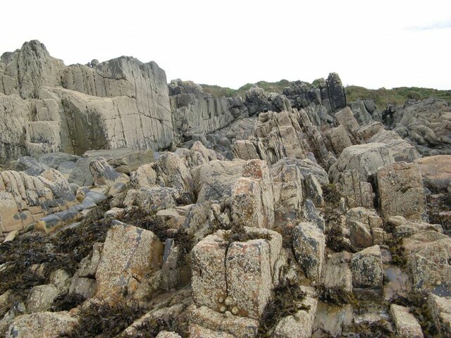
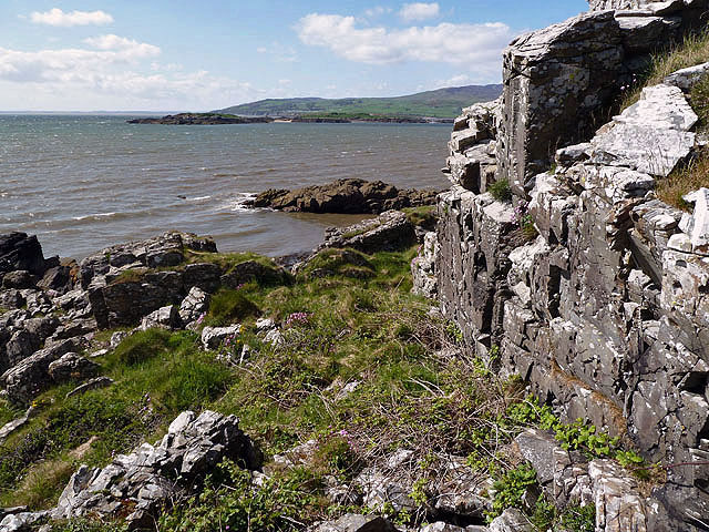
The marshland stretches across an area of approximately 2 square kilometers and is characterized by its low-lying, flat terrain. It is intersected by several small channels and creeks that meander through the landscape, creating a labyrinthine network of waterways. These channels are influenced by the tidal movements of the nearby Irish Sea, resulting in a dynamic and ever-changing environment.

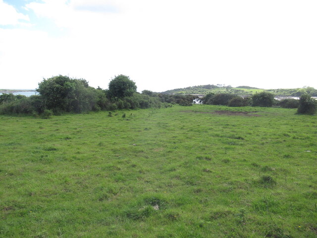
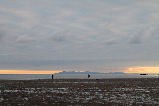
Carrick Neck's unique geographical features make it a haven for a wide variety of plant and animal species. The marshland is home to numerous salt-tolerant plants, such as sea lavender, glasswort, and cordgrass, which thrive in the saline conditions. These plants, in turn, provide a valuable habitat for many bird species, including oystercatchers, redshanks, and curlews. It is also a popular spot for birdwatchers, who come to observe the migratory patterns of various wading birds.

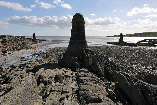
Due to its ecological significance, Carrick Neck is protected as a Site of Special Scientific Interest (SSSI) and forms part of the wider Fleet Valley National Scenic Area. It offers opportunities for leisure activities such as walking, nature photography, and wildlife observation. The marshland's tranquil atmosphere and picturesque landscapes make it a popular destination for both locals and tourists seeking a peaceful escape in nature.

If you have any feedback on the listing, please let us know in the comments section below.

Carrick Neck Images

Images are sourced within 2km of 54.830877/-4.2186439 or Grid Reference NX5750. Thanks to Geograph Open Source API. All images are credited.

Inlet, Knockbrex Bay Rock outcrops, almost covered by turf, at the side of an inlet on Knockbrex Bay. Knockbrex House can be seen over the coastal fields.
Inlet, Knockbrex Bay
Rock outcrops, almost covered by turf, at the side of an inlet on Knockbrex Bay. Knockbrex House can be seen over the coastal fields.
Folded strata Rock outcrops on the shore are bedded greywackes belonging to the Kirkmaiden Formation, of Silurian (Llandovery) age. Their hardness and resistance to erosion is due to their state of metamorphism through deep burial during continental collision. The folding demonstrated here was caused by differential movement along faults separating adjacent slices of sediments as they were scraped off a descending oceanic plate (an "accretionary prism").
Folded strata
Rock outcrops on the shore are bedded greywackes belonging to the Kirkmaiden Formation, of Silurian (Llandovery) age. Their hardness and resistance to erosion is due to their state of metamorphism through deep burial during continental collision. The folding demonstrated here was caused by differential movement along faults separating adjacent slices of sediments as they were scraped off a descending oceanic plate (an "accretionary prism").
Upright strata Large areas of the foreshore here comprise vertically disposed beds of Silurian greywacke which show only gentle folding. See also <a href="https://www.geograph.org.uk/photo/6968175">NX5749 : Folded strata</a> for an interpretation of the disposition and nature of the rocks here.
Upright strata
Large areas of the foreshore here comprise vertically disposed beds of Silurian greywacke which show only gentle folding. See also NX5749 : Folded strata for an interpretation of the disposition and nature of the rocks here.
Coastal pasture, Knockbrex
Murray's Isle South Taken far out from Carrick Bay, at the turn of a Spring Low Tide, late on a September evening 2023. The predicted tide height for low water was 1.8m. It was possible to walk further out to the isle although slightly deeper than my wellingtons would allow.
Murray's Isle South
Taken far out from Carrick Bay, at the turn of a Spring Low Tide, late on a September evening 2023. The predicted tide height for low water was 1.8m. It was possible to walk further out to the isle although slightly deeper than my wellingtons would allow.
Low tide near Ardwall Isle Two men on the east side of Ardwall Isle were taking advantage of an evening low tide to collect some whelks.
Low tide near Ardwall Isle
Two men on the east side of Ardwall Isle were taking advantage of an evening low tide to collect some whelks.
Unused gate Unused gate on the Knockbrex Estate.
Unused gate
Unused gate on the Knockbrex Estate.
Ardwall Isle This is at the southwest corner of the small tidal island in Wigtown Bay looking over to Murray’s Isles.
Ardwall Isle
This is at the southwest corner of the small tidal island in Wigtown Bay looking over to Murray’s Isles.
Navigation pillars at Knockbrex Bay Three pillars in the bay act as navigation markers for a small harbour at Knockbrex. This was viewed at low tide.
Navigation pillars at Knockbrex Bay
Three pillars in the bay act as navigation markers for a small harbour at Knockbrex. This was viewed at low tide.
A cairn on Ardwall Isle The cairn at 34m marks the high spot of this small tidal island in Wigtown Bay.
A cairn on Ardwall Isle
The cairn at 34m marks the high spot of this small tidal island in Wigtown Bay.
Ardwall Isle This is at the southwest edge of this small tidal island in Wigtown Bay at low tide.
Ardwall Isle
This is at the southwest edge of this small tidal island in Wigtown Bay at low tide.
A navigation pillar at Knockbrex Bay This is one of three pillars that act as navigation markers for a small harbour at Knockbrex. For a view of all three pillars, see <a href="https://www.geograph.org.uk/photo/3507589">NX5849 : Navigation pillars at Knockbrex Bay</a>.
A navigation pillar at Knockbrex Bay
This is one of three pillars that act as navigation markers for a small harbour at Knockbrex. For a view of all three pillars, see NX5849 : Navigation pillars at Knockbrex Bay.
A navigation pillar at Knockbrex Bay This is one of three pillars that act as navigation markers for a small harbour at Knockbrex. The harbour is just out of shot to the right. For a view of all three pillars, see <a href="https://www.geograph.org.uk/photo/3507589">NX5849 : Navigation pillars at Knockbrex Bay</a>.
A navigation pillar at Knockbrex Bay
This is one of three pillars that act as navigation markers for a small harbour at Knockbrex. The harbour is just out of shot to the right. For a view of all three pillars, see NX5849 : Navigation pillars at Knockbrex Bay.
Looking towards Ardwall Isle at dusk
Distant view of the Islands of Fleet From Cairnholy Hill
Distant view of the Islands of Fleet
From Cairnholy Hill
Islands of Fleet From the summit of Doon Hill.
Islands of Fleet
From the summit of Doon Hill.
Carrick, from Ardwall Carrick Bay from Ardwall Island. View is more or less due north.
Carrick, from Ardwall
Carrick Bay from Ardwall Island. View is more or less due north.
Murray's Isle South
Murray's Isle South
Show me another place!

Carrick Neck is located at Grid Ref: NX5750 (Lat: 54.830877, Lng: -4.2186439)

Unitary Authority: Dumfries and Galloway

Police Authority: Dumfries and Galloway

What 3 Words

///observe.instructs.tasters. Near Kirkcudbright, Dumfries & Galloway

Related Wikis

Water of Fleet

The Water of Fleet is a river in Scotland flowing into Fleet Bay on the Solway Firth. Its two tributaries are the Big Water of Fleet, which begins around...

Corseyard Farm

Corseyard Farm, known locally as the Coo Palace and now marketed under that name, is an architecturally unusual dairy farm near Kirkandrews in Scotland...

Plunton Castle

Plunton Castle is a ruined L-plan tower house between Kirkandrews and Gatehouse of Fleet in Dumfries and Galloway, Scotland. Built around 1575 for the...

Islands of Fleet

The Islands of Fleet are a group of small islands in Galloway, Scotland. They are in Fleet Bay, which is part of Wigtown Bay, and is in turn part of the...

Nearby Amenities

Located within 500m of 54.830877,-4.2186439
Source: PGS
Lat/Long: 54.8346089/-4.2149201
Source: PGS
Lat/Long: 54.8339503/-4.2152676
Source: PGS
Lat/Long: 54.8338279/-4.2155922
Source: PGS
Lat/Long: 54.8339962/-4.2162102
Source: PGS
Lat/Long: 54.833816/-4.2163712
Source: PGS
Lat/Long: 54.8336003/-4.2162215
Source: PGS
Lat/Long: 54.8329509/-4.2164265
Source: PGS
Lat/Long: 54.8317931/-4.2174669
Source: PGS
Lat/Long: 54.8312258/-4.2176424
Source: PGS
Lat/Long: 54.8308534/-4.2183449
Source: PGS
Lat/Long: 54.8306641/-4.2181512
Source: PGS
Lat/Long: 54.8305466/-4.2185245
Source: PGS
Lat/Long: 54.8305151/-4.2192132
Source: PGS
Lat/Long: 54.8302984/-4.2196772
Source: PGS
Lat/Long: 54.8296709/-4.2201692
Source: PGS
Lat/Long: 54.8291959/-4.2211259
Source: PGS
Lat/Long: 54.8289821/-4.2210374
Source: PGS
Lat/Long: 54.8292337/-4.2204199
Source: PGS
Lat/Long: 54.829428/-4.2197939
Source: PGS
Lat/Long: 54.8296508/-4.2190567
Source: PGS
Lat/Long: 54.8302497/-4.2180505
Source: PGS
Lat/Long: 54.8304129/-4.2176801
Source: PGS
Lat/Long: 54.8303082/-4.2171802
Source: PGS
Lat/Long: 54.8302122/-4.2168541
Source: PGS
Lat/Long: 54.8300797/-4.2165645
Source: PGS
Lat/Long: 54.8298663/-4.2164372
Source: PGS
Lat/Long: 54.8296557/-4.2163097
Source: PGS
Lat/Long: 54.8294413/-4.2164777
Source: PGS
Lat/Long: 54.8293283/-4.2175222
Source: PGS
Lat/Long: 54.8289538/-4.2172932
Source: PGS
Lat/Long: 54.8287161/-4.2171586
Source: PGS
Lat/Long: 54.8282381/-4.2176225
Source: PGS
Lat/Long: 54.8277532/-4.2183653
Source: PGS
Lat/Long: 54.8275044/-4.2184796
Source: PGS
Lat/Long: 54.8270535/-4.21899
Carrick
Place: hamlet
Lat/Long: 54.8307984/-4.2150778
Carrick Point
Place: locality
Lat/Long: 54.8292219/-4.2207681
Carrick Bay
Natural: bay
Lat/Long: 54.8297707/-4.217882
Power: pole
Lat/Long: 54.8314556/-4.211035
Power: pole
Lat/Long: 54.8310874/-4.2118981
Power: pole
Lat/Long: 54.8306561/-4.2129549
Power: pole
Lat/Long: 54.8301938/-4.2140653
Power: pole
Lat/Long: 54.8317216/-4.212759
Power: pole
Lat/Long: 54.8324203/-4.2137411
Power: pole
Lat/Long: 54.8327414/-4.2141913
Power: pole
Lat/Long: 54.8327105/-4.2149471
The data included in this document is from www.openstreetmap.org. The data is made available under ODbL.

Have you been to Carrick Neck?

Leave your review of Carrick Neck below (or comments, questions and feedback).