Aird Eachainn

Coastal Marsh, Saltings in Inverness-shire

Scotland

Aird Eachainn

Ruined summerhouse near Callert House
Ruined summerhouse near Callert House Credit: Steven Brown

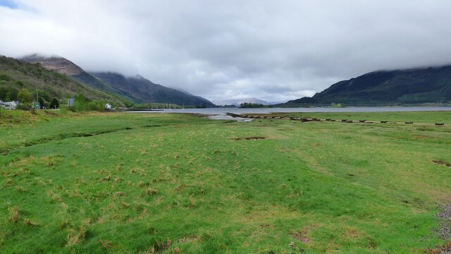
Aird Eachainn is a coastal marsh and saltings area located in Inverness-shire, Scotland. Situated along the eastern coast of the country, it is known for its unique ecosystem and diverse birdlife.

Covering a vast expanse of land, Aird Eachainn is characterized by its marshy terrain and tidal salt flats. The area experiences regular tidal fluctuations, resulting in the formation of salt marshes and mudflats. These marshes are home to a variety of specialized plants and animals that have adapted to the unique conditions.

The marshes of Aird Eachainn are crucial for many bird species, serving as an important nesting and feeding ground. It is a designated Site of Special Scientific Interest (SSSI) due to its significance as a habitat for various avian species. Birdwatchers and nature enthusiasts flock to this area to observe the diverse range of birds, such as waders, terns, and gulls that frequent the marshes.

In addition to its importance for birdlife, Aird Eachainn also plays a vital role in coastal erosion control. The marshes act as a natural buffer, absorbing wave energy and protecting the adjacent land from erosion.

Access to Aird Eachainn is facilitated by footpaths and observation points that provide visitors with opportunities to explore and appreciate the unique beauty of the area. The Coastal Marsh and Saltings of Aird Eachainn offer a peaceful and scenic setting, perfect for nature lovers and those seeking a tranquil escape by the sea.

If you have any feedback on the listing, please let us know in the comments section below.

Aird Eachainn Images

Images are sourced within 2km of 56.69584/-5.1097017 or Grid Reference NN0960. Thanks to Geograph Open Source API. All images are credited.

Ruined summerhouse near Callert House
Shoreline of Loch Leven at Glencoe village
Looking towards the mountains
Glencoe Mountain Rescue
Loch Leven View from Glencoe Village.
Loch Leven
View from Glencoe Village.
Building a new bridge over the River Coe at Glencoe
The Carnoch, Glencoe
The Carnoch, Glencoe Glencoe's public toilets are on the left.
The Carnoch, Glencoe
Glencoe's public toilets are on the left.
The Glencoe Inn, Tyndrum Road (A82), Glencoe The A82 runs from Glasgow to Fort William and Inverness, passing along the shores of Loch Lomond and Loch Ness and in the shadow of Ben Nevis along the way. The majority of the route is a trunk road and hence managed by Transport Scotland, who view the road as a vitally important link through the Scottish Highlands and beyond. 

At 167 miles, the road is the second longest A-road in Scotland (after the A9) and along its route uses pieces of road first built in the 1750s.
The Glencoe Inn, Tyndrum Road (A82), Glencoe
The A82 runs from Glasgow to Fort William and Inverness, passing along the shores of Loch Lomond and Loch Ness and in the shadow of Ben Nevis along the way. The majority of the route is a trunk road and hence managed by Transport Scotland, who view the road as a vitally important link through the Scottish Highlands and beyond. At 167 miles, the road is the second longest A-road in Scotland (after the A9) and along its route uses pieces of road first built in the 1750s.
Bus stop,  Tyndrum Road (A82), Glencoe The A82 runs from Glasgow to Fort William and Inverness, passing along the shores of Loch Lomond and Loch Ness and in the shadow of Ben Nevis along the way. The majority of the route is a trunk road and hence managed by Transport Scotland, who view the road as a vitally important link through the Scottish Highlands and beyond. 

At 167 miles, the road is the second longest A-road in Scotland (after the A9) and along its route uses pieces of road first built in the 1750s.
Bus stop, Tyndrum Road (A82), Glencoe
The A82 runs from Glasgow to Fort William and Inverness, passing along the shores of Loch Lomond and Loch Ness and in the shadow of Ben Nevis along the way. The majority of the route is a trunk road and hence managed by Transport Scotland, who view the road as a vitally important link through the Scottish Highlands and beyond. At 167 miles, the road is the second longest A-road in Scotland (after the A9) and along its route uses pieces of road first built in the 1750s.
Loch Leven from Tigh-phuirt A view down Loch Leven from Tigh-phuirt on the A82 near Glencoe.  Eilean Munde is in the middle distance.
Loch Leven from Tigh-phuirt
A view down Loch Leven from Tigh-phuirt on the A82 near Glencoe. Eilean Munde is in the middle distance.
A82 The A82 is a trunk road in Scotland. It is the principal route from Lowland Scotland to the western Scottish Highlands, running from Glasgow to Inverness, going by Loch Lomond, Glen Coe, Fort William and the Great Glen. It is 167 miles long.
<span class="nowrap"><a title="https://www.sabre-roads.org.uk/wiki/index.php?title=A82" rel="nofollow ugc noopener" href="https://www.sabre-roads.org.uk/wiki/index.php?title=A82">Link</a><img style="margin-left:2px;" alt="External link" title="External link - shift click to open in new window" src="https://s1.geograph.org.uk/img/external.png" width="10" height="10"/></span>
A82
The A82 is a trunk road in Scotland. It is the principal route from Lowland Scotland to the western Scottish Highlands, running from Glasgow to Inverness, going by Loch Lomond, Glen Coe, Fort William and the Great Glen. It is 167 miles long. LinkExternal link
Entering Glencoe, A82 The A82 is a trunk road in Scotland. It is the principal route from Lowland Scotland to the western Scottish Highlands, running from Glasgow to Inverness, going by Loch Lomond, Glen Coe, Fort William and the Great Glen. It is 167 miles long.
<span class="nowrap"><a title="https://www.sabre-roads.org.uk/wiki/index.php?title=A82" rel="nofollow ugc noopener" href="https://www.sabre-roads.org.uk/wiki/index.php?title=A82">Link</a><img style="margin-left:2px;" alt="External link" title="External link - shift click to open in new window" src="https://s1.geograph.org.uk/img/external.png" width="10" height="10"/></span>
Entering Glencoe, A82
The A82 is a trunk road in Scotland. It is the principal route from Lowland Scotland to the western Scottish Highlands, running from Glasgow to Inverness, going by Loch Lomond, Glen Coe, Fort William and the Great Glen. It is 167 miles long. LinkExternal link
A82, Glencoe The A82 is a trunk road in Scotland. It is the principal route from Lowland Scotland to the western Scottish Highlands, running from Glasgow to Inverness, going by Loch Lomond, Glen Coe, Fort William and the Great Glen. It is 167 miles long.
<span class="nowrap"><a title="https://www.sabre-roads.org.uk/wiki/index.php?title=A82" rel="nofollow ugc noopener" href="https://www.sabre-roads.org.uk/wiki/index.php?title=A82">Link</a><img style="margin-left:2px;" alt="External link" title="External link - shift click to open in new window" src="https://s1.geograph.org.uk/img/external.png" width="10" height="10"/></span>
A82, Glencoe
The A82 is a trunk road in Scotland. It is the principal route from Lowland Scotland to the western Scottish Highlands, running from Glasgow to Inverness, going by Loch Lomond, Glen Coe, Fort William and the Great Glen. It is 167 miles long. LinkExternal link
A82 and Loch Leven at Tigh-phuirt
Tree on the Shore of Loch Leven, Glencoe
Forestry road above Callert
Show me another place!

Aird Eachainn is located at Grid Ref: NN0960 (Lat: 56.69584, Lng: -5.1097017)

Unitary Authority: Highland

Police Authority: Highlands and Islands

What 3 Words

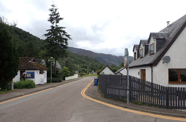
///drop.shapeless.already. Near Glencoe, Highland

Related Wikis

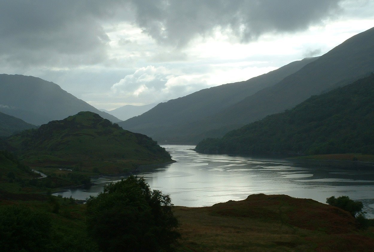
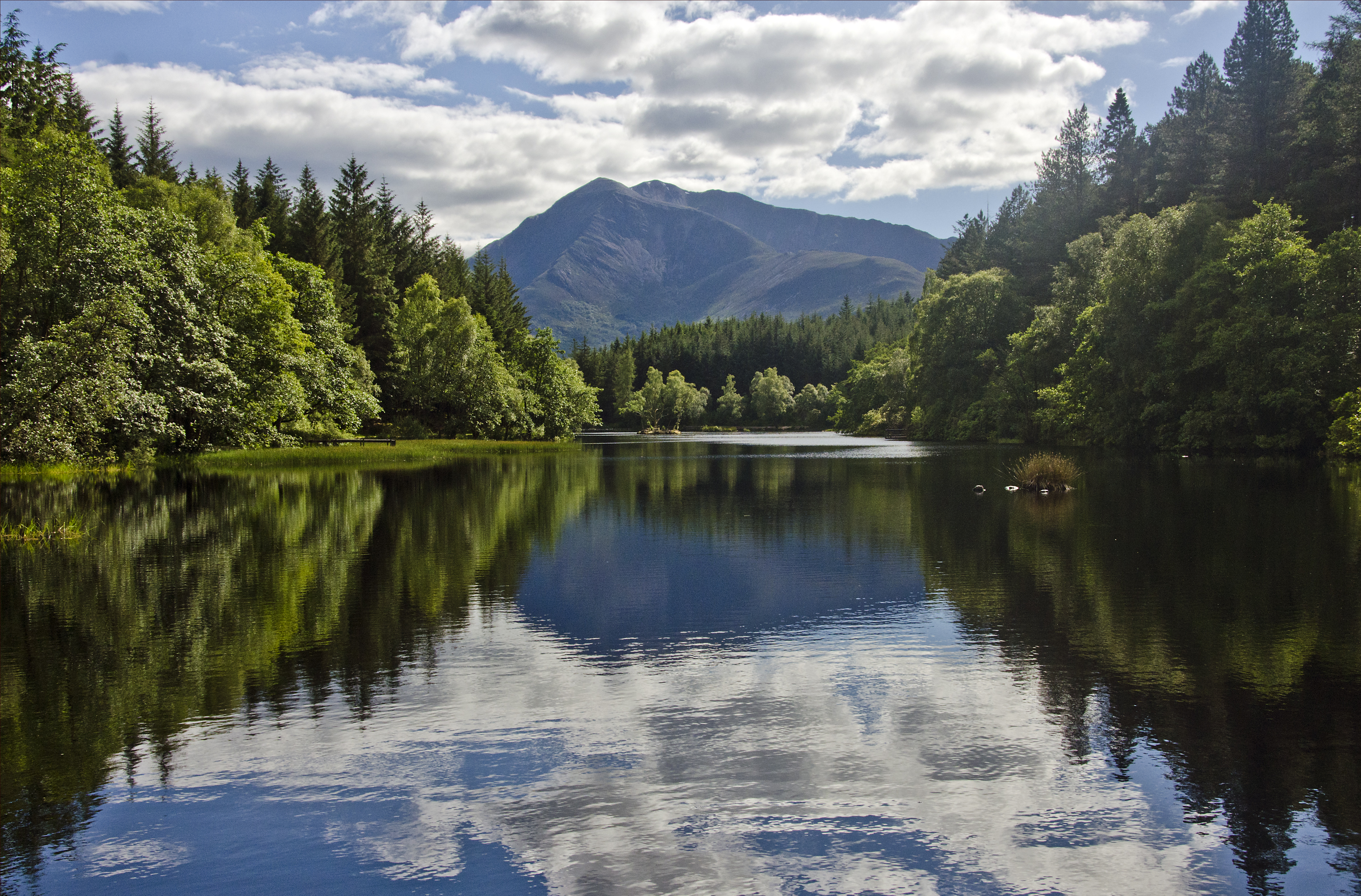
Loch Leven (Highlands)

Loch Leven (Scottish Gaelic: Loch Liobhann) is a sea loch located on the west coast of Scotland. It is spelled Loch Lyon in Timothy Pont's map of the area...

Glencoe Lochan

Glencoe Lochan is a tract of forest located just north of Glencoe village in the Scottish Highlands. It was planted in the 1890s by Donald Alexander Smith...

Glencoe House

Glencoe House is a category B listed four-storey Victorian estate house in Glencoe, Lochaber, Highland, Scotland. == History == Designed by Rowand Anderson...
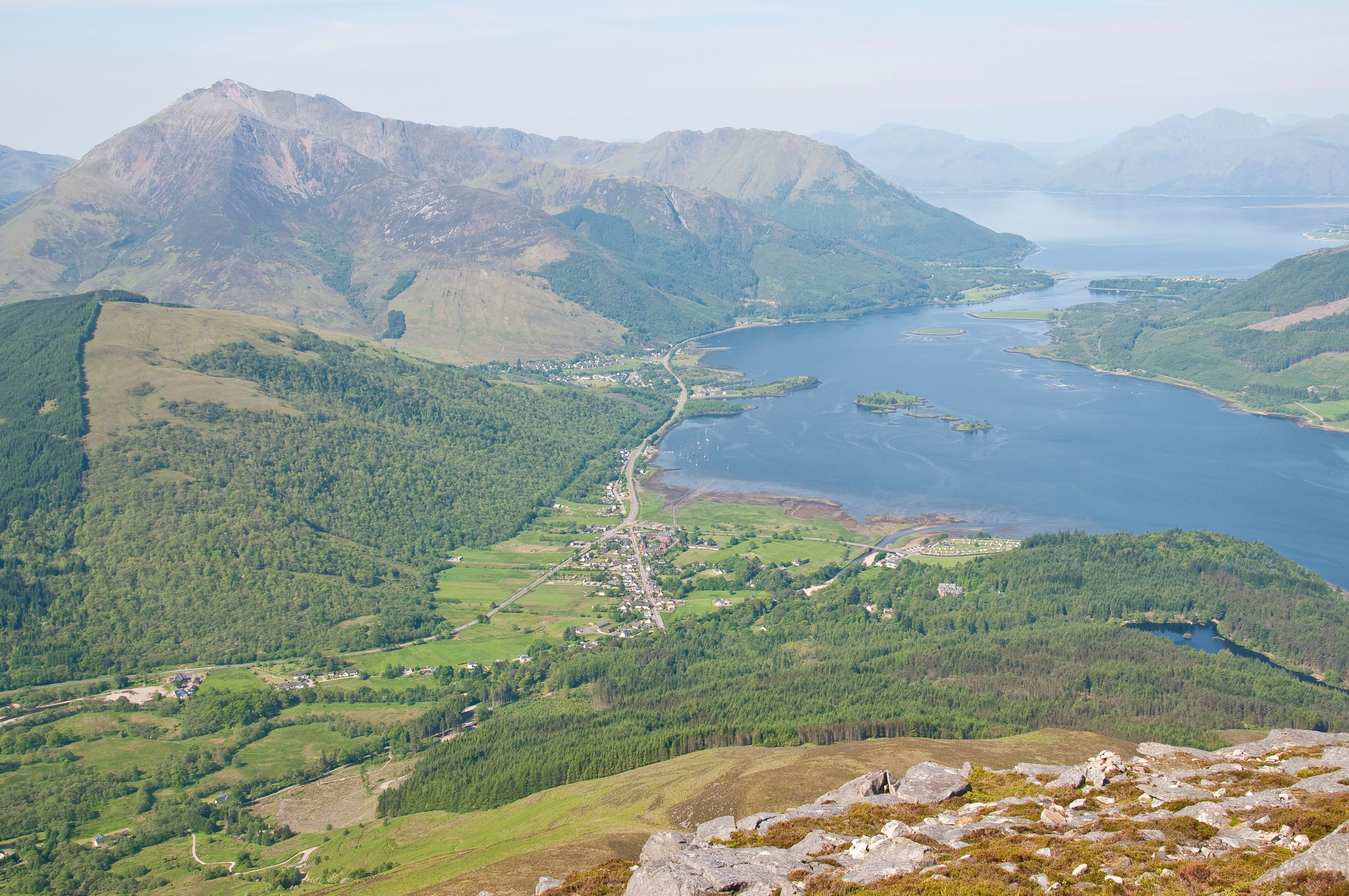
Glencoe, Highland

Glencoe or Glencoe Village (Gaelic: A’ Chàrnaich) is the main settlement in Glen Coe in the Lochaber area of the Scottish Highlands. It lies at the north...

Related Videos

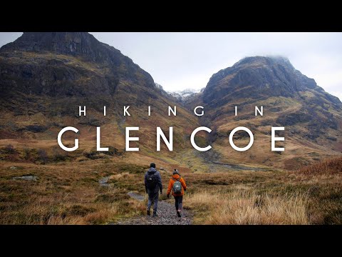
Best Day Hikes in Glencoe, Scotland | Lost Valley & Ballachulish

Best Day Hikes in Glencoe, Scotland: Lost Valley & Ballachulish Glencoe is a glen in the Scottish Highlands, famous for its deep ...

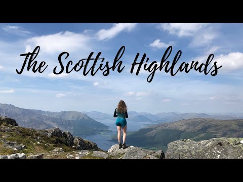
Hiking in the Scottish Highlands

I went to Glencoe in the Scottish Highlands for a few days of hiking, camping and exploring! Music (via Epidemic Sound) Nuna ...

Highland Cows Walking On The Road On Visit To Glencoe In The Highlands Of Scotland

Tour Scotland travel video, with Scottish music, of Highland Cows walking on the road on visit to Glencoe in the Scottish ...

Nearby Amenities

Located within 500m of 56.69584,-5.1097017
Source: PGS
Lat/Long: 56.6945835/-5.1175214
Source: PGS
Lat/Long: 56.6943893/-5.1167432
Source: PGS
Lat/Long: 56.6945757/-5.1164249
Source: PGS
Lat/Long: 56.6947117/-5.1160358
Source: PGS
Lat/Long: 56.6947311/-5.1154203
Source: PGS
Lat/Long: 56.6948593/-5.1146917
Source: PGS
Lat/Long: 56.6950147/-5.1139843
Source: PGS
Lat/Long: 56.6950302/-5.1128453
Source: PGS
Lat/Long: 56.6949447/-5.1119893
Source: PGS
Lat/Long: 56.695038/-5.1111616
Source: PGS
Lat/Long: 56.6951662/-5.1096548
Created By: dmgroom_coastlines
Source: PGS
Lat/Long: 56.695346/-5.109118
Source: PGS
Lat/Long: 56.6959741/-5.1089544
Source: PGS
Lat/Long: 56.6965684/-5.1083248
Source: PGS
Lat/Long: 56.696817/-5.1078367
Created By: dmgroom_coastlines
Source: PGS
Lat/Long: 56.697037/-5.107582
Source: PGS
Lat/Long: 56.697287/-5.1073132
Source: PGS
Lat/Long: 56.6975473/-5.1069736
Source: PGS
Lat/Long: 56.6977842/-5.1065704
Source: PGS
Lat/Long: 56.6980444/-5.1060398
Source: PGS
Lat/Long: 56.6984173/-5.1045825
Source: PGS
Lat/Long: 56.6986504/-5.1039317
Barrier: kissing_gate
Lat/Long: 56.6954248/-5.1120493
Memorial commemorating fatal road accident in 1916
Historic: memorial
Lat/Long: 56.6975583/-5.1075398
Power: pole
Lat/Long: 56.6984809/-5.1155736
Power: pole
Lat/Long: 56.6987292/-5.1142191
Power: pole
Lat/Long: 56.6989731/-5.1129194
Power: pole
Lat/Long: 56.6992837/-5.1111616
Power: pole
Lat/Long: 56.6994266/-5.1099734
Power: pole
Lat/Long: 56.6995212/-5.1089947
Power: pole
Lat/Long: 56.6996609/-5.1077733
Power: pole
Lat/Long: 56.6998028/-5.1064736
Power: pole
Lat/Long: 56.7000575/-5.1099695
The data included in this document is from www.openstreetmap.org. The data is made available under ODbL.

Have you been to Aird Eachainn?

Leave your review of Aird Eachainn below (or comments, questions and feedback).