An Dubhag

Coastal Marsh, Saltings in Argyllshire
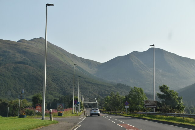
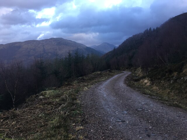
Scotland

An Dubhag

Road junction North Ballachulish
Road junction North Ballachulish Credit: thejackrustles

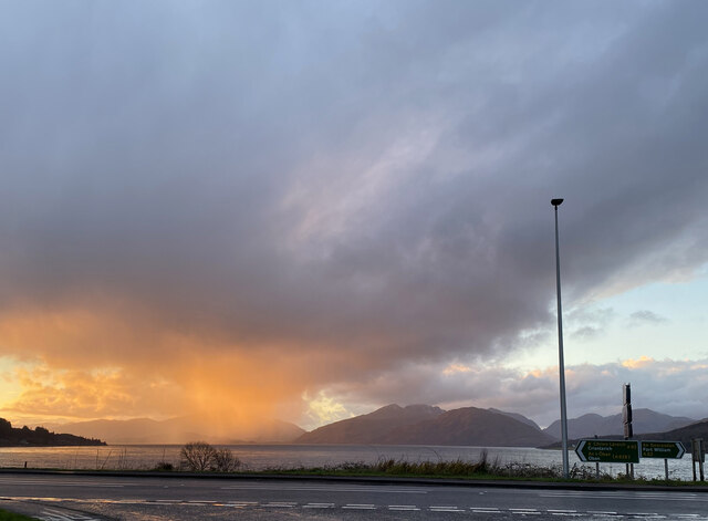
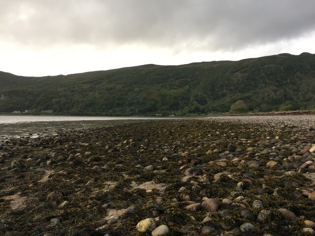
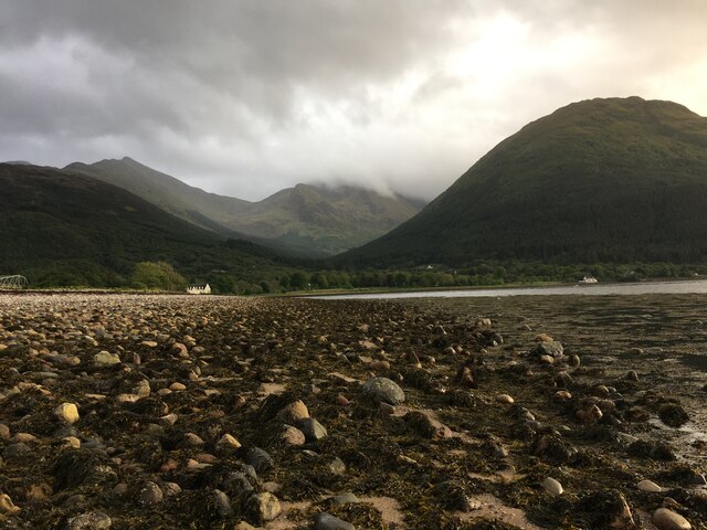
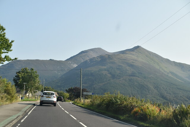
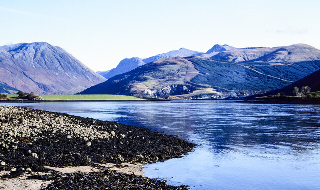
An Dubhag, located in Argyllshire, is a coastal marsh area characterized by its unique saltings. Situated along the western coast of Scotland, this region offers a diverse and abundant ecosystem that is home to a plethora of plant and animal species.

The marshland of An Dubhag is a prime example of a coastal wetland, characterized by its rich soils and high moisture levels. The area is influenced by the tides, which bring in a constant supply of nutrient-rich sediments. This, in turn, supports a variety of vegetation, including salt-tolerant plants such as sea lavender, sea aster, and sea purslane.

The saltings of An Dubhag are a distinctive feature of the marsh, consisting of low-lying areas of land that are regularly flooded by seawater during high tide. These saltings create a brackish environment, where both saltwater and freshwater mix. This unique habitat attracts a wide range of flora and fauna, including wading birds, such as sandpipers and redshanks, as well as various species of crabs and mollusks.

The marshland also serves as an important breeding ground for several bird species, including the rare and protected corncrake. Its remote location and diverse habitat make it an ideal spot for birdwatching enthusiasts and nature lovers alike.

An Dubhag, with its coastal marsh and saltings, offers a captivating glimpse into the intricate interactions between land and sea. Its natural beauty and ecological significance make it a valuable and protected area, contributing to the overall biodiversity and environmental health of Argyllshire.

If you have any feedback on the listing, please let us know in the comments section below.

An Dubhag Images

Images are sourced within 2km of 56.682045/-5.163814 or Grid Reference NN0658. Thanks to Geograph Open Source API. All images are credited.

Road junction North Ballachulish
Shoreline at North Ballachulish
A82, North Ballachulish The A82 is a trunk road in Scotland. It is the principal route from Lowland Scotland to the western Scottish Highlands, running from Glasgow to Inverness, going by Loch Lomond, Glen Coe, Fort William and the Great Glen. It is 167 miles long.
<span class="nowrap"><a title="https://www.sabre-roads.org.uk/wiki/index.php?title=A82" rel="nofollow ugc noopener" href="https://www.sabre-roads.org.uk/wiki/index.php?title=A82">Link</a><img style="margin-left:2px;" alt="External link" title="External link - shift click to open in new window" src="https://s1.geograph.org.uk/img/external.png" width="10" height="10"/></span>
A82, North Ballachulish
The A82 is a trunk road in Scotland. It is the principal route from Lowland Scotland to the western Scottish Highlands, running from Glasgow to Inverness, going by Loch Lomond, Glen Coe, Fort William and the Great Glen. It is 167 miles long. LinkExternal link
A82 The A82 is a trunk road in Scotland. It is the principal route from Lowland Scotland to the western Scottish Highlands, running from Glasgow to Inverness, going by Loch Lomond, Glen Coe, Fort William and the Great Glen. It is 167 miles long.
<span class="nowrap"><a title="https://www.sabre-roads.org.uk/wiki/index.php?title=A82" rel="nofollow ugc noopener" href="https://www.sabre-roads.org.uk/wiki/index.php?title=A82">Link</a><img style="margin-left:2px;" alt="External link" title="External link - shift click to open in new window" src="https://s1.geograph.org.uk/img/external.png" width="10" height="10"/></span>
A82
The A82 is a trunk road in Scotland. It is the principal route from Lowland Scotland to the western Scottish Highlands, running from Glasgow to Inverness, going by Loch Lomond, Glen Coe, Fort William and the Great Glen. It is 167 miles long. LinkExternal link
Stones on shore of Loch Leven The stones with seaweed are on and alongside the slipway at North Ballachulish which was the northern landing for the vehicle ferry service which operated prior to the opening of the Ballachulish Bridge.
The view beyond is to the east where the Glen Coe peaks rise, Sgorr nam Fiannaidh being at the left side of the image.
Stones on shore of Loch Leven
The stones with seaweed are on and alongside the slipway at North Ballachulish which was the northern landing for the vehicle ferry service which operated prior to the opening of the Ballachulish Bridge. The view beyond is to the east where the Glen Coe peaks rise, Sgorr nam Fiannaidh being at the left side of the image.
Forestry road above Glenachulish
Bridge over river in Glenachulish
Cameron mausoleum near Callart
Stained glass windows in Cameron mausoleum
Albert Road, Ballachulish
Private road to Carness
A82 approaching Ballachulish Bridge The A82 is a trunk road in Scotland. It is the principal route from Lowland Scotland to the western Scottish Highlands, running from Glasgow to Inverness, going by Loch Lomond, Glen Coe, Fort William and the Great Glen. It is 167 miles long.
<span class="nowrap"><a title="https://www.sabre-roads.org.uk/wiki/index.php?title=A82" rel="nofollow ugc noopener" href="https://www.sabre-roads.org.uk/wiki/index.php?title=A82">Link</a><img style="margin-left:2px;" alt="External link" title="External link - shift click to open in new window" src="https://s1.geograph.org.uk/img/external.png" width="10" height="10"/></span>
A82 approaching Ballachulish Bridge
The A82 is a trunk road in Scotland. It is the principal route from Lowland Scotland to the western Scottish Highlands, running from Glasgow to Inverness, going by Loch Lomond, Glen Coe, Fort William and the Great Glen. It is 167 miles long. LinkExternal link
Crossing Ballachulish Bridge The A82 is a trunk road in Scotland. It is the principal route from Lowland Scotland to the western Scottish Highlands, running from Glasgow to Inverness, going by Loch Lomond, Glen Coe, Fort William and the Great Glen. It is 167 miles long.
<span class="nowrap"><a title="https://www.sabre-roads.org.uk/wiki/index.php?title=A82" rel="nofollow ugc noopener" href="https://www.sabre-roads.org.uk/wiki/index.php?title=A82">Link</a><img style="margin-left:2px;" alt="External link" title="External link - shift click to open in new window" src="https://s1.geograph.org.uk/img/external.png" width="10" height="10"/></span>
Crossing Ballachulish Bridge
The A82 is a trunk road in Scotland. It is the principal route from Lowland Scotland to the western Scottish Highlands, running from Glasgow to Inverness, going by Loch Lomond, Glen Coe, Fort William and the Great Glen. It is 167 miles long. LinkExternal link
A82 The A82 is a trunk road in Scotland. It is the principal route from Lowland Scotland to the western Scottish Highlands, running from Glasgow to Inverness, going by Loch Lomond, Glen Coe, Fort William and the Great Glen. It is 167 miles long.
<span class="nowrap"><a title="https://www.sabre-roads.org.uk/wiki/index.php?title=A82" rel="nofollow ugc noopener" href="https://www.sabre-roads.org.uk/wiki/index.php?title=A82">Link</a><img style="margin-left:2px;" alt="External link" title="External link - shift click to open in new window" src="https://s1.geograph.org.uk/img/external.png" width="10" height="10"/></span>
A82
The A82 is a trunk road in Scotland. It is the principal route from Lowland Scotland to the western Scottish Highlands, running from Glasgow to Inverness, going by Loch Lomond, Glen Coe, Fort William and the Great Glen. It is 167 miles long. LinkExternal link
A82, southbound The A82 is a trunk road in Scotland. It is the principal route from Lowland Scotland to the western Scottish Highlands, running from Glasgow to Inverness, going by Loch Lomond, Glen Coe, Fort William and the Great Glen. It is 167 miles long.
<span class="nowrap"><a title="https://www.sabre-roads.org.uk/wiki/index.php?title=A82" rel="nofollow ugc noopener" href="https://www.sabre-roads.org.uk/wiki/index.php?title=A82">Link</a><img style="margin-left:2px;" alt="External link" title="External link - shift click to open in new window" src="https://s1.geograph.org.uk/img/external.png" width="10" height="10"/></span>
A82, southbound
The A82 is a trunk road in Scotland. It is the principal route from Lowland Scotland to the western Scottish Highlands, running from Glasgow to Inverness, going by Loch Lomond, Glen Coe, Fort William and the Great Glen. It is 167 miles long. LinkExternal link
Show me another place!

An Dubhag is located at Grid Ref: NN0658 (Lat: 56.682045, Lng: -5.163814)

Unitary Authority: Highland

Police Authority: Highlands and Islands

What 3 Words

///series.overjoyed.happen. Near Glencoe, Highland

Related Wikis

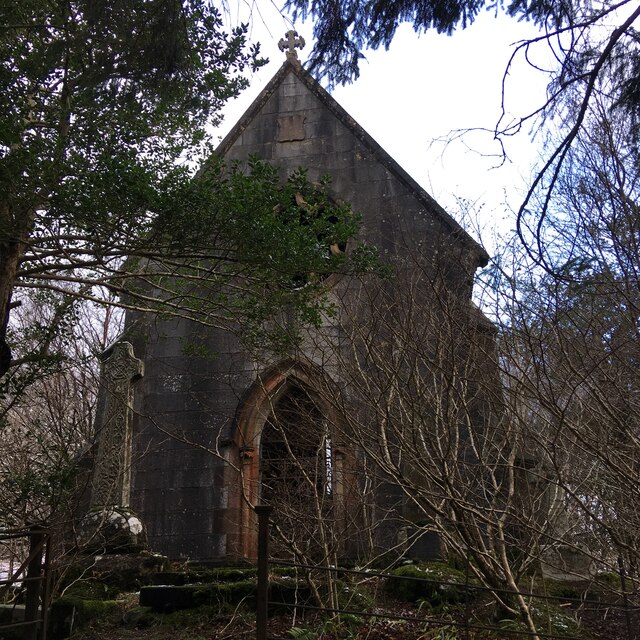
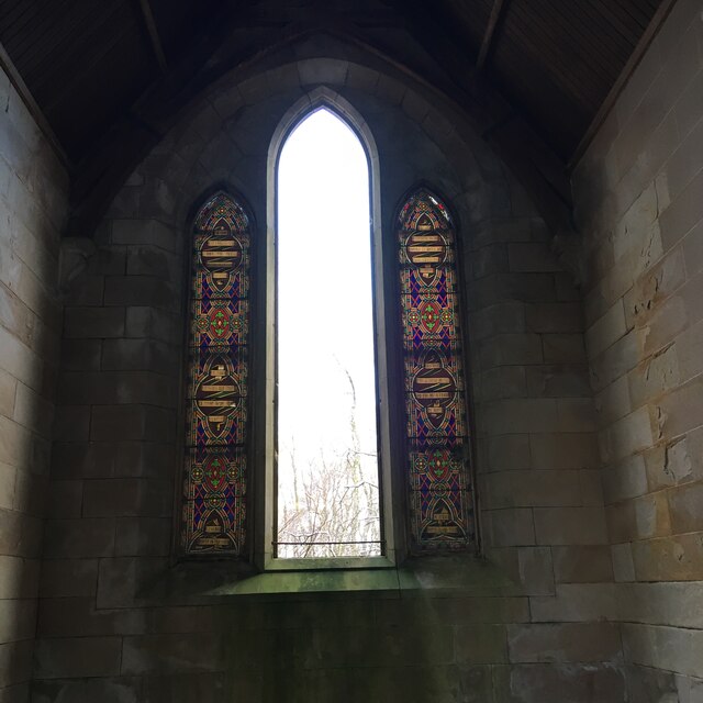
St John's Church, Ballachulish (former)

St John's Church is a former church building in Ballachulish, Highland, Scotland. It dates to 1842, replacing an earlier Episcopal church, and was designed...

Ballachulish Ferry railway station

Ballachulish Ferry was a railway station on the south shore at the narrows of Loch Leven at South Ballachulish in Highland region, Scotland. It was on...

Ballachulish House

Ballachulish House is a restaurant located in Ballachulish, Highland, Scotland. As of 2008, the restaurant holds one star in the Michelin Guide. ��2�...

Glenachulish

Glenachulish (Scottish Gaelic: Gleann a' Chaolais: valley of the narrows; pronounced Glen – ah – hoolish) is a hamlet and glen which lie close to the village...

Nearby Amenities

Located within 500m of 56.682045,-5.163814
Created By: dmgroom_coastlines
Source: PGS
Lat/Long: 56.682702/-5.166809
Source: PGS
Lat/Long: 56.6830469/-5.1675489
Source: PGS
Lat/Long: 56.6832473/-5.1679459
Source: PGS
Lat/Long: 56.6836067/-5.1682677
Source: PGS
Lat/Long: 56.6841607/-5.1683965
Created By: dmgroom_coastlines
Source: PGS
Lat/Long: 56.685105/-5.168577
Source: PGS
Lat/Long: 56.6859625/-5.1633711
Source: PGS
Lat/Long: 56.6855764/-5.1629024
Source: PGS
Lat/Long: 56.6852708/-5.1623752
Source: PGS
Lat/Long: 56.6851903/-5.162053
Created By: dmgroom_coastlines
Source: PGS
Lat/Long: 56.685366/-5.160912
Source: PGS
Lat/Long: 56.6856199/-5.1602901
Source: PGS
Lat/Long: 56.6859434/-5.159803
Source: PGS
Lat/Long: 56.679454/-5.1573187
Created By: dmgroom_coastlines
Source: PGS
Lat/Long: 56.679662/-5.157562
Source: PGS
Lat/Long: 56.6804207/-5.1581667
Created By: dmgroom_coastlines
Source: PGS
Lat/Long: 56.680545/-5.15831
Source: PGS
Lat/Long: 56.6807869/-5.1585196
Created By: dmgroom_coastlines
Source: PGS
Lat/Long: 56.681177/-5.158811
Source: PGS
Lat/Long: 56.6809404/-5.1596765
Created By: dmgroom_coastlines
Source: PGS
Lat/Long: 56.6810807/-5.1604915
Created By: dmgroom_coastlines
Source: PGS
Lat/Long: 56.6813686/-5.1614736
Source: PGS
Lat/Long: 56.6816296/-5.1623871
Source: PGS
Lat/Long: 56.681775/-5.1631861
Created By: dmgroom_coastlines
Source: PGS
Lat/Long: 56.68186/-5.163737
Created By: dmgroom_coastlines
Source: PGS
Lat/Long: 56.681983/-5.163976
Source: PGS
Lat/Long: 56.6822408/-5.1653282
Source: PGS
Lat/Long: 56.6824589/-5.1660782
Source: OS OpenData StreetView
Lat/Long: 56.6826108/-5.1665511
Man Made: tower
Tower Type: communication
Lat/Long: 56.6844291/-5.170382
The data included in this document is from www.openstreetmap.org. The data is made available under ODbL.

Have you been to An Dubhag?

Leave your review of An Dubhag below (or comments, questions and feedback).