Cairn Point

Coastal Marsh, Saltings in Wigtownshire

Scotland

Cairn Point

Stena Line Ferries, Loch Ryan One heading for Ireland (right) and one coming from Ireland (left).
Stena Line Ferries, Loch Ryan Credit: Billy McCrorie

Cairn Point, located in Wigtownshire, Scotland, is a scenic and important coastal marsh area known for its unique ecosystem and diverse wildlife. Spanning approximately 200 acres, this coastal marshland is situated at the mouth of the River Cree, where it meets the Solway Firth.

The landscape of Cairn Point is characterized by vast expanses of saltmarsh and saltings, which are dominated by halophytic plants, specially adapted to thrive in the saline conditions. These salt-tolerant plants, such as samphire, sea lavender, and sea aster, create a stunning mosaic of color and texture across the marshland. Additionally, the area boasts sand dunes, mudflats, and small freshwater pools, further enhancing the biodiversity of the site.

Cairn Point is a haven for countless species of birds, making it a popular destination for birdwatchers and nature enthusiasts alike. The marshland provides an important feeding ground and nesting habitat for a variety of wading birds, including oystercatchers, dunlins, redshanks, and curlews. Additionally, it serves as a wintering ground for migratory birds such as barnacle geese and pink-footed geese.

The area is also home to a diverse range of marine life. The intertidal mudflats are teeming with an abundance of invertebrates such as lugworms, cockles, and crabs, which provide a vital food source for the birds and fish that inhabit the estuary.

Cairn Point is not only a haven for wildlife but also offers stunning panoramic views of the surrounding coastline and the Galloway Hills. It provides opportunities for leisurely walks along the coastal path, observing the ever-changing tides and the interplay between land and sea.

Overall, Cairn Point in Wigtownshire is a truly remarkable coastal marshland, offering a valuable habitat for a wide range of species and providing visitors with a unique and enrich

If you have any feedback on the listing, please let us know in the comments section below.
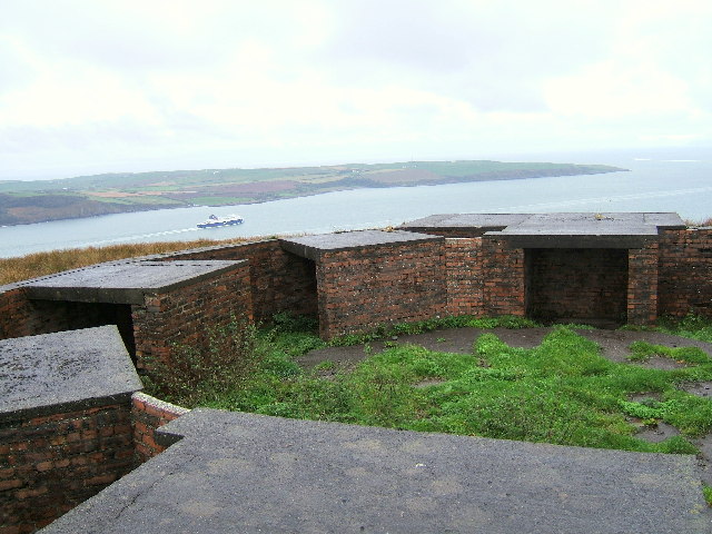
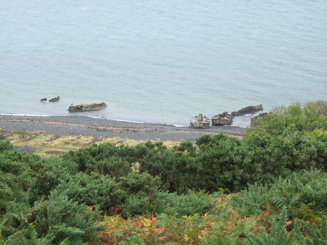
Cairn Point Images

Images are sourced within 2km of 54.974192/-5.0314546 or Grid Reference NX0668. Thanks to Geograph Open Source API. All images are credited.

Stena Line Ferries, Loch Ryan One heading for Ireland (right) and one coming from Ireland (left).
Stena Line Ferries, Loch Ryan
One heading for Ireland (right) and one coming from Ireland (left).
A Second World War gun battery emplacement overlooking Loch Ryan. This gun battery emplacement is situated at near Little Laight Farm, Cairnryan. There were many military camps, gun emplacements and connections to this area during the war and after.
A Second World War gun battery emplacement overlooking Loch Ryan.
This gun battery emplacement is situated at near Little Laight Farm, Cairnryan. There were many military camps, gun emplacements and connections to this area during the war and after.
Concrete barges on the shores of Lochryan, North of Cairnryan village. These barges are remnants from the Second World War and were used in practice and preparations for the Normandy Landings. The featured in a recent BBC series about Scotland's Secret War.
Concrete barges on the shores of Lochryan, North of Cairnryan village.
These barges are remnants from the Second World War and were used in practice and preparations for the Normandy Landings. The featured in a recent BBC series about Scotland's Secret War.
Loch Ryan Ferry Slope on Laird's with view of P&O ferry passing the new terminal site.
Loch Ryan Ferry
Slope on Laird's with view of P&O ferry passing the new terminal site.
The old military pier and breaker's yard at Cairnryan This pier and breaker's yard just to the north of Cairnryan is where the aircraft carrier Ark Royal (IV) was sent for decommissioning and breaking in the late 1970s. It has since been used as a commercial pier, but has collapsed in places and is too dangerous for use now.
The old military pier and breaker's yard at Cairnryan
This pier and breaker's yard just to the north of Cairnryan is where the aircraft carrier Ark Royal (IV) was sent for decommissioning and breaking in the late 1970s. It has since been used as a commercial pier, but has collapsed in places and is too dangerous for use now.
Cairn Hill overlooking the village of Cairnryan. This hill dominates the village of Cairnryan about 6 miles North of Stranraer.
Cairn Hill overlooking the village of Cairnryan.
This hill dominates the village of Cairnryan about 6 miles North of Stranraer.
Kirkcolm Point and The Scar near Kirkcolm, Stranraer The Scar is a long, narrow sandbar which extends into Loch Ryan from Kirkcolm Point. It is a breeding ground for Arctic Terns and the high speed ferries which use the loch have to slow down  so as not to disturb the breeding birds. It is also a popular destination for sea anglers and bird watchers.
Kirkcolm Point and The Scar near Kirkcolm, Stranraer
The Scar is a long, narrow sandbar which extends into Loch Ryan from Kirkcolm Point. It is a breeding ground for Arctic Terns and the high speed ferries which use the loch have to slow down so as not to disturb the breeding birds. It is also a popular destination for sea anglers and bird watchers.
Cairnryan Ferry Port Ferry about to leave the port of Cairnryan for Larne in Northern Ireland
Cairnryan Ferry Port
Ferry about to leave the port of Cairnryan for Larne in Northern Ireland
The foreshore north of Cairn Point
Unloading Vehicles The P&O European Highlander has just arrived from Larne, Northern Ireland and is seen unloading commercial vehicles.
Unloading Vehicles
The P&O European Highlander has just arrived from Larne, Northern Ireland and is seen unloading commercial vehicles.
Mulberry Harbour 'Beetles' at Old House Point, Loch Ryan
Loch Ryan Old House Point, Mulberry Harbour 'Beetles'
Lighthouse at Cairn Point Lighthouse at Cairn Point, viewed from the European Causeway which is leaving Cairnryan for Larne.
Lighthouse at Cairn Point
Lighthouse at Cairn Point, viewed from the European Causeway which is leaving Cairnryan for Larne.
Cairn Point Pier and Lighthouse Cairn Point Pier and Lighthouse
Cairn Point Pier and Lighthouse
Old Pier Old Pier at Cairn Point
Old Pier
Old Pier at Cairn Point
A P&O Ferry in Lochryan sailing to Larne and silhouetted against the setting sun. This photo was taken between Cairn Point and Old House Point, North of Cairnryan at sunset on 12th April 2007.
A P&O Ferry in Lochryan sailing to Larne and silhouetted against the setting sun.
This photo was taken between Cairn Point and Old House Point, North of Cairnryan at sunset on 12th April 2007.
European Causeway P&O ferry from Larne arriving at Cairnryan
European Causeway
P&O ferry from Larne arriving at Cairnryan
Loch Ryan Shore The loch doesn't boast sandy beaches, as these rocks and stones testify, however the waves caused by the passing HSS ferry more than make up for this entertainment. The unusual positioning is due to the deep water channels as the ship heads across to mid-channel at Milleur Point, at the head of Loch Ryan.
Loch Ryan Shore
The loch doesn't boast sandy beaches, as these rocks and stones testify, however the waves caused by the passing HSS ferry more than make up for this entertainment. The unusual positioning is due to the deep water channels as the ship heads across to mid-channel at Milleur Point, at the head of Loch Ryan.
Show me another place!

Cairn Point is located at Grid Ref: NX0668 (Lat: 54.974192, Lng: -5.0314546)

Unitary Authority: Dumfries and Galloway

Police Authority: Dumfries and Galloway

What 3 Words

///custodian.amused.shears. Near Cairnryan, Dumfries & Galloway

Nearby Locations

Cairn Point

Related Wikis

Loch Ryan

Loch Ryan (Scottish Gaelic: Loch Rìoghaine, pronounced [l̪ˠɔx ˈrˠiː.ɛɲə]) is a Scottish sea loch that acts as an important natural harbour for shipping...

Cairnryan Harbour

Cairnryan Harbour is a roll-on ferry terminal on Loch Ryan in south west Scotland north of Stranraer. In World War II it was developed as an emergency...

Cairnryan

Cairnryan (Scots: The Cairn; Scottish Gaelic: Càrn Rìoghain or Machair an Sgithich) is a village in the historical county of Wigtownshire, Dumfries and...

RAF Wig Bay

Royal Air Force Wig Bay, or more simply RAF Wig Bay, is a former Royal Air Force station near Stranraer, Dumfries and Galloway, Scotland The following...

Nearby Amenities

Located within 500m of 54.974192,-5.0314546
Created By: dmgroom_coastlines
Source: PGS
Lat/Long: 54.977979/-5.030149
Source: PGS
Lat/Long: 54.9770131/-5.0306232
Source: PGS
Lat/Long: 54.9762854/-5.0309739
Source: PGS
Lat/Long: 54.9755098/-5.0313273
Source: PGS
Lat/Long: 54.9750515/-5.0313273
Source: PGS
Lat/Long: 54.9742836/-5.0306097
Source: PGS
Lat/Long: 54.9739329/-5.0297708
Source: PGS
Lat/Long: 54.9739337/-5.028136
Source: PGS
Lat/Long: 54.9738707/-5.0275502
Source: PGS
Lat/Long: 54.9737568/-5.0261616
Source: PGS
Lat/Long: 54.9734785/-5.0249691
Source: PGS
Lat/Long: 54.9733175/-5.0245509
Source: PGS
Lat/Long: 54.9730047/-5.0239089
Cairnryan
Alt Name Gd: Machair an Sgithich
Is In: Dumfries & Galloway
Name Gd: Càrn Rìoghain
Name Sco: The Cairn
Place: village
Population: 142
Wikidata: Q3250447
Wikipedia: en:Cairnryan
Lat/Long: 54.9738045/-5.0250851
Bus Stop
Burnfoot Bridge
Naptan AtcoCode: 680000719111
Naptan Bearing: N
Naptan BusStopType: CUS
Naptan CommonName: Burnfoot Bridge
Naptan Indicator: North
Naptan Landmark: Burnfoot
Naptan NaptanCode: 34237269
Naptan Notes: none
Naptan Street: A77
Naptan Verified: no
Source: naptan_import
Lat/Long: 54.9772617/-5.0294737
Bus Stop
Burnfoot Bridge
Naptan AtcoCode: 680000719222
Naptan Bearing: S
Naptan BusStopType: CUS
Naptan CommonName: Burnfoot Bridge
Naptan Indicator: South
Naptan Landmark: Burnfoot
Naptan NaptanCode: 34237272
Naptan Notes: none
Naptan Street: A77
Naptan Verified: no
Source: naptan_import
Lat/Long: 54.9772921/-5.0293353
Lochryan House
Place: hamlet
Lat/Long: 54.9758588/-5.0264436
Loch Ryan Lighthouse
Seamark Light Character: Fl
Seamark Light Colour: red
Seamark Light Group: 2
Seamark Light Height: 14
Seamark Light Period: 10
Seamark Light Range: 12
Seamark Light Reference: A 4592
Seamark Type: light_minor
Source: US NGA Pub. 114. 2011-05-26.
Lat/Long: 54.9744667/-5.03075
Tourism: picnic_site
Lat/Long: 54.9781183/-5.0299188
Crossing
Crossing: unmarked
Lat/Long: 54.9742274/-5.0273701
Power: pole
Lat/Long: 54.9771115/-5.0296724
Power: pole
Lat/Long: 54.9772328/-5.0289329
Power: pole
Lat/Long: 54.9773433/-5.0282567
Power: pole
Lat/Long: 54.9774659/-5.0275853
The data included in this document is from www.openstreetmap.org. The data is made available under ODbL.

Have you been to Cairn Point?

Leave your review of Cairn Point below (or comments, questions and feedback).