Broad Port
Coastal Marsh, Saltings in Wigtownshire
Scotland
Broad Port

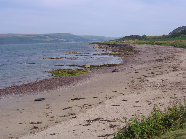
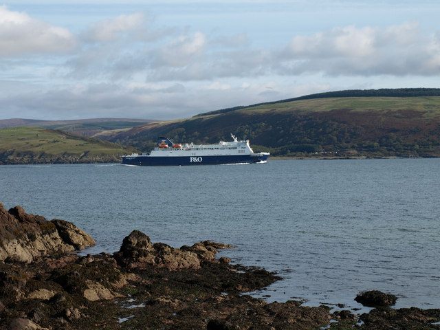
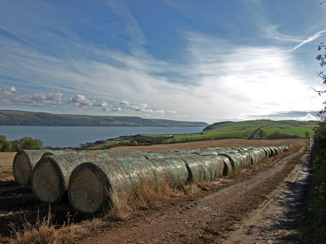
Broad Port, Wigtownshire, located on the southwestern coast of Scotland, is a picturesque coastal marsh and saltings area renowned for its natural beauty and diverse wildlife. Situated near the charming village of Port William, this coastal wetland stretches over a vast expanse of approximately 3 square kilometers.
The landscape of Broad Port is characterized by a mix of saltmarshes, mudflats, and sand dunes, which are formed by the constant interaction between the sea and the land. This unique combination of habitats offers an ideal environment for a wide array of plant and animal species to thrive.
The marshland is home to numerous plants, including saltmarsh grasses, sea lavender, and sea purslane, which have adapted to the high salt content of the soil. These plants not only provide shelter and food for various bird species but also help stabilize the marshes, preventing erosion and protecting the surrounding land.
The rich biodiversity of Broad Port is particularly evident in its birdlife. The area serves as an important breeding ground and feeding site for many species, including oystercatchers, curlews, redshanks, and dunlins. During migration seasons, birdwatchers flock to the area to catch a glimpse of rare visitors such as knot and sanderlings.
Apart from its ecological significance, Broad Port also holds historical importance. The marshes have been utilized for centuries as a grazing area for livestock and for harvesting salt from the salt pans. The remnants of these activities can still be seen today, adding to the area's cultural heritage.
In conclusion, Broad Port in Wigtownshire is a stunning coastal marsh and saltings area, teeming with diverse flora and fauna. Its ecological and historical significance make it a valuable asset to the region, attracting both nature enthusiasts and those seeking to immerse themselves in the natural beauty of Scotland's southwest coast.
If you have any feedback on the listing, please let us know in the comments section below.
Broad Port Images
Images are sourced within 2km of 55.004492/-5.0867508 or Grid Reference NX0272. Thanks to Geograph Open Source API. All images are credited.


Broad Port is located at Grid Ref: NX0272 (Lat: 55.004492, Lng: -5.0867508)
Unitary Authority: Dumfries and Galloway
Police Authority: Dumfries and Galloway
What 3 Words
///cold.eggshell.acquaint. Near Cairnryan, Dumfries & Galloway
Nearby Locations
Related Wikis

Kirkcolm
Kirkcolm (Scots: Kirkcoam) is a village and civil parish on the northern tip of the Rhinns of Galloway peninsula, south-west Scotland. It is in Dumfries...

RAF Wig Bay
Royal Air Force Wig Bay, or more simply RAF Wig Bay, is a former Royal Air Force station near Stranraer, Dumfries and Galloway, Scotland The following...

Corsewall Point
Corsewall Point, or Corsill Point, is a headland on the northwest coast of Wigtownshire, Kirkcolm near Stranraer, Dumfries and Galloway, Scotland. A lighthouse...

Loch Ryan
Loch Ryan (Scottish Gaelic: Loch Rìoghaine, pronounced [l̪ˠɔx ˈrˠiː.ɛɲə]) is a Scottish sea loch that acts as an important natural harbour for shipping...
Cairnryan Harbour
Cairnryan Harbour is a roll-on ferry terminal on Loch Ryan in south west Scotland north of Stranraer. In World War II it was developed as an emergency...
Ervie
Ervie is a small village in Dumfries and Galloway, Scotland, in the Rhins of Galloway, just outside Stranraer.

Cairnryan
Cairnryan (Scots: The Cairn; Scottish Gaelic: Càrn Rìoghain or Machair an Sgithich) is a village in the historical county of Wigtownshire, Dumfries and...
Leswalt
Leswalt (Scottish Gaelic: Lios Uillt) is a village and civil parish in Dumfries and Galloway, south-west Scotland. It lies between Portpatrick and Stranraer...
Nearby Amenities
Located within 500m of 55.004492,-5.0867508Have you been to Broad Port?
Leave your review of Broad Port below (or comments, questions and feedback).