Am Poll

Coastal Marsh, Saltings in Ross-shire

Scotland

Am Poll

Opinan Opinan is a crofting community astride the B8056 which is the road at the right side of the image.
Opinan Credit: Trevor Littlewood

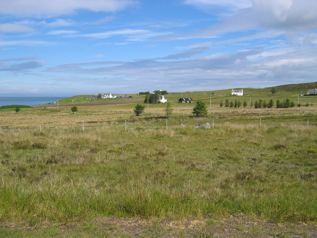
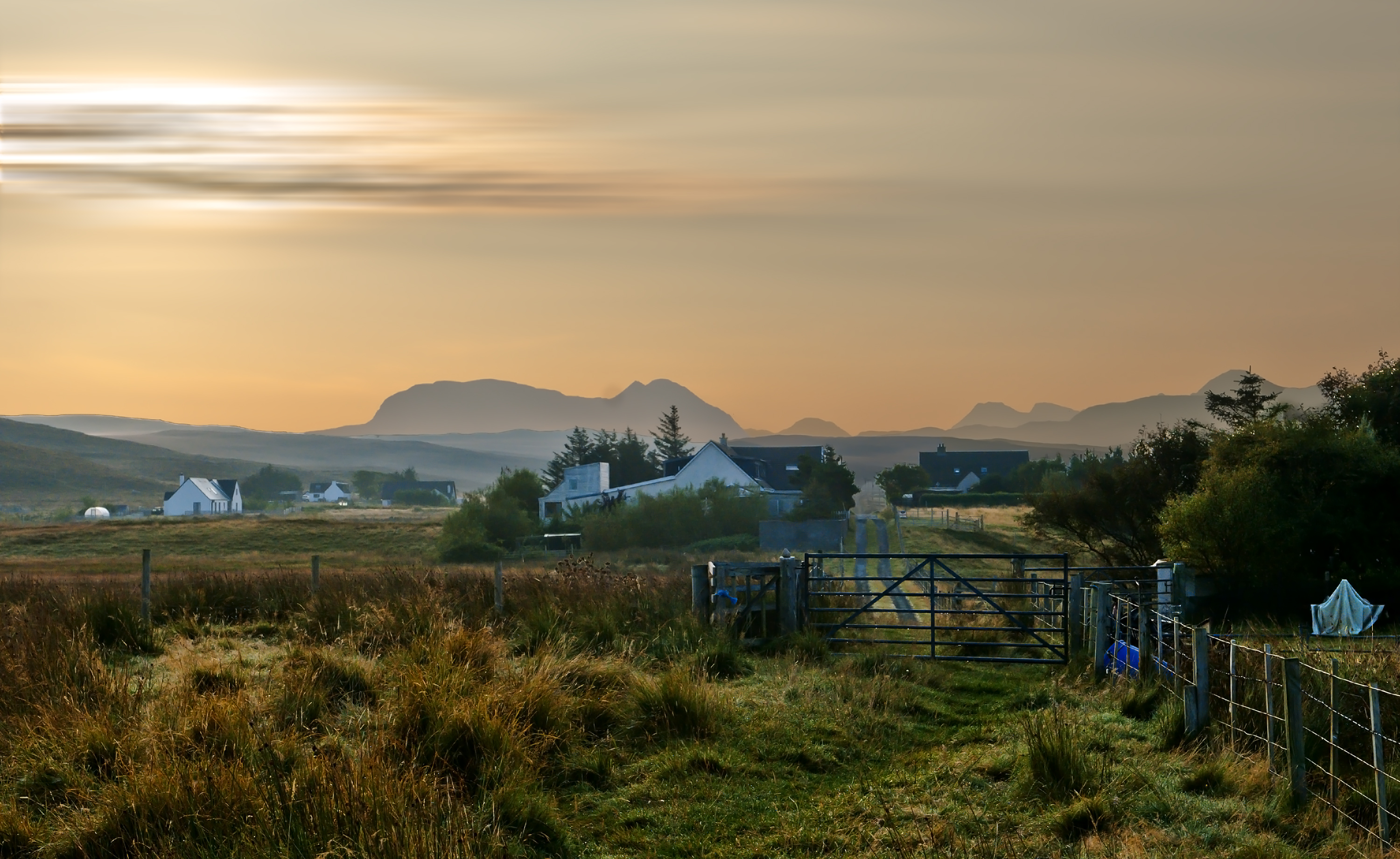
Am Poll is a coastal marsh and saltings located in Ross-shire, Scotland. It is a designated site of special scientific interest (SSSI), recognized for its ecological importance. The area covers an approximate area of 200 hectares and is nestled along the coastline, offering stunning views of the surrounding landscape.

The marshland of Am Poll is characterized by its unique combination of saltwater and freshwater habitats. It is situated at the mouth of a river, which brings a constant supply of fresh water, creating a diverse and thriving ecosystem. The intertidal zone is a mix of mudflats, saltmarsh, and sand dunes, providing a rich feeding ground for various bird species.

Am Poll is a significant site for birdwatching enthusiasts, as it attracts a wide range of migratory and resident bird species. Visitors can spot wading birds such as curlews, redshanks, and oystercatchers, as well as terns, gulls, and even the occasional osprey. The marsh also supports a variety of plant life, including sea lavender, sea aster, and glasswort, which play a crucial role in stabilizing the soil and creating a favorable environment for other organisms.

The area is managed by a conservation organization, which ensures the preservation of the fragile ecosystems. Access to Am Poll is allowed through designated footpaths and observation points, ensuring minimal disturbance to the wildlife. Interpretive signage and information boards are available to educate visitors about the importance of the site and its inhabitants.

Am Poll, Ross-shire is a remarkable coastal marsh and saltings, offering a unique opportunity to observe and appreciate the beauty and diversity of Scotland's natural environment.

If you have any feedback on the listing, please let us know in the comments section below.

Am Poll Images

Images are sourced within 2km of 57.686666/-5.7897268 or Grid Reference NG7472. Thanks to Geograph Open Source API. All images are credited.

Opinan Opinan is a crofting community astride the B8056 which is the road at the right side of the image.
Opinan
Opinan is a crofting community astride the B8056 which is the road at the right side of the image.
River Erradale The River Erradale passing through the crofting community of South Erradale as seen from the B8056.
River Erradale
The River Erradale passing through the crofting community of South Erradale as seen from the B8056.
Moorland and croft land at South Erradale The land immediately beyond the fence is uncultivated moorland showing possible signs of peat cutting. Beyond lies the crofted land and cottages of South Erradale.
Moorland and croft land at South Erradale
The land immediately beyond the fence is uncultivated moorland showing possible signs of peat cutting. Beyond lies the crofted land and cottages of South Erradale.
Moorland at Port Henderson Port Henderson is a crofting settlement at the south side of Loch Gairloch astride the B8056; from that road the minor road in the image heads out towards Sròn na Carra; the view is from the road end.
Moorland at Port Henderson
Port Henderson is a crofting settlement at the south side of Loch Gairloch astride the B8056; from that road the minor road in the image heads out towards Sròn na Carra; the view is from the road end.
Port Henderson crofting community
Coastal moorland near Opinan
Bridge at South Erradale over unnamed burn
Old croft at Opinan
Old croft at Opinan
River Erradale
River Erradale
Opinan
Opinan
Looking north over Port Henderson to Gairloch
Uamh an Fhreiceadain The literal English translation of the name of this hillock (40m above sea level) is 'the Cave of the Guard.' Clearly this is not a cave but is named after the cave which is nearby. It is reported to be the last defensive position held by the MacLeods of Gairloch before they were expelled by the Mackenzies in the 16th century.
Uamh an Fhreiceadain
The literal English translation of the name of this hillock (40m above sea level) is 'the Cave of the Guard.' Clearly this is not a cave but is named after the cave which is nearby. It is reported to be the last defensive position held by the MacLeods of Gairloch before they were expelled by the Mackenzies in the 16th century.
Port Henderson Looking over some of the houses of this scattered community to the bay beyond. The houses of Big Sand can be seen in the distance.
Port Henderson
Looking over some of the houses of this scattered community to the bay beyond. The houses of Big Sand can be seen in the distance.
Wind blown surf Bad weather approaching too...
Wind blown surf
Bad weather approaching too...
Croft land, Port Henderson What was improved croft land is gradually reverting to rushes.
Croft land, Port Henderson
What was improved croft land is gradually reverting to rushes.
Cottages in Port Henderson The building on the left has gained a red roof since Anne Burgess photographed it 40 years earlier - <a href="https://www.geograph.org.uk/photo/7495">NG7573 : Port Henderson</a>
Not much else has changed here.
Cottages in Port Henderson
The building on the left has gained a red roof since Anne Burgess photographed it 40 years earlier - NG7573 : Port Henderson Not much else has changed here.
Sròn na Carra The headland marks the south west extremity of Loch Gairloch.
Sròn na Carra
The headland marks the south west extremity of Loch Gairloch.
Opinan
Opinan
Show me another place!

Am Poll is located at Grid Ref: NG7472 (Lat: 57.686666, Lng: -5.7897268)

Unitary Authority: Highland

Police Authority: Highlands and Islands

What 3 Words

///rungs.factor.disarmed. Near Gairloch, Highland

Related Wikis

Opinan, Gairloch

Opinan (Scottish Gaelic: Na h-Òbaidhnean) is a fishing village on the west coast of Scotland in Gairloch, Ross-shire, Scottish Highlands and is in the...

Port Henderson

Port Henderson (Scottish Gaelic: Portaigil) is a fishing village on the south west shore of the Gair Loch near the village of Gairloch, Ross-shire, Scottish...

South Erradale

South Erradale is a small hamlet, situated on the coastline and to the southwest of Gairloch in Ross and Cromarty, Scottish Highlands and is in the Scottish...

Redpoint

Redpoint (Scottish Gaelic: An Rubha Dearg) is a small settlement in the north west of Highland, Scotland. It takes its name from Red Point, a low promontory...

Nearby Amenities

Located within 500m of 57.686666,-5.7897268
Source: PGS
Lat/Long: 57.6907467/-5.7908135
Created By: almien_coastlines
Source: PGS
Lat/Long: 57.690376/-5.791198
Source: PGS
Lat/Long: 57.6891071/-5.7913023
Source: PGS
Lat/Long: 57.6882101/-5.7909467
Source: PGS
Lat/Long: 57.6879867/-5.7900564
Source: PGS
Lat/Long: 57.6873497/-5.7893218
Source: PGS
Lat/Long: 57.6869745/-5.7886178
Source: PGS
Lat/Long: 57.6866973/-5.7881672
Source: PGS
Lat/Long: 57.6867193/-5.7879519
Source: PGS
Lat/Long: 57.6866662/-5.7877355
Source: PGS
Lat/Long: 57.6865573/-5.787659
Source: PGS
Lat/Long: 57.6856493/-5.7870023
Source: PGS
Lat/Long: 57.6846076/-5.7869293
Source: PGS
Lat/Long: 57.6839413/-5.7871599
Source: PGS
Lat/Long: 57.6833865/-5.7876321
Source: PGS
Lat/Long: 57.6833663/-5.7879835
Created By: almien_coastlines
Source: PGS
Lat/Long: 57.683274/-5.788021
Source: PGS
Lat/Long: 57.6827436/-5.7883962
Source: PGS
Lat/Long: 57.6824865/-5.7887207
Post Box
Post Box Type: lamp
Ref: IV21 230
Royal Cypher: scottish_crown
Source: survey
Lat/Long: 57.6869237/-5.7830276
Opinan
Name En: Opinan
Name Gd: Na h-Òbainean
Place: hamlet
Lat/Long: 57.6874516/-5.7833646
Power: pole
Lat/Long: 57.6884274/-5.7820042
Power: pole
Lat/Long: 57.6879735/-5.7820212
Power: pole
Lat/Long: 57.6875551/-5.7820278
Power: pole
Lat/Long: 57.6871368/-5.7820317
Power: pole
Lat/Long: 57.6866485/-5.7820356
Power: pole
Lat/Long: 57.6851893/-5.782105
Defibrillator
Access: yes
Defibrillator Location: On gable end of long house, right next to the road
Emergency: defibrillator
Indoor: no
Ref GB The Circuit: 02E2471B-6577-46D7-B72A-B10200AD87AC
Lat/Long: 57.6864844/-5.7825082
Booth: K6
Covered: booth
Disused Amenity: telephone
Man Made: telephone_box
Lat/Long: 57.686956/-5.7827166
The data included in this document is from www.openstreetmap.org. The data is made available under ODbL.

Have you been to Am Poll?

Leave your review of Am Poll below (or comments, questions and feedback).