Cladach Lag na Greine

Coastal Marsh, Saltings in Ross-shire

Scotland

Cladach Lag na Greine

Fields at Siadar
Fields at Siadar Credit: Hugh Venables

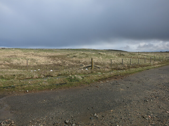
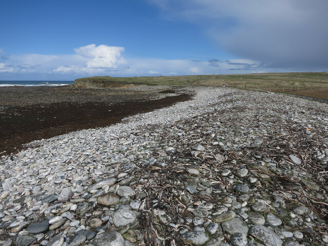
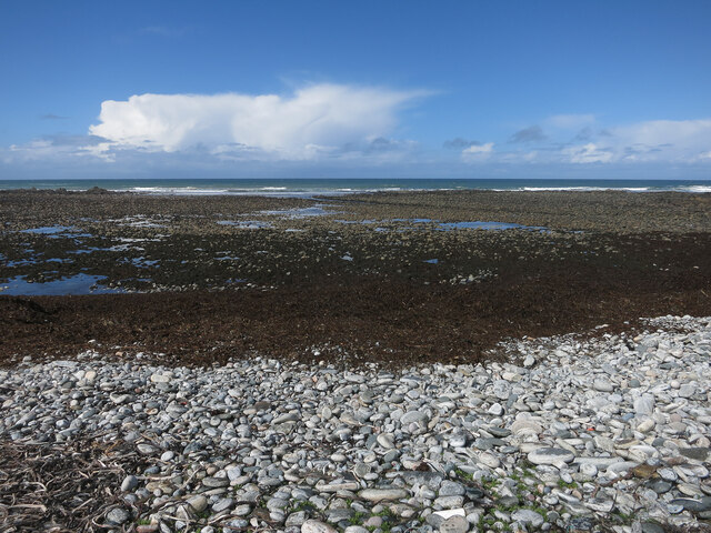
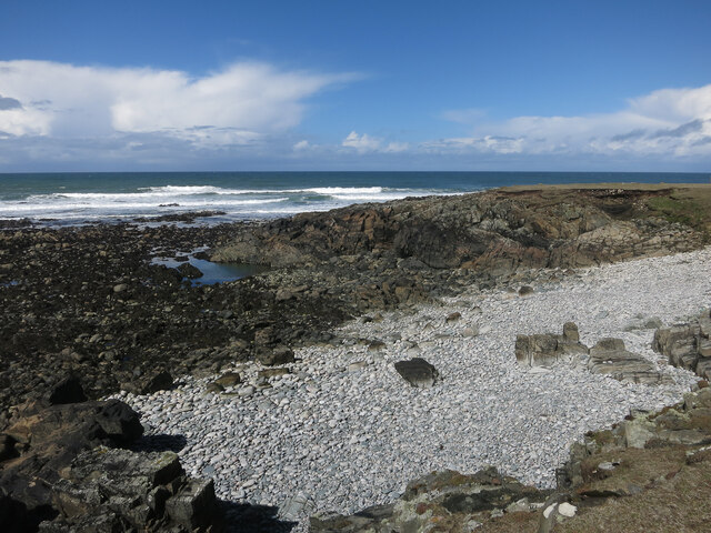
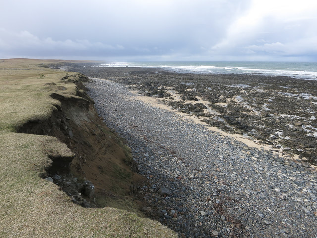
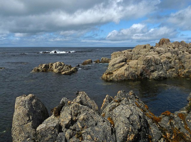
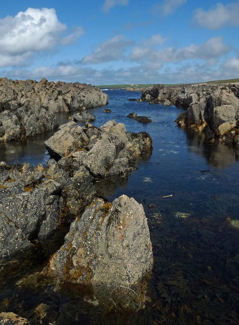
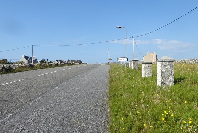
Cladach Lag na Greine, located in Ross-shire, Scotland, is a fascinating coastal marsh characterized by its unique saltings. The area is situated along the shoreline of the Moray Firth, a large inlet of the North Sea, and encompasses a diverse range of habitats.

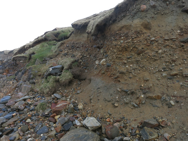
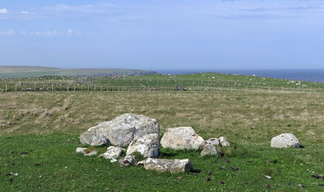
The marshland is composed of a mosaic of salt marshes, mudflats, sand dunes, and estuarine channels. These various habitats provide a rich and dynamic environment for a wide variety of plant and animal species. The salt marshes in particular are home to numerous halophytic plants that have adapted to the saline conditions, such as sea lavender, sea aster, and saltmarsh grasses.

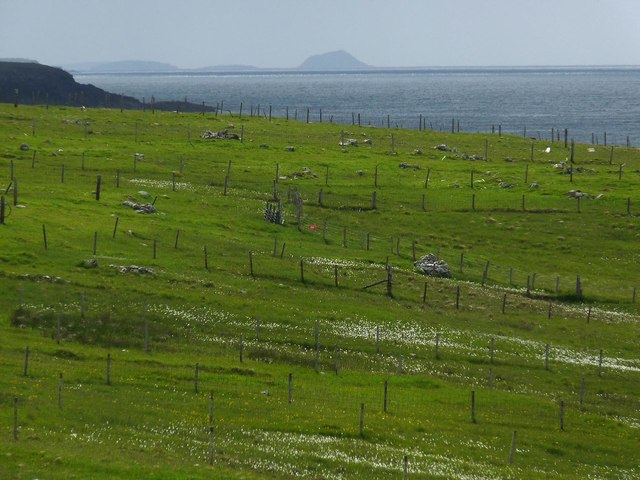
The area is also a vital breeding ground for many bird species, including waders like redshanks, oystercatchers, and curlews. These birds are attracted to the marshes due to the abundant food supply found in the mudflats and shallows. During the breeding season, the marshes come alive with the sounds of birdsong and the hustle and bustle of nesting activities.

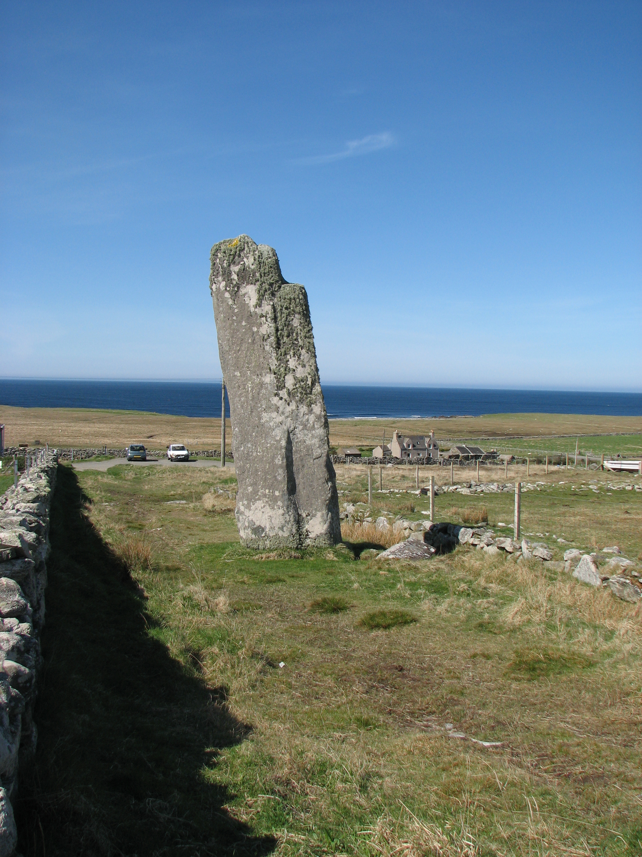
In addition to its ecological importance, Cladach Lag na Greine also holds cultural significance. The area has been inhabited for centuries, with evidence of ancient settlements and archaeological remains found in the surrounding landscape.

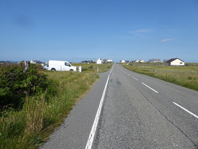
Visitors to Cladach Lag na Greine can enjoy the natural beauty of the marshland through walking trails and observation points. The area is a haven for nature enthusiasts, providing an opportunity to witness a vast array of plant and animal life in a stunning coastal setting.

If you have any feedback on the listing, please let us know in the comments section below.

Cladach Lag na Greine Images

Images are sourced within 2km of 58.413437/-6.472906 or Grid Reference NB3855. Thanks to Geograph Open Source API. All images are credited.

Fields at Siadar
Fields at Siadar
Upper beach near Siadar Exposed Atlantic coast.
Upper beach near Siadar
Exposed Atlantic coast.
Mol Eire Exposed Atlantic coast.
Mol Eire
Exposed Atlantic coast.
Rubha Bhlanisgaidh
Rubha Bhlanisgaidh
Cliff near Coig Peighinnean Bhuirgh A mix of unconsolidated deposits, not always a match for Atlantic storms.
Cliff near Coig Peighinnean Bhuirgh
A mix of unconsolidated deposits, not always a match for Atlantic storms.
Eroding cliff Interesting deposits revealed by the coastal erosion. Compare to <a href="https://www.geograph.org.uk/photo/71736">SW3530 : Climate history revealed!</a> from Cornwall. Here the raised beach and glacial deposits are the other way around. This is because the raised beach is a recent feature, raised by the isostatic rebound of the ground after the weight of the ice sheet was removed by the end of the last glacial period.
Eroding cliff
Interesting deposits revealed by the coastal erosion. Compare to SW3530 : Climate history revealed! from Cornwall. Here the raised beach and glacial deposits are the other way around. This is because the raised beach is a recent feature, raised by the isostatic rebound of the ground after the weight of the ice sheet was removed by the end of the last glacial period.
Borve Free Church
Borve Free Church
Empty house, Borve
Empty house, Borve
Cladach Lag na Greine, Isle of Lewis The entry for Cladach Lag na Greine in the OS Name Book of 1848-1852 reads, "A portion of shore between high and low water mark which is composed of shelving rock, boulders and shingle.  Signifies Shore of Sunny Hollow".
Cladach Lag na Greine, Isle of Lewis
The entry for Cladach Lag na Greine in the OS Name Book of 1848-1852 reads, "A portion of shore between high and low water mark which is composed of shelving rock, boulders and shingle. Signifies Shore of Sunny Hollow".
Cladach Lag na Greine, Isle of Lewis The entry for Cladach Lag na Greine in the OS Name Book of 1848-1852 reads, "A portion of shore between high and low water mark which is composed of shelving rock, boulders and shingle. Signifies Shore of Sunny Hollow".
Cladach Lag na Greine, Isle of Lewis
The entry for Cladach Lag na Greine in the OS Name Book of 1848-1852 reads, "A portion of shore between high and low water mark which is composed of shelving rock, boulders and shingle. Signifies Shore of Sunny Hollow".
Croftland, Cuivatotar, Isle of Lewis The OS Name Book of 1848-1852 describes this land as, "a low, arable hill, on the sea-shore, at the north end of Seadair Iochdrach. There are a good number of ruins upon it. It produces tolerably good crops, though full of small rocks".
Croftland, Cuivatotar, Isle of Lewis
The OS Name Book of 1848-1852 describes this land as, "a low, arable hill, on the sea-shore, at the north end of Seadair Iochdrach. There are a good number of ruins upon it. It produces tolerably good crops, though full of small rocks".
The A857 through Shader
Steinacleit and Loch an Dùin The best guess is that the stones of Steinacleit are the ruins of a prehistoric settlement rather than a ritual stone circle. The village of Siadar in the distance.
Steinacleit and Loch an Dùin
The best guess is that the stones of Steinacleit are the ruins of a prehistoric settlement rather than a ritual stone circle. The village of Siadar in the distance.
Broch or dun in Loch An Duin This small artificial island may be the remains of a broch or dun. <span class="nowrap"><a title="https://canmore.org.uk/site/4279/lewis-siadar-loch-an-duin" rel="nofollow ugc noopener" href="https://canmore.org.uk/site/4279/lewis-siadar-loch-an-duin">Link</a><img style="margin-left:2px;" alt="External link" title="External link - shift click to open in new window" src="https://s1.geograph.org.uk/img/external.png" width="10" height="10"/></span>
Broch or dun in Loch An Duin
This small artificial island may be the remains of a broch or dun. LinkExternal link
Steinacleit prehistoric round house It is considered that this is probably the remains of a prehistoric house.  It sits within an enclosure. <span class="nowrap"><a title="https://canmore.org.uk/site/4275/lewis-shader-steinacleit" rel="nofollow ugc noopener" href="https://canmore.org.uk/site/4275/lewis-shader-steinacleit">Link</a><img style="margin-left:2px;" alt="External link" title="External link - shift click to open in new window" src="https://s1.geograph.org.uk/img/external.png" width="10" height="10"/></span>
Steinacleit prehistoric round house
It is considered that this is probably the remains of a prehistoric house. It sits within an enclosure. LinkExternal link
Teampull Pheadair The earthwork of a medieval chapel (Scale 1m). <span class="nowrap"><a title="https://canmore.org.uk/site/4265/lewis-teampull-pheadair" rel="nofollow ugc noopener" href="https://canmore.org.uk/site/4265/lewis-teampull-pheadair">Link</a><img style="margin-left:2px;" alt="External link" title="External link - shift click to open in new window" src="https://s1.geograph.org.uk/img/external.png" width="10" height="10"/></span>
Teampull Pheadair
The earthwork of a medieval chapel (Scale 1m). LinkExternal link
Clearance cairn, Cuivatotar, Isle of Lewis According to <span class="nowrap"><a title="https://canmore.org.uk/site/335577" rel="nofollow ugc noopener" href="https://canmore.org.uk/site/335577">Link</a><img style="margin-left:2px;" alt="External link" title="External link - shift click to open in new window" src="https://s1.geograph.org.uk/img/external.png" width="10" height="10"/></span> , the clearance cairn was built on a prehistoric kerb cairn.
Clearance cairn, Cuivatotar, Isle of Lewis
According to LinkExternal link , the clearance cairn was built on a prehistoric kerb cairn.
Show me another place!

Cladach Lag na Greine is located at Grid Ref: NB3855 (Lat: 58.413437, Lng: -6.472906)

Unitary Authority: Na h-Eileanan an Iar

Police Authority: Highlands and Islands

What 3 Words

///pacifist.eternity.pardon. Near North Tolsta, Na h-Eileanan Siar

Related Wikis

Steinacleit

Steinacleit is a prehistoric archeological site on the west coast of Lewis in the Outer Hebrides of Scotland. The site consists of an array of boulders...

Borve, Lewis

Borve (Scottish Gaelic: Borgh) is a village on the west side of the Isle of Lewis in Scotland, 17 miles (27 kilometres) from the island's only town, Stornoway...

Baile an Truiseil

Ballantrushal (Scottish Gaelic: Baile an Truiseil) is a village on the Isle of Lewis in the West Side district, in the Outer Hebrides, Scotland. Ballantrushal...

Clach an Trushal

Clach an Trushal (Scottish Gaelic: Clach an Truiseil, Scottish Gaelic pronunciation: [kʰl̪ˠax ən̪ˠ ˈt̪ʰɾuʃal], translated to English "Stone of Compassion...

Nearby Amenities

Located within 500m of 58.413437,-6.472906
Created By: dmgroom_coastlines
Lat/Long: 58.41215/-6.47557
Created By: dmgroom_coastlines
Lat/Long: 58.4124/-6.47506
Created By: dmgroom_coastlines
Lat/Long: 58.41264/-6.47455
Created By: dmgroom_coastlines
Lat/Long: 58.41386/-6.47154
Created By: dmgroom_coastlines
Lat/Long: 58.41411/-6.47103
Created By: dmgroom_coastlines
Lat/Long: 58.41457/-6.46856
Created By: dmgroom_coastlines
Lat/Long: 58.41481/-6.46756
Created By: dmgroom_coastlines
Lat/Long: 58.41506/-6.46706
Created By: dmgroom_coastlines
Lat/Long: 58.41555/-6.46605
The data included in this document is from www.openstreetmap.org. The data is made available under ODbL.

Have you been to Cladach Lag na Greine?

Leave your review of Cladach Lag na Greine below (or comments, questions and feedback).