Rubha nan Uan

Coastal Marsh, Saltings in Ross-shire

Scotland

Rubha nan Uan

Footbridge over the Abhainn Ghascleit This footbridge over the Abhainn Ghascleit is a welcome sight to a weary hiker. The stream is often difficult to ford, and the bridge can be the only safe way across.
Footbridge over the Abhainn Ghascleit Credit: Marc Calhoun

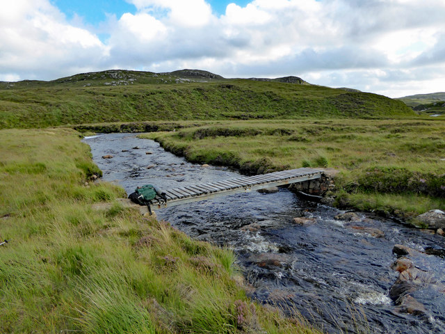
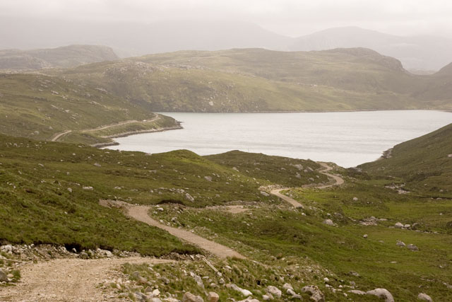
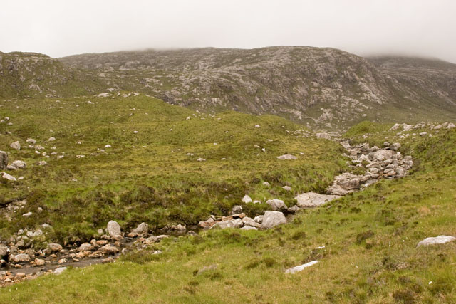
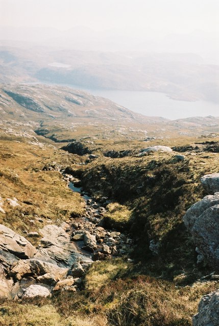
Rubha nan Uan, located in Ross-shire, Scotland, is a coastal marsh and saltings area that stretches along the shores of the North Sea. This unique natural landscape is characterized by its diverse range of habitats, including salt marshes, mudflats, sand dunes, and coastal grasslands.

The marshland at Rubha nan Uan is influenced by the ebb and flow of the tides, resulting in a dynamic and ever-changing environment. The salt marshes, which are flooded by seawater during high tide, provide a crucial habitat for a variety of plant and animal species. These marshes are characterized by the presence of salt-tolerant plants such as samphire, sea lavender, and cordgrass.

The mudflats and sand dunes found in this area are important feeding grounds for migratory birds, including waders like oystercatchers, dunlins, and curlews. The surrounding coastal grasslands support a diverse range of plant species, including wildflowers such as sea thrift and sea campion.

Rubha nan Uan is not only of ecological significance but also holds historical importance. The remains of an ancient settlement can be found in the vicinity, indicating human occupation in the area dating back centuries. The site has also been used for grazing livestock in the past.

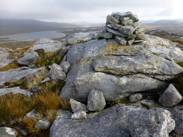
The marshland at Rubha nan Uan provides a valuable habitat for a variety of flora and fauna, making it an important site for conservation and scientific study. Its stunning natural beauty and rich biodiversity also make it a popular destination for nature enthusiasts and birdwatchers.

If you have any feedback on the listing, please let us know in the comments section below.

Rubha nan Uan Images

Images are sourced within 2km of 58.073795/-7.0280698 or Grid Reference NB0320. Thanks to Geograph Open Source API. All images are credited.

Footbridge over the Abhainn Ghascleit This footbridge over the Abhainn Ghascleit is a welcome sight to a weary hiker. The stream is often difficult to ford, and the bridge can be the only safe way across.
Footbridge over the Abhainn Ghascleit
This footbridge over the Abhainn Ghascleit is a welcome sight to a weary hiker. The stream is often difficult to ford, and the bridge can be the only safe way across.
Mullach na h-Airde Bige Second HuMP around the northern edge of Loch Resort on an Alan Holmes RIB trip. What a brilliant day.
Name: Mullach na h-Airde Bige
Hill number: 4947
Height: 182m / 597ft
Area: 24A: Lewis and Nearby Islands
Class: Hu,1
Grid ref: NB026188 (est)
Drop: 128m
Col: 54m  NB044194
Mullach na h-Airde Bige
Second HuMP around the northern edge of Loch Resort on an Alan Holmes RIB trip. What a brilliant day. Name: Mullach na h-Airde Bige Hill number: 4947 Height: 182m / 597ft Area: 24A: Lewis and Nearby Islands Class: Hu,1 Grid ref: NB026188 (est) Drop: 128m Col: 54m NB044194
Eoranish More Bagged on a RIB trip with 8 others to the HuMPs north of Loch Resort. Looking west towards Mullach na h-Airde Bige.
Name: Eoranish More
Hill number: 104363
Height: 158m / 518ft
Area: 24A: Lewis and Nearby Islands
Class: 1
Grid ref: NB032188 (est)
Drop: 79m
Col: 79m
Eoranish More
Bagged on a RIB trip with 8 others to the HuMPs north of Loch Resort. Looking west towards Mullach na h-Airde Bige. Name: Eoranish More Hill number: 104363 Height: 158m / 518ft Area: 24A: Lewis and Nearby Islands Class: 1 Grid ref: NB032188 (est) Drop: 79m Col: 79m
Aineabhal Summit Cairn Bagged with Jim Bloomer, Colin Crawford and George Morl. on a lovely day for September. Only 4 out of 9 of Alan Holmes RIB trip bagged this P98 today.
Name: Aineabhal
Hill number: 7098
Height: 166m / 545ft
Area: 24A: Lewis and Nearby Islands
Class: 1,sHu
Grid ref: NB053197 (est)
Drop: 98m
Col: 68m  NB063198
Aineabhal Summit Cairn
Bagged with Jim Bloomer, Colin Crawford and George Morl. on a lovely day for September. Only 4 out of 9 of Alan Holmes RIB trip bagged this P98 today. Name: Aineabhal Hill number: 7098 Height: 166m / 545ft Area: 24A: Lewis and Nearby Islands Class: 1,sHu Grid ref: NB053197 (est) Drop: 98m Col: 68m NB063198
View Across Loch Gruineabhat View across Loch Gruineabhat and beyond to the subHuMP Aineabhal which is the next hill on our bagging list today.
View Across Loch Gruineabhat
View across Loch Gruineabhat and beyond to the subHuMP Aineabhal which is the next hill on our bagging list today.
Crossing Damp Moorland Crossing damp moorland after descending from Eoranish More and heading towards Aineabhal.
Crossing Damp Moorland
Crossing damp moorland after descending from Eoranish More and heading towards Aineabhal.
House and Outbuildings at Tamnabhaigh
Loch Tamnabhaigh Aird Bheag to left of image and Tamana Sear to right
Loch Tamnabhaigh
Aird Bheag to left of image and Tamana Sear to right
Loch Cheann Chuisil This sheltered loch offers anchorage during stormy weather
Loch Cheann Chuisil
This sheltered loch offers anchorage during stormy weather
Sgaladal on the east ridge of Griomabhal
Sgaladal
on the east ridge of Griomabhal
The road down to Loch Cheann Chuisil The standard access roads on the island of Lewis are graded gravel. Though they may appear straight on an OS map, local rocky outcrops mean that they meander for short distances. The road can be seen descending down to the loch, and continuing around the bay to the left.
The road down to Loch Cheann Chuisil
The standard access roads on the island of Lewis are graded gravel. Though they may appear straight on an OS map, local rocky outcrops mean that they meander for short distances. The road can be seen descending down to the loch, and continuing around the bay to the left.
Abhainn Cheann Chuisil stream The rocky curve is the stream running down from the mountains on the island of Lewis in the Outer Hebrides. The surrounding vegetation is soft peat and bog amongst the rocks. In the distance the hills can be seen to be misty due to rainfall.
Abhainn Cheann Chuisil stream
The rocky curve is the stream running down from the mountains on the island of Lewis in the Outer Hebrides. The surrounding vegetation is soft peat and bog amongst the rocks. In the distance the hills can be seen to be misty due to rainfall.
Burn flowing into Gleann Sgaladail
The head of Gleann Sgaladail The lower picture shows ruined shielings with a burn running through.
The head of Gleann Sgaladail
The lower picture shows ruined shielings with a burn running through.
Ruined shielings in Gleann Sgaladail
Gleann Sgaladail burn meets Loch Tamnabhaigh
Moorland above Loch Tamnabhaigh
Bridge over Abhainn Tamnabhaig
Show me another place!

Rubha nan Uan is located at Grid Ref: NB0320 (Lat: 58.073795, Lng: -7.0280698)

Unitary Authority: Na h-Eileanan an Iar

Police Authority: Highlands and Islands

What 3 Words

///handed.unionists.chopper. Near Tarbert, Na h-Eileanan Siar

Related Wikis

Mealista

Mealista (Scottish Gaelic: Mealasta) was a township in the west of the Isle of Lewis. It is currently largely uninhabited due to the Highland Clearances...

Game pieces of the Lewis chessmen hoard

Game pieces of the Lewis chessmen hoard include the ninety-three game pieces of the Lewis chessmen hoard found on the Isle of Lewis in the Outer Hebrides...

Eilean Mhealasta

Eilean Mhealasta (Mealista Island) is an uninhabited island off the west coast of Lewis in the Outer Hebrides of Scotland. It takes its name from Mealista...

Brenish

Brenish (Scottish Gaelic: Brèinis) is a small village situated on the west coast of the Isle of Lewis, which is part of the Outer Hebrides of Scotland...

Nearby Amenities

Located within 500m of 58.073795,-7.0280698
Turning Circle
Lat/Long: 58.0725434/-7.0215941
Loch Ceann Chuisil
Natural: bay
Lat/Long: 58.0770296/-7.0317303
Camas na Crotha
Natural: bay
Lat/Long: 58.0717759/-7.0266448
Tamnabhagh
Place: locality
Lat/Long: 58.0724924/-7.0224836
The data included in this document is from www.openstreetmap.org. The data is made available under ODbL.

Have you been to Rubha nan Uan?

Leave your review of Rubha nan Uan below (or comments, questions and feedback).