Loch Cheann Chuisil

Bay in Ross-shire

Scotland

Loch Cheann Chuisil

Mullach na h-Airde Bige Second HuMP around the northern edge of Loch Resort on an Alan Holmes RIB trip. What a brilliant day.
Name: Mullach na h-Airde Bige
Hill number: 4947
Height: 182m / 597ft
Area: 24A: Lewis and Nearby Islands
Class: Hu,1
Grid ref: NB026188 (est)
Drop: 128m
Col: 54m  NB044194
Mullach na h-Airde Bige Credit: Rude Health

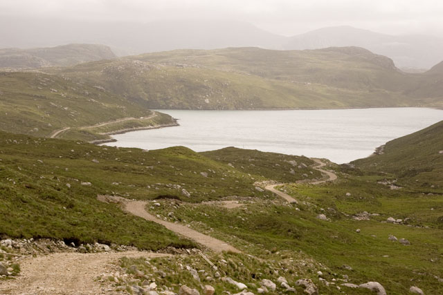
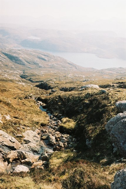
Loch Cheann Chuisil, also known as Bay Loch, is a picturesque body of water located in Ross-shire, Scotland. Situated on the west coast of the Highlands, this loch stretches approximately 4 miles in length and is surrounded by stunning scenery.

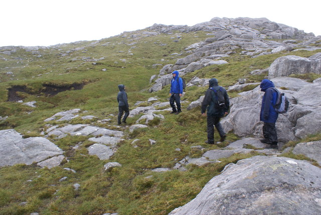
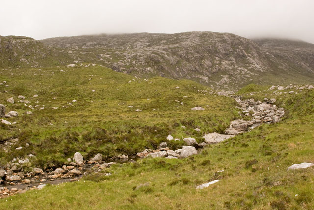
The bay is nestled between rolling hills and rugged mountains, providing a dramatic backdrop to the tranquil waters. Its location offers breathtaking views of the nearby Torridon mountain range and the Isle of Skye in the distance. The area is renowned for its natural beauty, attracting visitors and nature enthusiasts from around the world.

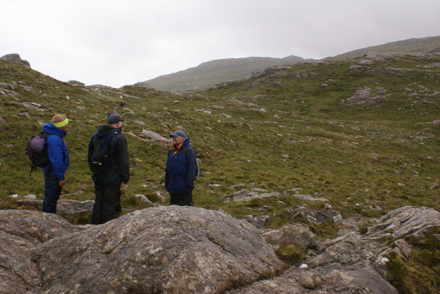
Loch Cheann Chuisil is a haven for wildlife, with a variety of bird species, including herons and gulls, frequenting its shores. Otters can also be spotted playing in the water, making it a popular spot for wildlife photographers and nature lovers.

The bay is a popular destination for outdoor activities such as fishing, kayaking, and boating. Anglers are drawn to the loch for its abundance of trout, making it a paradise for fishing enthusiasts. The calm waters also make it an ideal spot for leisurely boat rides and kayaking, allowing visitors to explore the loch and its surrounding beauty at their own pace.

The area around Loch Cheann Chuisil offers a range of accommodation options, including cozy cottages and bed and breakfasts, providing visitors with a comfortable base to explore the region. With its stunning scenery, diverse wildlife, and outdoor activities, Loch Cheann Chuisil is a must-visit destination for those seeking a peaceful and idyllic getaway in the heart of the Scottish Highlands.

If you have any feedback on the listing, please let us know in the comments section below.

Loch Cheann Chuisil Images

Images are sourced within 2km of 58.075358/-7.0338261 or Grid Reference NB0320. Thanks to Geograph Open Source API. All images are credited.

Mullach na h-Airde Bige Second HuMP around the northern edge of Loch Resort on an Alan Holmes RIB trip. What a brilliant day.
Name: Mullach na h-Airde Bige
Hill number: 4947
Height: 182m / 597ft
Area: 24A: Lewis and Nearby Islands
Class: Hu,1
Grid ref: NB026188 (est)
Drop: 128m
Col: 54m  NB044194
Mullach na h-Airde Bige
Second HuMP around the northern edge of Loch Resort on an Alan Holmes RIB trip. What a brilliant day. Name: Mullach na h-Airde Bige Hill number: 4947 Height: 182m / 597ft Area: 24A: Lewis and Nearby Islands Class: Hu,1 Grid ref: NB026188 (est) Drop: 128m Col: 54m NB044194
Eoranish More Bagged on a RIB trip with 8 others to the HuMPs north of Loch Resort. Looking west towards Mullach na h-Airde Bige.
Name: Eoranish More
Hill number: 104363
Height: 158m / 518ft
Area: 24A: Lewis and Nearby Islands
Class: 1
Grid ref: NB032188 (est)
Drop: 79m
Col: 79m
Eoranish More
Bagged on a RIB trip with 8 others to the HuMPs north of Loch Resort. Looking west towards Mullach na h-Airde Bige. Name: Eoranish More Hill number: 104363 Height: 158m / 518ft Area: 24A: Lewis and Nearby Islands Class: 1 Grid ref: NB032188 (est) Drop: 79m Col: 79m
View Across Loch Gruineabhat View across Loch Gruineabhat and beyond to the subHuMP Aineabhal which is the next hill on our bagging list today.
View Across Loch Gruineabhat
View across Loch Gruineabhat and beyond to the subHuMP Aineabhal which is the next hill on our bagging list today.
Crossing Damp Moorland Crossing damp moorland after descending from Eoranish More and heading towards Aineabhal.
Crossing Damp Moorland
Crossing damp moorland after descending from Eoranish More and heading towards Aineabhal.
House and Outbuildings at Tamnabhaigh
Loch Tamnabhaigh Aird Bheag to left of image and Tamana Sear to right
Loch Tamnabhaigh
Aird Bheag to left of image and Tamana Sear to right
Loch Cheann Chuisil This sheltered loch offers anchorage during stormy weather
Loch Cheann Chuisil
This sheltered loch offers anchorage during stormy weather
Sgaladal on the east ridge of Griomabhal
Sgaladal
on the east ridge of Griomabhal
Griomabhal East Ridge Summit on the skyline
Griomabhal East Ridge
Summit on the skyline
The road down to Loch Cheann Chuisil The standard access roads on the island of Lewis are graded gravel. Though they may appear straight on an OS map, local rocky outcrops mean that they meander for short distances. The road can be seen descending down to the loch, and continuing around the bay to the left.
The road down to Loch Cheann Chuisil
The standard access roads on the island of Lewis are graded gravel. Though they may appear straight on an OS map, local rocky outcrops mean that they meander for short distances. The road can be seen descending down to the loch, and continuing around the bay to the left.
Abhainn Cheann Chuisil stream The rocky curve is the stream running down from the mountains on the island of Lewis in the Outer Hebrides. The surrounding vegetation is soft peat and bog amongst the rocks. In the distance the hills can be seen to be misty due to rainfall.
Abhainn Cheann Chuisil stream
The rocky curve is the stream running down from the mountains on the island of Lewis in the Outer Hebrides. The surrounding vegetation is soft peat and bog amongst the rocks. In the distance the hills can be seen to be misty due to rainfall.
Burn flowing into Gleann Sgaladail
The head of Gleann Sgaladail The lower picture shows ruined shielings with a burn running through.
The head of Gleann Sgaladail
The lower picture shows ruined shielings with a burn running through.
Ruined shielings in Gleann Sgaladail
Gleann Sgaladail burn meets Loch Tamnabhaigh
Moorland above Loch Tamnabhaigh
Bridge over Abhainn Tamnabhaig
Aird Bheag Number 1 Aird Bheag on the shore of Loch Hamnaway
Aird Bheag
Number 1 Aird Bheag on the shore of Loch Hamnaway
Show me another place!

Loch Cheann Chuisil is located at Grid Ref: NB0320 (Lat: 58.075358, Lng: -7.0338261)

Unitary Authority: Na h-Eileanan an Iar

Police Authority: Highlands and Islands

What 3 Words

///grumbles.dealings.middle. Near Tarbert, Na h-Eileanan Siar

Related Wikis

Game pieces of the Lewis chessmen hoard

The game pieces of the Lewis chessmen hoard consist of ninety-three game pieces of the Lewis chessmen found on the Isle of Lewis in the Outer Hebrides...

Mealista

Mealista (Scottish Gaelic: Mealasta) was a township in the west of the Isle of Lewis. It is currently largely uninhabited due to the Highland Clearances...

Eilean Mhealasta

Eilean Mhealasta (Mealista Island) is an uninhabited island off the west coast of Lewis in the Outer Hebrides of Scotland. It takes its name from Mealista...

Brenish

Brenish (Scottish Gaelic: Brèinis) is a small village situated on the west coast of the Isle of Lewis, which is part of the Outer Hebrides of Scotland...

Nearby Amenities

Located within 500m of 58.075358,-7.0338261
Created By: dmgroom_coastlines
Lat/Long: 58.07465/-7.03667
Created By: dmgroom_coastlines
Lat/Long: 58.07453/-7.03691
Created By: dmgroom_coastlines
Lat/Long: 58.07441/-7.03716
Created By: dmgroom_coastlines
Lat/Long: 58.07428/-7.03741
Created By: dmgroom_coastlines
Lat/Long: 58.07416/-7.03766
Created By: dmgroom_coastlines
Lat/Long: 58.07354/-7.0389
Loch Ceann Chuisil
Natural: bay
Lat/Long: 58.0770296/-7.0317303
The data included in this document is from www.openstreetmap.org. The data is made available under ODbL.

Have you been to Loch Cheann Chuisil?

Leave your review of Loch Cheann Chuisil below (or comments, questions and feedback).