Bòta Ruadh
Coastal Marsh, Saltings in Inverness-shire
Scotland
Bòta Ruadh

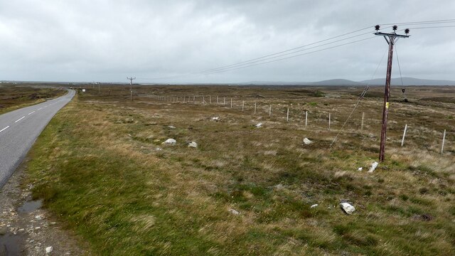
Bòta Ruadh, located in Inverness-shire, Scotland, is a beautiful coastal marsh and saltings area. Covering an expanse of land along the coast, it is renowned for its unique ecological characteristics and stunning natural beauty.
The marsh is characterized by its vast stretches of salt marshes and intertidal mudflats, which are home to a rich variety of plant and animal life. The area is an important habitat for many species of birds, including wading birds, waterfowl, and migratory birds. These birds are attracted to the marshes due to the abundance of food provided by the tidal waters.
The landscape of Bòta Ruadh is defined by the ebb and flow of the tides, with the marshes being submerged during high tide and exposed during low tide. This dynamic environment creates a constantly changing landscape, offering a unique experience for visitors.
The marshes also play a crucial role in protecting the coastline from erosion and flooding by absorbing and dissipating the energy of the waves. The extensive network of salt marshes acts as a natural buffer, reducing the impact of storms and providing a valuable defense against coastal erosion.
Bòta Ruadh is a popular destination for nature enthusiasts, birdwatchers, and photographers. Visitors can enjoy walking along the network of footpaths that traverse the marshes, observing the diverse wildlife and taking in the breathtaking views of the surrounding coastal scenery.
Overall, Bòta Ruadh in Inverness-shire is a captivating coastal marsh and saltings area that offers a unique and diverse ecosystem, making it a must-visit destination for those seeking to connect with nature and experience the beauty of Scotland's coastal landscapes.
If you have any feedback on the listing, please let us know in the comments section below.
Bòta Ruadh Images
Images are sourced within 2km of 57.507981/-7.3112404 or Grid Reference NF8258. Thanks to Geograph Open Source API. All images are credited.


Bòta Ruadh is located at Grid Ref: NF8258 (Lat: 57.507981, Lng: -7.3112404)
Unitary Authority: Na h-Eileanan an Iar
Police Authority: Highlands and Islands
What 3 Words
///truckload.heavy.beeline. Near Balivanich, Na h-Eileanan Siar
Nearby Locations
Related Wikis

Bail' Iochdrach
Bail' Iochdrach or Baliochrach (Scottish Gaelic: Am Baile Ìochdrach) is a village on Benbecula in the Outer Hebrides, Scotland. Baliochrach is within the...

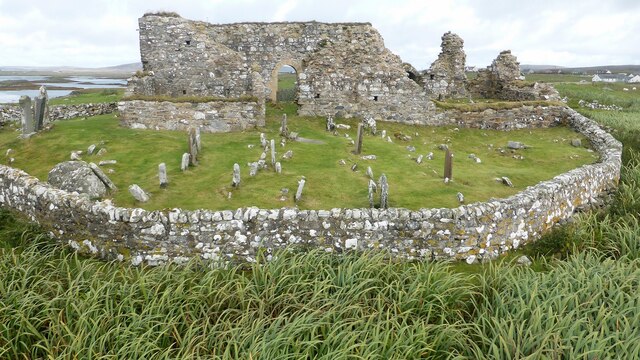
Teampull na Trionaid
Teampull na Trionaid ("trinity church") is a ruined 13th-century Augustinian nunnery at Carinish, on North Uist, in the Outer Hebrides of Scotland. �...

Carinish
Carinish (Scottish Gaelic: Càirinis), is a hamlet on North Uist, in the Outer Hebrides, Scotland. It is in the south of the island, about two miles (three...

Battle of Carinish
The Battle of Carinish was a Scottish clan battle fought in North Uist in 1601. It was part of a year of feuding between Clan MacLeod of Dunvegan and the...
Nearby Amenities
Located within 500m of 57.507981,-7.3112404Have you been to Bòta Ruadh?
Leave your review of Bòta Ruadh below (or comments, questions and feedback).