Mol Shoay

Coastal Marsh, Saltings in Inverness-shire

Scotland

Mol Shoay

Geodha na h-Àirde (The Tunnel),  St Kilda A long tunnel cuts through the headland of Gob na h-Àirde which is marked on OS maps as an arch. This is the view at the Gleann Mòr entrance looking towards the bay.  Access is by a sloping ledge visible in <a href="https://www.geograph.org.uk/photo/1291360">NA0800 : Gob na h-Airde</a>.  The floor of the tunnel has the name Leacan an t-Sluic Mhóir that means The flagstones of the big hole.  Jim Crumley in his book, Among Islands, published in 1994, commented that The Tunnel is a landscape out of the top drawer and that "The Trumpet-blowers played the thing down, for memory in such a landscape is not to be trusted".  This is the first image inside the Tunnel on Geograph.
Geodha na h-Àirde (The Tunnel), St Kilda Credit: Julian Paren

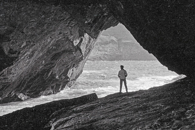
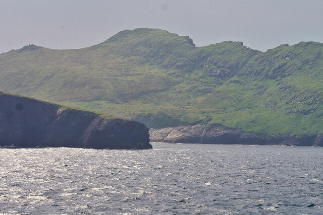
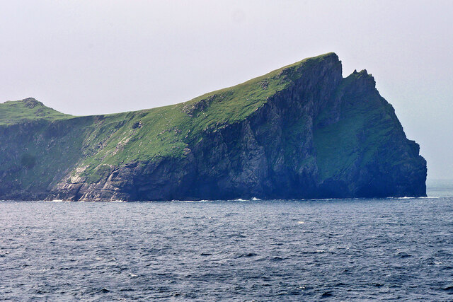
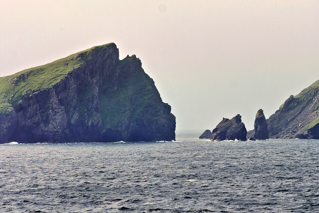
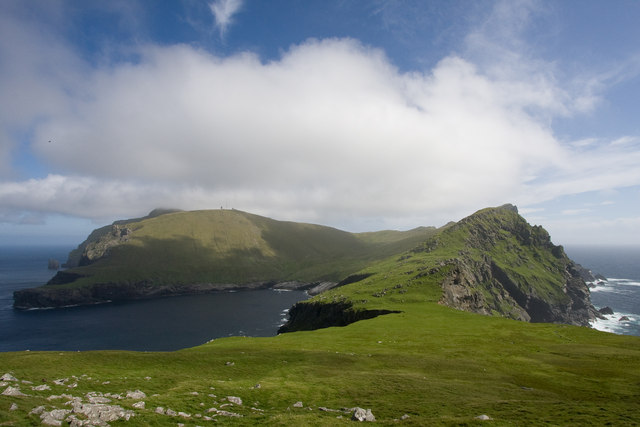
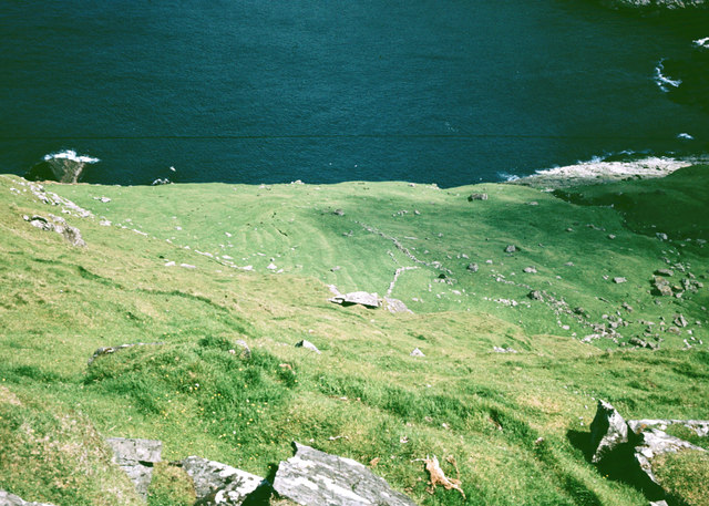
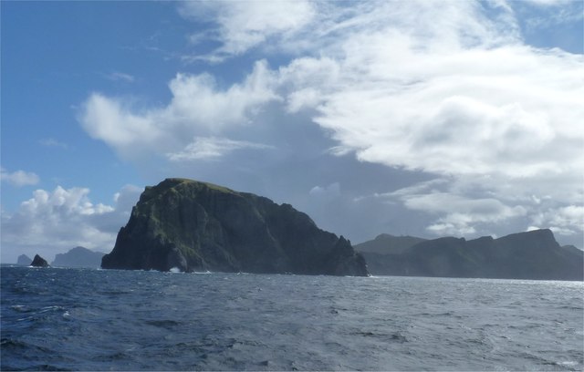
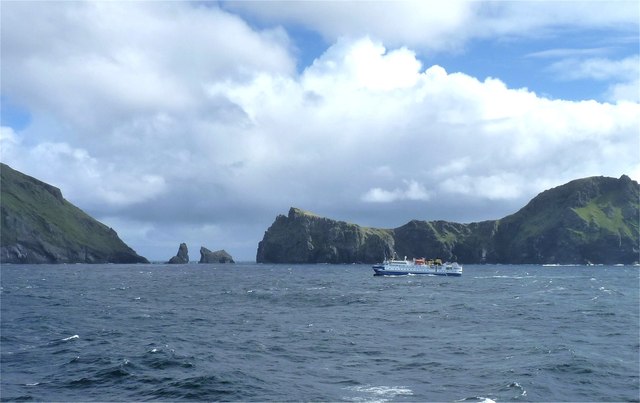
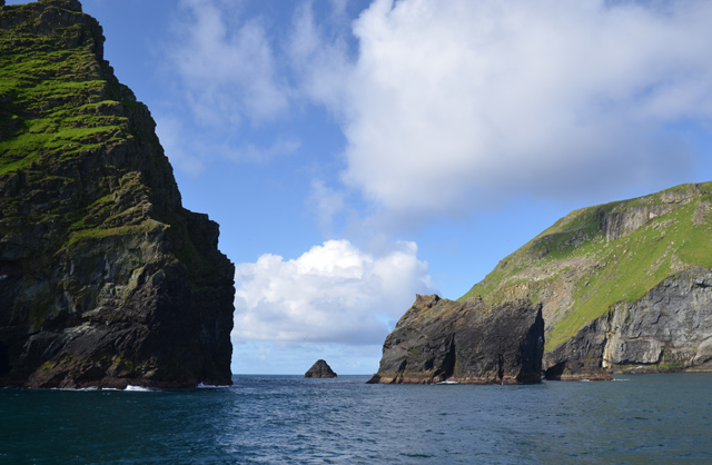
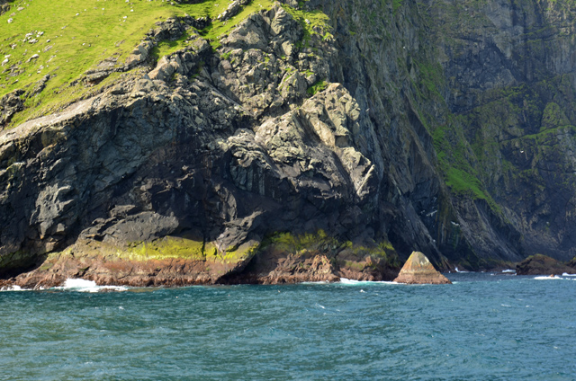
Mol Shoay, located in Inverness-shire, Scotland, is a coastal marsh and saltings area that offers a unique and diverse habitat for various plant and animal species. Situated along the coast, it is characterized by its wet and marshy landscape, which is influenced by the ebb and flow of tides from the nearby sea.

The marsh and saltings of Mol Shoay are known for their rich biodiversity. The area is home to a variety of plants, including marsh samphire, sea lavender, and sea purslane, which are well adapted to the salty conditions of the coast. These plants not only provide food and shelter for numerous invertebrates but also play a crucial role in stabilizing the marshland and preventing erosion.

The wetlands of Mol Shoay also attract a wide range of bird species, making it a haven for birdwatchers. Common sightings include wading birds such as oystercatchers, curlews, and redshanks, which forage for food in the shallow waters. Additionally, the marsh provides an important breeding ground for various waterfowl, including ducks and geese.

The area is also significant from a conservation perspective. Mol Shoay is part of a designated Site of Special Scientific Interest (SSSI), recognizing its importance for its unique ecology and wildlife. As a protected area, it is managed to maintain its natural features and ensure the preservation of its diverse flora and fauna.

Visitors to Mol Shoay can enjoy the tranquility of the marshland, take in the breathtaking coastal views, and observe the remarkable wildlife that thrives in this coastal habitat.

If you have any feedback on the listing, please let us know in the comments section below.
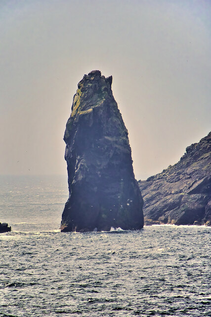
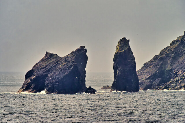
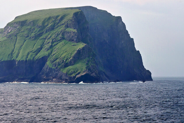
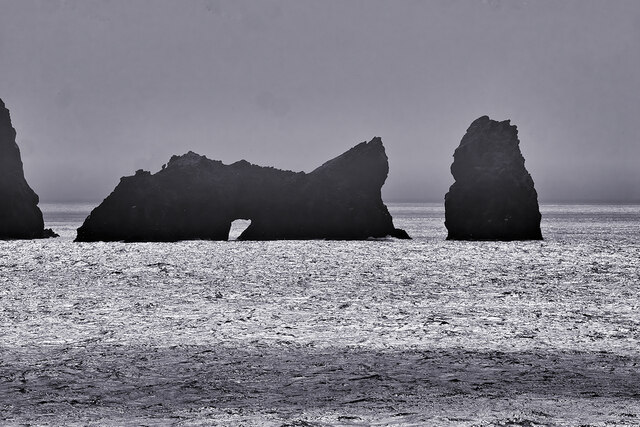
Mol Shoay Images

Images are sourced within 2km of 57.827451/-8.6250315 or Grid Reference NA0601. Thanks to Geograph Open Source API. All images are credited.

Geodha na h-Àirde (The Tunnel),  St Kilda A long tunnel cuts through the headland of Gob na h-Àirde which is marked on OS maps as an arch. This is the view at the Gleann Mòr entrance looking towards the bay.  Access is by a sloping ledge visible in <a href="https://www.geograph.org.uk/photo/1291360">NA0800 : Gob na h-Airde</a>.  The floor of the tunnel has the name Leacan an t-Sluic Mhóir that means The flagstones of the big hole.  Jim Crumley in his book, Among Islands, published in 1994, commented that The Tunnel is a landscape out of the top drawer and that "The Trumpet-blowers played the thing down, for memory in such a landscape is not to be trusted".  This is the first image inside the Tunnel on Geograph.
Geodha na h-Àirde (The Tunnel), St Kilda
A long tunnel cuts through the headland of Gob na h-Àirde which is marked on OS maps as an arch. This is the view at the Gleann Mòr entrance looking towards the bay. Access is by a sloping ledge visible in NA0800 : Gob na h-Airde. The floor of the tunnel has the name Leacan an t-Sluic Mhóir that means The flagstones of the big hole. Jim Crumley in his book, Among Islands, published in 1994, commented that The Tunnel is a landscape out of the top drawer and that "The Trumpet-blowers played the thing down, for memory in such a landscape is not to be trusted". This is the first image inside the Tunnel on Geograph.
Hirta, Gob na h-Àirde A small headland which forms the eastern side of Glen Bay on the north coast of Hirta, the principal island of the St Kilda archipelago.
Hirta, Gob na h-Àirde
A small headland which forms the eastern side of Glen Bay on the north coast of Hirta, the principal island of the St Kilda archipelago.
An Campar Hill at the north-western end of Hirta in the St Kilda archipelago.
An Campar
Hill at the north-western end of Hirta in the St Kilda archipelago.
St Kilda, Soay Strait The islands of Soay (Shoaigh) and Hirta (Hiort) in the St Kilda archipelago are separated by the narrow Sound of Soay which is only about 500 metres wide. Two sea stacks, Stac Shoaigh (Soay Stac) (200 ft), and Stac Biorach, (240 ft), lie between the two islands.
St Kilda, Soay Strait
The islands of Soay (Shoaigh) and Hirta (Hiort) in the St Kilda archipelago are separated by the narrow Sound of Soay which is only about 500 metres wide. Two sea stacks, Stac Shoaigh (Soay Stac) (200 ft), and Stac Biorach, (240 ft), lie between the two islands.
Stac Biorach, St Kilda Stac Biorach (Scottish Gaelic meaning "the pointed stack") is a sea stack, 73 metres tall, situated in the Sound of Soay, between the islands of Hirta and Soay in the St Kilda archipelago.
Stac Biorach, St Kilda
Stac Biorach (Scottish Gaelic meaning "the pointed stack") is a sea stack, 73 metres tall, situated in the Sound of Soay, between the islands of Hirta and Soay in the St Kilda archipelago.
Sea stacks between Soay and Hirta The islands of Soay (Shoaigh) and Hirta (Hiort) in the St Kilda archipelago are separated by the narrow Sound of Soay which is only about 500 metres wide. Two sea stacks, Stac Shoaigh (Soay Stac) (200 ft), and Stac Biorach, (240 ft), lie between the two islands.
Sea stacks between Soay and Hirta
The islands of Soay (Shoaigh) and Hirta (Hiort) in the St Kilda archipelago are separated by the narrow Sound of Soay which is only about 500 metres wide. Two sea stacks, Stac Shoaigh (Soay Stac) (200 ft), and Stac Biorach, (240 ft), lie between the two islands.
Soay, St Kilda Soay (Scottish Gaelic: Soaigh) is an uninhabited islet in the St Kilda archipelago; it is the westernmost point in the United Kingdom. The name derives from Old Norse Seyðoy, meaning "Island of Sheep". The island is home to a primitive breed of sheep, Soay sheep <span class="nowrap"><a title="https://en.wikipedia.org/wiki/Soay_sheep" rel="nofollow ugc noopener" href="https://en.wikipedia.org/wiki/Soay_sheep">Link</a><img style="margin-left:2px;" alt="External link" title="External link - shift click to open in new window" src="https://s1.geograph.org.uk/img/external.png" width="10" height="10"/></span> .
Soay, St Kilda
Soay (Scottish Gaelic: Soaigh) is an uninhabited islet in the St Kilda archipelago; it is the westernmost point in the United Kingdom. The name derives from Old Norse Seyðoy, meaning "Island of Sheep". The island is home to a primitive breed of sheep, Soay sheep LinkExternal link .
Stacs Shoaigh and Biorach, St Kilda Archipelago The islands of Soay (Shoaigh) and Hirta (Hiort) in the St Kilda archipelago are separated by the narrow Sound of Soay which is only about 500 metres wide. Two sea stacks, Stac Shoaigh (Soay Stac) (200 ft), and Stac Biorach, (240 ft), lie between the two islands.

Stac Shoaigh has an arch at its base.
Stacs Shoaigh and Biorach, St Kilda Archipelago
The islands of Soay (Shoaigh) and Hirta (Hiort) in the St Kilda archipelago are separated by the narrow Sound of Soay which is only about 500 metres wide. Two sea stacks, Stac Shoaigh (Soay Stac) (200 ft), and Stac Biorach, (240 ft), lie between the two islands. Stac Shoaigh has an arch at its base.
Cambir on St Kilda The view south from the tip of The Cambir (216 m) with Mullach Mor (361 m) on the left and Mullach Bi (358 m) on the right.
Cambir on St Kilda
The view south from the tip of The Cambir (216 m) with Mullach Mor (361 m) on the left and Mullach Bi (358 m) on the right.
Lazy beds in Gleann Mor Evidence of cultivation in the ancient settlement in Gleann Mor, Hirta.
Lazy beds in Gleann Mor
Evidence of cultivation in the ancient settlement in Gleann Mor, Hirta.
Preparing To Leave Soay Pete Ellis doing the calm lead climbing assisted by Dave Tyson and Alan Whatley. Once the slippy bits were out of the way it was just a rocky scramble then out onto a grassy ledge before upward and onward to the top of Soay. This pictures shows our two abseil ropes with a view towards Stac Dona.
Preparing To Leave Soay
Pete Ellis doing the calm lead climbing assisted by Dave Tyson and Alan Whatley. Once the slippy bits were out of the way it was just a rocky scramble then out onto a grassy ledge before upward and onward to the top of Soay. This pictures shows our two abseil ropes with a view towards Stac Dona.
Stac Shoaigh and Stac Biorach In the Sound of Soay between the islands of Soay and Hirta.
Stac Shoaigh and Stac Biorach
In the Sound of Soay between the islands of Soay and Hirta.
The island of Soay The sea stack to the left is Am Plastair and the hills of Hirta are in the background.
The island of Soay
The sea stack to the left is Am Plastair and the hills of Hirta are in the background.
Crossing the Sound of Soay A cruise ship with the islands of Soay to the left and Hirta to the right in the background.
Crossing the Sound of Soay
A cruise ship with the islands of Soay to the left and Hirta to the right in the background.
Gob na h-Airde The headland to the south of Loch a' Ghlinne on Hirta.
Gob na h-Airde
The headland to the south of Loch a' Ghlinne on Hirta.
The head of Loch a' Ghlinne Looking into Gleann Mòr, with Mullach Mòr rising on the left.
The head of Loch a' Ghlinne
Looking into Gleann Mòr, with Mullach Mòr rising on the left.
Channel between Hirta and Soay With the bulky Stac Shoaigh to the right of the visible gap.
Channel between Hirta and Soay
With the bulky Stac Shoaigh to the right of the visible gap.
Geodha Ruadh The northern extremity of Soay.
Geodha Ruadh
The northern extremity of Soay.
Show me another place!

Mol Shoay is located at Grid Ref: NA0601 (Lat: 57.827451, Lng: -8.6250315)

Unitary Authority: Na h-Eileanan an Iar

Police Authority: Highlands and Islands

What 3 Words

///hurls.abstracts.clothed. Near Balivanich, Na h-Eileanan Siar

Related Wikis

Stac Biorach

Stac Biorach (Scottish Gaelic: "the pointed stack") is a sea stack, 73 metres tall, situated between Hirta and Soay (in the "Sound of Soay") in the St...

Soay, St Kilda

Soay (Scottish Gaelic: Soaigh) is an uninhabited islet in the St Kilda archipelago, Scotland. The name is from Old Norse Seyðoy, meaning 'island of sheep...

St Kilda, Scotland

St Kilda (Scottish Gaelic: Hiort) is an isolated archipelago situated 64 kilometres (40 mi) west-northwest of North Uist in the North Atlantic Ocean. It...

Hirta

Hirta (Scottish Gaelic: Hiort) is the largest island in the St Kilda archipelago, on the western edge of Scotland. The names Hiort (in Scottish Gaelic...

Nearby Amenities

Located within 500m of 57.827451,-8.6250315
Ele: 340
Natural: peak
Source: npe
Lat/Long: 57.8291082/-8.6319221
Natural: rock
Seamark Type: rock
Lat/Long: 57.8259471/-8.6257112
Natural: rock
Seamark Type: rock
Lat/Long: 57.8265125/-8.624706
Natural: rock
Seamark Type: rock
Lat/Long: 57.8269233/-8.6248051
Natural: rock
Seamark Type: rock
Lat/Long: 57.827451/-8.6246565
Natural: rock
Seamark Type: rock
Lat/Long: 57.8277638/-8.6246919
Natural: rock
Seamark Type: rock
Lat/Long: 57.8279862/-8.6250812
Natural: rock
Seamark Type: rock
Lat/Long: 57.8277073/-8.624975
Natural: rock
Seamark Type: rock
Lat/Long: 57.8274585/-8.624975
Natural: rock
Seamark Type: rock
Lat/Long: 57.8271457/-8.6250175
Natural: rock
Seamark Type: rock
Lat/Long: 57.82939/-8.6183056
Natural: rock
Seamark Type: rock
Lat/Long: 57.8265736/-8.6180413
Natural: rock
Seamark Type: rock
Lat/Long: 57.8268032/-8.6179797
Natural: rock
Seamark Type: rock
Lat/Long: 57.8270657/-8.6179427
The data included in this document is from www.openstreetmap.org. The data is made available under ODbL.

Have you been to Mol Shoay?

Leave your review of Mol Shoay below (or comments, questions and feedback).