Foreness Point

Coastal Feature, Headland, Point in Kent Thanet

England

Foreness Point

Coast road above Kingsgate Bay Coast road above Kingsgate Bay at North Foreland.
Coast road above Kingsgate Bay Credit: Philip Halling

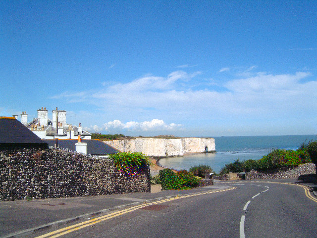
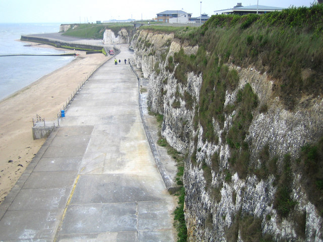
Foreness Point is a prominent coastal feature located in Kent, England. Situated near the town of Margate, it is classified as a headland and point due to its distinct geographical characteristics.

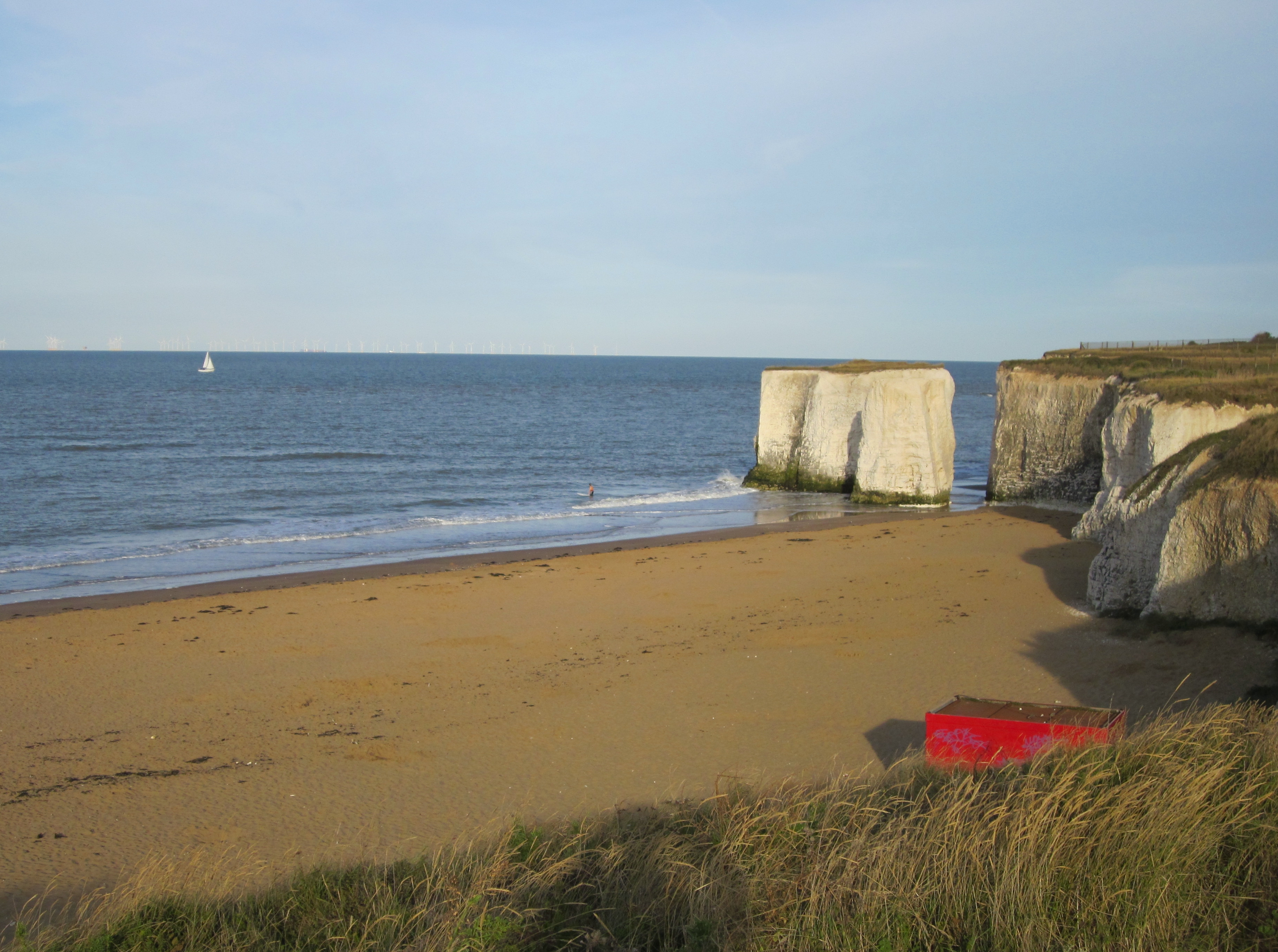
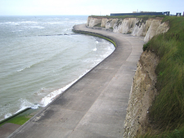
The area is known for its stunning natural beauty, with rugged cliffs and rock formations that stretch out into the English Channel. The headland offers panoramic views of the surrounding coastline and the open sea, making it a popular destination for tourists and locals alike.

Foreness Point is also notable for its rich biodiversity. The cliffs provide nesting sites for various seabird species, including gulls, cormorants, and fulmars. The surrounding waters are home to diverse marine life, with sightings of dolphins and seals being common.

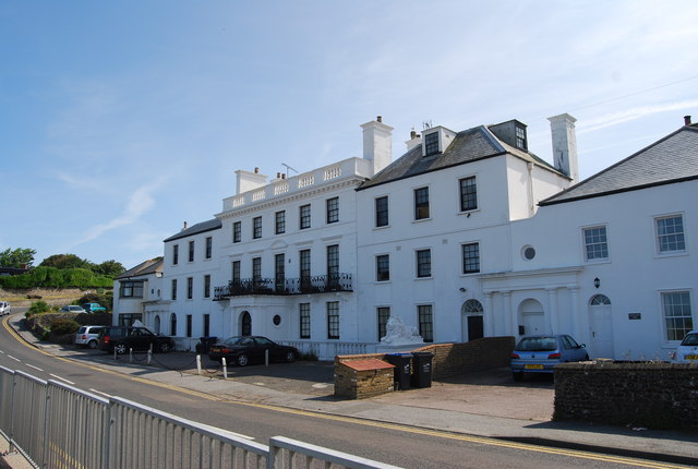
In addition to its natural attractions, Foreness Point has historical significance. The area has been inhabited for centuries, and archaeological remains from the Bronze Age have been discovered in the vicinity. The presence of a nearby lighthouse, built in the 19th century, further adds to the area's cultural heritage.

Visitors to Foreness Point can enjoy a range of activities. The headland offers opportunities for hiking and birdwatching, with designated trails allowing visitors to explore the area's diverse flora and fauna. The rocky shoreline is also popular among anglers, who come to fish for species such as bass and mackerel.

Overall, Foreness Point is a captivating coastal feature that combines natural beauty, rich wildlife, and historical significance. It is a must-visit destination for those seeking to experience the breathtaking landscapes and explore the cultural heritage of Kent's coastline.

If you have any feedback on the listing, please let us know in the comments section below.

Foreness Point Images

Images are sourced within 2km of 51.396975/1.4271928 or Grid Reference TR3872. Thanks to Geograph Open Source API. All images are credited.

Coast road above Kingsgate Bay Coast road above Kingsgate Bay at North Foreland.
Coast road above Kingsgate Bay
Coast road above Kingsgate Bay at North Foreland.
Kingsgate Bay A sandy beach on Kingsgate Bay with Whiteness Tower the cliffs in the background.
Kingsgate Bay
A sandy beach on Kingsgate Bay with Whiteness Tower the cliffs in the background.
Beach, Palm Bay The tide was coming in.
Beach, Palm Bay
The tide was coming in.
Cliff, Palm Bay Quite a lot of reinforcement has been applied.
Cliff, Palm Bay
Quite a lot of reinforcement has been applied.
Sackett's Gap and Bridge, Palm Bay A way down to the beach and lower promenade, bridged by the cliff top promenade.
Sackett's Gap and Bridge, Palm Bay
A way down to the beach and lower promenade, bridged by the cliff top promenade.
Sign at Hodges Gap, Palm Bay Addressed to those using personal water craft, although this is not obvious at first sight.
Sign at Hodges Gap, Palm Bay
Addressed to those using personal water craft, although this is not obvious at first sight.
Walpole Bay tidal bathing pool The rising tide was just overtopping the containing wall. There were two swimmers in the pool, and as I watched two more entered. Not my idea of November fun.
Walpole Bay tidal bathing pool
The rising tide was just overtopping the containing wall. There were two swimmers in the pool, and as I watched two more entered. Not my idea of November fun.
Beach, Palm Bay There is a chalk platform that extends some way out at low tide, probably the source of a lot of the washed up seaweed.
Beach, Palm Bay
There is a chalk platform that extends some way out at low tide, probably the source of a lot of the washed up seaweed.
Palm Bay Café, Palm Bay
Kingsgate Bay This is the old tower at the top of Kingsgate Bay, at White Ness, with the gap in the cliffs going down to the sea.
Kingsgate Bay
This is the old tower at the top of Kingsgate Bay, at White Ness, with the gap in the cliffs going down to the sea.
Kingsgate Post Office Located in Percy Avenue. Closed since the 1990s.
Kingsgate Post Office
Located in Percy Avenue. Closed since the 1990s.
Public conveniences by the steps leading down to Botany Bay photo taken looking roughly north-east across the bay
Public conveniences by the steps leading down to Botany Bay
photo taken looking roughly north-east across the bay
Across Kingsgate Bay Beautiful historical secluded bay
Across Kingsgate Bay
Beautiful historical secluded bay
Radio 1 Roadshow between Cliftonville and the sea Hot and Loud!
Radio 1 Roadshow between Cliftonville and the sea
Hot and Loud!
Kingsgate Bay View of the arch in chalk cliffs at high tide.
Kingsgate Bay
View of the arch in chalk cliffs at high tide.
Foreness Point from Botany Bay (low tide) The water treatment plant (under construction) at Foreness Point can be seen far right.  Chalk cliffs and chalk "reef" beach formation is in foreground.  Low tide view.
Foreness Point from Botany Bay (low tide)
The water treatment plant (under construction) at Foreness Point can be seen far right. Chalk cliffs and chalk "reef" beach formation is in foreground. Low tide view.
The Wheatsheaf Pub
The Wheatsheaf Pub
Cliftonville: Walpole Bay Swimming Pool This is a seawater swimming pool, built around 1937, which is washed out and replenished with each high tide. It is a Grade II Listed Structure. A couple of local mussel catchers appear to be washing their haul in the calm waters. The pool is large enough to warrant being shown on the OS 1:50,000 scale maps.
Cliftonville: Walpole Bay Swimming Pool
This is a seawater swimming pool, built around 1937, which is washed out and replenished with each high tide. It is a Grade II Listed Structure. A couple of local mussel catchers appear to be washing their haul in the calm waters. The pool is large enough to warrant being shown on the OS 1:50,000 scale maps.
Show me another place!

Foreness Point is located at Grid Ref: TR3872 (Lat: 51.396975, Lng: 1.4271928)

Administrative County: Kent

District: Thanet

Police Authority: Kent

What 3 Words

///voting.span.sage. Near Margate, Kent

Nearby Locations

Foreness Point

Related Wikis

Foreness Point

Foreness Point is a low headland on the coast of Kent in England. It extends a short distance into the entrance of the Thames Estuary, on the north coast...

Northern Belle

The Northern Belle was an American transatlantic ship which ran aground near Thanet, England, on 5 January 1857. No lives on her were lost, thanks to...

Botany Bay, Kent

Botany Bay is a bay in Broadstairs facing the north sea, Kent, England. Botany Bay is the northernmost of seven bays in Broadstairs. It features chalk...

Palm Bay, Kent

Palm Bay is an area of Cliftonville, a suburb of Margate in Kent, England. The area is predominantly housing, but also has recreational land for the general...

Holland House, Kingsgate

Holland House, Kingsgate, in Kent, is a Georgian country house built between 1762 and 1768 as his retirement home by the politician Henry Fox, 1st Baron...

Cliftonville

Cliftonville is a coastal area of Margate in the Thanet district of Kent, England. It includes the Palm Bay estate, built in the 1930s with wide avenues...
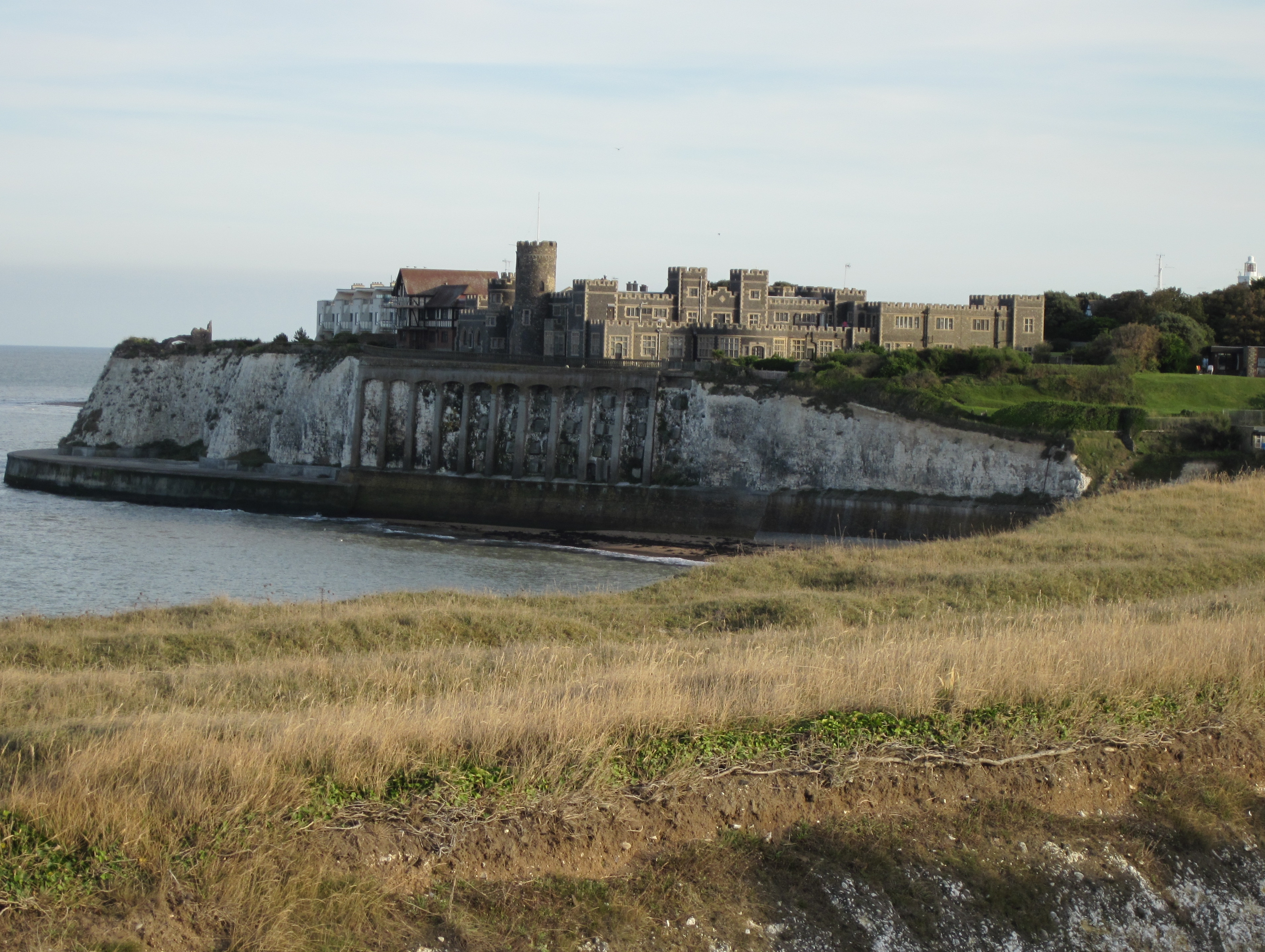
Kingsgate Castle

Kingsgate Castle on the cliffs above Kingsgate Bay, Broadstairs, Kent, was built for Lord Holland (Henry Fox, 1st Baron Holland) in the 1760s as the stable...

Kingsgate, Kent

Kingsgate is a hamlet in St Peter's parish, Broadstairs, Kent. The name Kingsgate is related to an incidental landing of Charles II on 30 June 1683 (‘gate...

Nearby Amenities

Located within 500m of 51.396975,1.4271928
Foreness Point
Place: locality
Source: npe
Wikidata: Q5468660
Wikipedia: en:Foreness Point
Lat/Long: 51.3933318/1.4252054
Fixme: what is this
Seamark Beacon Lateral Category: port
Seamark Beacon Lateral Colour: red
Seamark Beacon Lateral Shape: pile
Seamark Beacon Lateral System: iala-a
Seamark Light Character: Fl
Seamark Light Colour: red
Seamark Light Height: 5
Seamark Light Period: 2,5
Seamark Light Range: 2
Seamark Topmark Colour: red
Seamark Topmark Shape: cylinder
Seamark Type: beacon_lateral
Lat/Long: 51.3987169/1.4283322
Man Made: outfall
Lat/Long: 51.3977894/1.4280872
The data included in this document is from www.openstreetmap.org. The data is made available under ODbL.

Have you been to Foreness Point?

Leave your review of Foreness Point below (or comments, questions and feedback).