Athans

Coastal Feature, Headland, Point in Shetland

Scotland

Athans

Sunrise beyond the Nev from Haroldswick
Sunrise beyond the Nev from Haroldswick Credit: Mike Pennington

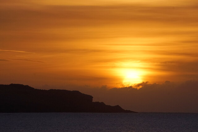
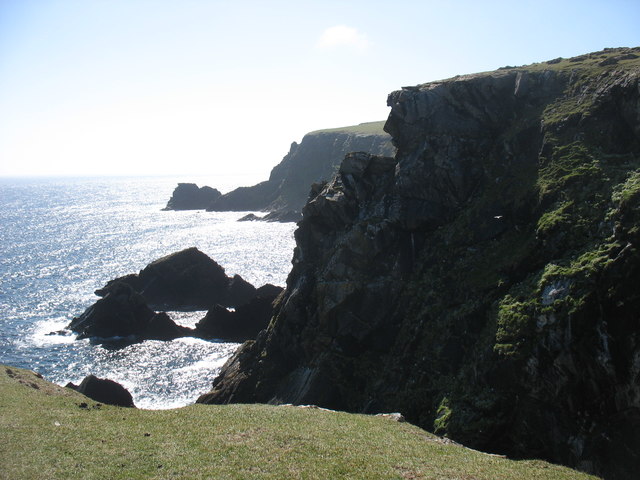
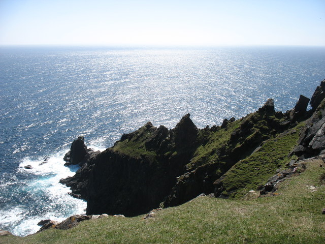
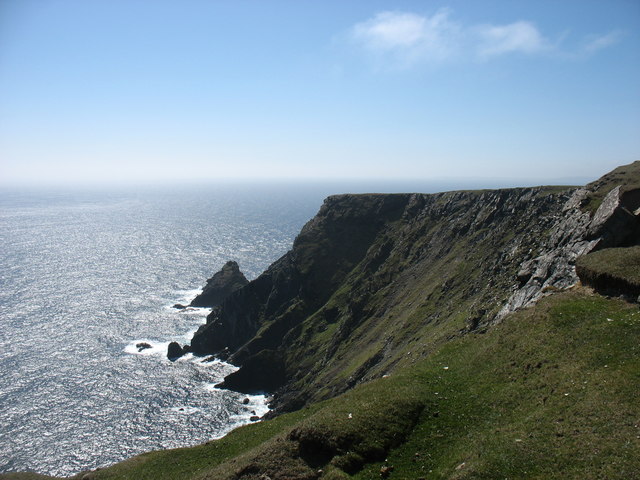
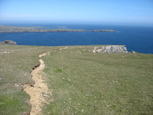
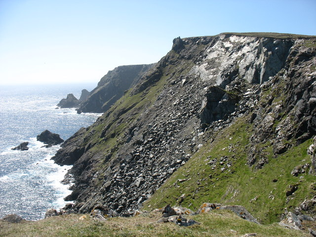
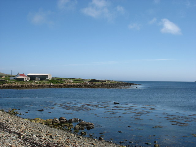
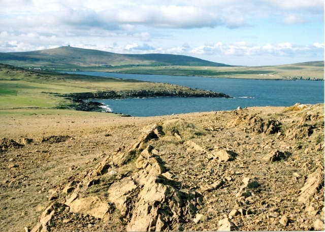
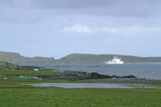
Athans is a striking coastal feature located in the Shetland Islands, Scotland. It is a headland that stretches out into the North Sea, forming a prominent point along the rugged coastline. This geographical formation is known for its remarkable beauty and unique features.

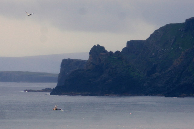
With its towering cliffs and jagged rocks, Athans presents a dramatic sight to those who visit. The headland is made up of layers of sedimentary rocks that have been shaped and carved by the relentless waves over thousands of years. The constant erosion has resulted in the creation of caves, arches, and stacks that dot the landscape, adding to its charm.

One of the most notable features of Athans is the presence of a lighthouse perched on top of the headland. This lighthouse serves as a crucial navigational aid for ships and vessels passing through the area, warning them of the treacherous rocks and guiding them safely along the coast.

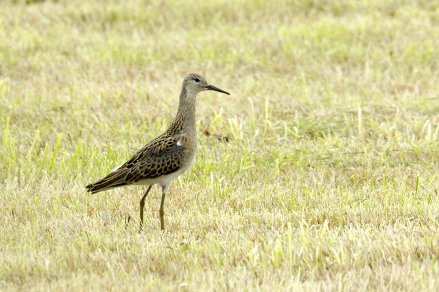
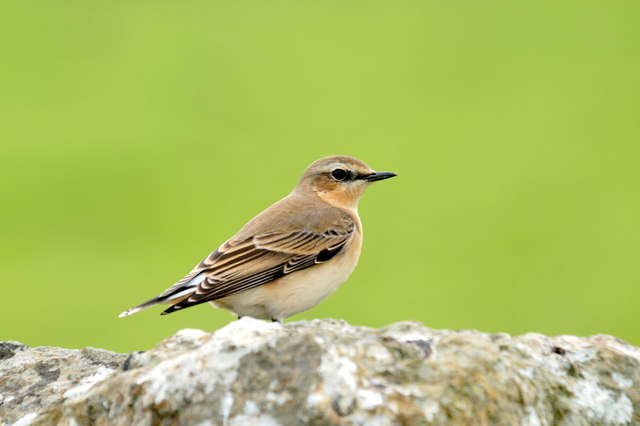
The headland also boasts rich biodiversity, with several species of seabirds nesting in the cliffs. Visitors can often spot gannets, puffins, and guillemots, among others, soaring above the waves or perched on the rocky ledges.

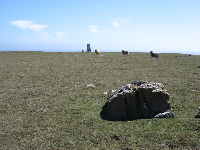
Athans is a popular destination for nature enthusiasts, hikers, and photographers alike. Its rugged and untouched beauty offers a unique experience, allowing visitors to immerse themselves in the raw power of the North Sea and witness the fascinating geological processes at work. Whether it's exploring the caves, observing the wildlife, or simply admiring the breathtaking views, Athans is a coastal feature that truly captivates all who encounter it.

If you have any feedback on the listing, please let us know in the comments section below.
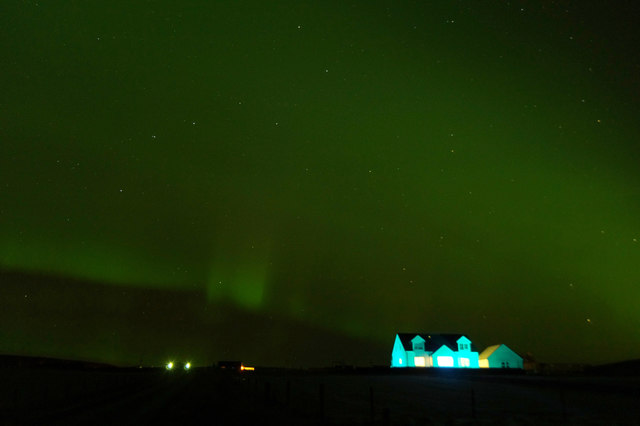
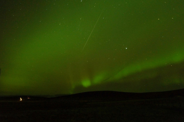
Athans Images

Images are sourced within 2km of 60.781848/-0.79128716 or Grid Reference HP6511. Thanks to Geograph Open Source API. All images are credited.

Sunrise beyond the Nev from Haroldswick
Ruff (Calidris pugnax), Haroldswick
Night sky over the Hill of Clibberswick A faint aurora on the left. The constellation of Auriga is just above and to the right of the aurora and the constellation of Taurus, including the star cluster of the Pleiades, is right of centre, just rising above the Hill of Clibberswick. The white streak of a very faint Draconid meteor is just right of Auriga. The orange glow on the right is presumably from an oil installation.
Night sky over the Hill of Clibberswick
A faint aurora on the left. The constellation of Auriga is just above and to the right of the aurora and the constellation of Taurus, including the star cluster of the Pleiades, is right of centre, just rising above the Hill of Clibberswick. The white streak of a very faint Draconid meteor is just right of Auriga. The orange glow on the right is presumably from an oil installation.
View to Gerratown from Clibberswick, Haroldswick
Aurora borealis over Dunban, Haroldswick The relatively newly built house with its blue floodlights, competing with the Northern Lights.
Aurora borealis over Dunban, Haroldswick
The relatively newly built house with its blue floodlights, competing with the Northern Lights.
Aurora and meteor over Haroldswick Looking towards the hill of Housi Field. A meteor from the Geminid meteor shower is in the centre - not the brightest I saw that night, but a pretty bright one. Cygnus and Lyra are the main constellations visible.
Aurora and meteor over Haroldswick
Looking towards the hill of Housi Field. A meteor from the Geminid meteor shower is in the centre - not the brightest I saw that night, but a pretty bright one. Cygnus and Lyra are the main constellations visible.
The cliffs at Girr Wick
Ship Stack from Valtoes
The Horns of Hagmark
Hill of Clibberswick summit The sheep seem very content, even though they are grazing only a few metres from a 160m sheer drop. (The actual highest point, by a few centimetres, of the hill is to the right and just out of shot.)
Hill of Clibberswick summit
The sheep seem very content, even though they are grazing only a few metres from a 160m sheer drop. (The actual highest point, by a few centimetres, of the hill is to the right and just out of shot.)
Western slopes of Hill of Clibberswick Looking towards the small village of Haroldswick, by the shore on the left.
Western slopes of Hill of Clibberswick
Looking towards the small village of Haroldswick, by the shore on the left.
Landslip danger ahead! Even quite far in from the cliff edge on Hill of Clibberswick there is clearly a risk of landslip. A local resident warned me that after the recent long period of dry weather, the risk was high. I thought that it would be greater after a period of wet weather, but I did not debate the point: I just made sure that I did not take any chances!
Landslip danger ahead!
Even quite far in from the cliff edge on Hill of Clibberswick there is clearly a risk of landslip. A local resident warned me that after the recent long period of dry weather, the risk was high. I thought that it would be greater after a period of wet weather, but I did not debate the point: I just made sure that I did not take any chances!
Towards the Horns of Hagmark This piece of landslip would appear to be fairly recent.
Towards the Horns of Hagmark
This piece of landslip would appear to be fairly recent.
Harold's Wick Bay
Harold's Wick Bay
Mute Swan (Cygnus olor), Haroldswick One of the 29 that arrived on the island in May, but which have gradually dispersed.
Mute Swan (Cygnus olor), Haroldswick
One of the 29 that arrived on the island in May, but which have gradually dispersed.
Creel boat off Hinda Stack, Clibberswick Photographed from Lamba Ness.
Creel boat off Hinda Stack, Clibberswick
Photographed from Lamba Ness.
Northern Wheatear (Oenanthe oenanthe), Clibberswick Probably a migrant from further north, rather than a local breeder, on its way to Africa for the winter.
Northern Wheatear (Oenanthe oenanthe), Clibberswick
Probably a migrant from further north, rather than a local breeder, on its way to Africa for the winter.
Gerratoun, Haroldswick, from Clibberswick Sothers Field in the background.
Gerratoun, Haroldswick, from Clibberswick
Sothers Field in the background.
Show me another place!

Athans is located at Grid Ref: HP6511 (Lat: 60.781848, Lng: -0.79128716)

Unitary Authority: Shetland Islands

Police Authority: Highlands and Islands

What 3 Words

///tarred.generals.boardroom. Near Haroldswick, Shetland Islands

Nearby Locations

Lunin Athans His Geo

Related Wikis

Keen of Hamar

Keen of Hamar is a nature reserve on Unst, in Shetland, Scotland, managed by Scottish Natural Heritage. The reserve is primarily of botanical interest...
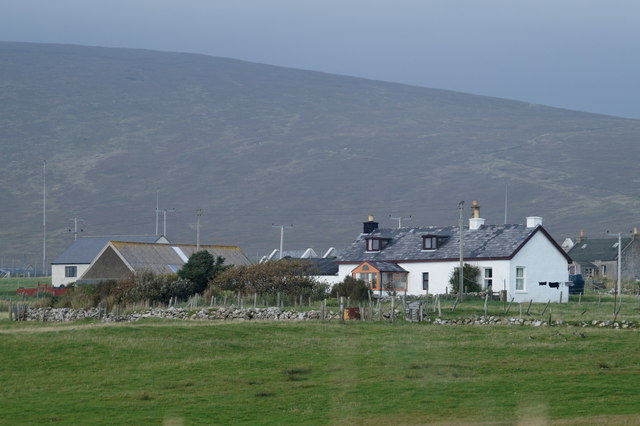
Haroldswick

Haroldswick or Harold's Wick (Old Norse: Haraldsvík, 'Harald's bay'), is on Unst, Shetland Islands, Scotland, and is one of the most northerly settlements...

Saxa Vord distillery

Saxa Vord distillery is a Scotch whisky and gin distillery on the island of Unst, part of the Shetland islands. The distillery takes its name from its...

Valhalla Brewery

The Valhalla Brewery in Unst, Shetland, Scotland, was the northernmost brewery in the United Kingdom. It was opened by the husband and wife team Sonny...
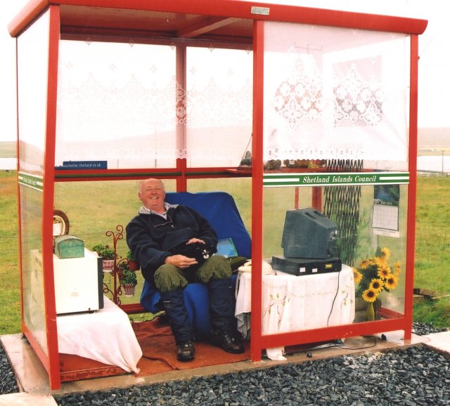
Unst Bus Shelter

The Unst Bus Shelter, also known as Bobby's Bus Shelter, is a bus shelter and bus stop near the village of Baltasound, on the isle of Unst, Shetland Islands...

Balta, Shetland

Balta (Scots: Balta; Old Norse: "Baltey") is an uninhabited island in Shetland, Scotland. == Geography == Balta lies off the east coast of Unst and Balta...

Balta Sound

Balta Sound is a sound (inlet) on the east coast of the island of Unst in the Shetland Islands, Scotland. The sound is sheltered from the North Sea to...

SaxaVord Spaceport

SaxaVord Spaceport, previously known as Shetland Space Centre, is a planned spaceport to be located on the Lamba Ness peninsula on Unst, the most northerly...

Nearby Amenities

Located within 500m of 60.781848,-0.79128716
His Geo
Natural: cliff
Lat/Long: 60.7834426/-0.7955563
Rurra Geo
Natural: cliff
Lat/Long: 60.7808417/-0.7869775
Brattaberg
Natural: cliff
Lat/Long: 60.7806853/-0.7839334
Sootra Geo
Natural: cliff
Lat/Long: 60.7803333/-0.7827318
The data included in this document is from www.openstreetmap.org. The data is made available under ODbL.

Have you been to Athans?

Leave your review of Athans below (or comments, questions and feedback).