Birrier Geo

Coastal Feature, Headland, Point in Shetland

Scotland

Birrier Geo

Vord Hill, the high point of Fetlar, Shetland Islands A couple of chambered cairns, but I think the nearby one is the high point: it is clearly higher than the trig point. Looking towards Burra Ness on Yell.
Vord Hill, the high point of Fetlar, Shetland Islands Credit: Michael Earnshaw

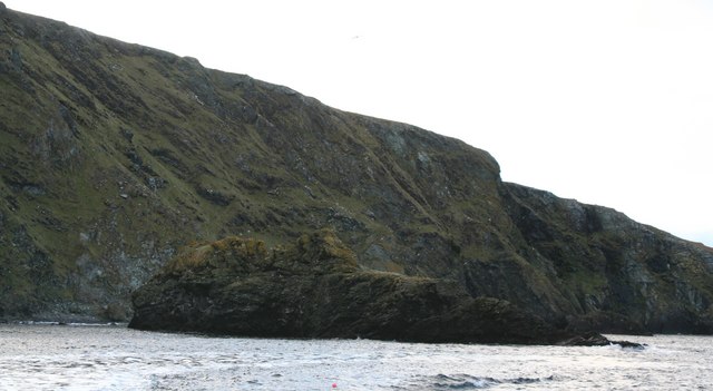
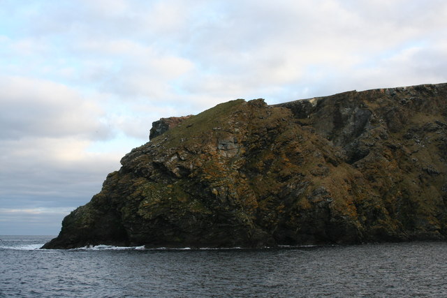
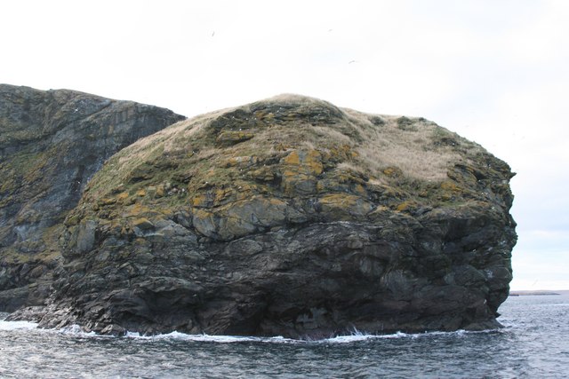
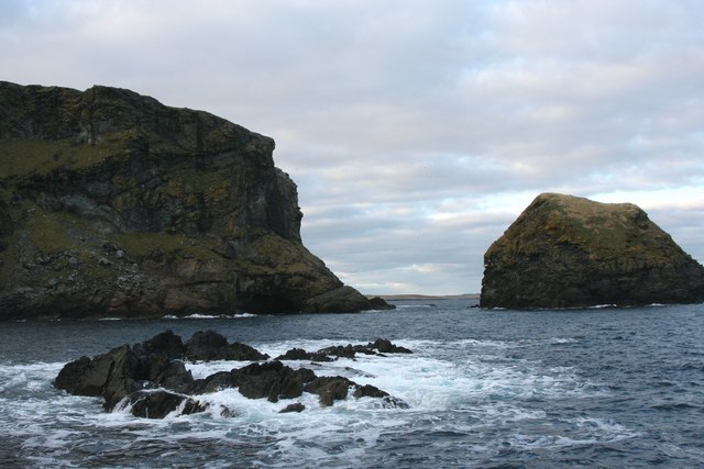
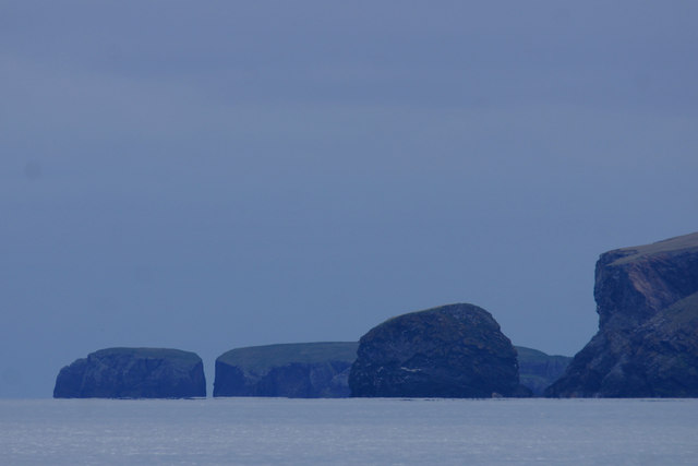
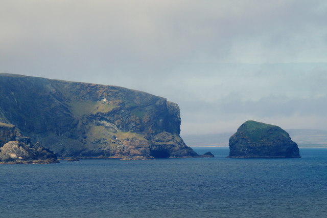
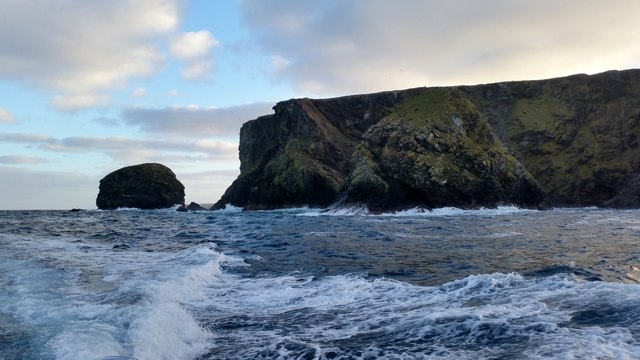
Birrier Geo is a prominent coastal feature located in Shetland, an archipelago in Scotland. It is classified as a headland or point due to its position jutting out into the sea. This geological formation is particularly notable for its stunning cliffs and unique rock formations.

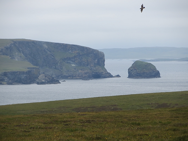
Situated on the western coast of Shetland, Birrier Geo offers breathtaking panoramic views of the surrounding ocean and rugged coastline. The area is known for its dramatic cliffs, which rise to impressive heights, providing a natural habitat for various seabirds such as puffins, guillemots, and kittiwakes.

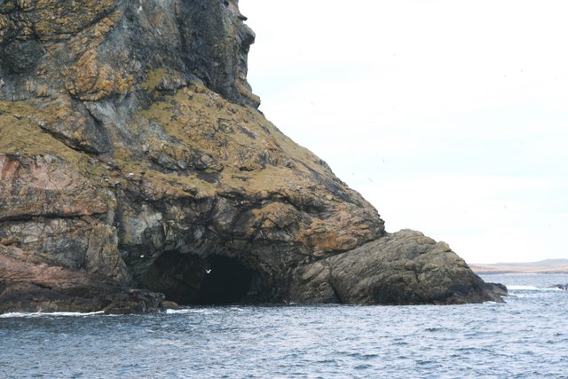
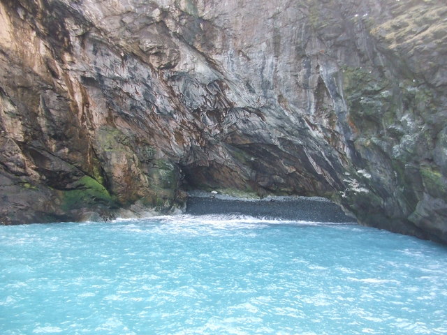
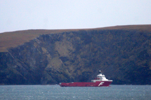
The rugged landscape of Birrier Geo is primarily composed of sedimentary rocks, including sandstone and shale. These rocks have been shaped and eroded over millions of years by the relentless power of the sea, resulting in the formation of captivating features such as sea stacks, caves, and arches. One notable feature is a large sea stack known as "The Stack of Birrier," which stands proudly in the waters just off the point.

Birrier Geo attracts not only nature enthusiasts but also geologists who are fascinated by the geological history preserved within its rocks. The exposed layers of sedimentary rocks offer valuable insights into the region's geological past, including evidence of ancient marine environments and the effects of glacial activity.

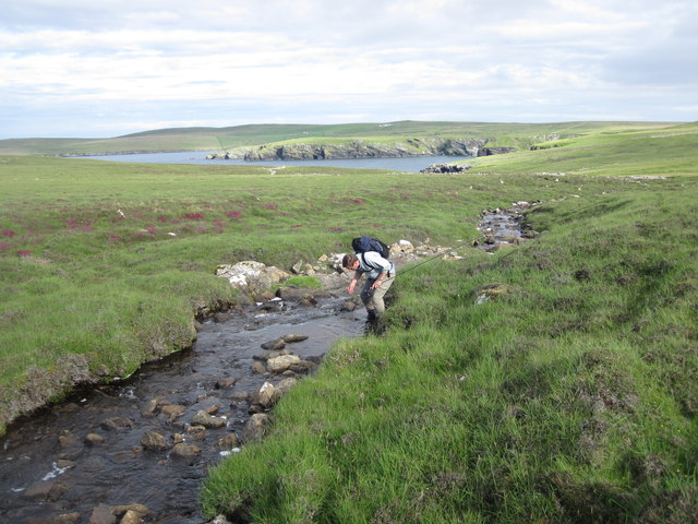
Access to Birrier Geo is possible via a coastal path, allowing visitors to explore the area on foot and fully appreciate its natural beauty. As with any coastal location, caution must be exercised due to potentially hazardous conditions, such as strong tides and slippery cliffs.

If you have any feedback on the listing, please let us know in the comments section below.

Birrier Geo Images

Images are sourced within 2km of 60.627856/-0.83783025 or Grid Reference HU6394. Thanks to Geograph Open Source API. All images are credited.

Vord Hill, the high point of Fetlar, Shetland Islands A couple of chambered cairns, but I think the nearby one is the high point: it is clearly higher than the trig point. Looking towards Burra Ness on Yell.
Vord Hill, the high point of Fetlar, Shetland Islands
A couple of chambered cairns, but I think the nearby one is the high point: it is clearly higher than the trig point. Looking towards Burra Ness on Yell.
Winyadepla east shore. Two prehistoric stone built enclosures, east shore of Winyadepla, Fetlar.
Winyadepla east shore.
Two prehistoric stone built enclosures, east shore of Winyadepla, Fetlar.
Il Holm
Il Holm
Stack of Birrier
Stack of Birrier
The Clett
The Clett
Skerry off Filla Wick, with natural arch at base of Busta Pund and the Clett in the background
Natural Arch at base of Busta Pund
Geo between Stack of Birrier and Busta Pund.The sea was a beautiful blue colour.
The Clett, off Busta Pund, Fetlar The Clett is the nearest stack. Beyond is Strandburgh Ness and the holm of Outer Brough.
The Clett, off Busta Pund, Fetlar
The Clett is the nearest stack. Beyond is Strandburgh Ness and the holm of Outer Brough.
Vord Hill Early ferry to Fetlar with Jen, Rick and Tricky parked at school then walked to summit cairn in variable levels of mist.
Name: Vord Hill
Hill number: 1548
Height: 159m / 522ft
Area: 22: Shetland Islands
Class: Ma
Grid ref: HU 62252 93506
Summit feature: cairn 25m E of trig point
Drop: 159m
Col: Sea
Vord Hill
Early ferry to Fetlar with Jen, Rick and Tricky parked at school then walked to summit cairn in variable levels of mist. Name: Vord Hill Hill number: 1548 Height: 159m / 522ft Area: 22: Shetland Islands Class: Ma Grid ref: HU 62252 93506 Summit feature: cairn 25m E of trig point Drop: 159m Col: Sea
Stream running from Grutinpunds to Mongirsdale on Fetlar The stream runs into a ruined settlement, Well of Health, an idyllic spot. The headland in the distance is the Ness of Gruting. This tiny stream is full of wild brown trout.
Stream running from Grutinpunds to Mongirsdale on Fetlar
The stream runs into a ruined settlement, Well of Health, an idyllic spot. The headland in the distance is the Ness of Gruting. This tiny stream is full of wild brown trout.
Preparing to fish on the Loch of Winyadepla, Fetlar Looking towards the shallows at the southern tip of this shallow loch. The western shore has a large colony of Bonxies (Great Skuas) whose guano can trigger algal blooms in warm seasons.
Preparing to fish on the Loch of Winyadepla, Fetlar
Looking towards the shallows at the southern tip of this shallow loch. The western shore has a large colony of Bonxies (Great Skuas) whose guano can trigger algal blooms in warm seasons.
The Clett Blue Banks of Fetlar around Busta Hill seen from Baa-neeps on the east of the island.
The Clett
Blue Banks of Fetlar around Busta Hill seen from Baa-neeps on the east of the island.
The supply vessel Far Reacher sheltering beside the 'Blue Banks' of Fetlar Taken from Uyeasound.
The supply vessel Far Reacher sheltering beside the 'Blue Banks' of Fetlar
Taken from Uyeasound.
The Clett and Busta Pund, Fetlar Taken from Strand on the east side of the Wick of Gruting.
The Clett and Busta Pund, Fetlar
Taken from Strand on the east side of the Wick of Gruting.
Stack of Birrier and the Clett, off the north coast of Fetlar
Holm of Tressaness, Fetlar, from the sea Looking into the sun in a heavy swell.
Holm of Tressaness, Fetlar, from the sea
Looking into the sun in a heavy swell.
Busta Pund with The Clett, Strandburgh Ness and Outer Brough beyond
Show me another place!

Birrier Geo is located at Grid Ref: HU6394 (Lat: 60.627856, Lng: -0.83783025)

Unitary Authority: Shetland Islands

Police Authority: Highlands and Islands

What 3 Words

///breeding.chatting.disarmed. Near Houbie, Shetland Islands

Related Wikis

Funzie Girt

Funzie Girt (; Scots: Funyie Girt "Finns' dyke") is an ancient dividing wall that was erected from north to south across the island of Fetlar in Shetland...
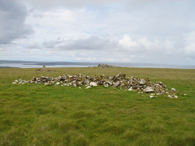
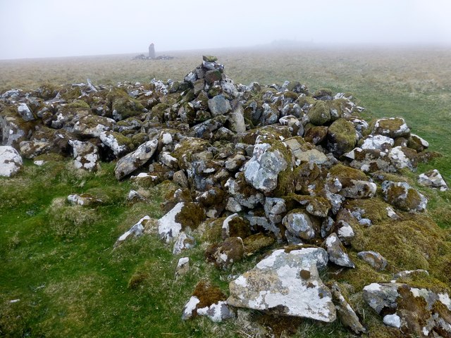
Haltadans

Haltadans, also known as Fairy Ring or Haltadans stone circle, is a stone circle on the island of Fetlar in Shetland, Scotland. This site is a ring of...

Fetlar

Fetlar is one of the North Isles of Shetland, Scotland, with a usually resident population of 61 at the time of the 2011 census. Its main settlement is...

Haaf Gruney

Haaf Gruney is a small island in the north east of the Shetland Islands. == Geography and geology == The island is between Unst and Fetlar which are to...

Have you been to Birrier Geo?

Leave your review of Birrier Geo below (or comments, questions and feedback).