Black Geo

Coastal Feature, Headland, Point in Shetland

Scotland

Black Geo

Fetlar Gardens On Fetlar, sheep are everywhere - so vegetables were grown inside these little 'walled gardens' to protect them from the sheep.
Fetlar Gardens Credit: Anne Burgess

Black Geo is a prominent coastal feature located on the Shetland Islands, an archipelago in Scotland. It is categorized as a headland or point due to its distinctive shape and geographical characteristics. Situated on the western coast of the main Shetland Island, Black Geo is known for its rugged cliffs and stunning views of the North Atlantic Ocean.

The headland stretches out into the sea, forming a narrow peninsula that juts into the water. Its defining feature is the dark-colored rock formations that give it its name, "Black Geo." These rocks are composed of basalt, a volcanic rock that has weathered over time, resulting in its unique appearance. The contrast between the black rocks and the surrounding green landscape creates a visually striking scene.

The cliffs of Black Geo rise to an impressive height, providing a vantage point for observing the dramatic coastal scenery. From this viewpoint, visitors can witness the power of the crashing waves against the cliffs, as well as the abundant marine wildlife that inhabits the area. Seabirds such as puffins, gannets, and fulmars can often be spotted nesting in the cliffs, adding to the area's natural splendor.

Black Geo is also a popular destination for hikers and nature enthusiasts, who enjoy exploring the rugged coastal paths and taking in the panoramic views. It offers a unique opportunity to immerse oneself in the wild beauty of the Shetland Islands and experience the untamed forces of nature firsthand.

Overall, Black Geo is a remarkable coastal feature on the Shetland Islands, characterized by its dark, basalt cliffs, stunning views, and diverse wildlife. It is a must-see location for anyone visiting the region, offering a glimpse into the untamed beauty of the Scottish coast.

If you have any feedback on the listing, please let us know in the comments section below.

Black Geo Images

Images are sourced within 2km of 60.591209/-0.85621669 or Grid Reference HU6290. Thanks to Geograph Open Source API. All images are credited.

Fetlar Gardens On Fetlar, sheep are everywhere - so vegetables were grown inside these little 'walled gardens' to protect them from the sheep.
Fetlar Gardens
On Fetlar, sheep are everywhere - so vegetables were grown inside these little 'walled gardens' to protect them from the sheep.
Burn flowing into Wick of Aith, Fetlar
Aith Ness The cliffs below Gillis Field and the Head of Lambhoga are visible in the distance.
Aith Ness
The cliffs below Gillis Field and the Head of Lambhoga are visible in the distance.
Aithbank, Fetlar The house has since been refurbished as a camping booth.
Aithbank, Fetlar
The house has since been refurbished as a camping booth.
Aith Ness from Wick of Tresta
Unsurfaced track View along the non surfaced track near Aithbank.
Unsurfaced track
View along the non surfaced track near Aithbank.
Beadlet Anemone (Actinia equina), Wick of Aith
Flat Periwinkle (Littorina obtusata), Wick of Aith
Common Sea Urchin (Echinus esculentus), Wick of Aith, Fetlar Not usually seen above water, even at low tide.
Common Sea Urchin (Echinus esculentus), Wick of Aith, Fetlar
Not usually seen above water, even at low tide.
Outer Dale, Lambhoga, Fetlar
North of Hoganeap, Lambhoga, Fetlar
Three Geos, Hoganeap, Fetlar Although this area seems to be named Three Stacks on the OS 1:10000 map, I am informed by Andrew Leaper of Fetlar that the area in the photo is named Three Geos and that Three Stacks is further north along the coast.
Three Geos, Hoganeap, Fetlar
Although this area seems to be named Three Stacks on the OS 1:10000 map, I am informed by Andrew Leaper of Fetlar that the area in the photo is named Three Geos and that Three Stacks is further north along the coast.
South Geo of Heoganeap, Fetlar
Camping booth at Aithbank
Fields on Aith Ness
Fields on Aith Ness
Fields, Aith Ness A fertile peninsula on the south side of Fetlar.
Fields, Aith Ness
A fertile peninsula on the south side of Fetlar.
Aithbank The house is now visitor accommodation as a camping böd (it is extremely comfortable). Aith Wick was the landing place for the peat that was cut here on Lamb Hoga.
Aithbank
The house is now visitor accommodation as a camping böd (it is extremely comfortable). Aith Wick was the landing place for the peat that was cut here on Lamb Hoga.
Gillis Field The higher parts of Lamb Hoga. The peninsula was the source of Fetlar's peat.
Gillis Field
The higher parts of Lamb Hoga. The peninsula was the source of Fetlar's peat.
Show me another place!

Black Geo is located at Grid Ref: HU6290 (Lat: 60.591209, Lng: -0.85621669)

Unitary Authority: Shetland Islands

Police Authority: Highlands and Islands

What 3 Words

///elbowed.runners.trappings. Near Houbie, Shetland Islands

Related Wikis

Fetlar

Fetlar (Scots: Fetlar) is one of the North Isles of Shetland, Scotland, with a usually resident population of 61 at the time of the 2011 census. Its main...

Haltadans

Haltadans, also known as Fairy Ring or Haltadans stone circle, is a stone circle on the island of Fetlar in Shetland, Scotland. This site is a ring of...

Funzie Girt

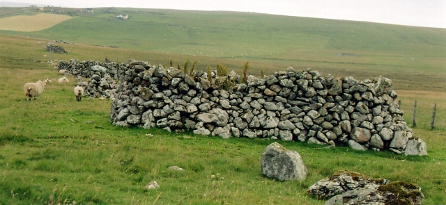
Funzie Girt (; Scots: Funyie Girt "Finns' dyke") is an ancient dividing wall that was erected from north to south across the island of Fetlar in Shetland...

Brough Lodge

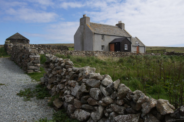
Brough Lodge is a 19th-century Gothic mansion on Fetlar, one of the Shetland Islands, in northern Scotland. Built by the Nicolson family, who were responsible...

Urie Lingey

For other islands with similar names, see Linga (disambiguation) Urie Lingey is one of the Shetland Islands. It is between Fetlar and Unst, and Yell is...

Hamars Ness

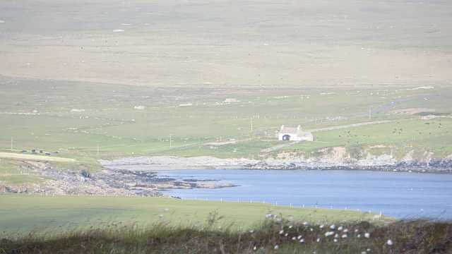
Hamars Ness is a headland on the island of Fetlar in Shetland, Scotland. The name is from the Old Norse Hamarsnes meaning "craggy headland". A ro-ro ferry...

Hascosay

Hascosay (Scots: Hascosay; Old Norse "Hafskotsey") is a small island lying between Yell and Fetlar in the Shetland Islands, Scotland. == Geography and... ==

Sound Gruney

For other islands with similar names, see Gruney (disambiguation) Sound Gruney is one of the Shetland islands. It lies about 1.5 kilometres (0.93 mi)...

Nearby Amenities

Located within 500m of 60.591209,-0.85621669
Passing Place
Lat/Long: 60.5941132/-0.8607535
Passing Place
Lat/Long: 60.5924239/-0.8558989
Wick of Houbie
Natural: bay
Source: OS OpenData StreetView
Lat/Long: 60.5904094/-0.8624392
Charging Station
Operator: elektrobay
Lat/Long: 60.5939576/-0.8593967
Doctors
Fetlar Clinic
Healthcare: doctor
Lat/Long: 60.5942662/-0.8617108
Defibrillator
Emergency: defibrillator
Lat/Long: 60.5942759/-0.8617567
Generator Method: wind_turbine
Generator Source: wind
Power: generator
Lat/Long: 60.5942458/-0.8590371
Passing Place
Lat/Long: 60.5907579/-0.850538
Power: pole
Lat/Long: 60.590429/-0.8478711
Power: pole
Lat/Long: 60.5906174/-0.8491827
Power: pole
Lat/Long: 60.590782/-0.8503092
Power: pole
Lat/Long: 60.5909677/-0.8516154
Power: pole
Lat/Long: 60.5910929/-0.8525274
Generator Method: wind_turbine
Generator Source: wind
Power: generator
Lat/Long: 60.5914168/-0.8551318
Power: pole
Lat/Long: 60.5911534/-0.8539168
Power: pole
Lat/Long: 60.5919239/-0.8537773
Power: pole
Lat/Long: 60.591617/-0.8532891
Power: pole
Lat/Long: 60.5924481/-0.8545632
Power: pole
Lat/Long: 60.5929551/-0.8553196
Power: pole
Lat/Long: 60.5933107/-0.8558399
Power: pole
Lat/Long: 60.5940258/-0.8557112
Power: pole
Lat/Long: 60.5950965/-0.855687
Power: pole
Lat/Long: 60.5946566/-0.8555771
Power: pole
Lat/Long: 60.5955456/-0.8558211
Power: pole
Lat/Long: 60.5944083/-0.8617124
Power: pole
Lat/Long: 60.5942252/-0.8615863
Power: pole
Lat/Long: 60.5939737/-0.8606609
Power: pole
Lat/Long: 60.5934996/-0.8581987
Power: pole
Lat/Long: 60.59341/-0.857056
Power: pole
Lat/Long: 60.5904615/-0.8521838
Power: pole
Lat/Long: 60.5936256/-0.8594704
The data included in this document is from www.openstreetmap.org. The data is made available under ODbL.

Have you been to Black Geo?

Leave your review of Black Geo below (or comments, questions and feedback).