Tarri Geos

Coastal Feature, Headland, Point in Shetland

Scotland

Tarri Geos

Burn flowing into Wick of Aith, Fetlar
Burn flowing into Wick of Aith, Fetlar Credit: Tom Pennington

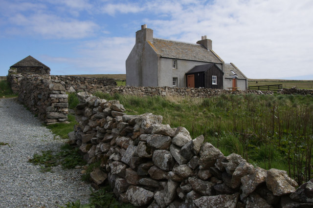
Tarri Geos is a prominent coastal feature located on the Shetland Islands, situated off the northeast coast of Scotland. It is primarily known for being a captivating headland and point that offers stunning views of the surrounding rugged landscape and the North Sea.

The headland is characterized by its sheer cliffs that tower above the crashing waves below, creating a dramatic and awe-inspiring sight. These cliffs are composed of layers of sedimentary rock, showcasing the geological history of the area. Tarri Geos is also home to a variety of seabirds, including puffins and guillemots, which nest and roost on the cliff ledges, making it a popular spot for birdwatching enthusiasts.

At the tip of the headland, there is a distinct point that juts out into the sea. This point offers panoramic vistas, allowing visitors to observe the expansive ocean and potentially catch a glimpse of marine wildlife, such as seals or dolphins. The point is easily accessible, and there are paths and trails that lead up to it, providing a thrilling walk along the edge of the cliffs.

Tarri Geos is a place of natural beauty and tranquility, offering visitors the opportunity to immerse themselves in the rugged and untamed landscape of the Shetland Islands. It is a popular destination for hikers, photographers, and nature lovers, who are drawn to its breathtaking scenery and diverse wildlife.

If you have any feedback on the listing, please let us know in the comments section below.

Tarri Geos Images

Images are sourced within 2km of 60.592075/-0.86401827 or Grid Reference HU6290. Thanks to Geograph Open Source API. All images are credited.

Burn flowing into Wick of Aith, Fetlar
Aith Ness The cliffs below Gillis Field and the Head of Lambhoga are visible in the distance.
Aith Ness
The cliffs below Gillis Field and the Head of Lambhoga are visible in the distance.
Aithbank, Fetlar The house has since been refurbished as a camping booth.
Aithbank, Fetlar
The house has since been refurbished as a camping booth.
Aith Ness from Wick of Tresta
Beadlet Anemone (Actinia equina), Wick of Aith
Flat Periwinkle (Littorina obtusata), Wick of Aith
Outer Dale, Lambhoga, Fetlar
North of Hoganeap, Lambhoga, Fetlar
Three Geos, Hoganeap, Fetlar Although this area seems to be named Three Stacks on the OS 1:10000 map, I am informed by Andrew Leaper of Fetlar that the area in the photo is named Three Geos and that Three Stacks is further north along the coast.
Three Geos, Hoganeap, Fetlar
Although this area seems to be named Three Stacks on the OS 1:10000 map, I am informed by Andrew Leaper of Fetlar that the area in the photo is named Three Geos and that Three Stacks is further north along the coast.
South Geo of Heoganeap, Fetlar
Looking north from path up to Lamb Hoga There is a very good track from the car park beside Fetlar Kirk up onto Lamb Hoga with views to Out Skerries, Bressay and across the whole of Fetlar.  I had assumed that Lamb Hoga would be pronounced as written but oh no, it's pronounced as a single word "Lahmuga" with the stress on the first sylable "Lahm".
Looking north from path up to Lamb Hoga
There is a very good track from the car park beside Fetlar Kirk up onto Lamb Hoga with views to Out Skerries, Bressay and across the whole of Fetlar. I had assumed that Lamb Hoga would be pronounced as written but oh no, it's pronounced as a single word "Lahmuga" with the stress on the first sylable "Lahm".
Camping booth at Aithbank
Fields on Aith Ness
Fields on Aith Ness
The Peat Road The bogs of Lamb Hoga provided Fetlar with high quality fuel. Every year, islanders would move to the peninsula to cast and dry peats. The fuel was then taken off via this road or by boat across to Aith for the eastern side of the island.
 The beach at Tresta is in the background along with Vord Hill.
The Peat Road
The bogs of Lamb Hoga provided Fetlar with high quality fuel. Every year, islanders would move to the peninsula to cast and dry peats. The fuel was then taken off via this road or by boat across to Aith for the eastern side of the island. The beach at Tresta is in the background along with Vord Hill.
The Dale A shallow reentrant on the boggy Lamb Hoga plateau. There is a view over the Wick of Tresta towards Aithbank where peats cut here were once landed.
The Dale
A shallow reentrant on the boggy Lamb Hoga plateau. There is a view over the Wick of Tresta towards Aithbank where peats cut here were once landed.
Fields, Aith Ness A fertile peninsula on the south side of Fetlar.
Fields, Aith Ness
A fertile peninsula on the south side of Fetlar.
The Peat Road Lamb Hoga was the source of Fetlar's peat and this was one of the ways the peat was carried to the crofts. Much of the peat was taken out by boat and landed at Airthbank.
The Peat Road
Lamb Hoga was the source of Fetlar's peat and this was one of the ways the peat was carried to the crofts. Much of the peat was taken out by boat and landed at Airthbank.
Gillis Field Triangulation pillar amongst the bogs.
Gillis Field
Triangulation pillar amongst the bogs.
Show me another place!

Tarri Geos is located at Grid Ref: HU6290 (Lat: 60.592075, Lng: -0.86401827)

Unitary Authority: Shetland Islands

Police Authority: Highlands and Islands

What 3 Words

///creamed.chins.catapult. Near Houbie, Shetland Islands

Related Wikis

Fetlar

Fetlar (Scots: Fetlar) is one of the North Isles of Shetland, Scotland, with a usually resident population of 61 at the time of the 2011 census. Its main...

Haltadans

Haltadans, also known as Fairy Ring or Haltadans stone circle, is a stone circle on the island of Fetlar in Shetland, Scotland. This site is a ring of...

Funzie Girt

Funzie Girt (; Scots: Funyie Girt "Finns' dyke") is an ancient dividing wall that was erected from north to south across the island of Fetlar in Shetland...

Brough Lodge

Brough Lodge is a 19th-century Gothic mansion on Fetlar, one of the Shetland Islands, in northern Scotland. Built by the Nicolson family, who were responsible...

Urie Lingey

For other islands with similar names, see Linga (disambiguation) Urie Lingey is one of the Shetland Islands. It is between Fetlar and Unst, and Yell is...

Hamars Ness

Hamars Ness is a headland on the island of Fetlar in Shetland, Scotland. The name is from the Old Norse Hamarsnes meaning "craggy headland". A ro-ro ferry...

Hascosay

Hascosay (Scots: Hascosay; Old Norse "Hafskotsey") is a small island lying between Yell and Fetlar in the Shetland Islands, Scotland. == Geography and... ==

Sound Gruney

For other islands with similar names, see Gruney (disambiguation) Sound Gruney is one of the Shetland islands. It lies about 1.5 kilometres (0.93 mi)...

Nearby Amenities

Located within 500m of 60.592075,-0.86401827
Fetlar General Merchants
Opening Hours: May 01-Sep 15 10:00-16:30; Sep 16-Apr 30 11:00-15:00
Shop: convenience
Lat/Long: 60.5948453/-0.8650198
Passing Place
Lat/Long: 60.5941132/-0.8607535
Passing Place
Lat/Long: 60.5924239/-0.8558989
Wick of Tresta
Natural: bay
Source: OS OpenData StreetView
Lat/Long: 60.5888288/-0.8681898
Wick of Houbie
Natural: bay
Source: OS OpenData StreetView
Lat/Long: 60.5904094/-0.8624392
Post Office
Fetlar Post Office
Addr City: Shetland
Addr Postcode: ZE2 9DJ
Brand: Post Office
Brand Wikidata: Q1783168
Opening Hours: Tu,We,Fr,Sa 11:00-13:00
Ref Pol Id: 1604
Website: https://www.postoffice.co.uk/branch-finder/1108492/fetlar
Lat/Long: 60.5947604/-0.8649419
Post Box
Operator: Royal Mail
Ref: ZE2 67
Lat/Long: 60.5947746/-0.8647282
Charging Station
Operator: elektrobay
Lat/Long: 60.5939576/-0.8593967
Doctors
Fetlar Clinic
Healthcare: doctor
Lat/Long: 60.5942662/-0.8617108
Defibrillator
Emergency: defibrillator
Lat/Long: 60.5942759/-0.8617567
Cafe
Opening Hours: May 01-Sep 15 10:00-16:30; Sep 16-Apr 30 11:00-15:00
Lat/Long: 60.5947344/-0.8649128
Generator Method: wind_turbine
Generator Source: wind
Power: generator
Lat/Long: 60.5942458/-0.8590371
Generator Method: wind_turbine
Generator Source: wind
Power: generator
Lat/Long: 60.5914168/-0.8551318
Power: pole
Lat/Long: 60.5929551/-0.8553196
Power: pole
Lat/Long: 60.5933107/-0.8558399
Power: pole
Lat/Long: 60.5958416/-0.8612105
Power: pole
Lat/Long: 60.5952516/-0.8614143
Power: pole
Lat/Long: 60.5953622/-0.8620715
Power: pole
Lat/Long: 60.5954847/-0.8627018
Power: pole
Lat/Long: 60.5956651/-0.8637157
Power: pole
Lat/Long: 60.5959088/-0.8651399
Power: pole
Lat/Long: 60.5959219/-0.8666554
Power: pole
Lat/Long: 60.5959338/-0.8678409
Power: pole
Lat/Long: 60.5944083/-0.8617124
Power: pole
Lat/Long: 60.5942252/-0.8615863
Power: pole
Lat/Long: 60.5939737/-0.8606609
Power: pole
Lat/Long: 60.5934996/-0.8581987
Power: pole
Lat/Long: 60.59341/-0.857056
Houbie
Place: hamlet
Lat/Long: 60.5949342/-0.8653855
Power: pole
Lat/Long: 60.5936256/-0.8594704
The data included in this document is from www.openstreetmap.org. The data is made available under ODbL.

Have you been to Tarri Geos?

Leave your review of Tarri Geos below (or comments, questions and feedback).