Outer Dale
Coastal Feature, Headland, Point in Shetland
Scotland
Outer Dale

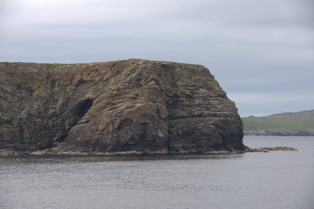
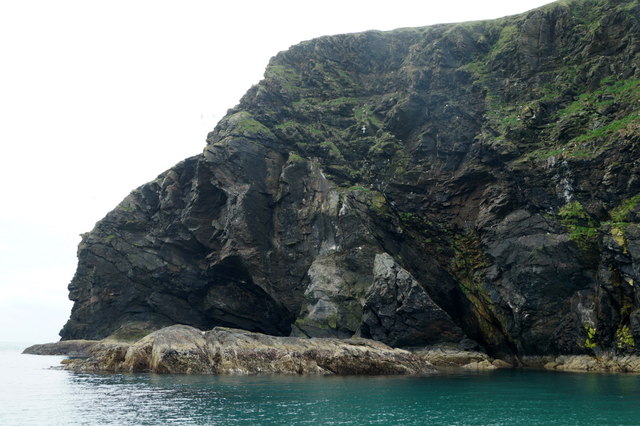
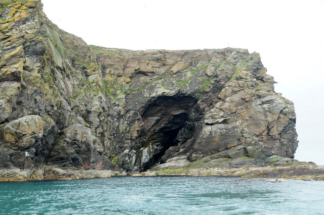
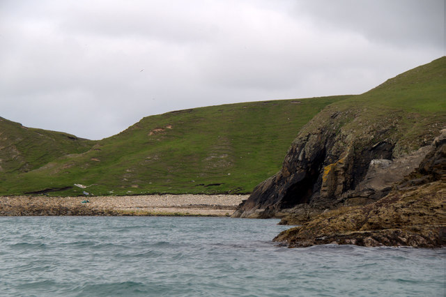
Outer Dale is a prominent coastal feature located on the Shetland Islands, an archipelago in Scotland. Situated on the mainland, Outer Dale is a headland that juts out into the North Sea, forming a distinctive point along the rugged coastline.
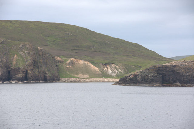
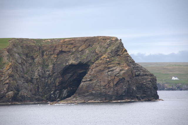
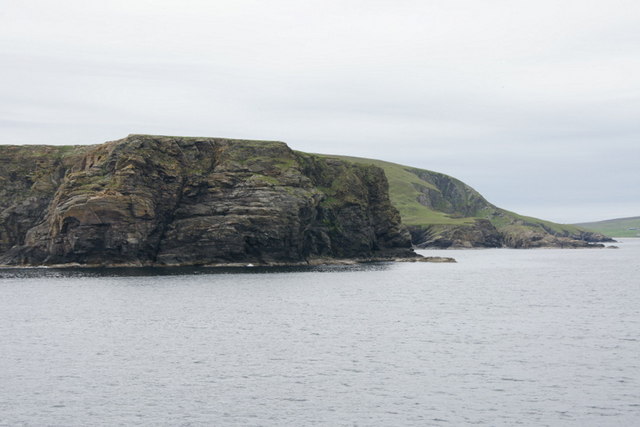
Characterized by its steep cliffs and jagged rocks, Outer Dale offers stunning panoramic views of the surrounding seascape and is a popular destination for nature enthusiasts and photographers. The headland is known for its dramatic coastal formations, including sea stacks, caves, and natural arches, which have been shaped by the relentless forces of erosion over thousands of years.
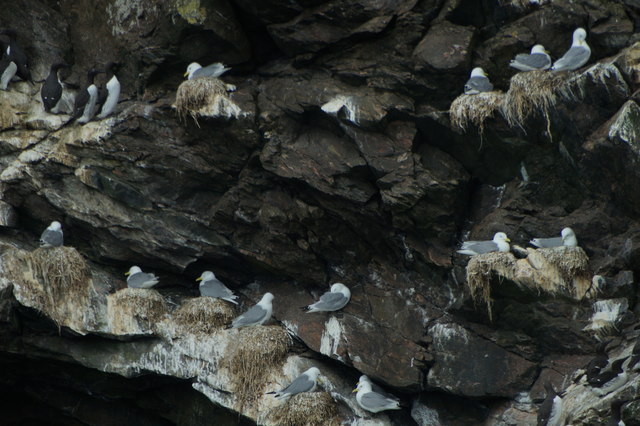
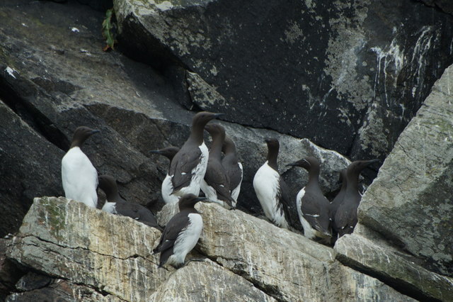
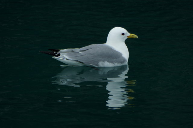
The area surrounding Outer Dale is rich in biodiversity, with various seabird colonies nesting on the cliffs, including puffins, guillemots, and razorbills. The headland also provides an important habitat for a wide range of marine life, such as seals and dolphins, which can often be spotted swimming in the waters off the point.
Access to Outer Dale is relatively easy, with a well-maintained footpath leading visitors along the clifftops, offering breathtaking views of the surrounding coastline. However, caution is advised, as the cliffs can be unstable, and care should be taken when exploring the area.
Outer Dale is a must-visit destination for those seeking natural beauty and a chance to witness the power of the sea. With its striking cliffs, diverse wildlife, and panoramic vistas, this headland is truly a remarkable coastal feature in the Shetland Islands.
If you have any feedback on the listing, please let us know in the comments section below.
Outer Dale Images
Images are sourced within 2km of 60.580827/-0.87499833 or Grid Reference HU6189. Thanks to Geograph Open Source API. All images are credited.


Outer Dale is located at Grid Ref: HU6189 (Lat: 60.580827, Lng: -0.87499833)
Unitary Authority: Shetland Islands
Police Authority: Highlands and Islands
What 3 Words
///pupils.unclaimed.wrong. Near Houbie, Shetland Islands
Nearby Locations
Related Wikis

Fetlar
Fetlar (Scots: Fetlar) is one of the North Isles of Shetland, Scotland, with a usually resident population of 61 at the time of the 2011 census. Its main...

Haltadans
Haltadans, also known as Fairy Ring or Haltadans stone circle, is a stone circle on the island of Fetlar in Shetland, Scotland. This site is a ring of...

Funzie Girt
Funzie Girt (; Scots: Funyie Girt "Finns' dyke") is an ancient dividing wall that was erected from north to south across the island of Fetlar in Shetland...

Brough Lodge
Brough Lodge is a 19th-century Gothic mansion on Fetlar, one of the Shetland Islands, in northern Scotland. Built by the Nicolson family, who were responsible...

Urie Lingey
For other islands with similar names, see Linga (disambiguation) Urie Lingey is one of the Shetland Islands. It is between Fetlar and Unst, and Yell is...

Hamars Ness
Hamars Ness is a headland on the island of Fetlar in Shetland, Scotland. The name is from the Old Norse Hamarsnes meaning "craggy headland". A ro-ro ferry...

Hascosay
Hascosay (Scots: Hascosay; Old Norse "Hafskotsey") is a small island lying between Yell and Fetlar in the Shetland Islands, Scotland. == Geography and... ==

Sound Gruney
For other islands with similar names, see Gruney (disambiguation) Sound Gruney is one of the Shetland islands. It lies about 1.5 kilometres (0.93 mi)...
Have you been to Outer Dale?
Leave your review of Outer Dale below (or comments, questions and feedback).