Gull Holm

Coastal Feature, Headland, Point in Shetland

Scotland

Gull Holm

Walkers at Saito, Hermaness
Walkers at Saito, Hermaness Credit: Mike Pennington

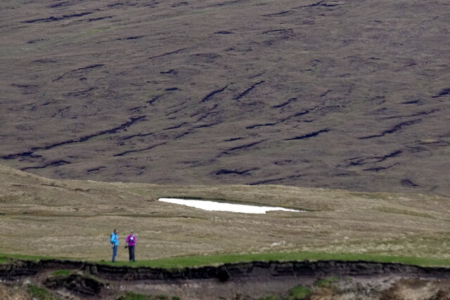
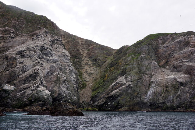
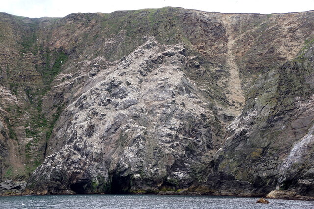
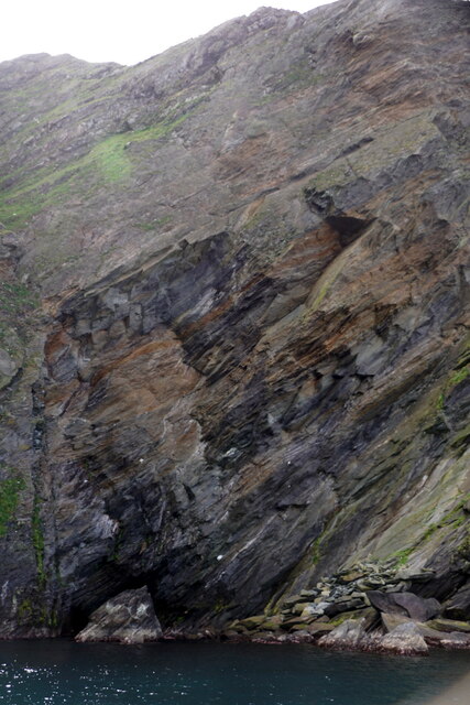
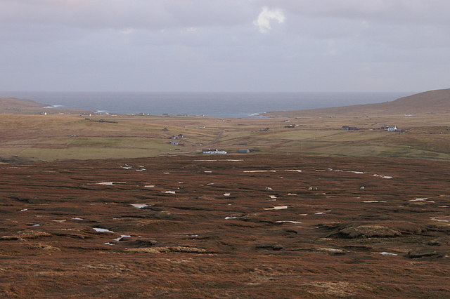
Gull Holm is a prominent coastal feature located in Shetland, Scotland. It is a headland that extends into the North Sea, forming a point that juts out into the water. The headland is characterized by its rugged and rocky terrain, with cliffs that rise steeply from the sea.

The name "Gull Holm" is derived from the Old Norse language, where "gull" means "gull" and "holm" means "island." This suggests that the headland may have been home to a large population of seabirds in the past, attracting gulls to nest on the cliffs and rocks.

The headland offers stunning panoramic views of the surrounding coastline and the vast expanse of the North Sea. The cliffs provide a nesting habitat for various seabird species, including gulls, puffins, and fulmars. Visitors to Gull Holm can witness these birds soaring through the air and nesting on the rocky ledges.

The area surrounding Gull Holm is rich in marine life, with numerous fish species inhabiting the waters, including cod, haddock, and mackerel. The strong currents and tides in the North Sea make it an ideal feeding ground for these fish, attracting larger marine predators such as seals and occasionally dolphins.

Gull Holm is also of historical significance, with remnants of ancient settlements and structures dating back to the Iron Age. Archaeological excavations have uncovered evidence of human activity, including stone tools, pottery fragments, and ruined buildings. These discoveries provide insights into the lives of the early inhabitants of Shetland and their connection to the surrounding landscape.

In summary, Gull Holm is a captivating coastal feature in Shetland, boasting rugged cliffs, diverse wildlife, and a rich historical heritage. It offers visitors a unique opportunity to experience the beauty of the North Sea and discover the ancient past of the region.

If you have any feedback on the listing, please let us know in the comments section below.
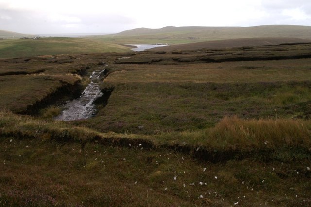
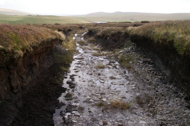
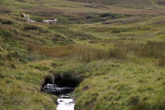
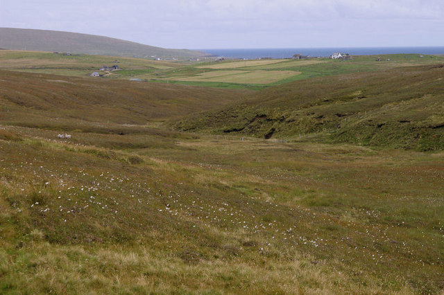
Gull Holm Images

Images are sourced within 2km of 60.815045/-0.87303851 or Grid Reference HP6115. Thanks to Geograph Open Source API. All images are credited.

Walkers at Saito, Hermaness
Un-named geo, Hermaness This obvious feature, separating the Neap from Saito, has no name that I am aware of.
Un-named geo, Hermaness
This obvious feature, separating the Neap from Saito, has no name that I am aware of.
Cliffs between the Neap and Saito, Hermaness, from the sea
Erosion on the cliffs between the Neap and Saito, Hermaness
Un-named geo between the Neap and Saito. Hermaness
Cliff between Kame of Flouravoug and Raabit Kame, Hermaness
Information board at the end of the boardwalk, Toolie, Hermaness
Herring Gulls (Larus argentatus), Saito, Hermaness
Fulmar (Fulmarus glacialis) chick, Hermaness
Rockfall at the Neap, Hermaness A relatively fresh rockfall (from the previous winter), with the gannetry on the Neap in the background.
Rockfall at the Neap, Hermaness
A relatively fresh rockfall (from the previous winter), with the gannetry on the Neap in the background.
Abandoned peat-workings at the south end of Hermaness NNR Peats have not been cut here since the 1980s.
Abandoned peat-workings at the south end of Hermaness NNR
Peats have not been cut here since the 1980s.
Peat track at the south end of Hermaness NNR The peat here is only about a metre thick, and the track has been cut down to the bedrock.
Peat track at the south end of Hermaness NNR
The peat here is only about a metre thick, and the track has been cut down to the bedrock.
Milldale Burn Milldale on the map, but known as Tonga Daal locally.
Milldale Burn
Milldale on the map, but known as Tonga Daal locally.
Looking down Milldale Some of the houses at Burrafirth can be seen in the distance and the Hill of Clibberswick is in the far distance on the left. Although named Milldale on the maps, it is known as Tonga Daal locally ('daal' is Shetlandic for dale or valley).
Looking down Milldale
Some of the houses at Burrafirth can be seen in the distance and the Hill of Clibberswick is in the far distance on the left. Although named Milldale on the maps, it is known as Tonga Daal locally ('daal' is Shetlandic for dale or valley).
Pool on the north end of Mill Field, Hermaness This ridge is named Mill Fiel on maps, but this is an OS typo, field being the Shetland word for a hill. The peninsula of Tonga is in the distance.
Pool on the north end of Mill Field, Hermaness
This ridge is named Mill Fiel on maps, but this is an OS typo, field being the Shetland word for a hill. The peninsula of Tonga is in the distance.
Mill Field, Hermaness Mill Fiel on the map is an OS typo - field means hill.
Mill Field, Hermaness
Mill Fiel on the map is an OS typo - field means hill.
View east from Mill Field, Hermaness Looking across the moorland on the ridge between Hoveburn and Milldale. The white house in the centre is Lower Sotland at Burrafirth with a view right across to Harold's Wick.
View east from Mill Field, Hermaness
Looking across the moorland on the ridge between Hoveburn and Milldale. The white house in the centre is Lower Sotland at Burrafirth with a view right across to Harold's Wick.
Show me another place!

Gull Holm is located at Grid Ref: HP6115 (Lat: 60.815045, Lng: -0.87303851)

Unitary Authority: Shetland Islands

Police Authority: Highlands and Islands

What 3 Words

///crispier.grafted.hobbyists. Near Haroldswick, Shetland Islands

Related Wikis

Burrafirth

Burrafirth links (Old Norse: Borgarfjorðr, meaning "the fjord with a castle") is a strip of land with a few houses on the island of Unst, Shetland, Scotland...

RAF Saxa Vord

Remote Radar Head Saxa Vord or RRH Saxa Vord (aka RAF Saxa Vord), is a Royal Air Force radar station located on the island of Unst, the most northern of...

Hermaness

Hermaness is the northernmost headland of Unst, the most northerly inhabited island of Shetland, Scotland. It consists of huge sea cliffs and moorland...

Valhalla Brewery

The Valhalla Brewery in Unst, Shetland, Scotland, was the northernmost brewery in the United Kingdom. It was opened by the husband and wife team Sonny...

Saxa Vord distillery

Saxa Vord distillery is a Scotch whisky and gin distillery on the island of Unst, part of the Shetland islands. The distillery takes its name from its...

Haroldswick

Haroldswick or Harold's Wick (Old Norse: Haraldsvík, 'Harald's bay'), is on Unst, Shetland Islands, Scotland, and is one of the most northerly settlements...

Muckle Flugga

Muckle Flugga () is a small rocky island north of Unst in the Shetland Islands, Scotland. It is often described as the northernmost point of the British...

Skaw, Unst

Skaw is a settlement in the Scottish archipelago of Shetland, located on the island of Unst. It is located north of Haroldswick on a peninsula in the northeast...

Nearby Amenities

Located within 500m of 60.815045,-0.87303851
Parking
Lat/Long: 60.8123377/-0.876483
Hermaness NNR Visitor Centre
Tourism: information
Lat/Long: 60.8119204/-0.8744338
Passing Place
Lat/Long: 60.8113714/-0.875207
Passing Place
Lat/Long: 60.8110895/-0.876692
Power: pole
Lat/Long: 60.8115168/-0.8751128
Power: pole
Lat/Long: 60.8112787/-0.8757807
Power: pole
Lat/Long: 60.8110393/-0.8764378
Toilets
Lat/Long: 60.8127672/-0.8764941
Defibrillator
Emergency: defibrillator
Lat/Long: 60.8127478/-0.8765469
The data included in this document is from www.openstreetmap.org. The data is made available under ODbL.

Have you been to Gull Holm?

Leave your review of Gull Holm below (or comments, questions and feedback).