Clingra Stack
Coastal Feature, Headland, Point in Shetland
Scotland
Clingra Stack

Clingra Stack is a prominent coastal feature located in the Shetland Islands, an archipelago in Scotland. It is specifically situated on the eastern coast of the main island, mainland Shetland. Clingra Stack is categorized as a headland or a point, due to its distinctive geological formation.
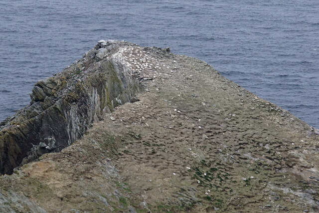
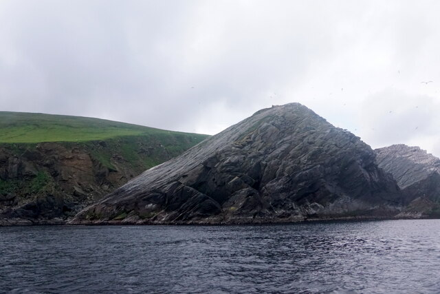
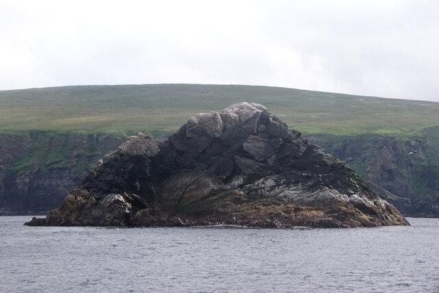
Rising majestically from the surrounding sea, Clingra Stack is an imposing rocky outcrop that juts out into the North Atlantic Ocean. It is composed of rugged cliffs and is characterized by its vertical, sheer sides. The stack itself is a tall, isolated pinnacle of rock that stands separate from the main headland. Its towering height and isolated nature make it a visually striking feature along the coastline.
The geological composition of Clingra Stack is primarily composed of sedimentary rocks, such as sandstone and shale. These rocks have been shaped and eroded over millions of years by the relentless forces of wind and waves. The stack's distinctive shape is a result of this continuous erosion, which has gradually worn away the softer rock layers, leaving behind the harder, more resistant rock that forms the pinnacle.
Clingra Stack is known not only for its geological significance but also for its rich biodiversity. The surrounding coastal area supports a diverse range of plant and animal species, including various seabirds, such as puffins, guillemots, and fulmars. These birds nest on the cliffs and use the stack as a safe haven away from predators.
As a prominent coastal feature, Clingra Stack is not only a natural wonder but also a popular destination for nature enthusiasts, geologists, and photographers who are drawn to its stunning beauty and unique geological formation.
If you have any feedback on the listing, please let us know in the comments section below.
Clingra Stack Images
Images are sourced within 2km of 60.838194/-0.89930425 or Grid Reference HP5917. Thanks to Geograph Open Source API. All images are credited.


Clingra Stack is located at Grid Ref: HP5917 (Lat: 60.838194, Lng: -0.89930425)
Unitary Authority: Shetland Islands
Police Authority: Highlands and Islands
What 3 Words
///trickled.overheard.grills. Near Haroldswick, Shetland Islands
Nearby Locations
Related Wikis

Hermaness
Hermaness is the northernmost headland of Unst, the most northerly inhabited island of Shetland, Scotland. It consists of huge sea cliffs and moorland...

Muckle Flugga
Muckle Flugga () is a small rocky island north of Unst in the Shetland Islands, Scotland. It is often described as the northernmost point of the British...

Out Stack
Out Stack or Ootsta is an island in Shetland, Scotland and the northernmost point of both Scotland and the British Isles. It lies 600 m (2,000 ft) northeast...

RAF Saxa Vord
Remote Radar Head Saxa Vord or RRH Saxa Vord (aka RAF Saxa Vord), is a Royal Air Force radar station located on the island of Unst, the most northern of...
Nearby Amenities
Located within 500m of 60.838194,-0.89930425Have you been to Clingra Stack?
Leave your review of Clingra Stack below (or comments, questions and feedback).