Beaulieu

Settlement in Hampshire New Forest

England

Beaulieu

Golden Arrow at the National Motor Museum, Beaulieu There are of course dozens of remarkable vehicles on show at the National Motor Museum, Beaulieu - but this is still one of the sleekest - at nearly 100 years old. 
Golden Arrow, driven by Henry Segrave on the 11th March 1929 at Daytona Beach broke the land speed record clocking 231.446mph (372.459 km/h) on the 'flying mile'; Segrave was knighted for this achievement. The record held for nearly two years up to February 5, 1931.
Golden Arrow has a 23.9 Litre (1,460 in³) W12 Napier Lion aero engine (used in Supermarine aeroplanes).
Wikipedia article: <span class="nowrap"><a title="https://en.wikipedia.org/wiki/Golden_Arrow_(car)" rel="nofollow ugc noopener" href="https://en.wikipedia.org/wiki/Golden_Arrow_(car)">Link</a><img style="margin-left:2px;" alt="External link" title="External link - shift click to open in new window" src="https://s1.geograph.org.uk/img/external.png" width="10" height="10"/></span>
Cf. Basher's side view from 10 years ago <a href="https://www.geograph.org.uk/photo/2669999">SU3802 : Lord Montagu's Wonderful Collection (166)</a>
Golden Arrow at the National Motor Museum, Beaulieu Credit: Rob Farrow

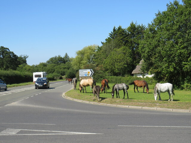
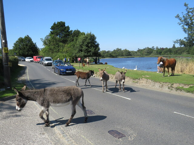
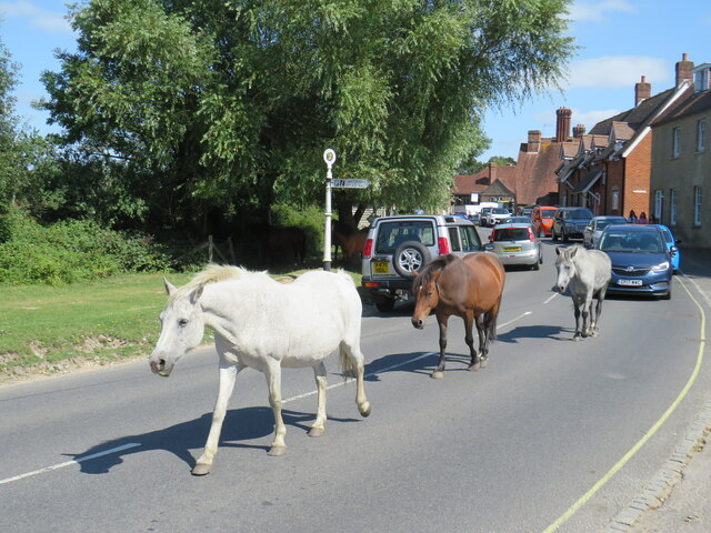
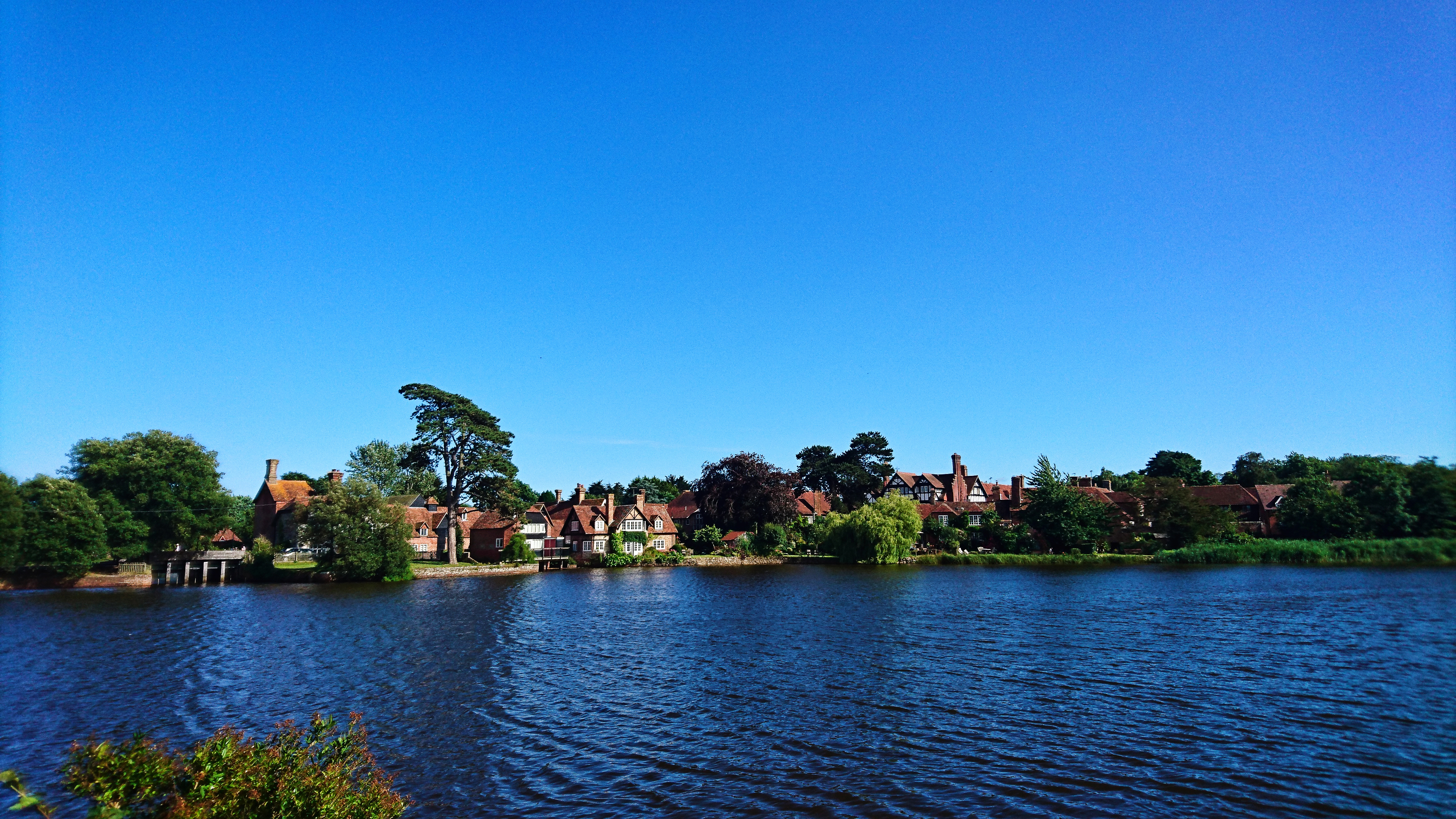
Beaulieu is a small village located in the New Forest district of Hampshire, England. Situated on the eastern edge of the New Forest National Park, it is surrounded by picturesque countryside and is known for its tranquility and natural beauty. The village lies on the Beaulieu River, near its junction with the Solent, a significant maritime inlet.

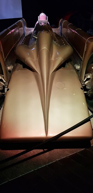
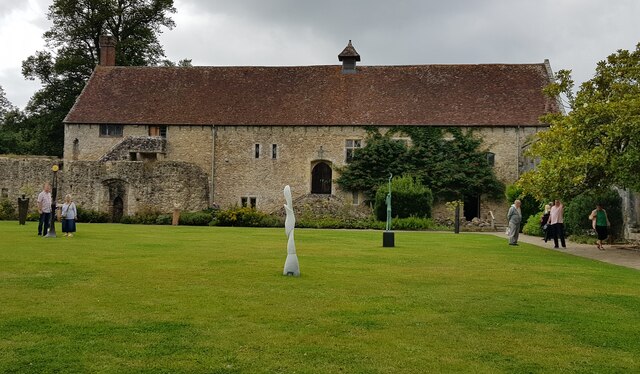
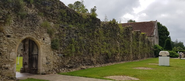
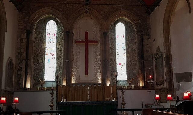
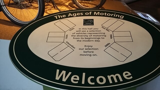
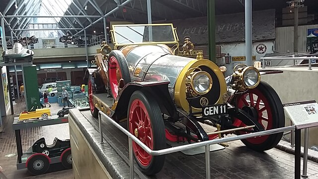
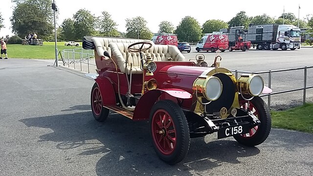
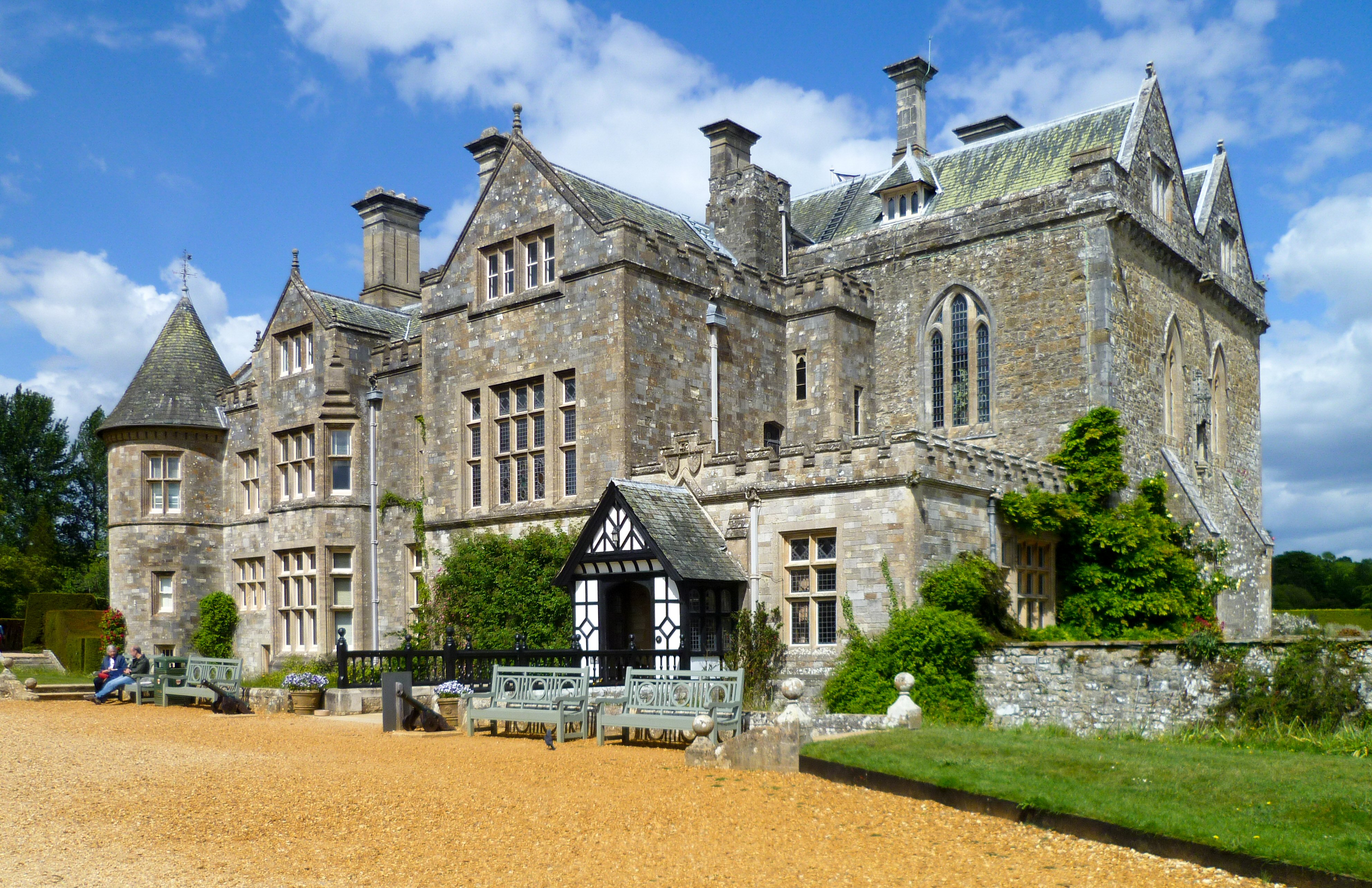
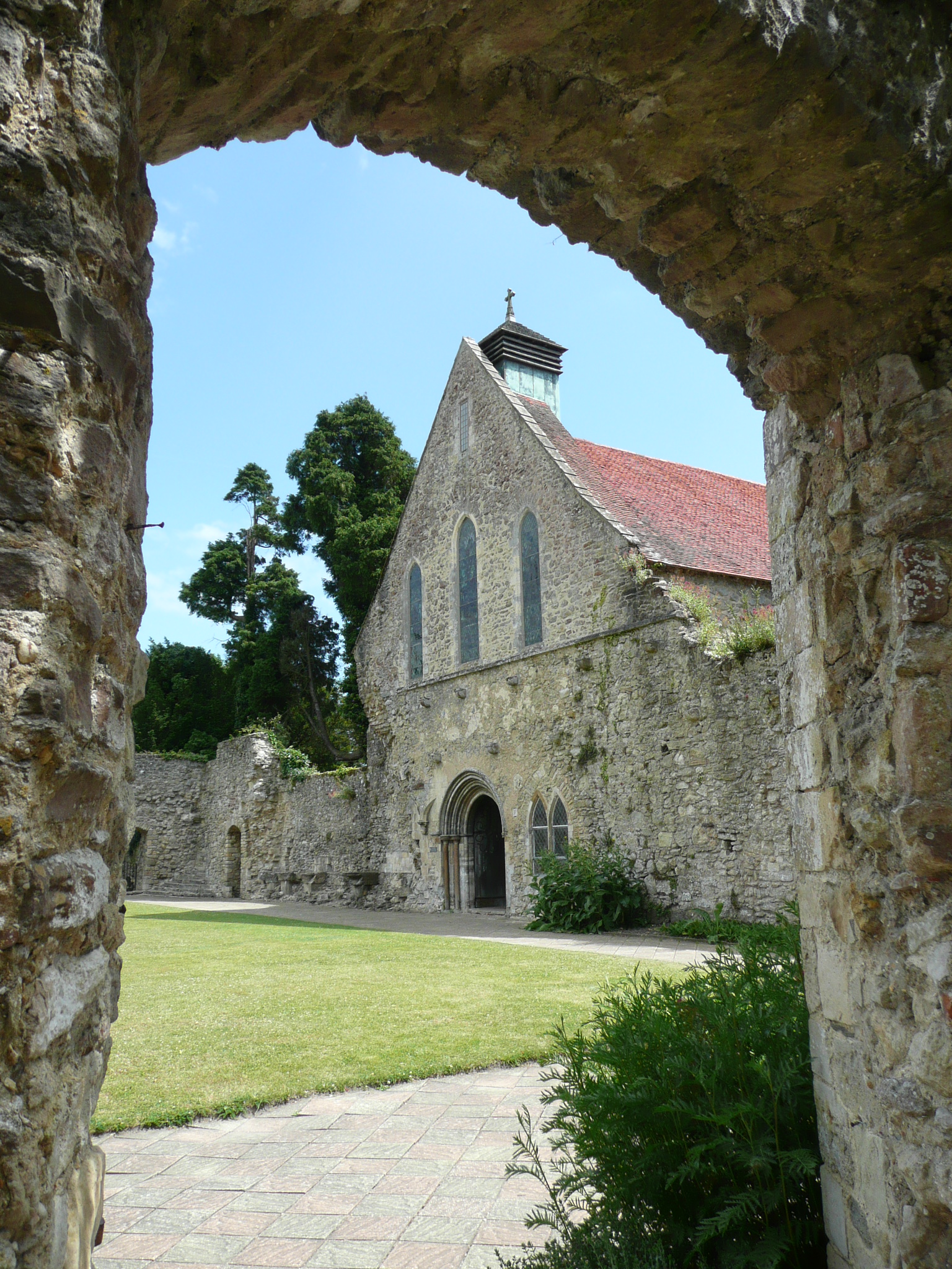
Beaulieu is renowned for its historical significance, being home to the famous Beaulieu Abbey, founded in 1204. The ruins of the abbey still stand today, attracting visitors who are captivated by its architectural grandeur and historical resonance. Additionally, the village features the renowned National Motor Museum, which showcases a vast collection of vintage cars, motorcycles, and other motoring memorabilia.

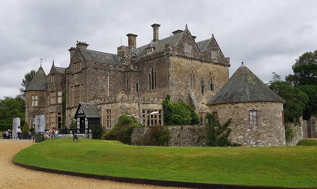
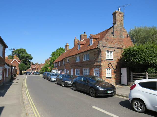
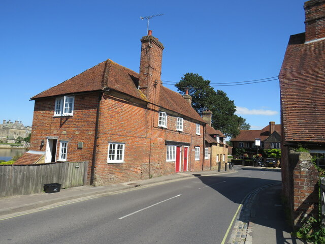
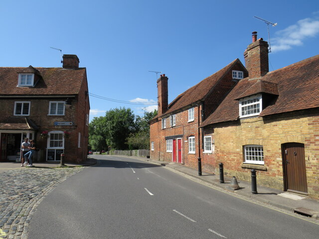
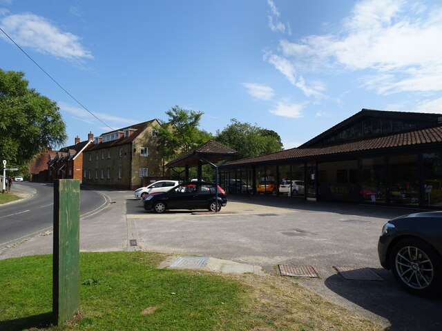
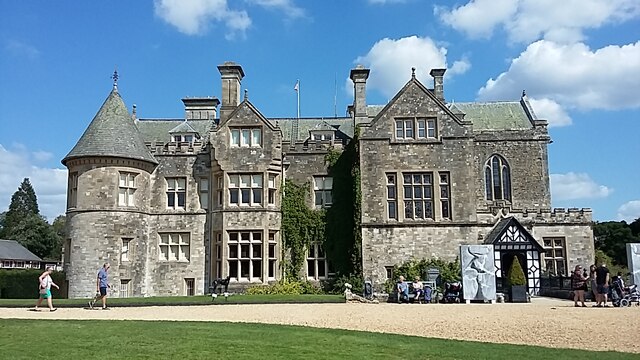
The focal point of Beaulieu is the High Street, lined with charming, traditional cottages and a variety of shops, tea rooms, and restaurants. The village maintains its old-world charm, with an emphasis on preserving its heritage and character. The Beaulieu Estate, owned by the Montagu family, dominates the village, with its stately home, Palace House, serving as a popular tourist attraction.

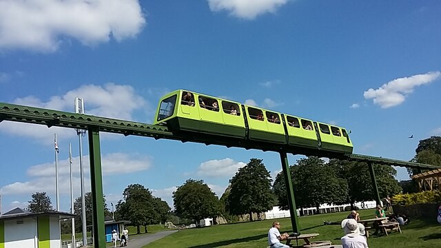
Nature enthusiasts are drawn to Beaulieu for its scenic beauty and abundant wildlife. The village offers opportunities for walking, cycling, and boating, allowing visitors to explore the surrounding natural landscapes. Moreover, Beaulieu hosts various events throughout the year, including classic car rallies, garden shows, and the Beaulieu Boatjumble, a popular event for boating enthusiasts.

Overall, Beaulieu is a delightful destination for history buffs, nature lovers, and those seeking a peaceful retreat in the heart of the New Forest.

If you have any feedback on the listing, please let us know in the comments section below.

Beaulieu Images

Images are sourced within 2km of 50.818263/-1.4519 or Grid Reference SU3802. Thanks to Geograph Open Source API. All images are credited.

Golden Arrow at the National Motor Museum, Beaulieu There are of course dozens of remarkable vehicles on show at the National Motor Museum, Beaulieu - but this is still one of the sleekest - at nearly 100 years old. 
Golden Arrow, driven by Henry Segrave on the 11th March 1929 at Daytona Beach broke the land speed record clocking 231.446mph (372.459 km/h) on the 'flying mile'; Segrave was knighted for this achievement. The record held for nearly two years up to February 5, 1931.
Golden Arrow has a 23.9 Litre (1,460 in³) W12 Napier Lion aero engine (used in Supermarine aeroplanes).
Wikipedia article: <span class="nowrap"><a title="https://en.wikipedia.org/wiki/Golden_Arrow_(car)" rel="nofollow ugc noopener" href="https://en.wikipedia.org/wiki/Golden_Arrow_(car)">Link</a><img style="margin-left:2px;" alt="External link" title="External link - shift click to open in new window" src="https://s1.geograph.org.uk/img/external.png" width="10" height="10"/></span>
Cf. Basher's side view from 10 years ago <a href="https://www.geograph.org.uk/photo/2669999">SU3802 : Lord Montagu's Wonderful Collection (166)</a>
Golden Arrow at the National Motor Museum, Beaulieu
There are of course dozens of remarkable vehicles on show at the National Motor Museum, Beaulieu - but this is still one of the sleekest - at nearly 100 years old. Golden Arrow, driven by Henry Segrave on the 11th March 1929 at Daytona Beach broke the land speed record clocking 231.446mph (372.459 km/h) on the 'flying mile'; Segrave was knighted for this achievement. The record held for nearly two years up to February 5, 1931. Golden Arrow has a 23.9 Litre (1,460 in³) W12 Napier Lion aero engine (used in Supermarine aeroplanes). Wikipedia article: LinkExternal link Cf. Basher's side view from 10 years ago SU3802 : Lord Montagu's Wonderful Collection (166)
Beaulieu - The Palace House The Palace House at Beaulieu as seen today dates mostly from the C18th with a restoration and enlargement of 1872. However it incorporates a Mid C14th gatehouse which had been converted to a hunting lodge c.1540 for Lord Wriothesley.
It has been the (not always primary) residence of the Montagu family for generations, see <span class="nowrap"><a title="https://www.beaulieu.co.uk/about-us" rel="nofollow ugc noopener" href="https://www.beaulieu.co.uk/about-us">Link</a><img style="margin-left:2px;" alt="External link" title="External link - shift click to open in new window" src="https://s1.geograph.org.uk/img/external.png" width="10" height="10"/></span>
Full EH Grade I listing here: <span class="nowrap"><a title="https://historicengland.org.uk/listing/the-list/list-entry/1094430" rel="nofollow ugc noopener" href="https://historicengland.org.uk/listing/the-list/list-entry/1094430">Link</a><img style="margin-left:2px;" alt="External link" title="External link - shift click to open in new window" src="https://s1.geograph.org.uk/img/external.png" width="10" height="10"/></span>
Their own website here: <span class="nowrap"><a title="https://www.beaulieu.co.uk/attractions/palace-house-gardens" rel="nofollow ugc noopener" href="https://www.beaulieu.co.uk/attractions/palace-house-gardens">Link</a><img style="margin-left:2px;" alt="External link" title="External link - shift click to open in new window" src="https://s1.geograph.org.uk/img/external.png" width="10" height="10"/></span>
Beaulieu - The Palace House
The Palace House at Beaulieu as seen today dates mostly from the C18th with a restoration and enlargement of 1872. However it incorporates a Mid C14th gatehouse which had been converted to a hunting lodge c.1540 for Lord Wriothesley. It has been the (not always primary) residence of the Montagu family for generations, see LinkExternal link Full EH Grade I listing here: LinkExternal link Their own website here: LinkExternal link
Beaulieu - The Domus The Domus is one of only two buildings of the original Cistercian abbey to have survived the Dissolution of the Monasteries in the C16th. It dates from the early C13th and was originally the Lay Brothers' Dormitory. It is now used by the estate for various functions e.g. conferences or "Medieval Banquets" - see <span class="nowrap"><a title="https://www.beaulieu.co.uk/corporate-and-weddings/our-venues/the-domus-conference-meeting-facility" rel="nofollow ugc noopener" href="https://www.beaulieu.co.uk/corporate-and-weddings/our-venues/the-domus-conference-meeting-facility">Link</a><img style="margin-left:2px;" alt="External link" title="External link - shift click to open in new window" src="https://s1.geograph.org.uk/img/external.png" width="10" height="10"/></span>
The Domus adjoins the (ruined) cloisters on their western side. The photograph was taken from the eastern side of these cloisters.
It is EH Grade I listed <span class="nowrap"><a title="https://historicengland.org.uk/listing/the-list/list-entry/1156631" rel="nofollow ugc noopener" href="https://historicengland.org.uk/listing/the-list/list-entry/1156631">Link</a><img style="margin-left:2px;" alt="External link" title="External link - shift click to open in new window" src="https://s1.geograph.org.uk/img/external.png" width="10" height="10"/></span>
Beaulieu - The Domus
The Domus is one of only two buildings of the original Cistercian abbey to have survived the Dissolution of the Monasteries in the C16th. It dates from the early C13th and was originally the Lay Brothers' Dormitory. It is now used by the estate for various functions e.g. conferences or "Medieval Banquets" - see LinkExternal link The Domus adjoins the (ruined) cloisters on their western side. The photograph was taken from the eastern side of these cloisters. It is EH Grade I listed LinkExternal link
Beaulieu - foundations of former abbey church Before the Dissolution of the Monasteries in the C16th there had been a Cistercian abbey here at Beaulieu with a large and magnificent abbey church. All that remains of that church now is the rocks of its foundations, some of which can be seen here.
The abbey was 'dissolved' in April 1538, one of the earliest monasteries to close. It passed into the possession of Thomas Wriothesley, 1st Earl of Southampton (1505-50). Soon after this date the stone of most of the abbey was 'quarried' for building stones for other buildings.
See extensive EH Ancient Monument write-up here: <span class="nowrap"><a title="https://historicengland.org.uk/listing/the-list/list-entry/1003450" rel="nofollow ugc noopener" href="https://historicengland.org.uk/listing/the-list/list-entry/1003450">Link</a><img style="margin-left:2px;" alt="External link" title="External link - shift click to open in new window" src="https://s1.geograph.org.uk/img/external.png" width="10" height="10"/></span>
See also <a href="https://www.geograph.org.uk/photo/6942218">SU3802 : Beaulieu - Northern Cloister wall</a> which adjoins it and has a separate EH listing.
Beaulieu - foundations of former abbey church
Before the Dissolution of the Monasteries in the C16th there had been a Cistercian abbey here at Beaulieu with a large and magnificent abbey church. All that remains of that church now is the rocks of its foundations, some of which can be seen here. The abbey was 'dissolved' in April 1538, one of the earliest monasteries to close. It passed into the possession of Thomas Wriothesley, 1st Earl of Southampton (1505-50). Soon after this date the stone of most of the abbey was 'quarried' for building stones for other buildings. See extensive EH Ancient Monument write-up here: LinkExternal link See also SU3802 : Beaulieu - Northern Cloister wall which adjoins it and has a separate EH listing.
Beaulieu - Northern Cloister wall A view along the northern wall of the former cloisters of Beaulieu Abbey. This wall would also effectively have been the southern wall of the nave of the former abbey church which has otherwise completely disappeared other than its foundations (see <a href="https://www.geograph.org.uk/photo/6942213">SU3802 : Beaulieu - foundations of former abbey church</a>)
The gateway seen on the left was the monks' entrance into the church from the cloister.
See EH Grade I listing: <span class="nowrap"><a title="https://historicengland.org.uk/listing/the-list/list-entry/1094429" rel="nofollow ugc noopener" href="https://historicengland.org.uk/listing/the-list/list-entry/1094429">Link</a><img style="margin-left:2px;" alt="External link" title="External link - shift click to open in new window" src="https://s1.geograph.org.uk/img/external.png" width="10" height="10"/></span>
Beaulieu - Northern Cloister wall
A view along the northern wall of the former cloisters of Beaulieu Abbey. This wall would also effectively have been the southern wall of the nave of the former abbey church which has otherwise completely disappeared other than its foundations (see SU3802 : Beaulieu - foundations of former abbey church) The gateway seen on the left was the monks' entrance into the church from the cloister. See EH Grade I listing: LinkExternal link
Beaulieu - Parish church (former frater) - Altar The Church of the Blessed Virgin and Child (formerly listed by EH as Parish Church) occupies the building that was originally the frater (the dining room or refectory of a monastery) of the Cistercian abbey of Beaulieu.
The abbey was founded in 1204 in the reign of King John, and the windows seen here to either side of the altar are clearly of the simple Early English Gothic style of that period.
Along with most of the abbey remains, this church is EH Grade I listed <span class="nowrap"><a title="https://historicengland.org.uk/listing/the-list/list-entry/1156943" rel="nofollow ugc noopener" href="https://historicengland.org.uk/listing/the-list/list-entry/1156943">Link</a><img style="margin-left:2px;" alt="External link" title="External link - shift click to open in new window" src="https://s1.geograph.org.uk/img/external.png" width="10" height="10"/></span> but interestingly is specifically excluded (along with its churchyard) from the Ancient Monument scheduling.
Note that to get the windows vertical in this image, the altar is seen to lean - the walls of the church lean outwards quite noticeably and are supported by huge external buttresses (see <a href="https://www.geograph.org.uk/photo/2124322">SU3802 : Beaulieu: parish church of the Blessed Virgin and Holy Child</a> for a good external view).
Beaulieu - Parish church (former frater) - Altar
The Church of the Blessed Virgin and Child (formerly listed by EH as Parish Church) occupies the building that was originally the frater (the dining room or refectory of a monastery) of the Cistercian abbey of Beaulieu. The abbey was founded in 1204 in the reign of King John, and the windows seen here to either side of the altar are clearly of the simple Early English Gothic style of that period. Along with most of the abbey remains, this church is EH Grade I listed LinkExternal link but interestingly is specifically excluded (along with its churchyard) from the Ancient Monument scheduling. Note that to get the windows vertical in this image, the altar is seen to lean - the walls of the church lean outwards quite noticeably and are supported by huge external buttresses (see SU3802 : Beaulieu: parish church of the Blessed Virgin and Holy Child for a good external view).
Horses grazing, Beaulieu Horses grazing by the roadside in Beaulieu, in The New Forest.  The road junction in the foreground forms the junction of the B3056, which starts/ends here, and the B3054.
Horses grazing, Beaulieu
Horses grazing by the roadside in Beaulieu, in The New Forest. The road junction in the foreground forms the junction of the B3056, which starts/ends here, and the B3054.
Ponies in the road, Beaulieu New Forest ponies wandering in the road in the village of Beaulieu.  The road forms part of the route of the B3054 which links the towns of Lymington and Hythe.
Ponies in the road, Beaulieu
New Forest ponies wandering in the road in the village of Beaulieu. The road forms part of the route of the B3054 which links the towns of Lymington and Hythe.
Horses in the road, Beaulieu Horses wandering along Palace Lane, in the village of Beaulieu.  A queue of cars has formed behind the animals.

Palace Lane forms part of the route of the B3054 road which links the towns of Lymington and Hythe.
Horses in the road, Beaulieu
Horses wandering along Palace Lane, in the village of Beaulieu. A queue of cars has formed behind the animals. Palace Lane forms part of the route of the B3054 road which links the towns of Lymington and Hythe.
High Street, Beaulieu High Street in the village of Beaulieu, in The New Forest.
High Street, Beaulieu
High Street in the village of Beaulieu, in The New Forest.
Palace Lane, Beaulieu Palace Lane in the village of Beaulieu, in The New Forest.  This road forms part of the route of the B3054 which links the towns of Lymington and Hythe.
Palace Lane, Beaulieu
Palace Lane in the village of Beaulieu, in The New Forest. This road forms part of the route of the B3054 which links the towns of Lymington and Hythe.
Palace Lane, Beaulieu Palace Lane forms part of the route of the B3054, which passes through Beaulieu on its way between Hythe and Lymington.  The village of Beaulieu lies within the New Forest.
Palace Lane, Beaulieu
Palace Lane forms part of the route of the B3054, which passes through Beaulieu on its way between Hythe and Lymington. The village of Beaulieu lies within the New Forest.
 Beaulieu Garage View The in Beaulieu village.
Beaulieu Garage View
The in Beaulieu village.
Beaulieu estate Beaulieu estate, the palace house
Beaulieu estate
Beaulieu estate, the palace house
Beaulieu Beaulieu, just inside entrance to museum, and the museum set up
Beaulieu
Beaulieu, just inside entrance to museum, and the museum set up
Beaulieu Beaulieu, the motor museum monorail which goes around the estate and museum
Beaulieu
Beaulieu, the motor museum monorail which goes around the estate and museum
Beaulieu Motor Museum Beaulieu Motor Museum, car on display, on the upper level, is as we know it, Chitty Chitty Bang Bang, it's actually Chitty Bang Bang, which won several races early 1920's
Beaulieu Motor Museum
Beaulieu Motor Museum, car on display, on the upper level, is as we know it, Chitty Chitty Bang Bang, it's actually Chitty Bang Bang, which won several races early 1920's
Beaulieu Motor Museum Beaulieu Motor Museum, the car on display near museum entrance, is a Rolls Royce, this went round the estate several times during my day out
Beaulieu Motor Museum
Beaulieu Motor Museum, the car on display near museum entrance, is a Rolls Royce, this went round the estate several times during my day out
Show me another place!

Beaulieu is located at Grid Ref: SU3802 (Lat: 50.818263, Lng: -1.4519)

Administrative County: Hampshire

District: New Forest

Police Authority: Hampshire

What 3 Words

///backyards.undulation.chat. Near Hythe, Hampshire

Nearby Locations

Beaulieu

Related Wikis

Beaulieu Palace House

Beaulieu Palace House ( BEW-lee) is a 13th-century house in Beaulieu, Hampshire, United Kingdom. Originally part of Beaulieu Abbey, the estate was bought...

Beaulieu, Hampshire

Beaulieu ( BEW-lee) is a village located on the southeastern edge of the New Forest in Hampshire, England. It is home to both Palace House and the National...

Beaulieu Abbey

Beaulieu Abbey was a Cistercian abbey in Hampshire, England. It was founded in 1203–1204 by King John and (uniquely in Britain) populated by 30 monks sent...

National Motor Museum, Beaulieu

The National Motor Museum (originally the Montagu Motor Museum) is a museum in the village of Beaulieu, set in the heart of the New Forest, in the English...

Nearby Amenities

Located within 500m of 50.818263,-1.4519
Crossing
Crossing: unmarked
Crossing Markings: no
Tactile Paving: no
Traffic Calming: hump
Lat/Long: 50.8176917/-1.4519686
Barrier: cattle_grid
Lat/Long: 50.8151672/-1.4471087
Beaulieu
Place: village
Source: npe
Wikidata: Q186954
Wikipedia: en:Beaulieu, Hampshire
Lat/Long: 50.8184137/-1.4519156
Cafe
The Old Bakehouse Tearooms
Diet Vegan: yes
Diet Vegetarian: yes
Website: https://WWW.THEBEAULIEUBAKEHOUSE.CO.UK
Wheelchair: limited
Lat/Long: 50.8177866/-1.4522532
Bus Stop
Beaulieu Garage
Bench: no
Bin: no
Bus: yes
Lit: yes
Naptan AtcoCode: 1900HAA13533
Naptan Bearing: W
Naptan CommonName: Beaulieu Garage
Naptan Crossing: High Street
Naptan NaptanCode: hamatdpm
Naptan Street: B3054
Naptan Verified: no
Public Transport: platform
Shelter: no
Source: naptan_import
Tactile Paving: no
Lat/Long: 50.8180701/-1.4528667
Bus Stop
Beaulieu Church
Bench: no
Bus: yes
Naptan AtcoCode: 1900HA080510
Naptan Bearing: NE
Naptan CommonName: Beaulieu Church
Naptan NaptanCode: hamatdwp
Naptan Street: Palace Lane
Naptan Verified: no
Public Transport: platform
Shelter: no
Source: naptan_import
Tactile Paving: no
Lat/Long: 50.8201042/-1.4494074
Bus Stop
Beaulieu Church
Bench: no
Bin: no
Bus: yes
Lit: no
Naptan AtcoCode: 1900HA080511
Naptan Bearing: SW
Naptan CommonName: Beaulieu Church
Naptan NaptanCode: hamatdwj
Naptan Street: Palace Lane
Naptan Verified: no
Public Transport: platform
Shelter: no
Source: naptan_import
Tactile Paving: no
Lat/Long: 50.8198984/-1.4496369
Bus Stop
Beaulieu Garage
Bench: yes
Bin: yes
Bus: yes
Lit: no
Naptan AtcoCode: 1900HA080512
Naptan Bearing: E
Naptan CommonName: Beaulieu Garage
Naptan Crossing: B3056
Naptan NaptanCode: hamatdpt
Naptan Street: B3054
Naptan Verified: no
Public Transport: platform
Shelter: yes
Source: naptan_import
Tactile Paving: no
Lat/Long: 50.8181863/-1.4527092
Bus Stop
Bunkers Hill
Bus: yes
Naptan AtcoCode: 1900HA080632
Naptan Bearing: NE
Naptan CommonName: Bunkers Hill
Naptan Crossing: Bunkers Hill
Naptan Landmark: Nr Rose Cottage
Naptan NaptanCode: hamatdga
Naptan Street: Hatchet Lane
Naptan Verified: no
Public Transport: platform
Shelter: no
Source: naptan_import
Tactile Paving: no
Lat/Long: 50.814366/-1.4549966
Bus Stop
Bunkers Hill
Bench: no
Bus: yes
Naptan AtcoCode: 1900HA080633
Naptan Bearing: SW
Naptan CommonName: Bunkers Hill
Naptan Crossing: Bunkers Hill
Naptan Landmark: O/s Myrtle Cottage
Naptan NaptanCode: hamatdgd
Naptan Street: Hatchet Lane
Naptan Verified: no
Public Transport: platform
Shelter: no
Source: naptan_import
Tactile Paving: no
Lat/Long: 50.8143028/-1.4549406
Fire Station
Beaulieu Fire Station
Lat/Long: 50.8184757/-1.4503131
Crossing
Traffic Calming: hump
Lat/Long: 50.8167072/-1.45211
Crossing
Traffic Calming: hump
Lat/Long: 50.8173018/-1.4520413
Traffic Calming: hump
Lat/Long: 50.8182456/-1.4519198
Cafe
Steff's Kitchen
Lat/Long: 50.8166561/-1.4518577
Barrier: lift_gate
Lat/Long: 50.8199939/-1.450061
Fairweather's Garden Centre
Shop: garden_centre
Lat/Long: 50.8165451/-1.4515729
Queensmeade Village Shop
Shop: convenience
Lat/Long: 50.8177685/-1.4520584
Barrier: cattle_grid
Lat/Long: 50.8173752/-1.4497007
Telephone
Booth: K6
Covered: booth
Listed Status: Grade II
Payment Coins: yes
Payment Credit Cards: yes
Payment Debit Cards: yes
Phone: +44 1590 612201
Lat/Long: 50.8172336/-1.4519627
Abbey Stores
Addr City: Brockenhurst
Addr Country: GB
Addr Place: Beaulieu
Addr Postcode: SO42 7YD
Addr Street: High Street
Shop: convenience
Lat/Long: 50.8181283/-1.451748
Cafe
Steff's to go
Cuisine: sandwich;cake;coffee
Lat/Long: 50.8167387/-1.4521853
Flowers of the Forest
Shop: gift
Lat/Long: 50.8182063/-1.452046
Bear it in Mind
Shop: toys
Lat/Long: 50.8170998/-1.452164
Norris Gifts & Furnishings
Shop: gift
Lat/Long: 50.8177504/-1.451791
Beaulieu Fine Arts
Shop: art
Lat/Long: 50.8180962/-1.4520513
Check Date: 2021-11-21
Information: map
Tourism: information
Lat/Long: 50.8177629/-1.4523915
Post Box
Collection Times: Mo-Fr 16:30; Sa 11:00
Operator: Royal Mail
Operator Wikidata: Q638098
Ref: SO42 111
Royal Cypher: GR
Royal Cypher Wikidata: Q33102273
Lat/Long: 50.81801/-1.4520143
Shepherds Mead
Place: isolated_dwelling
Lat/Long: 50.8202567/-1.4559611
The Lodge
Place: isolated_dwelling
Lat/Long: 50.8146386/-1.4511257
Toilets
Lat/Long: 50.8212924/-1.4505824
Play Trail
Leisure: playground
Lat/Long: 50.8223294/-1.4523339
Mini Cars
Tourism: attraction
Lat/Long: 50.8224454/-1.452063
Bus Stop
Veteran Bus
Bus: yes
Public Transport: platform
Lat/Long: 50.8208645/-1.4508211
Shelter
Lat/Long: 50.820086/-1.4494751
South Station
Public Transport: station
Railway: station
Source: Bing
Usage: tourism
Lat/Long: 50.8214669/-1.4518349
Drinking Water: yes
Man Made: water_tap
Lat/Long: 50.8184197/-1.4503262
Bicycle Parking
Bicycle Parking: stands
Capacity: 10
Covered: no
Lat/Long: 50.8165035/-1.4519729
Turning Loop
Lat/Long: 50.8159499/-1.4518063
Bicycle Parking
Cycle parking - Hotel
Bicycle Parking: stands
Capacity: 8
Covered: no
Lat/Long: 50.8185059/-1.4513366
Bicycle Parking
Bicycle Parking: wall_loops
Capacity: 9
Covered: no
Lat/Long: 50.8165242/-1.4519211
Give Way
Direction: forward
Lat/Long: 50.8156491/-1.4531591
Waste Basket
Lat/Long: 50.8177515/-1.4525487
Waste Basket
Lat/Long: 50.8177186/-1.4520404
Waste Basket
Waste: dog_excrement
Lat/Long: 50.8172811/-1.4496093
Bicycle Repair Station
Covered: yes
Fee: no
Indoor: no
Opening Hours: 24/7
Operator: Gravel Kings
Service Bicycle Bicycle Sales And Service: no
Service Bicycle Bicycle: no
Service Bicycle Chain Tool: no
Service Bicycle Cleaning: no
Service Bicycle Diy: no
Service Bicycle Ebike: no
Service Bicycle Parts: no
Service Bicycle Pump: yes
Service Bicycle Rental: no
Service Bicycle Repair: yes
Service Bicycle Retail: no
Service Bicycle Sales: no
Service Bicycle Second Hand: no
Service Bicycle Service: no
Service Bicycle Spare Parts: no
Service Bicycle Stand: no
Service Bicycle Tools: yes
Lat/Long: 50.8177537/-1.4521403
Barrier: bollard
Material: wood
Lat/Long: 50.8177084/-1.4520176
Barrier: bollard
Bollard: wood
Lat/Long: 50.8176854/-1.4520223
The data included in this document is from www.openstreetmap.org. The data is made available under ODbL.

Have you been to Beaulieu?

Leave your review of Beaulieu below (or comments, questions and feedback).