Andie Geo

Coastal Feature, Headland, Point in Shetland

Scotland

Andie Geo

Gudon With the Wick of Gossabrough.
Gudon Credit: Oliver Dixon

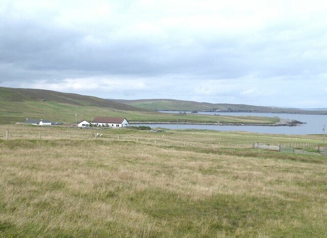
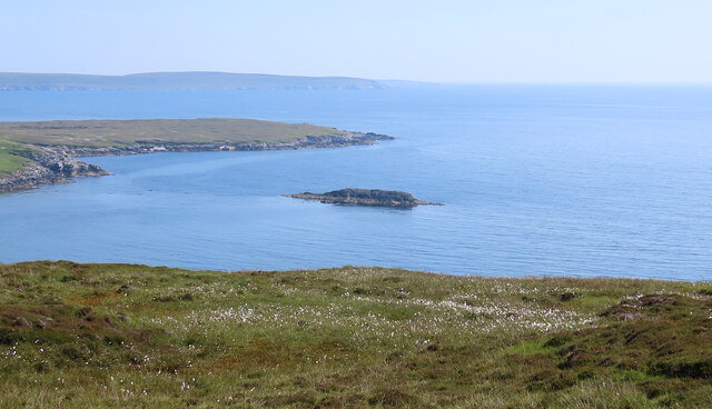
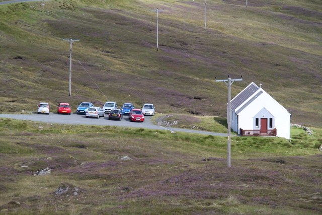
Andie Geo is a prominent coastal feature located on the Shetland Islands, an archipelago in Scotland. It is a headland that extends into the North Sea, forming a distinctive point along the coastline. The name "geo" is derived from the Old Norse word "gjá," meaning a narrow inlet or cleft, which accurately describes the geological formation of Andie Geo.

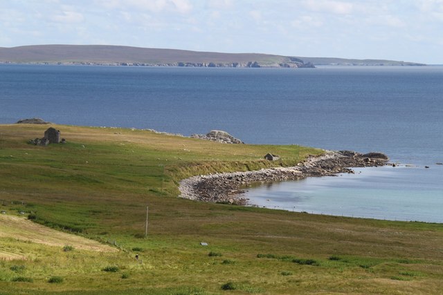
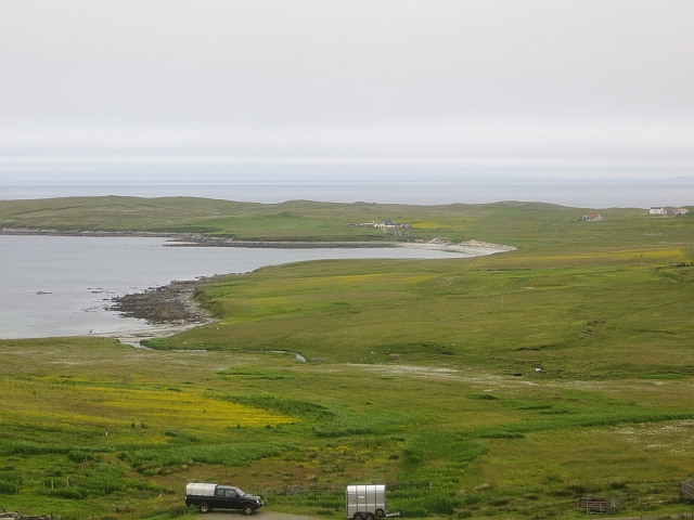
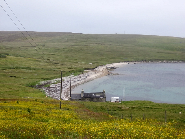
With its rugged cliffs and rocky terrain, Andie Geo showcases the dramatic and picturesque landscape that characterizes the Shetland Islands. The headland is composed of layers of sedimentary rock, including sandstone and shale, which have been shaped by erosion over millions of years. The relentless pounding of the sea against the cliffs has sculpted the rock formations into unique shapes, providing a stunning visual display.

Andie Geo is known for its rich biodiversity. The cliffs provide nesting sites for numerous seabirds, including puffins, razorbills, and guillemots. Visitors to the area can witness these birds in their natural habitat, soaring above the cliffs or perched on narrow ledges.

The headland also offers breathtaking views of the surrounding coastline and the vast expanse of the North Sea. On a clear day, visitors can see the distant horizon, with the waves crashing against the rocks below. The ever-changing weather and the play of light over the sea and cliffs add to the enchanting atmosphere of Andie Geo.

Overall, Andie Geo is a must-visit destination for nature enthusiasts and those seeking awe-inspiring coastal landscapes. Its geological features, diverse wildlife, and stunning views make it a truly remarkable and unforgettable place within the Shetland Islands.

If you have any feedback on the listing, please let us know in the comments section below.

Andie Geo Images

Images are sourced within 2km of 60.548984/-1.0403217 or Grid Reference HU5285. Thanks to Geograph Open Source API. All images are credited.

Gudon With the Wick of Gossabrough.
Gudon
With the Wick of Gossabrough.
Ness of Queyon Taken on the B9081 as we pass through East Yell, Yell, Shetland, I am looking across Otters Wick to the Ness of Queyon, the croft of the same name and the Hill of Queyon. The cliffs of Hascosay and Mid Yell can be seen beyond.
Ness of Queyon
Taken on the B9081 as we pass through East Yell, Yell, Shetland, I am looking across Otters Wick to the Ness of Queyon, the croft of the same name and the Hill of Queyon. The cliffs of Hascosay and Mid Yell can be seen beyond.
Black Skerry Taken on the B9081 as we pass through East Yell, Yell, Shetland, I am looking east across common cotton-grass and the water of Otters Wick to Black Skerry. The Ness of Queyon is to the left of shot in the middle distance with Mid Yell beyond.
Black Skerry
Taken on the B9081 as we pass through East Yell, Yell, Shetland, I am looking east across common cotton-grass and the water of Otters Wick to Black Skerry. The Ness of Queyon is to the left of shot in the middle distance with Mid Yell beyond.
East Yell: postbox № ZE2 38, Holligarth A small, lonely postbox serving the hamlet of Gossabrough, which lies alongside the shore of the bay, Wick of Gossabrough, which we see in the background. The box is emptied at 9:30am daily, except Sunday.
East Yell: postbox № ZE2 38, Holligarth
A small, lonely postbox serving the hamlet of Gossabrough, which lies alongside the shore of the bay, Wick of Gossabrough, which we see in the background. The box is emptied at 9:30am daily, except Sunday.
East Yell: postbox № ZE2 59 A small postbox alongside a bus shelter at the junction, a short distance from the post office. The box is emptied at half past nine on weekday and Saturday mornigs.
East Yell: postbox № ZE2 59
A small postbox alongside a bus shelter at the junction, a short distance from the post office. The box is emptied at half past nine on weekday and Saturday mornigs.
East Yell: the White Wife This unusual monument commemorates a shipping disaster in April 1924. Setting sail from Gothenburg, bound for Chile, the 'Bohus' had been sailing for three days when a navigational error resulted in the ship becoming grounded a short distance from here, some 60 miles off her intended course. Within half an hour most of the ship had broken up.

Four of the 39 on board perished, and the survivors owed a lot to the men of Yell who acted swiftly when they saw the tragedy emerging.

The ship's figurehead was washed ashore in September 1924 and this is what we see here: erected by local people as a memorial to the tragedy, within sight of where it occurred.
East Yell: the White Wife
This unusual monument commemorates a shipping disaster in April 1924. Setting sail from Gothenburg, bound for Chile, the 'Bohus' had been sailing for three days when a navigational error resulted in the ship becoming grounded a short distance from here, some 60 miles off her intended course. Within half an hour most of the ship had broken up. Four of the 39 on board perished, and the survivors owed a lot to the men of Yell who acted swiftly when they saw the tragedy emerging. The ship's figurehead was washed ashore in September 1924 and this is what we see here: erected by local people as a memorial to the tragedy, within sight of where it occurred.
East Yell: the White Wife looks out Another view of <a href="https://www.geograph.org.uk/photo/2651277">HU5285 : East Yell: the White Wife</a>, from behind her as she looks out across Otters Wick. Black Skerry is the rock in the centre of the picture.

This unusual monument commemorates a shipping disaster in April 1924. Setting sail from Gothenburg, bound for Chile, the 'Bohus' had been sailing for three days when a navigational error resulted in the ship becoming grounded a short distance from here, some 60 miles off her intended course. Within half an hour most of the ship had broken up.

Four of the 39 on board perished, and the survivors owed a lot to the men of Yell who acted swiftly when they saw the tragedy emerging.

The ship's figurehead was washed ashore in September 1924 and this is what we see here: erected by local people as a memorial to the tragedy, within sight of where it occurred.
East Yell: the White Wife looks out
Another view of HU5285 : East Yell: the White Wife, from behind her as she looks out across Otters Wick. Black Skerry is the rock in the centre of the picture. This unusual monument commemorates a shipping disaster in April 1924. Setting sail from Gothenburg, bound for Chile, the 'Bohus' had been sailing for three days when a navigational error resulted in the ship becoming grounded a short distance from here, some 60 miles off her intended course. Within half an hour most of the ship had broken up. Four of the 39 on board perished, and the survivors owed a lot to the men of Yell who acted swiftly when they saw the tragedy emerging. The ship's figurehead was washed ashore in September 1924 and this is what we see here: erected by local people as a memorial to the tragedy, within sight of where it occurred.
East Yell: north edge of Otters Wick Looking down on the head of Otters Wick.
East Yell: north edge of Otters Wick
Looking down on the head of Otters Wick.
East Yell: the Methodist chapel A small chapel in the Otterswick area of East Yell.
East Yell: the Methodist chapel
A small chapel in the Otterswick area of East Yell.
Wick of Gossabrough Looking towards the beach
Wick of Gossabrough
Looking towards the beach
Small Church A small church near Otterswick
Small Church
A small church near Otterswick
Otterswick: Burn of the Mires of Queyintiptins The course of this, surely one of the longest named streams, can be seen running across the picture left-to-right and then coming towards us into the North Burn of Otterswick, whose northern bank is more prominent across the bottom of the picture.
Otterswick: Burn of the Mires of Queyintiptins
The course of this, surely one of the longest named streams, can be seen running across the picture left-to-right and then coming towards us into the North Burn of Otterswick, whose northern bank is more prominent across the bottom of the picture.
B9081, Otterswick View of a bend in the road from the bogs. The East Yell Methodist Chapel is on the right.
B9081, Otterswick
View of a bend in the road from the bogs. The East Yell Methodist Chapel is on the right.
Gudon Croft land beside the Wick of Gossabrough, Yell.
Gudon
Croft land beside the Wick of Gossabrough, Yell.
Heading Back To The Road Moorland view towards road with distant view of East Yell Methodist Chapel.
Heading Back To The Road
Moorland view towards road with distant view of East Yell Methodist Chapel.
Reused salmon cages Old salmon cage parts used as fencing, Otterwick.
Reused salmon cages
Old salmon cage parts used as fencing, Otterwick.
Otters Wick Beach at Otterswick.
Otters Wick
Beach at Otterswick.
East Yell Hall Community hall near Otterswick. The balers are lined up at an agricultural market.
East Yell Hall
Community hall near Otterswick. The balers are lined up at an agricultural market.
Show me another place!

Andie Geo is located at Grid Ref: HU5285 (Lat: 60.548984, Lng: -1.0403217)

Unitary Authority: Shetland Islands

Police Authority: Highlands and Islands

What 3 Words

///bands.over.ombudsman. Near Ulsta, Shetland Islands

Related Wikis

Otterswick

Otterswick is a hamlet on the island of Yell in the Shetland Islands, on the inlet of Otters Wick. It is on the east side of the island. There is also...

Aywick

Aywick is a small settlement on the east side of Yell, an island forming part of the Shetland Islands north of Scotland.The naturalist Bobby Tulloch was...

Gossabrough

Gossabrough is a coastal hamlet, wick and ness on the southeast side of the island of Yell, Shetland, Scotland. The Wick of Gossabrough lies between the...

Burravoe

Burravoe is a community on the north shore of Burra Voe, in the south-east part of the island of Yell in the Shetland Islands, Scotland. The name Burravoe...

Burra Voe

Burra Voe (Old Norse: Borgavagr, Broch Bay) is sheltered bay (voe) at the southeast corner of the island of Yell. The village of Burravoe (HU525795) is...

Mid Yell

Mid Yell is a coastal settlement on the island of Yell, the second largest of Shetland Islands, Scotland. Mid Yell, the largest settlement on the island...

Old Haa Museum

The Old Haa of Brough in located in Burravoe, Yell, Shetland, Scotland. Built for Robert Tyrie, a merchant, in 1672, houses the local museum for Burravoe...

Copister

Copister is a village in Yell. It is a former centre for haaf fishing, and has a shingle beach. == References == Blackadder, Jill Slee (2003). Shetland...

Nearby Amenities

Located within 500m of 60.548984,-1.0403217
Otters Wick
Natural: bay
Source: OS OpenData StreetView
Lat/Long: 60.5470109/-1.0440998
Power: pole
Lat/Long: 60.55017/-1.0394362
Power: pole
Lat/Long: 60.5504819/-1.0384383
Power: pole
Lat/Long: 60.5507666/-1.0375457
Power: pole
Lat/Long: 60.5511229/-1.0364551
Power: pole
Lat/Long: 60.5515173/-1.0352591
Power: pole
Lat/Long: 60.5519217/-1.034028
Power: pole
Lat/Long: 60.549773/-1.0379695
Power: pole
Lat/Long: 60.5503943/-1.0403113
Power: pole
Lat/Long: 60.5506545/-1.0412891
Power: pole
Lat/Long: 60.5509552/-1.0424199
Power: pole
Lat/Long: 60.551224/-1.0434304
Power: pole
Lat/Long: 60.5515691/-1.0447367
Power: pole
Lat/Long: 60.5518341/-1.0457396
White Lady Boegbeeld
Historic: memorial
Lat/Long: 60.5499298/-1.0416697
The data included in this document is from www.openstreetmap.org. The data is made available under ODbL.

Have you been to Andie Geo?

Leave your review of Andie Geo below (or comments, questions and feedback).