Boadi Geo
Coastal Feature, Headland, Point in Shetland
Scotland
Boadi Geo
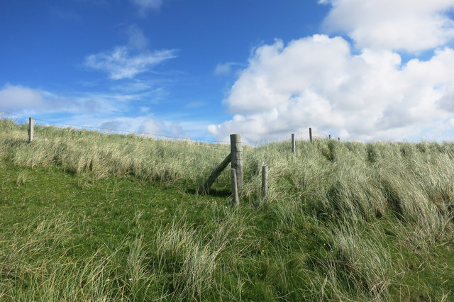
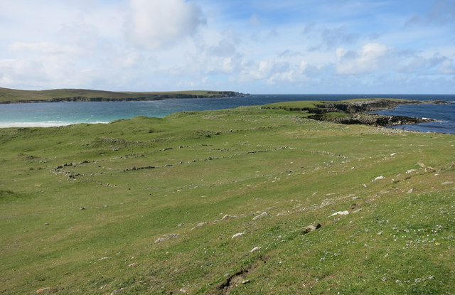
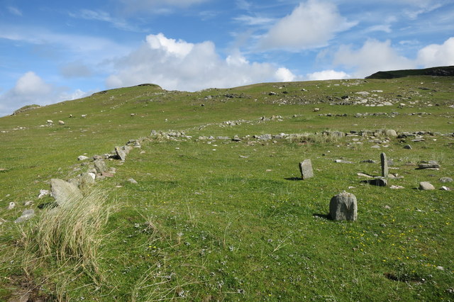
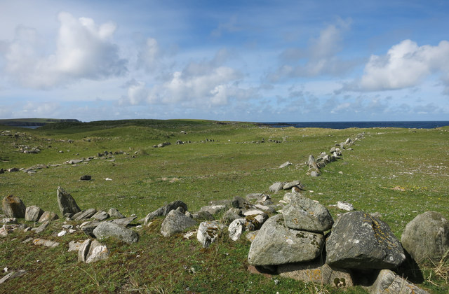
Boadi Geo is a prominent coastal feature located on the Shetland Islands, an archipelago in Scotland. It is specifically situated on the mainland, near the village of Walls. Boadi Geo stands out due to its unique geological formation, as it takes the shape of a headland or point.
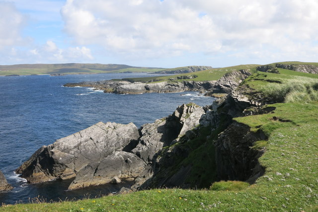
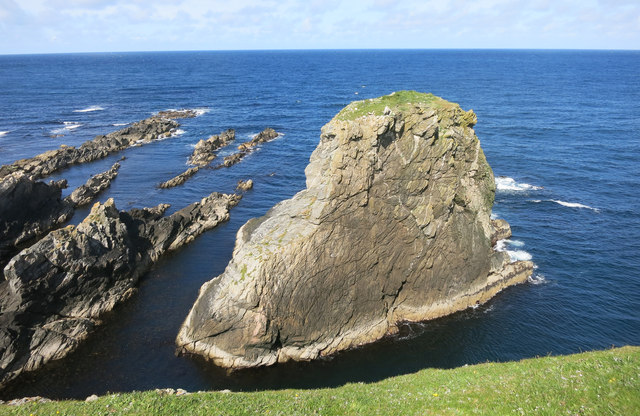
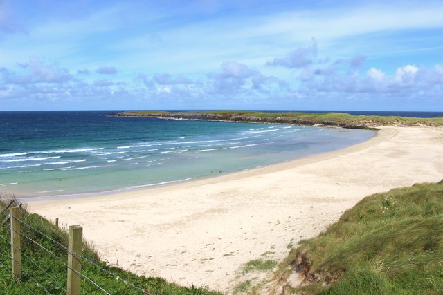
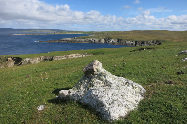
This coastal feature is characterized by its rugged cliffs, which rise steeply from the surrounding sea. Boadi Geo offers stunning panoramic views of the North Atlantic Ocean and the dramatic coastline of Shetland. The cliffs are composed of ancient rocks, primarily consisting of sandstone and shale, which have been shaped and eroded by the relentless force of the waves over thousands of years.
One of the distinctive features of Boadi Geo is the presence of sea stacks and natural arches. These geological formations have formed through the ongoing erosion of the softer rock layers, leaving behind pillars of more resistant rock that withstand the constant battering of the waves. These sea stacks and arches provide a breathtaking sight, especially during high tides when the crashing waves create a spectacular display.
Boadi Geo also serves as a habitat for a variety of seabirds, including puffins, guillemots, and fulmars. These birds nest along the cliffs, taking advantage of the inaccessible ledges for protection from predators. Birdwatchers often visit Boadi Geo to observe and photograph these fascinating creatures in their natural environment.
Overall, Boadi Geo is a remarkable coastal feature in Shetland, offering both stunning views and a glimpse into the geological history of the region. Its unique formations, dramatic cliffs, and rich wildlife make it a popular destination for nature enthusiasts and tourists alike.
If you have any feedback on the listing, please let us know in the comments section below.
Boadi Geo Images
Images are sourced within 2km of 60.729383/-1.0361736 or Grid Reference HP5205. Thanks to Geograph Open Source API. All images are credited.


Boadi Geo is located at Grid Ref: HP5205 (Lat: 60.729383, Lng: -1.0361736)
Unitary Authority: Shetland Islands
Police Authority: Highlands and Islands
What 3 Words
///curls.array.willpower. Near Gutcher, Shetland Islands
Nearby Locations
Related Wikis

Gloup
Note: Gloup is common in Scottish placenames referring to a sea jet. Gloup is a village in the far north of the island of Yell in the Shetland Islands...

Cullivoe
Cullivoe (Old Norse: Kollavágr - Bay of Kolli), is a village on Yell in the Shetland Islands. It is in the north east of the island, near Bluemull Sound...

Brough Holm
Brough Holm is a small island off Unst, in the North Isles of Shetland. It is off Westing, which as the name implies is on the west coast of Unst. The...

St Olaf's Church, Unst
St Olaf's Church, Unst is a ruined medieval church located on the island of Unst, in Shetland, Scotland, UK. The church was built in the Celtic style,...

Society of Our Lady of the Isles
The Society of Our Lady of the Isles (SOLI) is a small Anglican religious order for women, founded in the late 20th century. It is located in Shetland...

Gloup Holm
Gloup Holm is an islet in the Shetland Islands, lying to the north of Yell. == Geography and geology == Gloup Holm is near to the part of Yell called North...
Bluemull Sound
Bluemull Sound is the strait between Unst and Yell in Shetland's North Isles. A ferry service crosses it regularly. Cullivoe is on the Yell side, and the...

Belmont House, Shetland
Belmont House is a neo classical Georgian Country House Estate on the island of Unst, the most northerly of the Shetland Islands, [United Kingdom] and...
Nearby Amenities
Located within 500m of 60.729383,-1.0361736Have you been to Boadi Geo?
Leave your review of Boadi Geo below (or comments, questions and feedback).