Birrier Head

Coastal Feature, Headland, Point in Shetland

Scotland

Birrier Head

Loch of Papil, Cullivoe
Loch of Papil, Cullivoe Credit: Mike Pennington

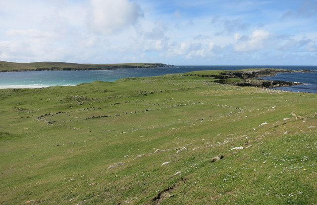
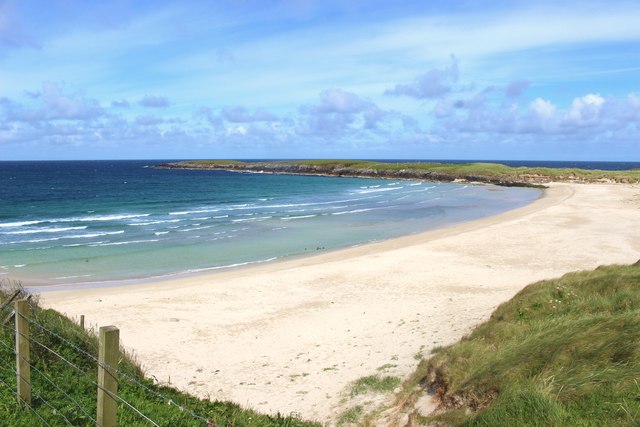
Birrier Head is a prominent coastal feature located in the Shetland Islands, situated in the northernmost part of Scotland. It is a headland that juts out into the North Sea, forming a distinct point in the landscape. The headland is located on the eastern coast of Shetland, near the village of Sandwick.

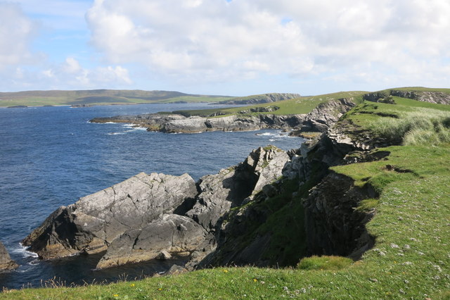
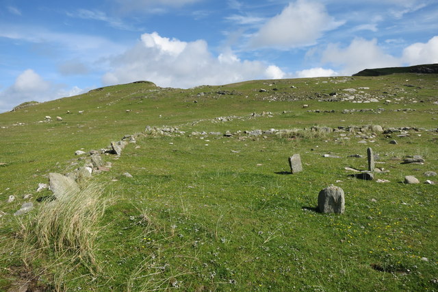
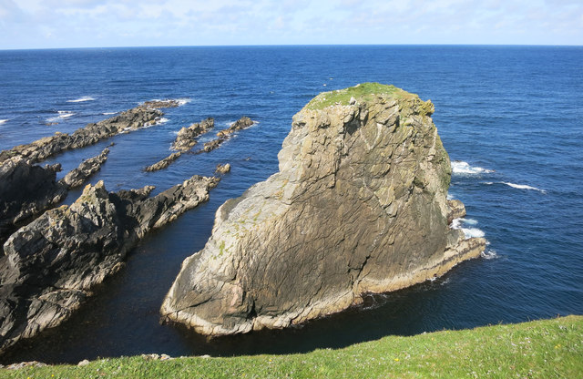
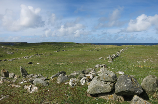
Birrier Head is known for its rugged and dramatic cliffs, which rise steeply from the sea, providing stunning panoramic views of the surrounding coastline. These cliffs, composed of sedimentary rocks, showcase various layers and geological formations, offering a glimpse into the region's ancient history.

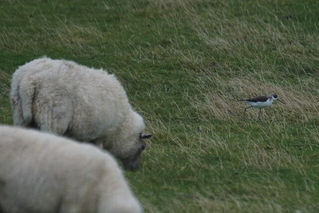
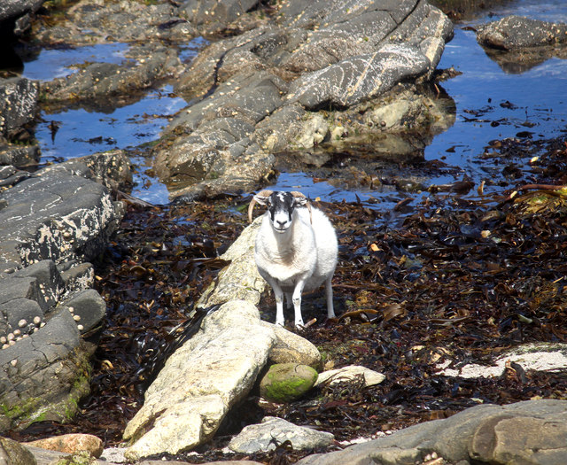
The headland is home to a diverse range of wildlife, both on land and in the sea. Birdwatchers can spot a variety of seabirds, including puffins, guillemots, and gannets, nesting and soaring above the cliffs. The surrounding waters are frequented by seals and occasionally porpoises, attracting nature enthusiasts and photographers.

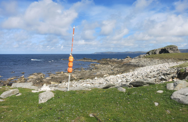
Access to Birrier Head is relatively easy, with a network of walking trails and paths leading visitors to the point. The headland is a popular destination for hikers and nature lovers, who can explore the rugged coastline and take in the breathtaking scenery. However, caution is advised when walking close to the cliff edges, as they can be unstable and dangerous.

Overall, Birrier Head is a stunning coastal feature in the Shetland Islands, offering visitors a chance to experience the raw beauty of the region's coastline, observe wildlife in its natural habitat, and immerse themselves in the rich geological history of the area.

If you have any feedback on the listing, please let us know in the comments section below.
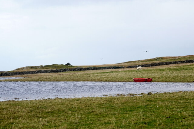
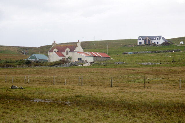
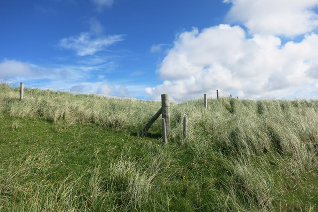
Birrier Head Images

Images are sourced within 2km of 60.728999/-1.0314916 or Grid Reference HP5205. Thanks to Geograph Open Source API. All images are credited.

Loch of Papil, Cullivoe
Houses at Cullivoe
Houses at Cullivoe
Black-winged Pratincole (Himantopus himantopus), feeding with sheep, Papil, Cullivoe Looking rather incongruous feeding in a field and a long way from the Mediterranean.
Black-winged Pratincole (Himantopus himantopus), feeding with sheep, Papil, Cullivoe
Looking rather incongruous feeding in a field and a long way from the Mediterranean.
Fence and Grass The cliff edge is just at the top here.
Fence and Grass
The cliff edge is just at the top here.
Rocky Coast at Brei Wick
Sheep in the Seaweed There were quite a few sheep down on the rocks here tucking into this stuff.
Sheep in the Seaweed
There were quite a few sheep down on the rocks here tucking into this stuff.
Rocky Shore, Ness of Houlland On one side of the Ness of Houlland is the beautiful Breckon Sands beach. On the other side, the shoreline reverts to being less hospitable. 
The orange thing is some of the assorted fishing debris that washes up from time to time.
Rocky Shore, Ness of Houlland
On one side of the Ness of Houlland is the beautiful Breckon Sands beach. On the other side, the shoreline reverts to being less hospitable. The orange thing is some of the assorted fishing debris that washes up from time to time.
Site of a Settlement, Ness of Houlland This is the site of a big area of archaeological remains. This view shows the large enclosure at the centre of the site. Closer to, the outlines of huts and buildings are easy to find.
Some of it has already vanished into the sea from erosion.
Site of a Settlement, Ness of Houlland
This is the site of a big area of archaeological remains. This view shows the large enclosure at the centre of the site. Closer to, the outlines of huts and buildings are easy to find. Some of it has already vanished into the sea from erosion.
Ancient Walls Part of a large settlement site near the Sands of Breckon.
Ancient Walls
Part of a large settlement site near the Sands of Breckon.
Birrier Stack A small island with a spot height of 23 metres marked on the map.
It looks like it should be more, somehow.
Birrier Stack
A small island with a spot height of 23 metres marked on the map. It looks like it should be more, somehow.
Ancient Walls 2 Another view on this ancient settlement site.
Ancient Walls 2
Another view on this ancient settlement site.
Sands of Breckon
Sands of Breckon
Fencepost with a hat on Not being from round here, when I first saw this I thought somebody had been messing about, but then I noticed a lot of other posts topped with assorted buckets, boxes, hard hats etc.
I guess it protects the wood against rain soaking down the grain and rotting the post.
Good idea.
Fencepost with a hat on
Not being from round here, when I first saw this I thought somebody had been messing about, but then I noticed a lot of other posts topped with assorted buckets, boxes, hard hats etc. I guess it protects the wood against rain soaking down the grain and rotting the post. Good idea.
Skulls on a Tomb, St Olaf's Churchyard The remains of St Olaf's church are just beyond this rather creepy old tomb with its skulls and bones.
St Olaf (995-1030) was a king of Norway. There is a long page about him on Wikipedia <span class="nowrap"><a title="https://en.wikipedia.org/wiki/Olaf_II_of_Norway" rel="nofollow ugc noopener" href="https://en.wikipedia.org/wiki/Olaf_II_of_Norway">Link</a><img style="margin-left:2px;" alt="External link" title="External link - shift click to open in new window" src="https://s1.geograph.org.uk/img/external.png" width="10" height="10"/></span>. which suggests that he wasn't exactly up there with the apostles in the league of saintliness, but as he is the Patron saint of Norway I will tactfully leave it there.
Skulls on a Tomb, St Olaf's Churchyard
The remains of St Olaf's church are just beyond this rather creepy old tomb with its skulls and bones. St Olaf (995-1030) was a king of Norway. There is a long page about him on Wikipedia LinkExternal link. which suggests that he wasn't exactly up there with the apostles in the league of saintliness, but as he is the Patron saint of Norway I will tactfully leave it there.
Kirk Loch From St Olaf's Churchyard.
Kirk Loch
From St Olaf's Churchyard.
A Bit of Colour at Midbrake A touch of random decorating along the road to Breckon Sands.
A Bit of Colour at Midbrake
A touch of random decorating along the road to Breckon Sands.
Parking Notice at Breckon The usual beach car park was being used by farm vehicles today, bringing in the hay crop.
We were re directed into someone's back yard.
Parking Notice at Breckon
The usual beach car park was being used by farm vehicles today, bringing in the hay crop. We were re directed into someone's back yard.
A field of flowers at Breckon Correct me if I'm wrong but I believe this is Machair, where wind blown sand mixes with peat to form good pasture.
That's what it was on Tiree anyway. It may be called something else here.
A field of flowers at Breckon
Correct me if I'm wrong but I believe this is Machair, where wind blown sand mixes with peat to form good pasture. That's what it was on Tiree anyway. It may be called something else here.
Show me another place!

Birrier Head is located at Grid Ref: HP5205 (Lat: 60.728999, Lng: -1.0314916)

Unitary Authority: Shetland Islands

Police Authority: Highlands and Islands

What 3 Words

///month.squaring.master. Near Gutcher, Shetland Islands

Related Wikis

Gloup

Note: Gloup is common in Scottish placenames referring to a sea jet. Gloup is a village in the far north of the island of Yell in the Shetland Islands...

Cullivoe

Cullivoe (Old Norse: Kollavágr - Bay of Kolli), is a village on Yell in the Shetland Islands. It is in the north east of the island, near Bluemull Sound...

Brough Holm

Brough Holm is a small island off Unst, in the North Isles of Shetland. It is off Westing, which as the name implies is on the west coast of Unst. The...

St Olaf's Church, Unst

St Olaf's Church, Unst is a ruined medieval church located on the island of Unst, in Shetland, Scotland, UK. The church was built in the Celtic style,...

Society of Our Lady of the Isles

The Society of Our Lady of the Isles (SOLI) is a small Anglican religious order for women, founded in the late 20th century. It is located in Shetland...

Gloup Holm

Gloup Holm is an islet in the Shetland Islands, lying to the north of Yell. == Geography and geology == Gloup Holm is near to the part of Yell called North...

Bluemull Sound

Bluemull Sound is the strait between Unst and Yell in Shetland's North Isles. A ferry service crosses it regularly. Cullivoe is on the Yell side, and the...

Belmont House, Shetland

Belmont House is a neo classical Georgian Country House Estate on the island of Unst, the most northerly of the Shetland Islands, [United Kingdom] and...

Nearby Amenities

Located within 500m of 60.728999,-1.0314916
The data included in this document is from www.openstreetmap.org. The data is made available under ODbL.

Have you been to Birrier Head?

Leave your review of Birrier Head below (or comments, questions and feedback).