Boedersgeo
Coastal Feature, Headland, Point in Shetland
Scotland
Boedersgeo

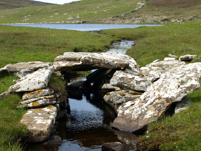
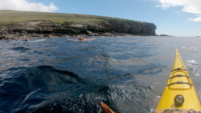
Boedersgeo is a prominent coastal feature located in the Shetland Islands, Scotland. Positioned on the west coast of the mainland, it is specifically classified as a headland or point due to its distinct protrusion into the sea. Boedersgeo offers breathtaking views of the surrounding rugged coastline and the vast expanse of the North Atlantic Ocean.
The headland is characterized by its jagged cliffs, which rise dramatically from the sea, reaching heights of up to 100 meters in certain areas. The exposed rock formations showcase layers of sedimentary rock, providing valuable insights into the geological history of the region. Erosion has carved out various caves and arches along the coastline, adding to the geological intrigue and creating unique formations.
The coastal area surrounding Boedersgeo is rich in biodiversity, attracting a wide array of seabirds and marine life. The cliffs serve as nesting grounds for colonies of puffins, guillemots, and razorbills, while seals can often be spotted basking on the rocky shores below. The surrounding waters are home to numerous species of fish, making it a popular spot for anglers.
Visitors to Boedersgeo can enjoy picturesque walks along the cliff-top paths, taking in the stunning panoramic views and the refreshing sea breeze. The area is also a favored destination for landscape photographers, who are drawn to the dramatic scenery and unique rock formations.
Overall, Boedersgeo in Shetland is a captivating coastal feature, offering a blend of natural beauty, geological significance, and diverse wildlife, making it an ideal destination for nature enthusiasts and those seeking a tranquil escape.
If you have any feedback on the listing, please let us know in the comments section below.
Boedersgeo Images
Images are sourced within 2km of 60.140895/-1.0547518 or Grid Reference HU5239. Thanks to Geograph Open Source API. All images are credited.


Boedersgeo is located at Grid Ref: HU5239 (Lat: 60.140895, Lng: -1.0547518)
Unitary Authority: Shetland Islands
Police Authority: Highlands and Islands
What 3 Words
///optimists.foreheads.weedy. Near Lerwick, Shetland Islands
Nearby Locations
Related Wikis

Bressay
Bressay (Scots: Bressa) is a populated island in the Shetland archipelago of Scotland. == Geography and geology == Bressay lies due south of Whalsay, west...

Isle of Noss
The Isle of Noss or Noss (Scots: Noss) is a small, previously inhabited island in Shetland, Scotland. Noss is separated from the island of Bressay by the...

Broch of Cullingsburgh
The Broch of Cullingsburgh is an Iron Age broch located in the Shetland islands. == Location == Located on Bressay, off the east coast of mainland Shetland...
Bressay transmitting station
Bressay transmitting station is a broadcasting transmission facility for the Shetland Islands, located on the isle of Bressay, owned and operated by Arqiva...

Holm of Noss
The Holm of Noss or Cradle Holm is an uninhabited islet of the Shetland Islands. It is about 48m at its highest point. == Geography and geology == It is...
Voe of Cullingsburgh
Voe of Cullingsburgh is a large sea loch off the Shetland island of Bressay, voe meaning "sea inlet" in Shetland dialect. The local spelling of the name...

Gardie House
Gardie House is an 18th-century estate house on Bressay in Shetland, Scotland. Located opposite Lerwick, across the Bressay Sound, Gardie is described...
Lerwick and Bressay Parish Church
Lerwick and Bressay Parish Church is the largest Church of Scotland congregation in Shetland, serving the islands' capital Lerwick and the surrounding...
Have you been to Boedersgeo?
Leave your review of Boedersgeo below (or comments, questions and feedback).