Achina

Settlement in Sutherland

Scotland

Achina

Farr Bay Looking towards Àrd Beag.
Farr Bay Credit: Carron K

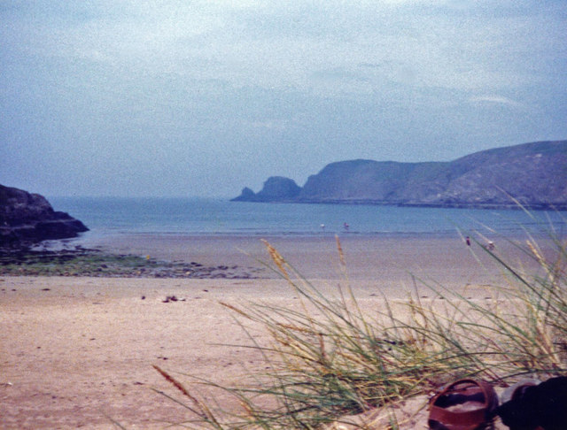
Achina is a small village located in the county of Sutherland, in the northern part of Scotland. Situated on the eastern shore of the Dornoch Firth, it is nestled amidst picturesque landscapes, offering stunning views of the surrounding hills and the tranquil waters of the firth.

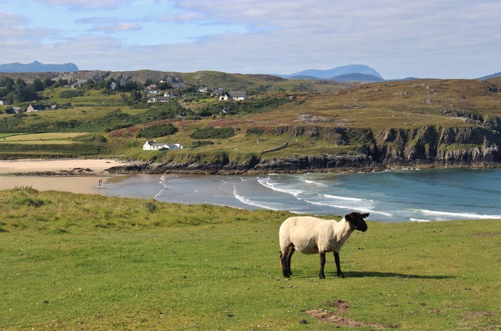
The village is primarily an agricultural community, with farming being the main occupation of the local residents. The fertile land in the area allows for the cultivation of various crops, and livestock rearing is also prevalent. This traditional way of life has been preserved in Achina, giving visitors a glimpse into the agricultural heritage of the region.

Achina is surrounded by natural beauty, making it an ideal destination for outdoor enthusiasts. The nearby hills and mountains offer opportunities for hiking, climbing, and wildlife observation. The Dornoch Firth is also a popular spot for fishing and boating, attracting anglers and water sports enthusiasts.

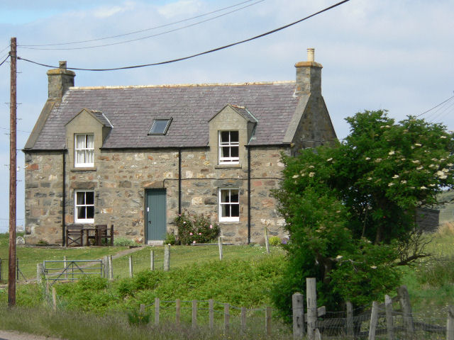
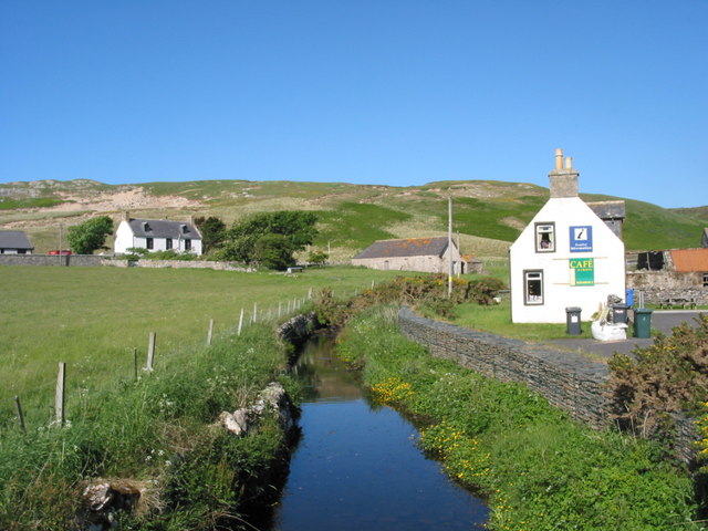
The village itself is quaint and charming, with a small number of houses and a community center. It has a close-knit population, and the residents take pride in their rich cultural heritage. Traditional Scottish customs and festivals are celebrated throughout the year, providing a glimpse into the local traditions and way of life.

Overall, Achina is a peaceful and scenic village that offers visitors a chance to experience the rural charm and natural beauty of the Scottish Highlands.

If you have any feedback on the listing, please let us know in the comments section below.

Achina Images

Images are sourced within 2km of 58.51803/-4.220883 or Grid Reference NC7061. Thanks to Geograph Open Source API. All images are credited.

Farr Bay Looking towards Àrd Beag.
Farr Bay
Looking towards Àrd Beag.
Bettyhill Hotel
Bettyhill Hotel
West end of Bettyhill Bridge
War Memorial, Bettyhill This memorial has been moved from a hillside location outside of the village to this more accessible  position in the village.
War Memorial, Bettyhill
This memorial has been moved from a hillside location outside of the village to this more accessible position in the village.
Bettyhill Hotel Dating from 1819; it has been much extended since .
Bettyhill Hotel
Dating from 1819; it has been much extended since .
Coastal view, Bettyhill Looking across the estuary of the River Naver to Torrisdale Bay. For other takes on this view see <a title="https://www.geograph.org.uk/photo/596772" href="https://www.geograph.org.uk/photo/596772">Link</a> <a title="https://www.geograph.org.uk/photo/1146320" href="https://www.geograph.org.uk/photo/1146320">Link</a> <a title="https://www.geograph.org.uk/photo/1486917" href="https://www.geograph.org.uk/photo/1486917">Link</a> .
Coastal view, Bettyhill
Looking across the estuary of the River Naver to Torrisdale Bay. For other takes on this view see Link Link Link .
Farr Bay
Farr Bay
Torrisdale Bay - 1978 River Naver estuary and Torrisdale Bay seen from A836 near Bettyhill.
Torrisdale Bay - 1978
River Naver estuary and Torrisdale Bay seen from A836 near Bettyhill.
River Naver - 1978 River Naver seen from the A836 near Invernaver.
River Naver - 1978
River Naver seen from the A836 near Invernaver.
Croft land above Bettyhill The high ground gives an expansive view over Farr Bay
Croft land above Bettyhill
The high ground gives an expansive view over Farr Bay
The footpath to Invernaver After crossing the ridge the path peters out on the flat, sand-smothered plain beside the Naver estuary.
The footpath to Invernaver
After crossing the ridge the path peters out on the flat, sand-smothered plain beside the Naver estuary.
Bettyhill war memorial
Footbridge to the Strathnaver Museum and graveyard, Clachan
Farr Bay, Bettyhill
Farr Bay, Bettyhill
Monument overlooking Farr Bay A small memorial plaque sits in the centre of the stone wall. Looking towards the rocks of Sgeir Dhubh across the bay.
Monument overlooking Farr Bay
A small memorial plaque sits in the centre of the stone wall. Looking towards the rocks of Sgeir Dhubh across the bay.
Former Farr Parish Church The church has been restored and is now a museum. It was known as 'St Columba's Church'
Former Farr Parish Church
The church has been restored and is now a museum. It was known as 'St Columba's Church'
Bridge carrying the A836 over the River Naver
Bridge across River Naver South of Bettyhill, where A 836 crosses over River Naver
Bridge across River Naver
South of Bettyhill, where A 836 crosses over River Naver
Show me another place!

Achina is located at Grid Ref: NC7061 (Lat: 58.51803, Lng: -4.220883)

Unitary Authority: Highland

Police Authority: Highlands and Islands

What 3 Words

///nerves.terribly.warmers. Near Forsinard, Highland

Related Wikis

Invernaver

Invernaver (Gaelic: Inbhir Nabhair) is a small, remote hamlet, situated on the west bank of the River Naver as it flows into Torrisdale Bay, in Sutherland...

Baile Mhargaite (Sandy Dun)

Baile Mhargaite (also known as Lochan Druim An Duin, the Sandy Dun, or Invernaver Broch) is an Iron Age broch in Strathnaver, Sutherland. It is a scheduled...

Bettyhill

Bettyhill (Scottish Gaelic: Am Blàran Odhar) is a village in the parish of Farr, on the north coast of Scotland.Bettyhill lies on the A836 road 32 miles...

Strathnaver Museum

Strathnaver Museum is located in Bettyhill, Sutherland, Scotland. It is a fully accredited volunteer-run independent museum which first opened in 1976...

Leckfurin

Leckfurin is a small remote village, which lies on the left bank of the River Naver, in northern Sutherland in Scottish Highlands and is in the Scottish...

Crask

Crask is a small remote hamlet, situated on Farr Bay in the Scottish Highlands, on the shore of northern Sutherland in the Scottish council area of Highland...

Achina, Highland

Achina is a village in Highland, Scotland. == References ==

Farr, Sutherland

Farr (Scottish Gaelic: Fàrr) is a parish in the county of Sutherland in the Scottish council area of Highland. The parish also includes a small hamlet...

Nearby Amenities

Located within 500m of 58.51803,-4.220883
Achina
Name Gd: Achadh an Àtha
Place: hamlet
Wikidata: Q3405833
Wikipedia: en:Achina, Highland
Lat/Long: 58.5166199/-4.2196046
Power: pole
Lat/Long: 58.5154366/-4.2160544
Power: pole
Lat/Long: 58.5168871/-4.2168845
Power: pole
Lat/Long: 58.5192712/-4.2209011
Power: pole
Lat/Long: 58.5195569/-4.2202681
Power: pole
Lat/Long: 58.5198216/-4.2197116
Power: pole
Lat/Long: 58.5200429/-4.2192194
Power: pole
Lat/Long: 58.5206704/-4.2195493
Power: pole
Lat/Long: 58.5210794/-4.2197491
Power: pole
Lat/Long: 58.5190611/-4.218117
Power: pole
Lat/Long: 58.5196634/-4.2184362
Power: pole
Lat/Long: 58.5203077/-4.218805
Power: pole
Lat/Long: 58.5223532/-4.2199624
Power: pole
Lat/Long: 58.5216726/-4.2195855
Power: pole
Lat/Long: 58.5209744/-4.2191912
Power: pole
Lat/Long: 58.5214457/-4.2199261
Power: pole
Lat/Long: 58.5220696/-4.2202735
Power: pole
Lat/Long: 58.5224849/-4.2205082
Dalcharn
Name Gd: Dail a' Chàirn
Place: hamlet
Lat/Long: 58.5216975/-4.2243483
The data included in this document is from www.openstreetmap.org. The data is made available under ODbL.

Have you been to Achina?

Leave your review of Achina below (or comments, questions and feedback).