Bery Geo
Coastal Feature, Headland, Point in Shetland
Scotland
Bery Geo
Bery Geo is a prominent coastal feature located in the Shetland Islands, Scotland. It is a headland that juts out into the North Sea, forming a distinct point along the rugged coastline. The name "geo" is a local term used to describe a narrow inlet or cove, typically found in this area.
Bery Geo is known for its stunning natural beauty and unique geological formations. The headland is composed of layers of sedimentary rocks, primarily sandstone and shale, which have been shaped and eroded by the relentless forces of the sea over thousands of years. This has resulted in dramatic cliffs and rugged sea stacks that provide a breathtaking backdrop to the area.
The headland is also home to a diverse range of flora and fauna. Seabirds such as guillemots, fulmars, and kittiwakes can be spotted nesting on the cliffs, while seals and otters can often be seen swimming in the surrounding waters. The area is also rich in marine life, with a variety of fish and shellfish inhabiting the rocky shores and offshore waters.
Bery Geo is a popular destination for outdoor enthusiasts and nature lovers, offering opportunities for hiking, birdwatching, and photography. The headland is easily accessible by foot, with a well-maintained trail leading visitors to the edge of the cliffs, providing panoramic views of the sea and the surrounding coastline.
Overall, Bery Geo is a captivating coastal feature that showcases the raw beauty and geological diversity of the Shetland Islands. It is a must-visit destination for anyone seeking to explore the stunning natural landscapes of this remote and enchanting region.
If you have any feedback on the listing, please let us know in the comments section below.
Bery Geo Images
Images are sourced within 2km of 60.344215/-1.1737426 or Grid Reference HU4562. Thanks to Geograph Open Source API. All images are credited.


Bery Geo is located at Grid Ref: HU4562 (Lat: 60.344215, Lng: -1.1737426)
Unitary Authority: Shetland Islands
Police Authority: Highlands and Islands
What 3 Words
///available.workers.daylight. Near Vidlin, Shetland Islands
Nearby Locations
Related Wikis

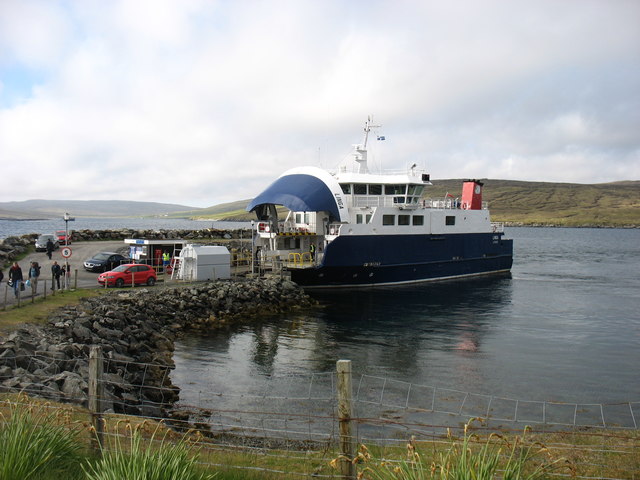
Laxo
Laxo is a small settlement at the end of Laxo Voe in Vidlin, Shetland, Scotland. A ferry from the Mainland to Symbister in Whalsay operates from the nearby...

Billister
Billister is a settlement in the parish of Nesting, on the island of Mainland, in Shetland, Scotland. It is on Lax Firth. Billister was formerly the terminal...

Vidlin
Vidlin (from Old Norse: Vaðill meaning a ford) is a small village located on Mainland, Shetland, Scotland. The settlement is within the parish of Nesting...

Viking Wind Farm
Viking Wind Farm is a large on-shore wind farm under construction in the Shetland Islands which is being developed by Viking Energy, a partnership between...
Nearby Amenities
Located within 500m of 60.344215,-1.1737426Have you been to Bery Geo?
Leave your review of Bery Geo below (or comments, questions and feedback).