Blow Geo
Coastal Feature, Headland, Point in Shetland
Scotland
Blow Geo
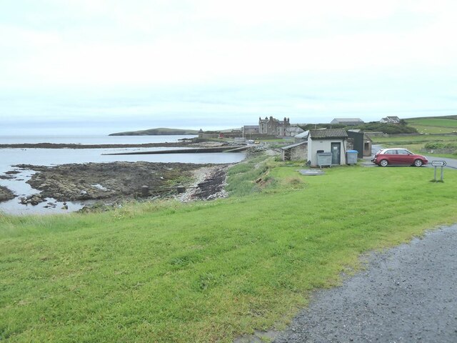
Blow Geo is a prominent coastal feature located on the Shetland Islands, a remote archipelago in Scotland. It is classified as a headland and point, characterized by its distinctive rocky cliffs and rugged terrain. Situated on the western coast of the main Shetland Island, Blow Geo is an exposed area that faces the fierce Atlantic Ocean.
The headland is renowned for its dramatic landscape, with towering cliffs that reach heights of over 100 feet. These cliffs are primarily composed of sedimentary rocks, displaying layers of sandstone and shale, which are a testament to the geological history of the region. The constant pounding of the waves against the cliffs has created numerous sea caves and natural arches, adding to Blow Geo's allure.
Visitors to Blow Geo are treated to breathtaking panoramic views of the surrounding coastline, providing an excellent vantage point to observe the diverse marine life that thrives in the area. Seabird colonies, including puffins, fulmars, and guillemots, nest on the cliffs, adding to the ecological significance of the site.
Accessing Blow Geo can be challenging due to its remote location and the steep, uneven terrain. However, for those willing to make the journey, the headland offers a unique opportunity to experience the raw beauty and power of nature. Hiking along the coastal path, visitors can witness the force of the crashing waves and feel the invigorating sea breeze against their face.
Blow Geo is a captivating coastal feature that showcases the rugged charm of the Shetland Islands. Its geological and ecological significance, along with its stunning scenery, make it a must-visit destination for nature enthusiasts and adventure seekers alike.
If you have any feedback on the listing, please let us know in the comments section below.
Blow Geo Images
Images are sourced within 2km of 60.00366/-1.1927738 or Grid Reference HU4524. Thanks to Geograph Open Source API. All images are credited.


Blow Geo is located at Grid Ref: HU4524 (Lat: 60.00366, Lng: -1.1927738)
Unitary Authority: Shetland Islands
Police Authority: Highlands and Islands
What 3 Words
///amazed.headings.seasons. Near Sandwick, Shetland Islands
Nearby Locations
Related Wikis

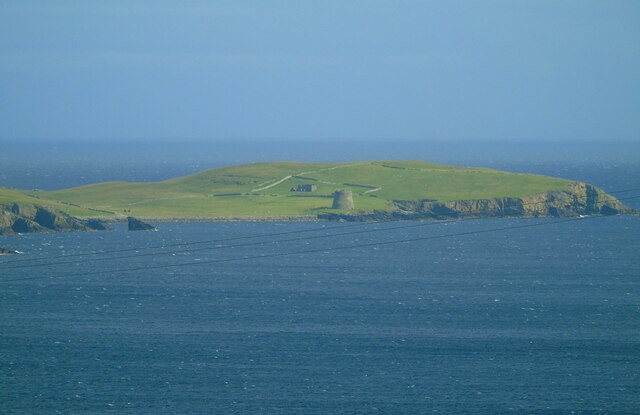
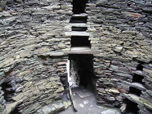
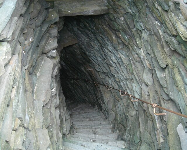
Broch of Mousa
Broch of Mousa (or Mousa Broch) is a preserved Iron Age broch or round tower. It is on the island of Mousa in Shetland, Scotland. It is the tallest broch...

Mousa
Mousa (Old Norse: Mosey "moss island") is a small island in Shetland, Scotland, uninhabited since the nineteenth century. The island is known for the...

Sandwick, Dunrossness
see also Sandwick, Whalsay and Sandwick, Orkney Sandwick (Old Norse: Sandvik "Sandy Bay") is a village and an ancient parish in the Shetland Islands,...

Peerie Bard
Perie Bard is one of the Shetland Islands. It is a small islet off the east coast of the island of Mousa. Although named 'Perie Bard' on OS Maps, the name...
Nearby Amenities
Located within 500m of 60.00366,-1.1927738Have you been to Blow Geo?
Leave your review of Blow Geo below (or comments, questions and feedback).