Billya Geo
Coastal Feature, Headland, Point in Shetland
Scotland
Billya Geo
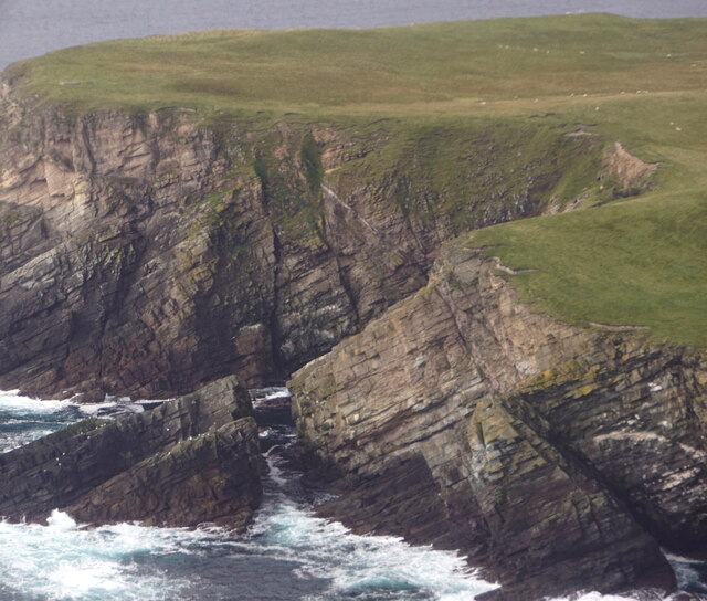
Billya Geo is a prominent coastal feature located on the island of Shetland, Scotland. It is categorized as a headland, specifically a point that protrudes into the surrounding sea. Situated on the western coast of Shetland, Billya Geo offers stunning views of the North Atlantic Ocean and the rugged coastline.
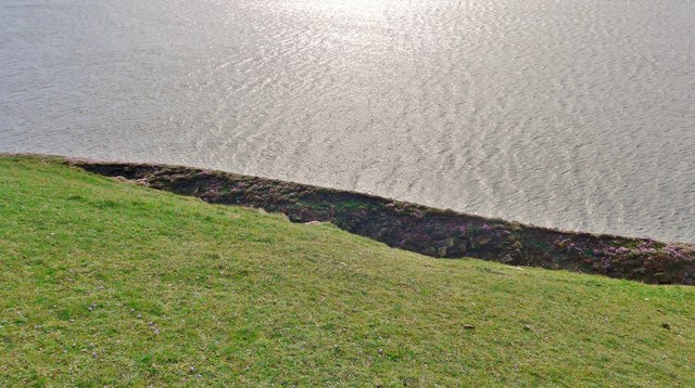
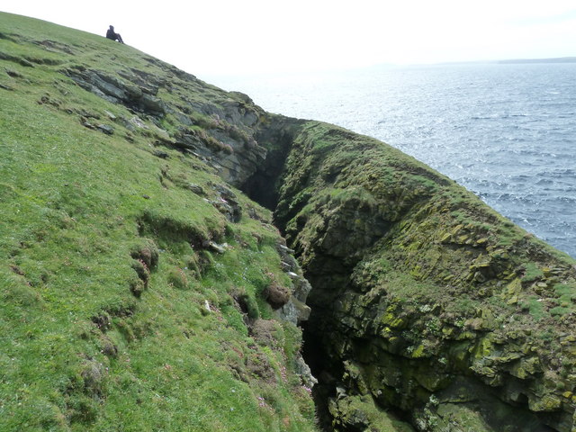
The headland is characterized by its remarkable geological formations, with towering cliffs that reach heights of up to 100 meters. These cliffs are composed of layers of sedimentary rock, displaying a variety of colors and textures. Over the years, natural erosion processes have sculpted the cliffs, creating fascinating shapes and patterns.
Billya Geo is also known for its rich wildlife. The surrounding waters are home to a diverse range of marine species, including seals, dolphins, and various seabirds such as puffins and gannets. Birdwatchers often flock to the headland to observe these fascinating creatures in their natural habitat.
Access to Billya Geo is relatively easy, with a well-maintained coastal path leading visitors to the headland. The path offers breathtaking vistas along the way and is suitable for both leisurely walkers and more experienced hikers. It is advisable to wear appropriate footwear and exercise caution near the cliff edges.
Overall, Billya Geo is a captivating coastal feature in Shetland, renowned for its dramatic cliffs, picturesque views, and abundant wildlife. Whether you are a nature enthusiast, a photographer, or simply seeking tranquility in a stunning natural setting, this headland is sure to leave a lasting impression.
If you have any feedback on the listing, please let us know in the comments section below.
Billya Geo Images
Images are sourced within 2km of 59.973101/-1.2043196 or Grid Reference HU4421. Thanks to Geograph Open Source API. All images are credited.


Billya Geo is located at Grid Ref: HU4421 (Lat: 59.973101, Lng: -1.2043196)
Unitary Authority: Shetland Islands
Police Authority: Highlands and Islands
What 3 Words
///notch.brambles.plugs. Near Sandwick, Shetland Islands
Nearby Locations
Related Wikis

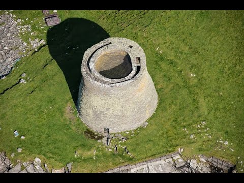
Broch of Mousa
Broch of Mousa (or Mousa Broch) is a preserved Iron Age broch or round tower. It is on the island of Mousa in Shetland, Scotland. It is the tallest broch...

Sandwick, Dunrossness
see also Sandwick, Whalsay and Sandwick, OrkneySandwick (Old Norse: Sandvik "Sandy Bay") is a village and an ancient parish in the Shetland Islands, Scotland...

Levenwick
Levenwick is a small village about 17 miles (27 km) south of Lerwick, on the east side of the South Mainland of Shetland, Scotland. It is part of the parish...

Mousa
Mousa (Old Norse: Mosey "moss island") is a small island in Shetland, Scotland, uninhabited since the nineteenth century. The island is known for the...

Peerie Bard
Perie Bard is one of the Shetland Islands. It is a small islet off the east coast of the island of Mousa.Although named 'Perie Bard' on OS Maps, the name...

Hoswick
Hoswick is a settlement in Sandwick in the south mainland of Shetland, Scotland, on the eastern part of the Dunrossness civil parish. It is separated from...

Clumlie Broch
Clumlie Broch is an Iron Age broch located on Mainland, Shetland, in Scotland (grid reference HU40451811). == Location == Clumlie Broch is located in Dunrossness...

Catpund
Catpund is a quarry site in Shetland, Scotland, where steatite vessels were cut from the rock from prehistory onwards. The quarrying marks are still visible...
Related Videos
Broch of Mousa On Visit To Shetland Islands Scotland
Tour Scotland travel video clip, with Scottish music, of the Broch of Mousa, located on Mousa, a small island on ancestry visit to ...
Broch of Mousa On History Visit To Shetland Islands Scotland
Tour Scotland short travel video clip, with Scottish music, of the Broch of Mousa, located on Mousa, a small island on ancestry, ...
Nearby Amenities
Located within 500m of 59.973101,-1.2043196Have you been to Billya Geo?
Leave your review of Billya Geo below (or comments, questions and feedback).