Dean, Lower

Settlement in Bedfordshire

England

Dean, Lower

Upper Dean Ford This ford is found on Shay Lane in Upper Dean.
Upper Dean Ford Credit: John Walton

Dean, Lower is a small village located in the county of Bedfordshire, England. Situated in the eastern part of the county, Dean, Lower is surrounded by picturesque countryside and offers a tranquil and idyllic setting for its residents.

The village itself is characterized by its charming and traditional architecture, with many buildings dating back several centuries. Dean, Lower is primarily a residential area, with a close-knit community that prides itself on its friendly and welcoming atmosphere. The village is home to a population of approximately 500 people.

Despite its small size, Dean, Lower boasts a number of amenities and facilities for its residents. These include a local primary school, a village hall, and a church, all of which play an integral role in the community. Additionally, there are a few small shops and businesses that cater to the everyday needs of the villagers.

The surrounding countryside offers ample opportunities for outdoor activities and exploration. The village is surrounded by rolling hills, meandering rivers, and lush green fields, making it a popular destination for nature lovers and outdoor enthusiasts. The nearby forests and woodlands provide excellent walking and cycling routes, allowing residents to enjoy the beauty of the natural surroundings.

Overall, Dean, Lower is a charming and peaceful village in Bedfordshire, offering a tranquil and close-knit community for its residents. With its beautiful surroundings and range of amenities, it is a delightful place to call home.

If you have any feedback on the listing, please let us know in the comments section below.
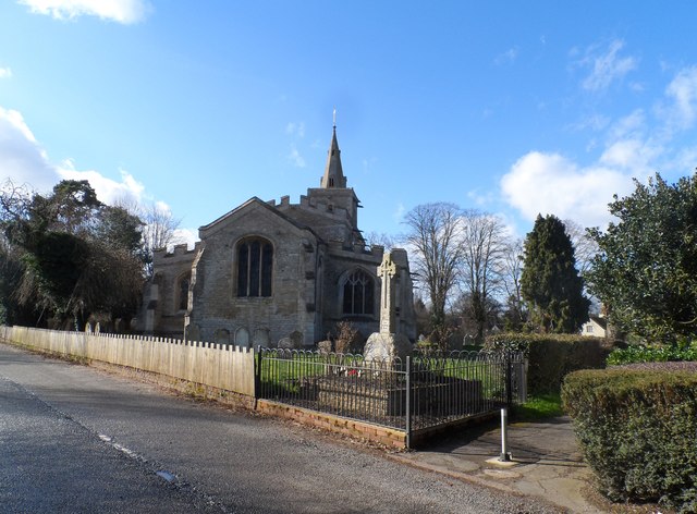
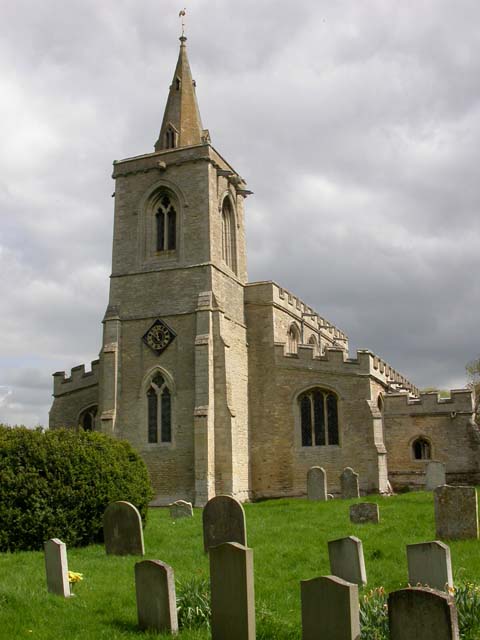
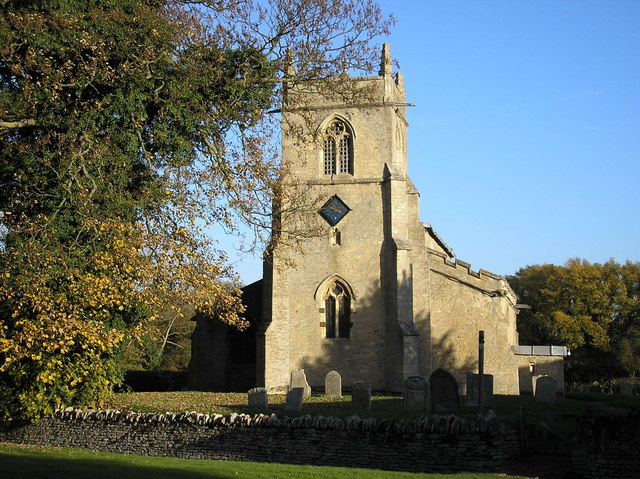
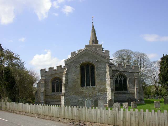
Dean, Lower Images

Images are sourced within 2km of 52.3103/-0.45391 or Grid Reference TL0569. Thanks to Geograph Open Source API. All images are credited.

Upper Dean Ford This ford is found on Shay Lane in Upper Dean.
Upper Dean Ford
This ford is found on Shay Lane in Upper Dean.
Non standard bridge on the Bridleway Crossing point over the River Til
Non standard bridge on the Bridleway
Crossing point over the River Til
Better than wet feet "Bridge" crossing over the River Til.
Better than wet feet
"Bridge" crossing over the River Til.
Windmill Tower at Upper Dean Recent history explained <span class="nowrap"><a title="http://www.windmillworld.com/millid/2260.htm" rel="nofollow ugc noopener" href="http://www.windmillworld.com/millid/2260.htm">Link</a><img style="margin-left:2px;" alt="External link" title="External link - shift click to open in new window" src="https://s1.geograph.org.uk/img/external.png" width="10" height="10"/></span>
Windmill Tower at Upper Dean
Recent history explained LinkExternal link
Cap details of Upper Dean Windmill Building description <span class="nowrap"><a title="http://www.windmillworld.com/millid/2260.htm" rel="nofollow ugc noopener" href="http://www.windmillworld.com/millid/2260.htm">Link</a><img style="margin-left:2px;" alt="External link" title="External link - shift click to open in new window" src="https://s1.geograph.org.uk/img/external.png" width="10" height="10"/></span>
Cap details of Upper Dean Windmill
Building description LinkExternal link
Windmill Tower at Upper Dean
The Three Compasses A pint of Thwaites "Good Elf" was taken here along with a fine pub lunch.
The Three Compasses
A pint of Thwaites "Good Elf" was taken here along with a fine pub lunch.
Upper Dean windmill For recent history see: <span class="nowrap"><a title="http://www.windmillworld.com/millid/2260.htm" rel="nofollow ugc noopener" href="http://www.windmillworld.com/millid/2260.htm">Link</a><img style="margin-left:2px;" alt="External link" title="External link - shift click to open in new window" src="https://s1.geograph.org.uk/img/external.png" width="10" height="10"/></span>
Upper Dean windmill
For recent history see: LinkExternal link
The Three Compasses pub, Upper Dean
Small stream by the roadside, Upper Dean
Timber-framed house, Upper Dean The road is partially blocked by fallen branches-the weather had been very stormy the preceding few days.
Timber-framed house, Upper Dean
The road is partially blocked by fallen branches-the weather had been very stormy the preceding few days.
All Saints' church, Upper Dean See <span class="nowrap"><a title="http://www.britishlistedbuildings.co.uk/en-36266-church-of-all-saints-dean-and-shelton-" rel="nofollow ugc noopener" href="http://www.britishlistedbuildings.co.uk/en-36266-church-of-all-saints-dean-and-shelton-">Link</a><img style="margin-left:2px;" alt="External link" title="External link - shift click to open in new window" src="https://s1.geograph.org.uk/img/external.png" width="10" height="10"/></span> for entry as listed building. Mostly C14 with some C13.
All Saints' church, Upper Dean
See LinkExternal link for entry as listed building. Mostly C14 with some C13.
Barn at Nether Dean Nether Dean is not marked on the O.S. map-this location is marked "Lower Dean"
Barn at Nether Dean
Nether Dean is not marked on the O.S. map-this location is marked "Lower Dean"
The Three Compasses pub, Upper Dean Built around 1700. See <span class="nowrap"><a title="http://www.britishlistedbuildings.co.uk/en-36264-the-three-compasses-public-house-dean-and#.VXQtLs9Viko" rel="nofollow ugc noopener" href="http://www.britishlistedbuildings.co.uk/en-36264-the-three-compasses-public-house-dean-and#.VXQtLs9Viko">Link</a><img style="margin-left:2px;" alt="External link" title="External link - shift click to open in new window" src="https://s1.geograph.org.uk/img/external.png" width="10" height="10"/></span> for entry in British Listed Buildings.
The Three Compasses pub, Upper Dean
Built around 1700. See LinkExternal link for entry in British Listed Buildings.
All Saints' church, Upper Dean The oldest part of the church is the C13 chancel arch. Most of the rest of the church is C14.
All Saints' church, Upper Dean
The oldest part of the church is the C13 chancel arch. Most of the rest of the church is C14.
Grass triangle road junction at Covington On the route of the Three Shires Way.
Grass triangle road junction at Covington
On the route of the Three Shires Way.
Road junction with grass traffic island Road junction on the B654 Raunds to Kimbolton road.
Road junction with grass traffic island
Road junction on the B654 Raunds to Kimbolton road.
All Saints' church Covington The church was also dedicated to St. Margaret at some point. The nave is C11. The first recorded priest was Richard De Baiocis who retired in 1293 (see <span class="nowrap"><a title="http://www.covington.org.uk/gallery/trailmappage.pdf" rel="nofollow ugc noopener" href="http://www.covington.org.uk/gallery/trailmappage.pdf">Link</a><img style="margin-left:2px;" alt="External link" title="External link - shift click to open in new window" src="https://s1.geograph.org.uk/img/external.png" width="10" height="10"/></span> )
All Saints' church Covington
The church was also dedicated to St. Margaret at some point. The nave is C11. The first recorded priest was Richard De Baiocis who retired in 1293 (see LinkExternal link )
Show me another place!

Dean, Lower is located at Grid Ref: TL0569 (Lat: 52.3103, Lng: -0.45391)

Unitary Authority: Bedford

Police Authority: Bedfordshire

What 3 Words

///buffoon.alerting.scoots. Near Swineshead, Bedfordshire

Nearby Locations

Dean, Lower Lower Dean

Related Wikis

Lower Dean

Lower Dean is a village located in the Borough of Bedford in Bedfordshire, England. The village forms part of the Dean and Shelton civil parish (where...

Dean, Bedfordshire

Dean or Over Dene is a former civil parish, now in the parish of Dean and Shelton, in the Bedford district, in the ceremonial county of Bedfordshire, England...

Dean and Shelton

Dean and Shelton is a civil parish in the Bedford district, in the ceremonial county of Bedfordshire, England. The two parishes of Dean and Shelton were...

Upper Dean

Upper Dean is a village located in the Borough of Bedford in Bedfordshire, England. == Description == The village forms part of the Dean and Shelton civil...

Church of All Saints, Upper Dean

The Church of All Saints is a Grade I listed church in Upper Dean, Bedfordshire, England. It became a listed building on 13 July 1964.The church escaped...

Tilbrook

Tilbrook is a village and civil parish in Cambridgeshire, England. Tilbrook lies approximately 10 miles (16 km) west of Huntingdon, near Covington. Tilbrook...

Shelton, North Bedfordshire

Shelton is a village and former civil parish, now in the parish of Dean and Shelton, in the Bedford district, in the ceremonial county of Bedfordshire...

Church of St Mary the Virgin, Shelton, North Bedfordshire

Church of St Mary the Virgin is a Grade I listed church in Shelton, Bedfordshire, England. == See also == Grade I listed buildings in Bedfordshire �...

Nearby Amenities

Located within 500m of 52.3103,-0.45391
Created By: Merkaartor 0.12
Lat/Long: 52.3114861/-0.458309
Created By: Merkaartor 0.12
Lat/Long: 52.3112139/-0.4575848
Created By: Merkaartor 0.12
Lat/Long: 52.310735/-0.4564422
Telephone
Defibrillator
Booth: K6
Covered: booth
Defibrillator Location: inside old red phone box in Lower Dean
Emergency: defibrillator
Man Made: telephone_box
Lat/Long: 52.3100119/-0.4554873
Post Box
Post Box Mounting: brick_pillar
Post Box Type: wall
Lat/Long: 52.3099823/-0.4554471
Created By: Merkaartor 0.12
Lat/Long: 52.3126635/-0.4597949
Created By: Merkaartor 0.12
Lat/Long: 52.3123289/-0.458722
Created By: Merkaartor 0.12
Lat/Long: 52.3112729/-0.4561042
Created By: Merkaartor 0.12
Lat/Long: 52.3103743/-0.4546987
Created By: Merkaartor 0.12
Lat/Long: 52.3086295/-0.4539906
Created By: Merkaartor 0.12
Lat/Long: 52.3085049/-0.455321
Created By: Merkaartor 0.12
Lat/Long: 52.309948/-0.4569089
Created By: Merkaartor 0.12
Lat/Long: 52.3112467/-0.4593121
Lower Dean
Place: village
Wikidata: Q1520689
Wikipedia: en:Lower Dean
Lat/Long: 52.3106236/-0.457456
Power: pole
Lat/Long: 52.3063311/-0.4567874
Power: pole
Lat/Long: 52.3070104/-0.4562566
Power: pole
Lat/Long: 52.307046/-0.4556631
Power: pole
Lat/Long: 52.3078042/-0.4556994
Power: pole
Lat/Long: 52.3082444/-0.4553572
Power: pole
Lat/Long: 52.3088642/-0.454885
Power: pole
Lat/Long: 52.309263/-0.454173
Power: pole
Lat/Long: 52.3097331/-0.4533818
Power: pole
Lat/Long: 52.3101313/-0.4526429
Power: pole
Lat/Long: 52.3084816/-0.4547004
Power: pole
Lat/Long: 52.3092437/-0.4550581
Power: pole
Lat/Long: 52.3107909/-0.4514615
Power: pole
Lat/Long: 52.312173/-0.4489962
Power: pole
Lat/Long: 52.3114473/-0.4502877
The data included in this document is from www.openstreetmap.org. The data is made available under ODbL.

Have you been to Dean, Lower?

Leave your review of Dean, Lower below (or comments, questions and feedback).