Baa Geo
Coastal Feature, Headland, Point in Shetland
Scotland
Baa Geo

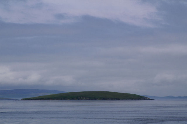
Baa Geo is a prominent coastal feature located in the Shetland Islands, an archipelago in Scotland. It is primarily known as a headland or point, characterized by its rugged cliffs and rocky terrain. Baa Geo is situated on the west side of Shetland's mainland, specifically in the Northmavine region.
The name "Baa Geo" is derived from the Shetland dialect, with "Baa" meaning "bay" and "Geo" referring to a narrow, steep-sided inlet. This name accurately reflects the physical characteristics of the coastal feature, as Baa Geo is indeed a small bay with towering cliffs on either side. The cliffs are composed of sedimentary rocks, such as sandstone and shale, which have been shaped by the relentless forces of wind and waves over millions of years.
The area surrounding Baa Geo is known for its rich biodiversity and dramatic scenery. The cliffs provide nesting sites for various seabirds, including guillemots, puffins, and fulmars. Visitors to Baa Geo can often witness these birds in their natural habitat, soaring above the waves or perching on the cliff ledges.
In addition to its ecological significance, Baa Geo also has cultural importance. It is a popular destination for hikers and nature enthusiasts, who come to admire the breathtaking views and experience the wild beauty of Shetland's coastline. The ruggedness of the cliffs and the crashing waves add to the sense of adventure and awe that Baa Geo evokes.
Overall, Baa Geo is a remarkable coastal feature, showcasing the raw power of nature and providing a habitat for diverse wildlife. Its combination of geological and ecological features make it a must-visit destination for anyone exploring the Shetland Islands.
If you have any feedback on the listing, please let us know in the comments section below.
Baa Geo Images
Images are sourced within 2km of 60.499041/-1.2649201 or Grid Reference HU4079. Thanks to Geograph Open Source API. All images are credited.


Baa Geo is located at Grid Ref: HU4079 (Lat: 60.499041, Lng: -1.2649201)
Unitary Authority: Shetland Islands
Police Authority: Highlands and Islands
What 3 Words
///homes.stacks.eradicate. Near Toft, Shetland Islands
Nearby Locations
Related Wikis

Little Roe
Little Roe is an island in Yell Sound in the Shetland Islands == History == The island's name is Norse in origin, from Rauðey Litla, meaning "small red...

Lamba, Shetland
Lamba is an uninhabited island in Yell Sound in Shetland. It lies 1.5 km (0.93 mi) north of the entrance to the Sullom Voe inlet and 1.4 kilometres (0...

Brother Isle
Brother Isle (Old Norse: breiðare øy meaning broad beach island) is a small, uninhabited island in Shetland, Scotland. It lies between the islands of Yell...

Shetland Gas Plant
The Shetland Gas Plant is a natural-gas processing plant in the Shetland Islands, Scotland. == History == The site is the collection point for the Laggan...
RAF Sullom Voe
Royal Air Force Sullom Voe or more simply RAF Sullom Voe is a former Royal Air Force station near the village of Brae, in the Shetland Isles of Scotland...

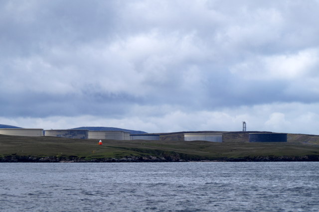
Sullom Voe Terminal
The Sullom Voe Terminal is an oil and gas terminal at Sullom Voe in the Shetland Islands of Scotland. It handles production from oilfields in the North...
Uynarey
Uynarey is one of the Shetland islands in Yell Sound, just to the north of Bigga, and east of Brother Island. It is an RSPB reserve. The name comes from...

Bigga, Shetland
Bigga is an uninhabited island in the Yell Sound between the Mainland and Yell in Shetland, Scotland. == Geography and geology == Just over 1,000 metres...
Have you been to Baa Geo?
Leave your review of Baa Geo below (or comments, questions and feedback).