The Taings

Coastal Feature, Headland, Point in Shetland

Scotland

The Taings

Loch of Clevigarth from the air
Loch of Clevigarth from the air Credit: Mike Pennington

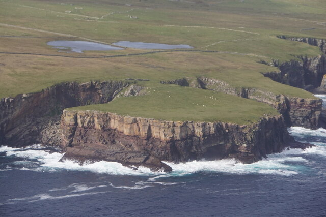
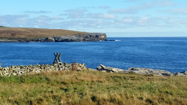
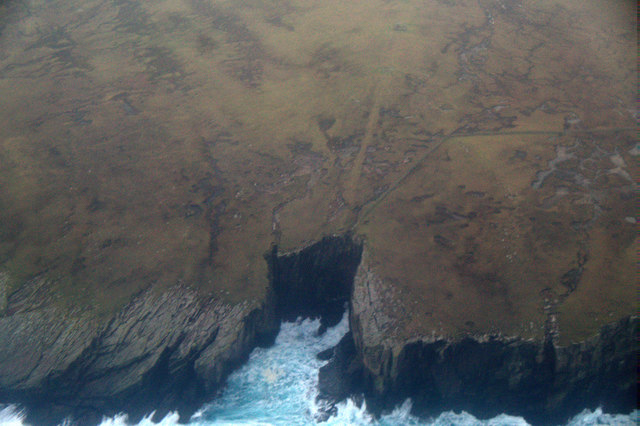
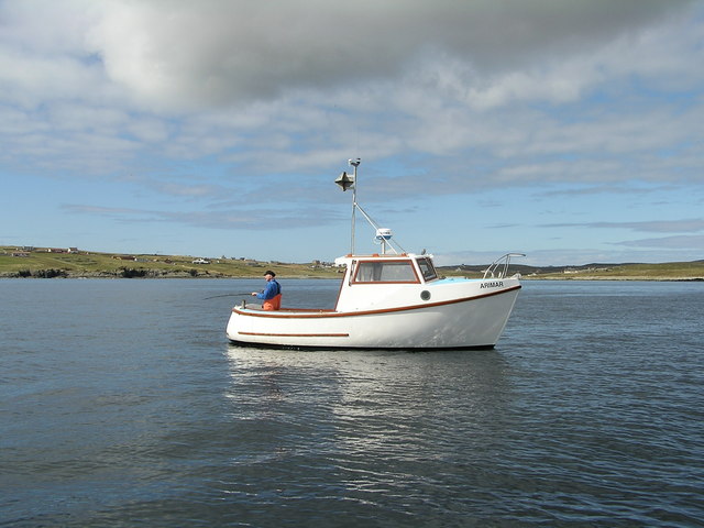
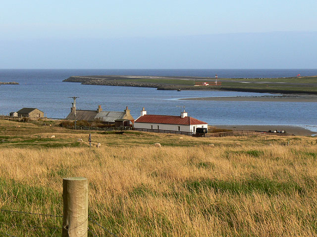
The Taings is a notable coastal feature located in Shetland, an archipelago in Scotland. It is a headland that juts out into the North Sea, forming a distinctive point along the coastline. The Taings is situated on the eastern coast of Shetland, near the village of Vidlin.

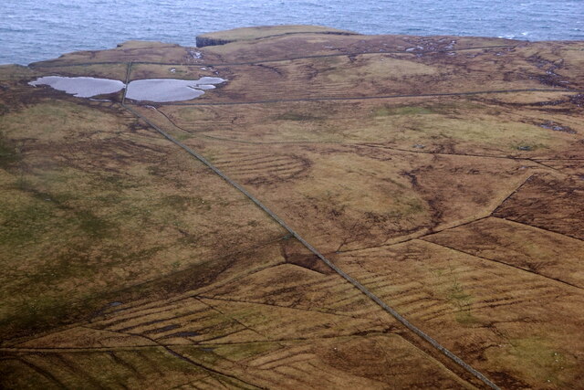
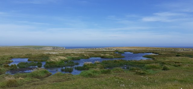
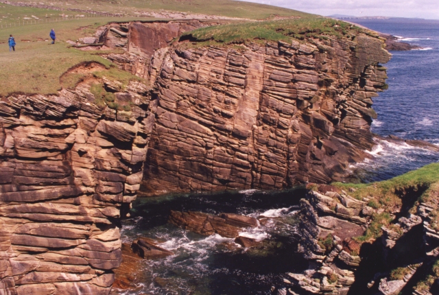
This prominent headland is characterized by its rugged and rocky terrain, with steep cliffs that provide stunning panoramic views of the surrounding sea. The cliffs are composed of sedimentary rocks, displaying layers of different geological formations that have been shaped by centuries of erosion from wind and waves.

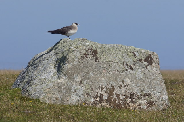
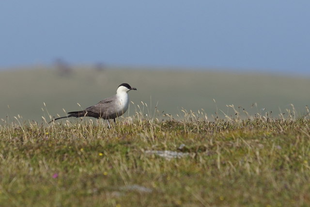
The Taings is known for its rich biodiversity. The surrounding waters teem with marine life, making it a popular spot for birdwatching and wildlife enthusiasts. Visitors may spot various seabirds such as puffins, guillemots, and kittiwakes, as well as seals and otters that frequent the area.

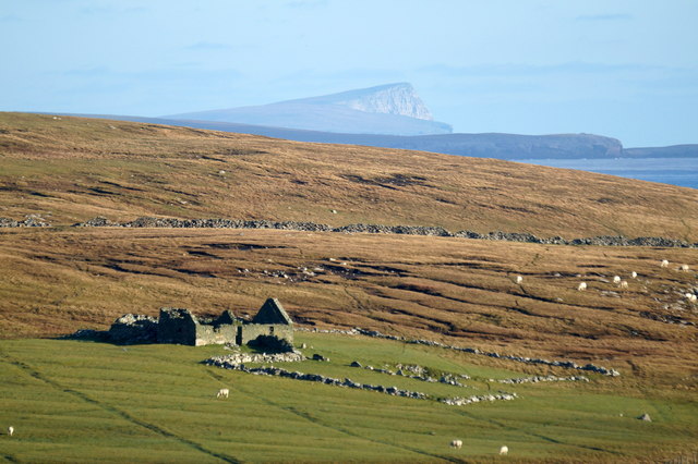
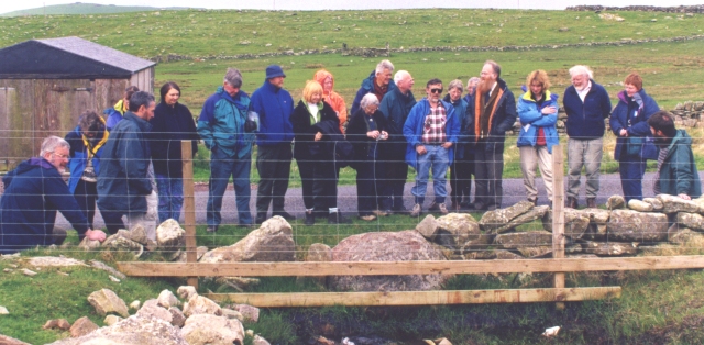
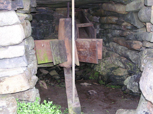
The headland also holds historical significance. There are remnants of ancient settlements in the vicinity, indicating that The Taings has been inhabited for thousands of years. Archaeological findings suggest that these settlements were primarily focused on fishing and maritime activities, highlighting the deep connection between the local communities and the sea.

The Taings offers a picturesque setting for outdoor activities such as hiking, photography, and nature exploration. Its dramatic coastal landscape and diverse wildlife make it a captivating destination for both locals and tourists alike.

If you have any feedback on the listing, please let us know in the comments section below.

The Taings Images

Images are sourced within 2km of 59.917123/-1.2858685 or Grid Reference HU4014. Thanks to Geograph Open Source API. All images are credited.

Loch of Clevigarth from the air
Lambhoga Head and Loch of Mails from the air
Loch of Mails from the air
Clevigarth from the air
Clevigarth, north of Exnaboe
Coastal path at Bu Taing, Boddam Looking across to Dalsetter.
Coastal path at Bu Taing, Boddam
Looking across to Dalsetter.
Clevigarth from North Town, Exnaboe The Noup of Noss in the distance.
Clevigarth from North Town, Exnaboe
The Noup of Noss in the distance.
Sheep at Clevigarth,Exnaboe
Teisti Geo, south of Boddam
Arctic Skua (Stercorarius parastiticus), Dalsetter, Boddam
Long-tailed Skua (Stercorarius longicauda), Dalsetter, Boddam Normally a high Arctic breeder, but this bird has been here for a month.
Long-tailed Skua (Stercorarius longicauda), Dalsetter, Boddam
Normally a high Arctic breeder, but this bird has been here for a month.
Small pool at Dalsetter
The Dalsetter Erratic This party of geologists is admiring the large boulder in the centre, which is of such a distinctive rock that it has been possible to pinpoint exactly where it came from before the glaciers of the Ice Age dumped it in Shetland - from Tonsberg, near Larvik in Norway!

For a closer view of the erratic itself see <a href="https://www.geograph.org.uk/photo/2619886">HU4016 : Dalsetter erratic</a>.
The Dalsetter Erratic
This party of geologists is admiring the large boulder in the centre, which is of such a distinctive rock that it has been possible to pinpoint exactly where it came from before the glaciers of the Ice Age dumped it in Shetland - from Tonsberg, near Larvik in Norway! For a closer view of the erratic itself see HU4016 : Dalsetter erratic.
Broken Brough Spectacular dune cross-bedding in Devonian desert sandstones.
Broken Brough
Spectacular dune cross-bedding in Devonian desert sandstones.
Broch of Dalsetter Remains of the Broch at Dalsetter
Broch of Dalsetter
Remains of the Broch at Dalsetter
The old croft Old croft buildings at Dalsetter
The old croft
Old croft buildings at Dalsetter
Voe Dunrossness Looking west into Voe, from a fishing mark known as 'Da Kirk on Da Brakes'
Voe Dunrossness
Looking west into Voe, from a fishing mark known as 'Da Kirk on Da Brakes'
Tirl under the mill at Sout Voe Dunrossness The Tirl which drives the grinding stone. Crofthouse Museum.
Tirl under the mill at Sout Voe Dunrossness
The Tirl which drives the grinding stone. Crofthouse Museum.
Show me another place!

The Taings is located at Grid Ref: HU4014 (Lat: 59.917123, Lng: -1.2858685)

Unitary Authority: Shetland Islands

Police Authority: Highlands and Islands

What 3 Words

///laugh.focus.pressing. Near Sumburgh, Shetland Islands

Related Wikis

Boddam, Shetland

Boddam is a village on the island of Mainland, in Shetland, Scotland. Boddam is an area of Dunrossness in the South Mainland of Shetland. Although Boddam...

Dunrossness

Dunrossness, (Old Norse: Dynrastarnes meaning "headland of the loud tide-race", referring to the noise of Sumburgh Roost) is the southernmost parish of...

Exnaboe

Exnaboe, locally referred to as 'bö', is a settlement in the Virkie area of the parish of Dunrossness, South Mainland, Shetland, Scotland, overlooking...

Clumlie Broch

Clumlie Broch is an Iron Age broch located on Mainland, Shetland, in Scotland (grid reference HU40451811). == Location == Clumlie Broch is located in Dunrossness...

Lochs of Spiggie and Brow

The Lochs of Spiggie and Brow are located west of Boddam in the parish of Dunrossness, in the South Mainland of Shetland, Scotland, about 6 km north of...

Toab, Shetland

Toab is the southernmost village on Mainland, Shetland, Scotland. It is part of Virkie and overlooks Sumburgh Airport. Toab is within the parish of Dunrossness...

Pool of Virkie

The Pool of Virkie is a tidal lagoon in the parish of Dunrossness, south Mainland, Shetland. == History == The Pool of Virkie, during the late 15th and...

Scousburgh

Scousburgh is a small community in the parish of Dunrossness, in the South Mainland of Shetland, Scotland, overlooking the picturesque Scousburgh Sand...

Nearby Amenities

Located within 500m of 59.917123,-1.2858685
Power: pole
Lat/Long: 59.9174674/-1.293785
Power: pole
Lat/Long: 59.9176045/-1.2928033
Power: pole
Lat/Long: 59.9167064/-1.2919745
Power: pole
Lat/Long: 59.9157662/-1.2908417
Power: pole
Lat/Long: 59.9171528/-1.2930796
Power: pole
Lat/Long: 59.9162931/-1.2909733
Power: pole
Lat/Long: 59.9179312/-1.2925592
Power: pole
Lat/Long: 59.9177914/-1.2945736
Power: pole
Lat/Long: 59.9153702/-1.2906846
Power: pole
Lat/Long: 59.9158392/-1.2912944
Power: pole
Lat/Long: 59.9154188/-1.2916109
Power: pole
Lat/Long: 59.9152289/-1.291761
Power: pole
Lat/Long: 59.9147055/-1.2919735
Power: pole
Lat/Long: 59.9183413/-1.2925279
Power: pole
Lat/Long: 59.9186632/-1.2919181
Power: pole
Lat/Long: 59.9151896/-1.2899615
Power: pole
Lat/Long: 59.9168419/-1.2880466
Power: pole
Lat/Long: 59.9169357/-1.2888574
Power: pole
Lat/Long: 59.917033/-1.2897028
Power: pole
Lat/Long: 59.9171267/-1.2904975
Power: pole
Lat/Long: 59.9171383/-1.2906569
Power: pole
Lat/Long: 59.9170214/-1.2913498
The data included in this document is from www.openstreetmap.org. The data is made available under ODbL.

Have you been to The Taings?

Leave your review of The Taings below (or comments, questions and feedback).