Big Geo

Coastal Feature, Headland, Point in Shetland

Scotland

Big Geo

To Sumburgh Head Taken at Jarlshof, settlement site on Shetland dating back 4,000 years and still in use in the 17th century, I am looking across the West Voe of Sumburgh towards Sumburgh Head, the most southerly point of mainland Shetland.
To Sumburgh Head Credit: Carroll Pierce

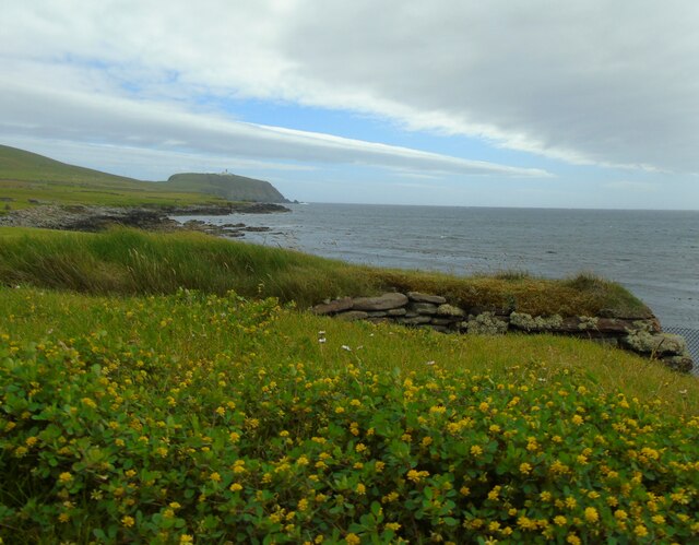
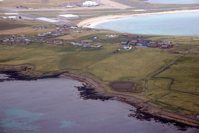
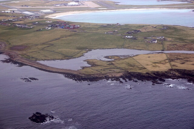
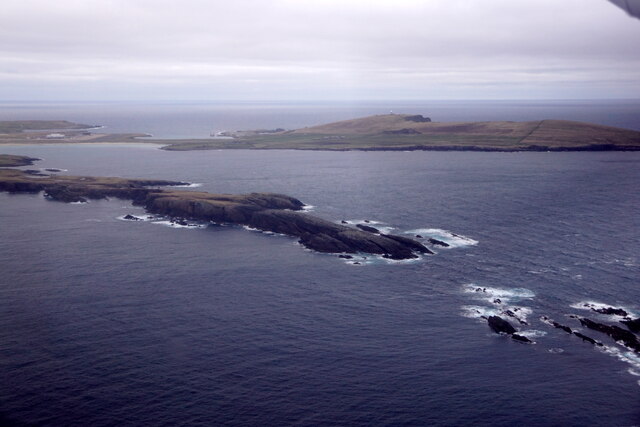
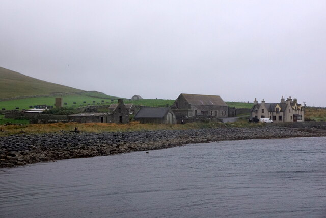
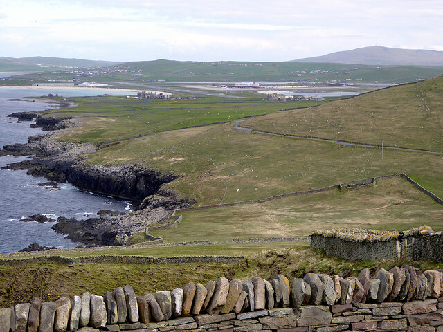
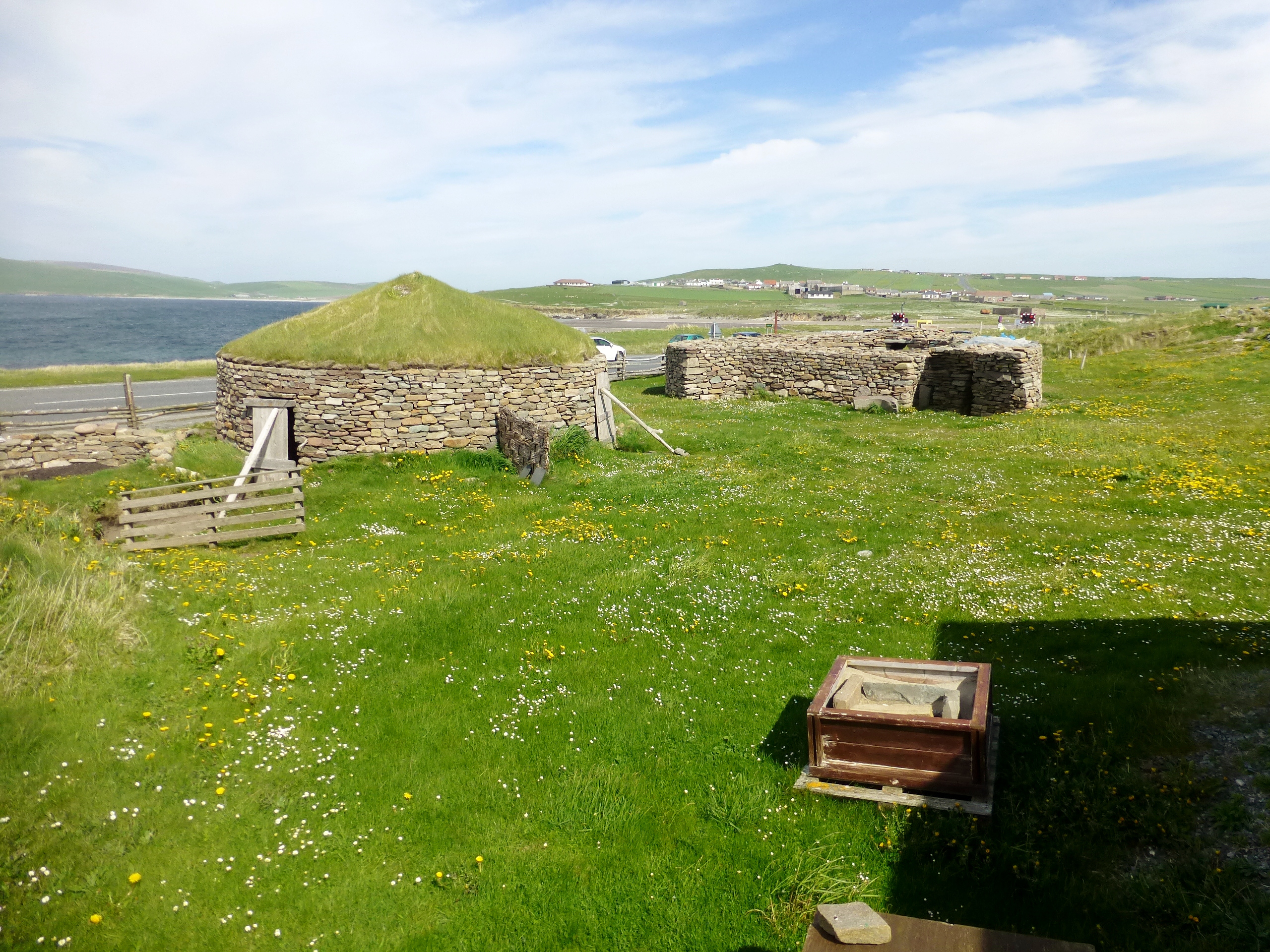
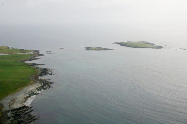
Big Geo is a prominent coastal feature located on the Shetland Islands, an archipelago in Scotland, United Kingdom. Situated on the eastern coast of the main island, known as Mainland, Big Geo is a stunning headland that juts out into the North Sea.

Rising dramatically from the surrounding landscape, Big Geo boasts impressive cliffs that tower above the crashing waves below. These cliffs, composed predominantly of sandstone and shale, are weathered and carved by the relentless force of the sea, creating a rugged and picturesque scene. The exposed rock faces display layers of sediment, offering a glimpse into the geological history of the area.

The headland is characterized by its distinctive shape, featuring a sharp, narrow point that stretches out into the ocean. This unique formation has been shaped over thousands of years through the erosive power of the waves, creating a boundary between land and sea that is both striking and dynamic.

Big Geo is a popular destination for nature enthusiasts and photographers, drawn to its awe-inspiring coastal scenery. The headland provides an ideal vantage point to observe a diverse range of marine wildlife, including seabirds, seals, and occasionally even dolphins or whales.

Accessible by foot, Big Geo can be reached by following a coastal path that meanders along the cliff tops, providing breathtaking views of the surrounding coastline and the vast expanse of the North Sea. Its remote location and natural beauty make Big Geo a captivating destination for those seeking tranquility and a connection with the raw power of nature.

If you have any feedback on the listing, please let us know in the comments section below.

Big Geo Images

Images are sourced within 2km of 59.86896/-1.3031873 or Grid Reference HU3909. Thanks to Geograph Open Source API. All images are credited.

To Sumburgh Head Taken at Jarlshof, settlement site on Shetland dating back 4,000 years and still in use in the 17th century, I am looking across the West Voe of Sumburgh towards Sumburgh Head, the most southerly point of mainland Shetland.
To Sumburgh Head
Taken at Jarlshof, settlement site on Shetland dating back 4,000 years and still in use in the 17th century, I am looking across the West Voe of Sumburgh towards Sumburgh Head, the most southerly point of mainland Shetland.
Wheelhouse entrance This is a section of the extensive remains located at Jarlshof, Sumburgh, Shetland. The site was first settled around 4,000 years ago and had a succession of inhabitants through the Bronze and Iron Ages to Norse settlement and medieval farming following on until the 17th century. I am looking at an entrance to the wheelhouse complex on the site.
Wheelhouse entrance
This is a section of the extensive remains located at Jarlshof, Sumburgh, Shetland. The site was first settled around 4,000 years ago and had a succession of inhabitants through the Bronze and Iron Ages to Norse settlement and medieval farming following on until the 17th century. I am looking at an entrance to the wheelhouse complex on the site.
Sumburgh Airport from Jarlshof Taken on the inner path running between the wheelhouse complex and the Norse settlement at Jarlshof, Sumburgh, I am looking across the eastern edge of West Voe to Sumburgh Airport, Shetland's main airport.
Sumburgh Airport from Jarlshof
Taken on the inner path running between the wheelhouse complex and the Norse settlement at Jarlshof, Sumburgh, I am looking across the eastern edge of West Voe to Sumburgh Airport, Shetland's main airport.
Sumburgh Hotel I am near the visitor centre at Jarlshof, Shetland, and looking past the Shetland pony towards the Sumburgh Hotel which is flying the Shetland flag. The hill beyond crowned with radar installation is the landward side of Compass Head.
Sumburgh Hotel
I am near the visitor centre at Jarlshof, Shetland, and looking past the Shetland pony towards the Sumburgh Hotel which is flying the Shetland flag. The hill beyond crowned with radar installation is the landward side of Compass Head.
Scatness from the air
Loch of Gards, Scatness, from the air
Ness of Burgi, Scatness, from the air
MV Good Shepherd IV at Grutness pier The Fair Isle ferry.
MV Good Shepherd IV at Grutness pier
The Fair Isle ferry.
MV Good Shepherd IV arriving at Grutness pier
MV Good Shepherd IV approaching the pier at Grutness
Male House Sparrow (Passer domesticus) bathing, Grutness
Hudsonian Godwit (Limosa haemastica), Grutness A rare vagrant from North America; only the 5th seen in Britain.
Hudsonian Godwit (Limosa haemastica), Grutness
A rare vagrant from North America; only the 5th seen in Britain.
Grutness House from the pier
Compass Head from the air
View across Sumburgh from the Head With the airport further on.
View across Sumburgh from the Head
With the airport further on.
Communication masts, Sumburgh Viewed from Grutness.
Communication masts, Sumburgh
Viewed from Grutness.
Grutness and Compass Head from the air Just before touchdown at Sumburgh Airport
Grutness and Compass Head from the air
Just before touchdown at Sumburgh Airport
Sea Wall Sea wall at Grutness.  In the foreground is an Ordnance Survey New OSBM Bolt described as: NEW OSBM BOLT SEAWALL 16.7M SW EDGE PIER 1.0M W N ANG BLDG (2.217m above Lerwick datum, 2nd order, new 1978).
Sea Wall
Sea wall at Grutness. In the foreground is an Ordnance Survey New OSBM Bolt described as: NEW OSBM BOLT SEAWALL 16.7M SW EDGE PIER 1.0M W N ANG BLDG (2.217m above Lerwick datum, 2nd order, new 1978).
Show me another place!

Big Geo is located at Grid Ref: HU3909 (Lat: 59.86896, Lng: -1.3031873)

Unitary Authority: Shetland Islands

Police Authority: Highlands and Islands

What 3 Words

///giants.still.gurgling. Near Sumburgh, Shetland Islands

Related Wikis

West Voe of Sumburgh

The West Voe of Sumburgh, (grid reference: HU 395 088), is the most southerly bay on the Shetland Mainland, located between Sumburgh Head, and the point...

Scatness

Scatness is a settlement on the headland of Scat Ness at the southern tip of Mainland, Shetland, Scotland, across the West Voe of Sumburgh from Sumburgh...
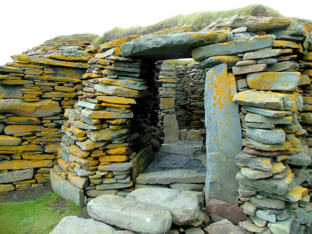
Jarlshof

Jarlshof ( YARLZ-hof) is the best-known prehistoric archaeological site in Shetland, Scotland. It lies in Sumburgh, Mainland, Shetland and has been described...

Little Holm, Dunrossness

Little Holm is a small island to the west of South Mainland in Shetland. It is near Scatness and Lady's Holm. A trawler was wrecked there in 1916. ��2...

Ness of Burgi

The Ness of Burgi is a narrow peninsula that stretches to the south from the Scat Ness headland of Mainland, Shetland, a Scottish island. It is in the...

Old Scatness

Old Scatness is an archeological site on Scat Ness, near the village of Scatness, in the parish of Dunrossness in the south end of Mainland, Shetland,...
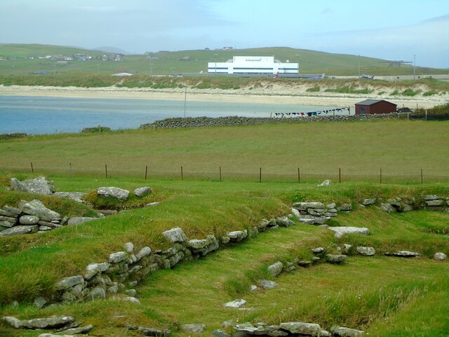
Sumburgh

Sumburgh is a small settlement in the Shetland Islands, Scotland. Sumburgh is located at the south end of the Mainland on Sumburgh Head. Sumburgh Airport...

Grutness

Grutness is a small settlement and headland at the southern tip of the main island of the Shetland Islands, Scotland. The settlement is within the parish...

Nearby Amenities

Located within 500m of 59.86896,-1.3031873
Barrier: cattle_grid
Lat/Long: 59.8718412/-1.3075581
Historic: memorial
Inscription: 1945. Erected by Italian POW for kindness shown to them by the people of Scatness while serving with the RAF Coastal Command. Cpl Carruthers Wm.
Memorial: stele
Source Name: survey
Lat/Long: 59.8705818/-1.3081407
Man Made: cairn
Lat/Long: 59.8655922/-1.3072604
Power: pole
Lat/Long: 59.8695368/-1.3086735
The data included in this document is from www.openstreetmap.org. The data is made available under ODbL.

Have you been to Big Geo?

Leave your review of Big Geo below (or comments, questions and feedback).