Peerie Vati Geo
Coastal Feature, Headland, Point in Shetland
Scotland
Peerie Vati Geo
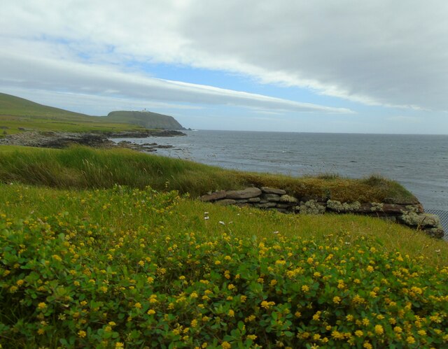
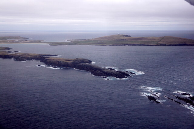
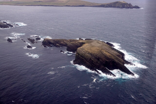
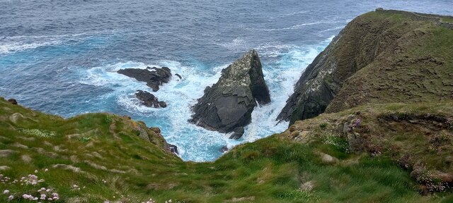
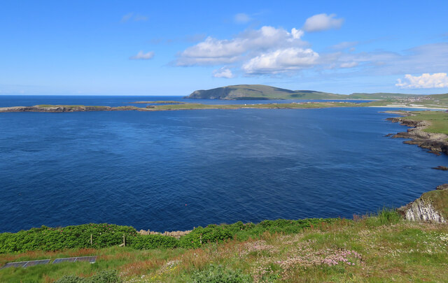
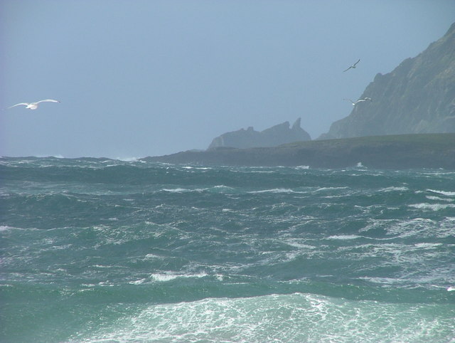
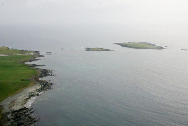
Peerie Vati Geo is a picturesque coastal feature located in Shetland, Scotland. It is characterized as a small headland or point that juts out into the North Sea, offering stunning views of the surrounding rugged coastline.
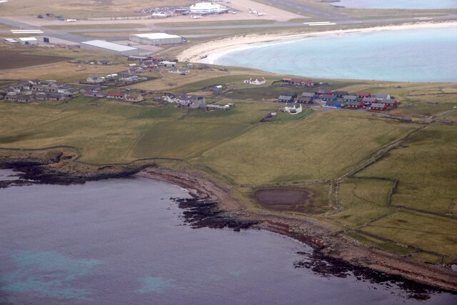
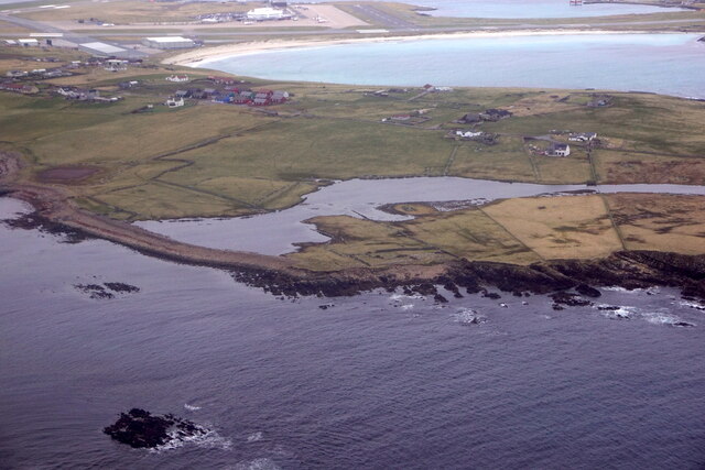
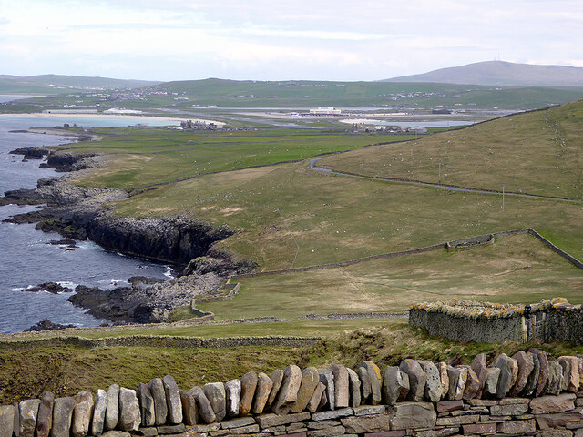
Situated on the western coast of the Shetland Mainland, Peerie Vati Geo is renowned for its dramatic cliffs and rocky outcrops. The name "Peerie Vati Geo" translates to "small fishing bay" in the local dialect, reflecting the area's historical significance as a fishing spot.
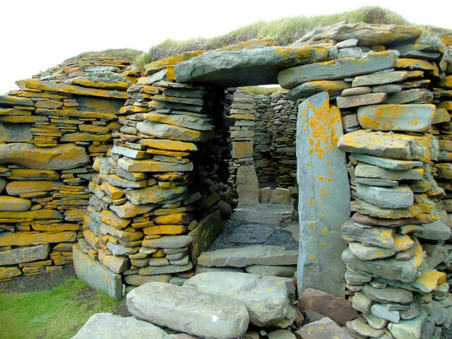
The headland is composed of sedimentary rocks, predominantly sandstone and shale, which have been shaped by years of erosion from the relentless waves. This has resulted in the formation of numerous sea caves and natural arches along the coastline, adding to the area's charm and intrigue.
Peerie Vati Geo is also home to a diverse range of wildlife, both on land and in the surrounding waters. Visitors may spot various seabirds nesting on the cliffs, including puffins, guillemots, and razorbills. Seals can often be seen lazing on the rocks, while otters occasionally make an appearance in the nearby kelp forests.
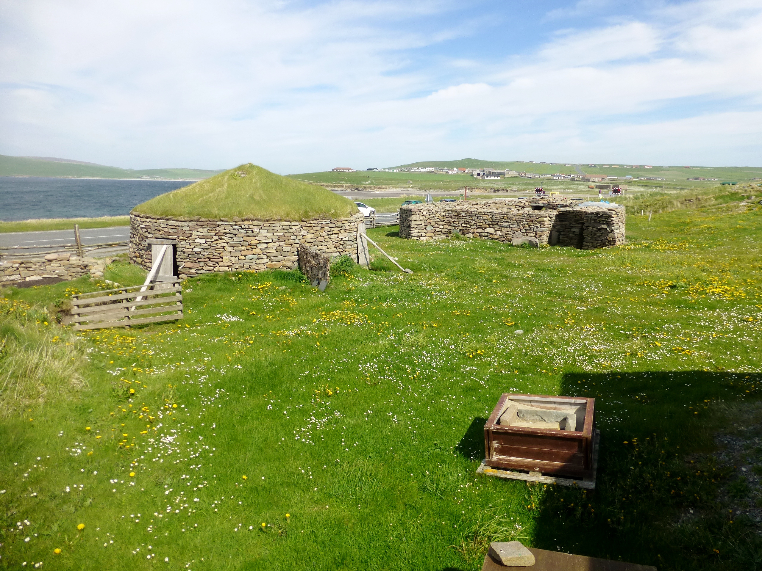
Access to Peerie Vati Geo is relatively straightforward, with a well-maintained footpath leading down to the headland from a nearby parking area. The walk provides an opportunity to enjoy the breathtaking scenery and experience the wild beauty of Shetland's coastal landscape.
Overall, Peerie Vati Geo offers visitors a chance to immerse themselves in the natural wonders of Shetland, with its stunning cliffs, sea caves, and abundant wildlife making it a must-see destination for nature enthusiasts and photographers alike.
If you have any feedback on the listing, please let us know in the comments section below.
Peerie Vati Geo Images
Images are sourced within 2km of 59.861713/-1.3081594 or Grid Reference HU3808. Thanks to Geograph Open Source API. All images are credited.


Peerie Vati Geo is located at Grid Ref: HU3808 (Lat: 59.861713, Lng: -1.3081594)
Unitary Authority: Shetland Islands
Police Authority: Highlands and Islands
What 3 Words
///velocity.easels.baths. Near Sumburgh, Shetland Islands
Nearby Locations
Related Wikis

Ness of Burgi
The Ness of Burgi is a narrow peninsula that stretches to the south from the Scat Ness headland of Mainland, Shetland, a Scottish island. It is in the...

West Voe of Sumburgh
The West Voe of Sumburgh, (grid reference: HU 395 088), is the most southerly bay on the Shetland Mainland, located between Sumburgh Head, and the point...

Jarlshof
Jarlshof ( YARLZ-hof) is the best-known prehistoric archaeological site in Shetland, Scotland. It lies in Sumburgh, Mainland, Shetland and has been described...
Little Holm, Dunrossness
Little Holm is a small island to the west of South Mainland in Shetland. It is near Scatness and Lady's Holm. A trawler was wrecked there in 1916. ��2...
Scatness
Scatness is a settlement on the headland of Scat Ness at the southern tip of Mainland, Shetland, Scotland, across the West Voe of Sumburgh from Sumburgh...

Horse Holm
Horse Island or Horse Holm, known locally as Da Holm, is one of the Shetland Islands. It lies about 2.3 km west of Sumburgh Head at the south tip of the...
Sumburgh
Sumburgh is a small settlement in the Shetland Islands, Scotland. Sumburgh is located at the south end of the Mainland on Sumburgh Head. Sumburgh Airport...

Lady's Holm
Lady's Holm is an island off southern Mainland in the Shetland Islands. It is not to be confused with the Maiden Stack, which is also known as "Frau Stack...
Nearby Amenities
Located within 500m of 59.861713,-1.3081594Have you been to Peerie Vati Geo?
Leave your review of Peerie Vati Geo below (or comments, questions and feedback).