Scarfi Geo

Coastal Feature, Headland, Point in Shetland

Scotland

Scarfi Geo

To Sumburgh Head Taken at Jarlshof, settlement site on Shetland dating back 4,000 years and still in use in the 17th century, I am looking across the West Voe of Sumburgh towards Sumburgh Head, the most southerly point of mainland Shetland.
To Sumburgh Head Credit: Carroll Pierce

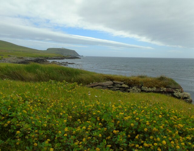
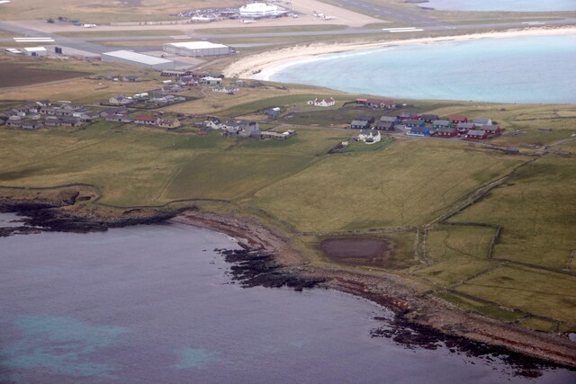
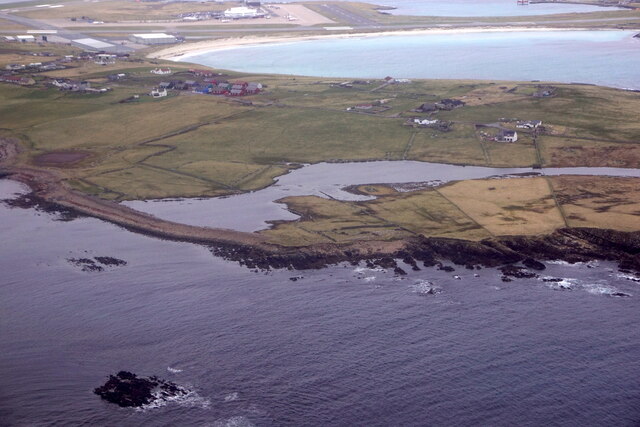
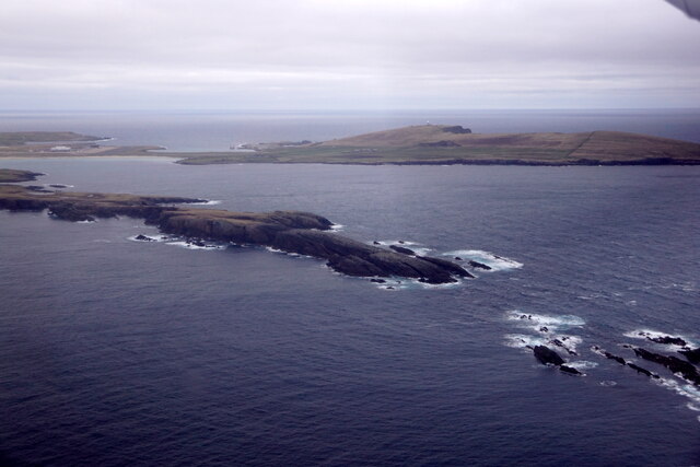
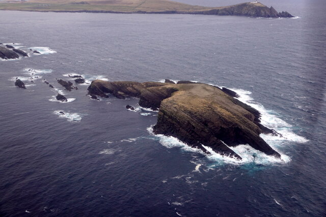
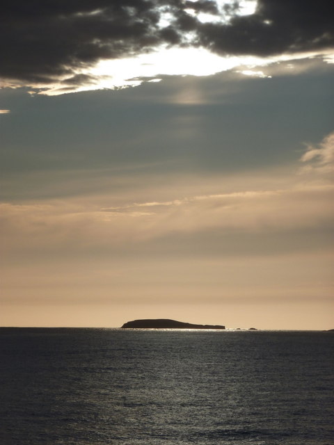
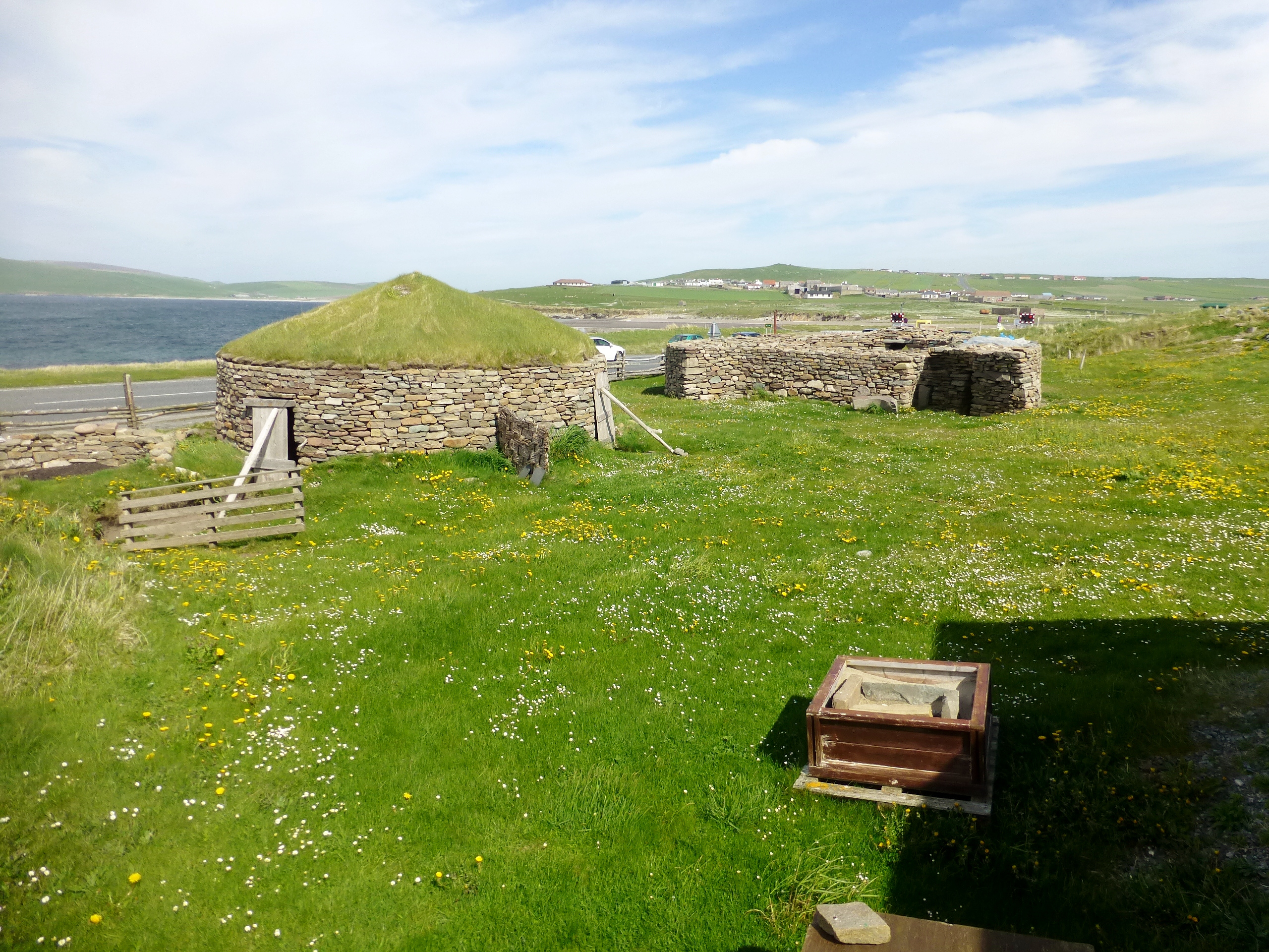
Scarfi Geo is a prominent coastal feature located in the Shetland Islands, off the northeastern coast of Scotland. It is classified as a headland or point due to its protrusion into the North Sea. Scarfi Geo is situated on the west coast of the island of Unst, which is the northernmost inhabited island in the United Kingdom.

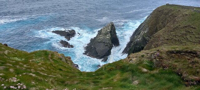
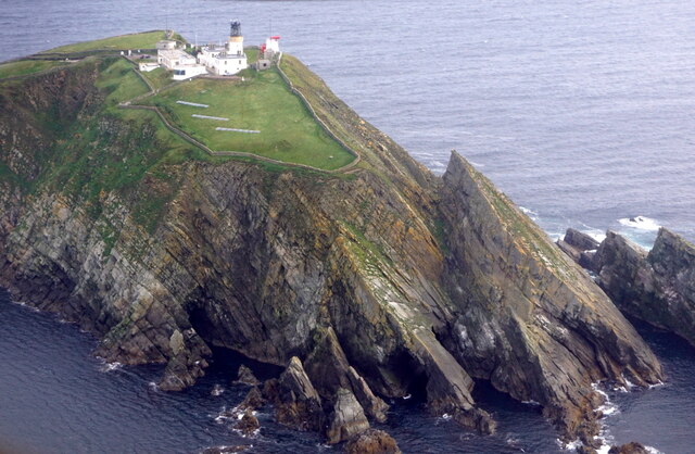
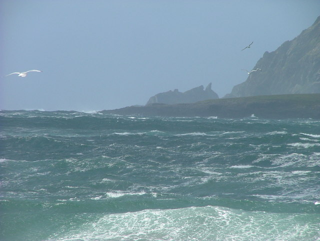
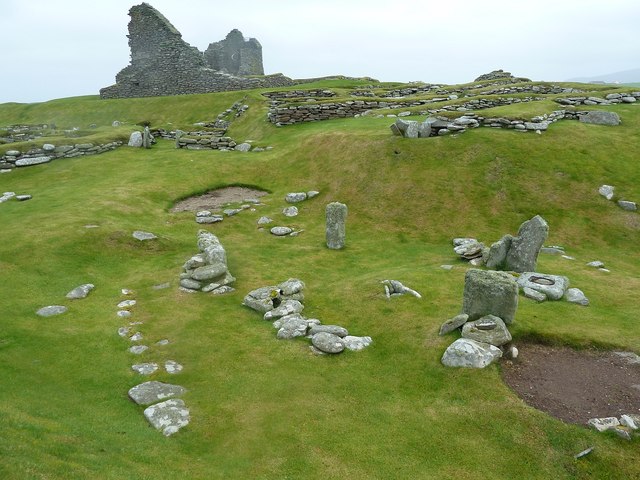
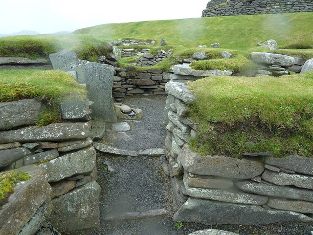
The headland is characterized by steep cliffs, rugged terrain, and dramatic rock formations. These cliffs, which reach heights of around 200 feet, are composed of ancient sedimentary rocks, including sandstone and shale. The exposed rock faces display fascinating geological features, such as layers of different colored rock and intricate patterns formed by erosion over millions of years.

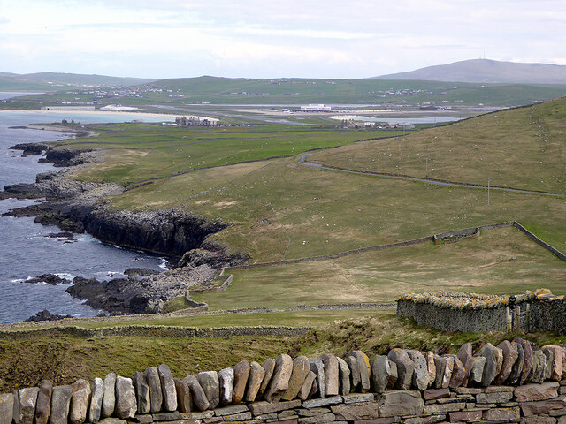
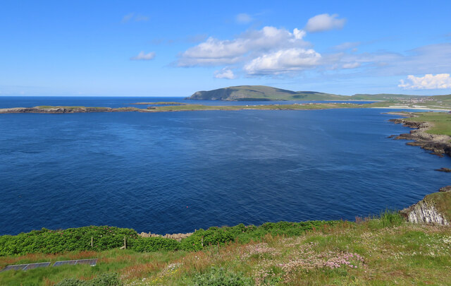
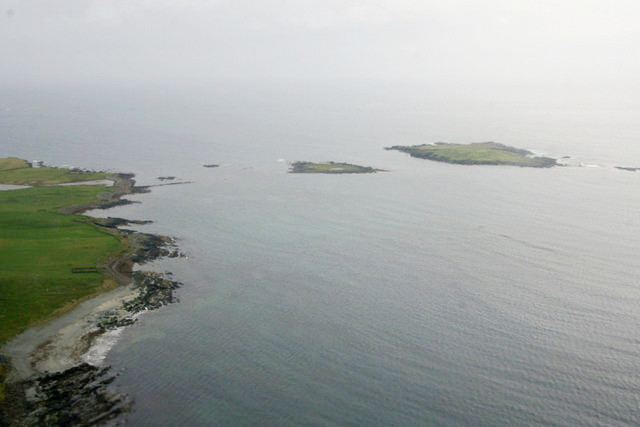
Scarfi Geo offers stunning panoramic views of the surrounding coastline and the North Sea. On a clear day, visitors can see the neighboring islands of Yell and Fetlar, as well as the distant outline of the Scottish mainland. The headland also provides excellent opportunities for birdwatching, as it is a nesting site for various seabirds, including puffins, guillemots, and razorbills.

Access to Scarfi Geo is possible via a footpath that leads from the nearby village of Haroldswick. The path takes visitors along the clifftops, providing breathtaking vistas along the way. Due to the exposed and often windy conditions, it is advisable to wear appropriate clothing and sturdy footwear when visiting Scarfi Geo.

Overall, Scarfi Geo is a captivating coastal feature that showcases the rugged beauty and natural diversity of the Shetland Islands. Its unique geological formations, panoramic views, and abundant wildlife make it an attractive destination for nature enthusiasts and photographers alike.

If you have any feedback on the listing, please let us know in the comments section below.

Scarfi Geo Images

Images are sourced within 2km of 59.857773/-1.3102584 or Grid Reference HU3808. Thanks to Geograph Open Source API. All images are credited.

To Sumburgh Head Taken at Jarlshof, settlement site on Shetland dating back 4,000 years and still in use in the 17th century, I am looking across the West Voe of Sumburgh towards Sumburgh Head, the most southerly point of mainland Shetland.
To Sumburgh Head
Taken at Jarlshof, settlement site on Shetland dating back 4,000 years and still in use in the 17th century, I am looking across the West Voe of Sumburgh towards Sumburgh Head, the most southerly point of mainland Shetland.
Wheelhouse entrance This is a section of the extensive remains located at Jarlshof, Sumburgh, Shetland. The site was first settled around 4,000 years ago and had a succession of inhabitants through the Bronze and Iron Ages to Norse settlement and medieval farming following on until the 17th century. I am looking at an entrance to the wheelhouse complex on the site.
Wheelhouse entrance
This is a section of the extensive remains located at Jarlshof, Sumburgh, Shetland. The site was first settled around 4,000 years ago and had a succession of inhabitants through the Bronze and Iron Ages to Norse settlement and medieval farming following on until the 17th century. I am looking at an entrance to the wheelhouse complex on the site.
Sumburgh Airport from Jarlshof Taken on the inner path running between the wheelhouse complex and the Norse settlement at Jarlshof, Sumburgh, I am looking across the eastern edge of West Voe to Sumburgh Airport, Shetland's main airport.
Sumburgh Airport from Jarlshof
Taken on the inner path running between the wheelhouse complex and the Norse settlement at Jarlshof, Sumburgh, I am looking across the eastern edge of West Voe to Sumburgh Airport, Shetland's main airport.
Sumburgh Hotel I am near the visitor centre at Jarlshof, Shetland, and looking past the Shetland pony towards the Sumburgh Hotel which is flying the Shetland flag. The hill beyond crowned with radar installation is the landward side of Compass Head.
Sumburgh Hotel
I am near the visitor centre at Jarlshof, Shetland, and looking past the Shetland pony towards the Sumburgh Hotel which is flying the Shetland flag. The hill beyond crowned with radar installation is the landward side of Compass Head.
Scatness from the air
Loch of Gards, Scatness, from the air
Ness of Burgi, Scatness, from the air
Horse Island, Scatness, from the air
Guillemots on a stack at Sumburgh Head
Sumburgh Lighthouse from the air
View across Sumburgh from the Head With the airport further on.
View across Sumburgh from the Head
With the airport further on.
Ness of Burgi and Fitful Head Taken on the western side of Sumburgh Head, beside its lighthouse and visitor centre, I am looking across the West Voe of Sumburgh to the Ness of Burgi. The Bay of Quendale and Fitful lie beyond. Main island, Shetland.
Ness of Burgi and Fitful Head
Taken on the western side of Sumburgh Head, beside its lighthouse and visitor centre, I am looking across the West Voe of Sumburgh to the Ness of Burgi. The Bay of Quendale and Fitful lie beyond. Main island, Shetland.
Sumburgh: Horse Island in silhouette Looking towards this island off the southern tip of the Shetland mainland, from the Lerwick-Aberdeen ferry many miles away.
Sumburgh: Horse Island in silhouette
Looking towards this island off the southern tip of the Shetland mainland, from the Lerwick-Aberdeen ferry many miles away.
West Voe of Sumburgh
Sumburgh Hotel This welcoming hotel, restaurant and bar was our first and last port of call on our visit to the Shetland Isles. I'm pleased to report that they had pretty much the full range of the islands' own excellent Valhalla Brewery ales in bottle, though none yet on draught when we were there.
Photo taken on a dismally wet afternoon from the path to Jarlshof.
Sumburgh Hotel
This welcoming hotel, restaurant and bar was our first and last port of call on our visit to the Shetland Isles. I'm pleased to report that they had pretty much the full range of the islands' own excellent Valhalla Brewery ales in bottle, though none yet on draught when we were there. Photo taken on a dismally wet afternoon from the path to Jarlshof.
Jarlshof - Iron age settlement and visitor centre On a very wet afternoon at the fascinating excavated site at Jarlshof - the section seen ahead here is from the Iron Age period with the visitor centre being the modern building behind.
Jarlshof - Iron age settlement and visitor centre
On a very wet afternoon at the fascinating excavated site at Jarlshof - the section seen ahead here is from the Iron Age period with the visitor centre being the modern building behind.
Jarlshof - Neolithic dwelling remains The oldest part of the Jarlshof site dates from about 2500BC or 4,500 years ago. This places it in the Neolithic or New Stone Age. Only a few stones remain as can be seen, but considerable pottery finds have helped in dating this area.
Jarlshof - Neolithic dwelling remains
The oldest part of the Jarlshof site dates from about 2500BC or 4,500 years ago. This places it in the Neolithic or New Stone Age. Only a few stones remain as can be seen, but considerable pottery finds have helped in dating this area.
Jarlshof - Bronze Age dwellings The Bronze Age and Iron Age areas of Jarlshof adjoin each other. I think this view is from the former period looking towards the latter. Unfortunately it was such a dismal day when we visited that we didn't linger as long here as we'd have liked - and my lens was getting covered in rain drops as can be seen !
Jarlshof - Bronze Age dwellings
The Bronze Age and Iron Age areas of Jarlshof adjoin each other. I think this view is from the former period looking towards the latter. Unfortunately it was such a dismal day when we visited that we didn't linger as long here as we'd have liked - and my lens was getting covered in rain drops as can be seen !
Show me another place!

Scarfi Geo is located at Grid Ref: HU3808 (Lat: 59.857773, Lng: -1.3102584)

Unitary Authority: Shetland Islands

Police Authority: Highlands and Islands

What 3 Words

///barn.zeal.tutorial. Near Sumburgh, Shetland Islands

Related Wikis

Ness of Burgi

The Ness of Burgi is a narrow peninsula that stretches to the south from the Scat Ness headland of Mainland, Shetland, a Scottish island. It is in the...

Horse Holm

Horse Island or Horse Holm, known locally as Da Holm, is one of the Shetland Islands. It lies about 2.3 km west of Sumburgh Head at the south tip of the...

West Voe of Sumburgh

The West Voe of Sumburgh, (grid reference: HU 395 088), is the most southerly bay on the Shetland Mainland, located between Sumburgh Head, and the point...

Little Holm, Dunrossness

Little Holm is a small island to the west of South Mainland in Shetland. It is near Scatness and Lady's Holm. A trawler was wrecked there in 1916. ��2...

Jarlshof

Jarlshof ( YARLZ-hof) is the best-known prehistoric archaeological site in Shetland, Scotland. It lies in Sumburgh, Mainland, Shetland and has been described...

Scatness

Scatness is a settlement on the headland of Scat Ness at the southern tip of Mainland, Shetland, Scotland, across the West Voe of Sumburgh from Sumburgh...

Sumburgh

Sumburgh is a small settlement in the Shetland Islands, Scotland. Sumburgh is located at the south end of the Mainland on Sumburgh Head. Sumburgh Airport...

Lady's Holm

Lady's Holm is an island off southern Mainland in the Shetland Islands. It is not to be confused with the Maiden Stack, which is also known as "Frau Stack...

Have you been to Scarfi Geo?

Leave your review of Scarfi Geo below (or comments, questions and feedback).