Black Geo

Coastal Feature, Headland, Point in Shetland

Scotland

Black Geo

The Ness, South Havra, from the air
The Ness, South Havra, from the air Credit: Mike Pennington

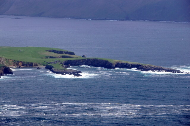
Black Geo is a prominent coastal feature located on the rugged coastline of Shetland, an archipelago in the North Atlantic Ocean, northeast of mainland Scotland. It is primarily characterized as a headland or point, jutting out into the turbulent waters of the North Sea.

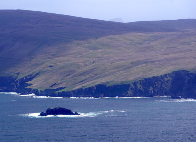
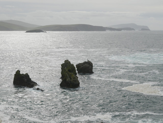
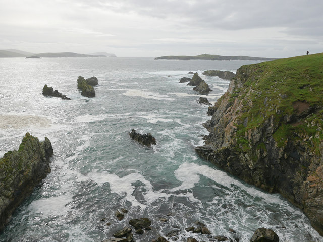
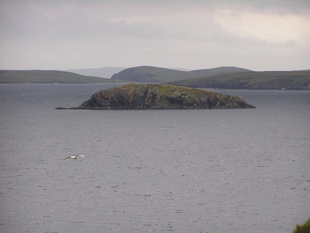
Situated on the eastern coast of Shetland, Black Geo is known for its dramatic cliffs and rocky terrain, which have been carved over thousands of years by the relentless forces of wind and waves. The headland is composed of layered sedimentary rocks, displaying various shades of black, gray, and brown, giving it its distinctive name.

Visitors to Black Geo are treated to breathtaking views of the surrounding coastline, with panoramic vistas of the sea and nearby islets. The headland is also a haven for wildlife, with numerous seabirds nesting on its cliffs, including puffins, guillemots, and fulmars. On occasion, lucky visitors may even spot seals and dolphins swimming in the waters below.

Access to Black Geo is relatively easy, with a well-maintained footpath leading from the nearby village of Scalloway. The path takes visitors along the coastline, offering magnificent views along the way. However, caution is advised when exploring the headland, as the cliffs can be dangerous and should be approached with care.

Black Geo is a popular destination for hikers, nature enthusiasts, and photographers seeking to capture the rugged beauty of Shetland's coastline. Its striking cliffs, diverse wildlife, and stunning views make it a must-visit location for anyone exploring this picturesque part of Scotland.

If you have any feedback on the listing, please let us know in the comments section below.

Black Geo Images

Images are sourced within 2km of 60.024308/-1.3177548 or Grid Reference HU3826. Thanks to Geograph Open Source API. All images are credited.

The Ness, South Havra, from the air
Holm of Maywick from the air
Stacks of Houssness, East Burra Part of the group of rocks known as the Stacks of Houssness.  Fitful Head is in the far distance.
Stacks of Houssness, East Burra
Part of the group of rocks known as the Stacks of Houssness. Fitful Head is in the far distance.
Sea running in Mare's Geo and the Stacks of Houssness A good swell was creating much spray and activity and the southerly point of Houss Ness.  A great day to be exploring East Burra.
Sea running in Mare's Geo and the Stacks of Houssness
A good swell was creating much spray and activity and the southerly point of Houss Ness. A great day to be exploring East Burra.
Sandy Geo Secluded Beach on the east side of Taing of Maywick Headland,
looking north up Clift Sound. Several grey seals hurried into the water
when I peeped over the edge of the cliff.
Sandy Geo
Secluded Beach on the east side of Taing of Maywick Headland, looking north up Clift Sound. Several grey seals hurried into the water when I peeped over the edge of the cliff.
Pair of Great Skuas in Flight at Hill of Deepdale, Shetland
View West from Hill of Deepdale, Shetland View from the summit of Hill of Deepdale on mainland Shetland.  The isles of East Burra and West Burra are visible.
View West from Hill of Deepdale, Shetland
View from the summit of Hill of Deepdale on mainland Shetland. The isles of East Burra and West Burra are visible.
Moorland Fence on Hill of Deepdale, Shetland
View Down Deepdale, Shetland
Abandoned Motor Car on the Moors, Shetland A motor car abandoned some miles from the nearest road, on moorlands in the Shetland Isles, Great Britain.
Abandoned Motor Car on the Moors, Shetland
A motor car abandoned some miles from the nearest road, on moorlands in the Shetland Isles, Great Britain.
Moorland under low cloud Near the top of the Royl Field there is a view south to Channer Wick. But on this day the cloud came down to hill, darkening the view.
Moorland under low cloud
Near the top of the Royl Field there is a view south to Channer Wick. But on this day the cloud came down to hill, darkening the view.
Mosquito Memorial This stone marks the site of a wartime crash. The inscription reads:

This memorial commemorates de Havilland Mosquito Mk VII "DZ642" of 627 Squadron, Royal Air Force.

Pilot - F/Lt John A Reid RAF 48900
Navigator - F/O Wesley D Irwin RCAF J16115

Returning from target marking an ill-fated raid on U-Boat pens at Tronheim, Norway, short of fuel and in bad visibility the aircraft hit Royl Hill on 22nd November 1944 at 23:00 hours.
Mosquito Memorial
This stone marks the site of a wartime crash. The inscription reads: This memorial commemorates de Havilland Mosquito Mk VII "DZ642" of 627 Squadron, Royal Air Force. Pilot - F/Lt John A Reid RAF 48900 Navigator - F/O Wesley D Irwin RCAF J16115 Returning from target marking an ill-fated raid on U-Boat pens at Tronheim, Norway, short of fuel and in bad visibility the aircraft hit Royl Hill on 22nd November 1944 at 23:00 hours.
Mosquito engine Several parts of the aircraft are scattered around the crash site. This is one of the engines.
Mosquito engine
Several parts of the aircraft are scattered around the crash site. This is one of the engines.
Mosquito remains Several parts of the Mosquito aircraft are still visible at the crash site.
Mosquito remains
Several parts of the Mosquito aircraft are still visible at the crash site.
South Havra South Havra seen from Maywick. Note remains of windmill on summit.
South Havra
South Havra seen from Maywick. Note remains of windmill on summit.
Claver Beach northeast of Maywick, with Ramna Geo top left.
Claver
Beach northeast of Maywick, with Ramna Geo top left.
Holm of Maywick Seen from the cliff above the Claver at Maywick.
Holm of Maywick
Seen from the cliff above the Claver at Maywick.
South Havra from the air Taken from 700 feet (approx) returning from Fair Isle to Tingwall.  Deserted since 1923, the island was once home to a small fishing community.  Land was at a premium and houses were built so near to the cliffs that both animals and children were tethered for their own safety.
South Havra from the air
Taken from 700 feet (approx) returning from Fair Isle to Tingwall. Deserted since 1923, the island was once home to a small fishing community. Land was at a premium and houses were built so near to the cliffs that both animals and children were tethered for their own safety.
Show me another place!

Black Geo is located at Grid Ref: HU3826 (Lat: 60.024308, Lng: -1.3177548)

Unitary Authority: Shetland Islands

Police Authority: Highlands and Islands

What 3 Words

///toddler.shook.saying. Near Sandwick, Shetland Islands

Related Wikis

South Havra

South Havra (Scots: Sooth Haevra; Old Norse: Hafrey), formerly Hevera, is an uninhabited island in the Scalloway Islands, Shetland, Scotland. == Geography... ==

Little Havra

Little Havra is a small island off the west of South Mainland in Shetland. It is 35 metres (115 ft) at its highest point, upon which there is a cairn....

Catpund

Catpund is a quarry site in Shetland, Scotland, where steatite vessels were cut from the rock from prehistory onwards. The quarrying marks are still visible...

Hoswick

Hoswick is a settlement in Sandwick in the south mainland of Shetland, Scotland, on the eastern part of the Dunrossness civil parish. It is separated from...

Have you been to Black Geo?

Leave your review of Black Geo below (or comments, questions and feedback).