Blo Geo

Coastal Feature, Headland, Point in Shetland

Scotland

Blo Geo

Track to Calsta, North Roe
Track to Calsta, North Roe Credit: Mike Pennington

Blo Geo is a prominent coastal feature located in the Shetland Islands, an archipelago in Scotland. It is characterized as a headland, specifically a point where the land juts out into the sea. Blo Geo is known for its rugged and dramatic cliffs that tower above the North Atlantic Ocean.

Situated in the western part of the Shetland Mainland, Blo Geo offers breathtaking views of the surrounding landscape. The headland is composed of steep slopes and sheer cliffs that provide a nesting site for various seabird species, including puffins, guillemots, and fulmars. These bird colonies make Blo Geo a popular attraction for birdwatchers and nature enthusiasts.

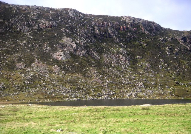
The geology of Blo Geo is also of great interest. The cliffs are composed of layers of sedimentary rocks, including sandstone and shale, which have been shaped by millions of years of weathering and erosion. Fossils, such as ancient fish and plant remains, can sometimes be found in the rocks, offering insights into the region's geological history.

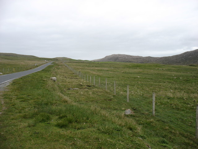
Access to Blo Geo is relatively easy, with a footpath leading visitors to the headland. From there, they can explore the area, taking in the stunning views and observing the diverse wildlife. The location is also a popular spot for photographers, who are drawn to the dramatic cliffs and the ever-changing moods of the sea.

Overall, Blo Geo in Shetland is a captivating headland that showcases the beauty and geological significance of the region. Its rugged cliffs, diverse birdlife, and accessibility make it a must-visit destination for those seeking a unique coastal experience.

If you have any feedback on the listing, please let us know in the comments section below.

Blo Geo Images

Images are sourced within 2km of 60.562515/-1.3146043 or Grid Reference HU3786. Thanks to Geograph Open Source API. All images are credited.

Track to Calsta, North Roe
Track on Billia Field, North Roe
Skelberry, North Roe, from the Colsta track
Track to Colsta on Billia Field, North Roe
Skelberry, North Roe
Purple saxifrage (Saxifraga oppositifolia), Skelberry, North Roe A very local plant in Shetland, only found in North Roe. It is however, widespread in northern latitudes and is Holarctic (found around the Arctic in Eurasia and America).
Purple saxifrage (Saxifraga oppositifolia), Skelberry, North Roe
A very local plant in Shetland, only found in North Roe. It is however, widespread in northern latitudes and is Holarctic (found around the Arctic in Eurasia and America).
The A970 heading south The A970 just comes to a dead stop about 3 km north of here (behind the camera), at Isbister. Looking south, for the next ten miles or so it is "single track with passing places", but there is so little traffic that it is hardly a problem. After that, and all the way to Sumburgh <a href="https://www.geograph.org.uk/gridref/HU4009">HU4009</a>, 80km away, it is a splendid road, upgraded (like other main routes on the Shetland Islands) when the oil money was at its peak.
The A970 heading south
The A970 just comes to a dead stop about 3 km north of here (behind the camera), at Isbister. Looking south, for the next ten miles or so it is "single track with passing places", but there is so little traffic that it is hardly a problem. After that, and all the way to Sumburgh HU4009, 80km away, it is a splendid road, upgraded (like other main routes on the Shetland Islands) when the oil money was at its peak.
The A970 heading south The A970 just comes to a dead stop about 4 km north of here (behind the camera), at Isbister. Looking south, for just under ten miles it is "single track with passing places", but there is so little traffic that it is hardly a problem. After that, and all the way to Sumburgh <a href="https://www.geograph.org.uk/gridref/HU4009">HU4009</a>, 80 km away, it is a splendid road, upgraded (like other main routes on the Shetland Islands) when the oil money was at its peak.
The A970 heading south
The A970 just comes to a dead stop about 4 km north of here (behind the camera), at Isbister. Looking south, for just under ten miles it is "single track with passing places", but there is so little traffic that it is hardly a problem. After that, and all the way to Sumburgh HU4009, 80 km away, it is a splendid road, upgraded (like other main routes on the Shetland Islands) when the oil money was at its peak.
A970 Road A970 road near Skelberry
A970 Road
A970 road near Skelberry
A970 approaching North Roe
Trowie Knowe chambered cairn A Neolithic heel shaped chambered cairn with an irregular chamber (Scale 1m). <span class="nowrap"><a title="https://canmore.org.uk/site/834/trowie-knowe-beorgs-of-housetter" rel="nofollow ugc noopener" href="https://canmore.org.uk/site/834/trowie-knowe-beorgs-of-housetter">Link</a><img style="margin-left:2px;" alt="External link" title="External link - shift click to open in new window" src="https://s1.geograph.org.uk/img/external.png" width="10" height="10"/></span>
Trowie Knowe chambered cairn
A Neolithic heel shaped chambered cairn with an irregular chamber (Scale 1m). LinkExternal link
Houlland This shot shows the difference between the improved grazing land and the unimproved moorland beyond. This is one of several places in Shetland named Houlland; in this case it is a Burn of Houlland, not visible in the shot, which drains this area into Burra Voe beyond.
Houlland
This shot shows the difference between the improved grazing land and the unimproved moorland beyond. This is one of several places in Shetland named Houlland; in this case it is a Burn of Houlland, not visible in the shot, which drains this area into Burra Voe beyond.
Skelberry Looking south from the side of the A970. The house at Skelberry looks new, and in front of it are the remnants of other now vanished buildings. The Burn of Houlland occupies the dip between Skelberry and the ridge to the right.
Skelberry
Looking south from the side of the A970. The house at Skelberry looks new, and in front of it are the remnants of other now vanished buildings. The Burn of Houlland occupies the dip between Skelberry and the ridge to the right.
Skelberry below the Beorgs.
Laurence Loch Small lochan below the Beorgs of Housetter, North Roe.
Laurence Loch
Small lochan below the Beorgs of Housetter, North Roe.
British willow sailing Tanker British Willow escorted out by tug Dunter, Shalder and pilot boat.
British willow sailing
Tanker British Willow escorted out by tug Dunter, Shalder and pilot boat.
Tanker Delaware on way in to Sullom Voe oil Terminal Tug Dunter running in to connect aft for active escort .
Tanker Delaware on way in to Sullom Voe oil Terminal
Tug Dunter running in to connect aft for active escort .
Tanker tug escort Tanker Forward Pioneer escorted out by Tug Dunter, Tug Shalder (where photo taken from) and Pilot boat. Shot taken looking at light on the skerrie, which is the only fixed installation in the square.
Tanker tug escort
Tanker Forward Pioneer escorted out by Tug Dunter, Tug Shalder (where photo taken from) and Pilot boat. Shot taken looking at light on the skerrie, which is the only fixed installation in the square.
Show me another place!

Blo Geo is located at Grid Ref: HU3786 (Lat: 60.562515, Lng: -1.3146043)

Unitary Authority: Shetland Islands

Police Authority: Highlands and Islands

What 3 Words

///stupidly.barman.lands. Near Ulsta, Shetland Islands

Related Wikis

Little Holm, Yell Sound

Little Holm is a small island in Yell Sound, in Shetland, Scotland. It lies between Northmavine and the island of Yell. There is a lighthouse here. In...

Yell Sound

Yell Sound is the strait running between Yell and Mainland, Shetland, Scotland. It is the boundary between the Mainland and the North Isles and it contains...

North Roe

North Roe is a village, and protected area at the northern tip in the large Northmavine peninsula of the Mainland of Shetland, Scotland. It is a small...

Muckle Holm, Yell Sound

Muckle Holm is a small island in Shetland. It is in Yell Sound, near the Northmavine. It is 23 metres (75 ft) at its highest point. There is a lighthouse...

Lamba, Shetland

Lamba is an uninhabited island in Yell Sound in Shetland. It lies 1.5 km (0.93 mi) north of the entrance to the Sullom Voe inlet and 1.4 kilometres (0...

Ollaberry

Ollaberry (Old Norse: Olafrsberg, meaning Olaf's Hill) is a village on Mainland, Shetland, Scotland on the west shore of Yell Sound, 10.9 miles (17.5 km...

Voe, Northmavine

Voe is a settlement on the Northmavine peninsula of Mainland, Shetland, Scotland. It is at the head of Ronas Voe and just off the A970 road. == Whaling... ==

Brother Isle

Brother Isle (Old Norse: breiðare øy meaning broad beach island) is a small, uninhabited island in Shetland, Scotland. It lies between the islands of Yell...

Nearby Amenities

Located within 500m of 60.562515,-1.3146043
The data included in this document is from www.openstreetmap.org. The data is made available under ODbL.

Have you been to Blo Geo?

Leave your review of Blo Geo below (or comments, questions and feedback).