Rettoo Baa

Coastal Feature, Headland, Point in Shetland

Scotland

Rettoo Baa

Blythoid, Ollaberry Looking across Yell Sound to Sullom Voe Terminal.
Blythoid, Ollaberry Credit: Mike Pennington

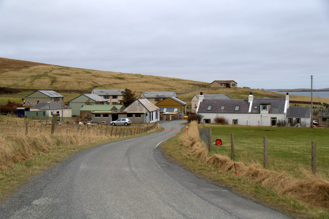
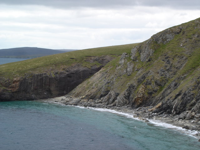
Rettoo Baa is a picturesque coastal feature located in the Shetland Islands, an archipelago in Scotland. It is a prominent headland and point that juts out into the North Sea, offering stunning views of the surrounding landscape.

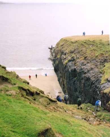
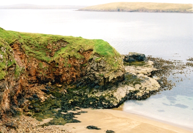
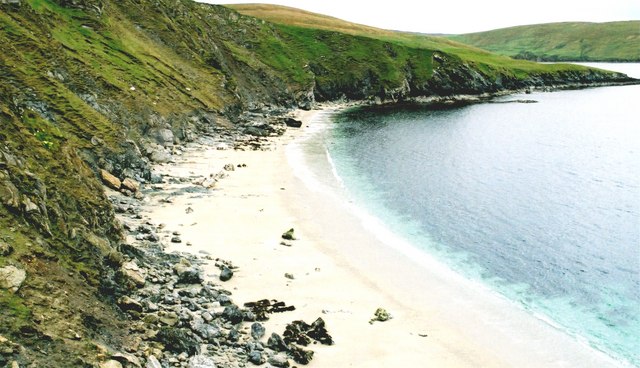
Situated on the east coast of the main island, Rettoo Baa is known for its rugged beauty and dramatic cliffs that overlook the sea. The headland is characterized by steep slopes covered in lush vegetation, including heather and grasses, which provide a vibrant splash of color against the grayish rock formations.

The point itself is a popular destination for nature enthusiasts and hikers, who flock to the area to explore its diverse flora and fauna. The coastal path leading to Rettoo Baa offers breathtaking vistas of the surrounding coastline, with the crashing waves providing a soothing soundtrack to the experience.

The headland is also home to a variety of seabirds, including puffins, guillemots, and kittiwakes, which nest in the cliffs and can be observed from viewpoints along the path. Visitors may also spot seals basking on the rocks or dolphins frolicking in the sea.

Rettoo Baa is a place of natural beauty and tranquility, offering a peaceful escape from the hustle and bustle of everyday life. Its rugged cliffs, stunning views, and abundant wildlife make it a must-visit destination for those seeking a true taste of the Scottish coastal landscape.

If you have any feedback on the listing, please let us know in the comments section below.

Rettoo Baa Images

Images are sourced within 2km of 60.495177/-1.3272192 or Grid Reference HU3779. Thanks to Geograph Open Source API. All images are credited.

Blythoid, Ollaberry Looking across Yell Sound to Sullom Voe Terminal.
Blythoid, Ollaberry
Looking across Yell Sound to Sullom Voe Terminal.
Runnadale, Ollaberry Small housing estate at the end of the road.
Runnadale, Ollaberry
Small housing estate at the end of the road.
Small burn entering the Bay of Ollaberry Looking across to Ollaberry and the hill the Back of Ollaberry.
Small burn entering the Bay of Ollaberry
Looking across to Ollaberry and the hill the Back of Ollaberry.
Eastwick, Ollaberry Looking across the small burn and a cabbage patch towards an old kirk.
Eastwick, Ollaberry
Looking across the small burn and a cabbage patch towards an old kirk.
Hillside, Ollaberry
Hillside, Ollaberry
Waterside, Gluss, and Sullom Voe from Turvister From the hill above Gluss Voe looking across the house on the tombolo at Gluss Isle towards Sullom Voe Terminal.
Waterside, Gluss, and Sullom Voe from Turvister
From the hill above Gluss Voe looking across the house on the tombolo at Gluss Isle towards Sullom Voe Terminal.
Waterside, Gluss House at the Mainland end of the tombolo joining Gluss Isle to the rest of Shetland.
Waterside, Gluss
House at the Mainland end of the tombolo joining Gluss Isle to the rest of Shetland.
The tombolo at Gluss Isle
Navigation light on Gluss Isle
Bay of Ollaberry The B9079 leads to this small village at the northern end of the Shetland Mainland.
Bay of Ollaberry
The B9079 leads to this small village at the northern end of the Shetland Mainland.
Saberstone This spectacular cliff is part of the Walls Boundary Fault, which cuts Shetland from north to south and may be the continuation of the Great Glen Fault in Scotland.
Saberstone
This spectacular cliff is part of the Walls Boundary Fault, which cuts Shetland from north to south and may be the continuation of the Great Glen Fault in Scotland.
Ollaberry A quiet village in Northmavine.
Ollaberry
A quiet village in Northmavine.
Otter Hadd The headland beyond Ollaberry
Otter Hadd
The headland beyond Ollaberry
Looking towards the Taing of Norwick The Taing is the headland beyond this fine but rather inaccessible beach.
Looking towards the Taing of Norwick
The Taing is the headland beyond this fine but rather inaccessible beach.
Ollaberry Fault An extension of the Great Glen Fault of Scotland, outcropping in Shetland. A must for all geologists.The cliff on the far side is granite; that on the nearside is schist.
Ollaberry Fault
An extension of the Great Glen Fault of Scotland, outcropping in Shetland. A must for all geologists.The cliff on the far side is granite; that on the nearside is schist.
Ollaberry Small village at the end of the B9079.
Ollaberry
Small village at the end of the B9079.
Bay of Ollaberry A far better beach than the map indicates.
Bay of Ollaberry
A far better beach than the map indicates.
The waterfront at Ollaberry From the Pier, looking towards the slipway.
The waterfront at Ollaberry
From the Pier, looking towards the slipway.
Show me another place!

Rettoo Baa is located at Grid Ref: HU3779 (Lat: 60.495177, Lng: -1.3272192)

Unitary Authority: Shetland Islands

Police Authority: Highlands and Islands

What 3 Words

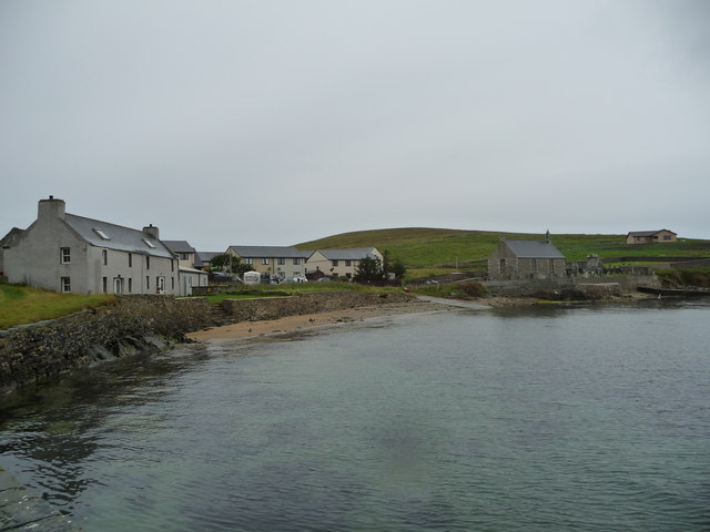
///habits.notes.fixtures. Near Toft, Shetland Islands

Related Wikis

Ollaberry

Ollaberry (Old Norse: Olafrsberg, meaning Olaf's Hill) is a village on Mainland, Shetland, Scotland on the west shore of Yell Sound, 10.9 miles (17.5 km...

Lamba, Shetland

Lamba is an uninhabited island in Yell Sound in Shetland. It lies 1.5 km (0.93 mi) north of the entrance to the Sullom Voe inlet and 1.4 kilometres (0...

Little Roe

Little Roe is an island in Yell Sound in the Shetland Islands == History == The island's name is Norse in origin, from Rauðey Litla, meaning "small red...

Eela Water

Eela Water is a freshwater loch (lake) in Northmavine, part of the mainland of Shetland in Scotland. Besides being a freshwater fishing location, the site...

Northmavine

Northmavine or Northmaven (Old Norse: Norðan Mæfeið, meaning ‘the land north of the Mavis Grind’) is a peninsula in northwest Mainland Shetland in Scotland...

Voe, Northmavine

Voe is a settlement on the Northmavine peninsula of Mainland, Shetland, Scotland. It is at the head of Ronas Voe and just off the A970 road. == Whaling... ==

RAF Sullom Voe

Royal Air Force Sullom Voe or more simply RAF Sullom Voe is a former Royal Air Force station near the village of Brae, in the Shetland Isles of Scotland...

Sullom Voe Terminal

The Sullom Voe Terminal is an oil and gas terminal at Sullom Voe in the Shetland Islands of Scotland. It handles production from oilfields in the North...

Nearby Amenities

Located within 500m of 60.495177,-1.3272192
Seamark Light Category: lower
Seamark Light Character: F
Seamark Light Colour: white
Seamark Light Exhibition: 24h
Seamark Light Height: 39
Seamark Light Range: 19
Seamark Light Reference: A 3822
Seamark Type: light_minor
Source: US NGA Pub. 114. 2011-05-26.
Lat/Long: 60.4962167/-1.3238
Man Made: tower
Tower Type: lighting
Lat/Long: 60.4962002/-1.3238007
The data included in this document is from www.openstreetmap.org. The data is made available under ODbL.

Have you been to Rettoo Baa?

Leave your review of Rettoo Baa below (or comments, questions and feedback).