Point of Virkie
Coastal Feature, Headland, Point in Shetland
Scotland
Point of Virkie

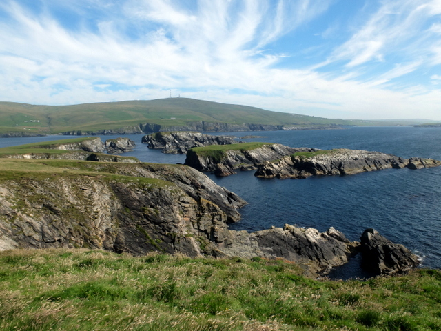
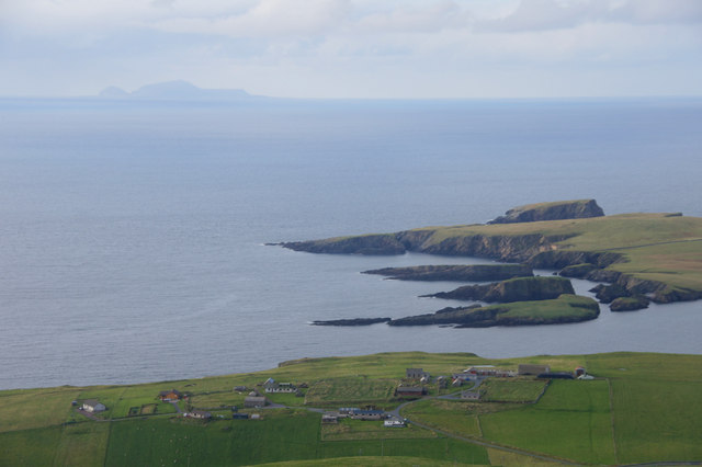
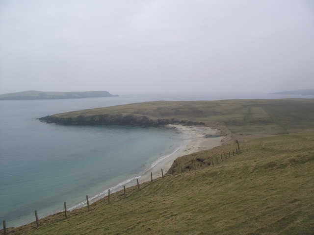
Point of Virkie is a prominent headland located on the southwest coast of Shetland, an archipelago in Scotland. Situated near the village of Virkie, this coastal feature is known for its rugged beauty and dramatic cliffs that overlook the North Atlantic Ocean.
The Point of Virkie stands at an elevation of approximately 50 meters (164 feet) above sea level, making it an ideal vantage point for observing the surrounding coastal landscapes. The headland is composed mainly of sedimentary rocks, including sandstone and shale, which have been shaped over thousands of years by the relentless force of the ocean waves.
One of the most striking features of Point of Virkie is its steep cliffs, which reach heights of up to 75 meters (246 feet) in some areas. These cliffs provide nesting sites for various seabird species, including fulmars, kittiwakes, and razorbills. The surrounding waters are also home to a diverse range of marine life, including seals, dolphins, and various species of fish.
Access to Point of Virkie is relatively easy, with a well-maintained footpath leading from the nearby village to the headland. This path offers stunning views of the coastal scenery, and visitors can also explore the rocky shoreline and sandy beaches that surround the area.
Due to its scenic beauty and rich biodiversity, Point of Virkie is a popular destination for nature enthusiasts, birdwatchers, and photographers. The headland provides a unique opportunity to experience the untamed beauty of Shetland's coastline and to witness the incredible power of the North Atlantic Ocean.
If you have any feedback on the listing, please let us know in the comments section below.
Point of Virkie Images
Images are sourced within 2km of 59.948989/-1.3534036 or Grid Reference HU3618. Thanks to Geograph Open Source API. All images are credited.


Point of Virkie is located at Grid Ref: HU3618 (Lat: 59.948989, Lng: -1.3534036)
Unitary Authority: Shetland Islands
Police Authority: Highlands and Islands
What 3 Words
///bags.sweeten.thud. Near Sandwick, Shetland Islands
Nearby Locations
Related Wikis

Colsay
Colsay is an uninhabited island off the South West coast of Mainland, Shetland. Fora Ness lies to the south, across the Muckle Sound. The highest elevation...

Scousburgh
Scousburgh is a small community in the parish of Dunrossness, in the South Mainland of Shetland, Scotland, overlooking the picturesque Scousburgh Sand...

Lochs of Spiggie and Brow
The Lochs of Spiggie and Brow are located west of Boddam in the parish of Dunrossness, in the South Mainland of Shetland, Scotland, about 6 km north of...

St Ninian's Isle
St Ninian's Isle is a small tied island connected by the largest tombolo in the UK to the south-western coast of the Mainland, Shetland, in Scotland. It...

Dunrossness
Dunrossness, (Old Norse: Dynrastarnes meaning "headland of the loud tide-race", referring to the noise of Sumburgh Roost) is the southernmost parish of...

Bigton
Bigton is a small settlement on South Mainland, Shetland, UK. Bigton is within the civil parish of Dunrossness.Bigton lies on the Atlantic coast of the...

Clumlie Broch
Clumlie Broch is an Iron Age broch located on Mainland, Shetland, in Scotland (grid reference HU40451811). == Location == Clumlie Broch is located in Dunrossness...

Boddam, Shetland
Boddam is a village on the island of Mainland, in Shetland, Scotland. Boddam is an area of Dunrossness in the South Mainland of Shetland. Although Boddam...
Have you been to Point of Virkie?
Leave your review of Point of Virkie below (or comments, questions and feedback).