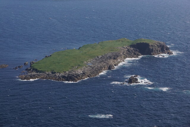
Black Skerry
Coastal Feature, Headland, Point in Shetland
Scotland
Black Skerry
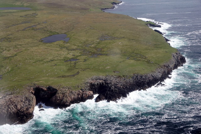
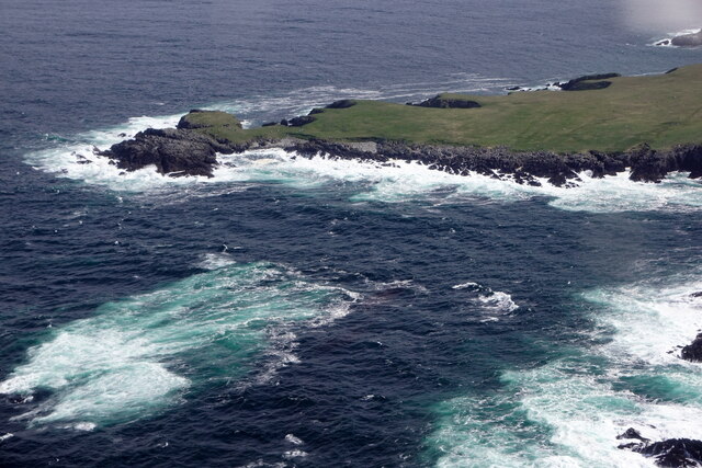
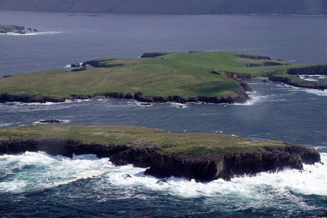
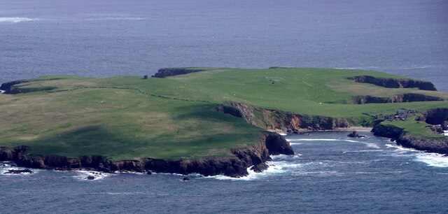
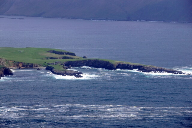
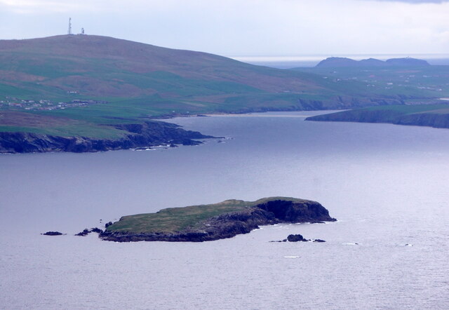
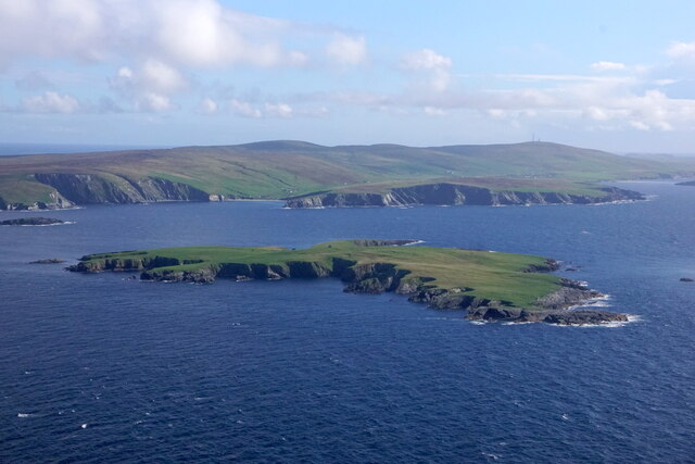
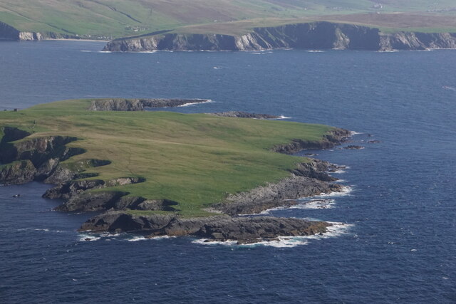
Black Skerry is a prominent coastal feature located in the archipelago of Shetland, Scotland. It is a headland that extends into the North Atlantic Ocean, forming a distinctive point along the coastline. The skerry is situated on the eastern side of the Shetland mainland, near the village of Cunningsburgh.
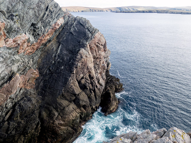
As its name suggests, Black Skerry is characterized by its dark-colored rocky outcrop, which stands out against the surrounding coastal landscape. The skerry is composed of rugged cliffs that rise steeply from the sea, creating an impressive vista for visitors. These cliffs are often battered by the strong winds and waves of the Atlantic, adding to the dramatic nature of the site.
The area surrounding Black Skerry is known for its rich biodiversity. The skerry itself provides important breeding grounds and habitats for various seabird species, including puffins, guillemots, and razorbills. These birds take advantage of the steep cliffs to nest and rear their young, creating a bustling colony during the breeding season.
In addition to its ecological significance, Black Skerry also holds historical and cultural importance. The surrounding region is dotted with archaeological sites, indicating human presence in the area since ancient times. These sites provide evidence of early settlements and activities such as fishing and farming.
Overall, Black Skerry is a captivating coastal feature that combines stunning natural beauty, diverse wildlife, and a rich cultural heritage. Its distinctive dark cliffs and abundant birdlife make it a must-visit destination for nature enthusiasts and history buffs alike.
If you have any feedback on the listing, please let us know in the comments section below.
Black Skerry Images
Images are sourced within 2km of 60.023824/-1.3724857 or Grid Reference HU3526. Thanks to Geograph Open Source API. All images are credited.


Black Skerry is located at Grid Ref: HU3526 (Lat: 60.023824, Lng: -1.3724857)
Unitary Authority: Shetland Islands
Police Authority: Highlands and Islands
What 3 Words
///idea.bill.increases. Near Sandwick, Shetland Islands
Nearby Locations
Related Wikis

Little Havra
Little Havra is a small island off the west of South Mainland in Shetland. It is 35 metres (115 ft) at its highest point, upon which there is a cairn....

South Havra
South Havra (Scots: Sooth Haevra; Old Norse: Hafrey), formerly Hevera, is an uninhabited island in the Scalloway Islands, Shetland, Scotland. == Geography... ==
St Ninian's Isle
St Ninian's Isle is a small tied island connected by the largest tombolo in the UK to the south-western coast of the Mainland, Shetland, in Scotland. It...

West Burra
West Burra is one of the Scalloway Islands, a subgroup of the Shetland Islands in Scotland. It is connected by bridge to East Burra. With an area of 743...

Bigton
Bigton is a small settlement on South Mainland, Shetland, UK. Bigton is within the civil parish of Dunrossness.Bigton lies on the Atlantic coast of the...

Burra, Shetland
Burra (Old Norse: Barrey ) is the collective name for two of the Shetland Islands, West (pop. 753) and East Burra (pop. 66), which are connected by bridge...

Scalloway Islands
The Scalloway Islands are in Shetland opposite Scalloway on south west of the Mainland. They form a mini-archipelago and include: Burra (two islands linked...

Hoswick
Hoswick is a settlement in Sandwick in the south mainland of Shetland, Scotland, on the eastern part of the Dunrossness civil parish. It is separated from...
Have you been to Black Skerry?
Leave your review of Black Skerry below (or comments, questions and feedback).