Bearwood

Settlement in Herefordshire

England

Bearwood

Bottles inside the Bottle Grotto at Westonbury Mill Gardens My maternal grandfather took a series of photographs inside the bottle grotto at Westonbury Mill Gardens, and here is one them. Speaking of which, my most viewed photograph on Geograph is the exterior of the bottle grotto at 723 views <a href="https://www.geograph.org.uk/photo/6432382">SO3656 : Bottle Grotto at Westonbury Mill Gardens</a>, taken on the same day as this photograph.
Bottles inside the Bottle Grotto at Westonbury Mill Gardens Credit: Brian Kemp (1945-2022)

Bearwood is a small village located in the county of Herefordshire, England. Situated approximately 4 miles southwest of the market town of Leominster, Bearwood is nestled within the picturesque countryside of the county. It is a predominantly rural area with a population of around 200 residents.

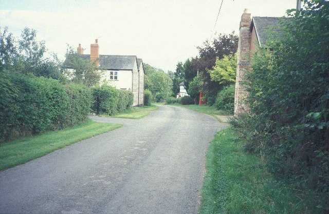
The village is known for its charming and tranquil atmosphere, offering residents and visitors a peaceful escape from the hustle and bustle of city life. Surrounded by lush green fields and rolling hills, Bearwood provides ample opportunities for outdoor activities such as walking, cycling, and horseback riding.

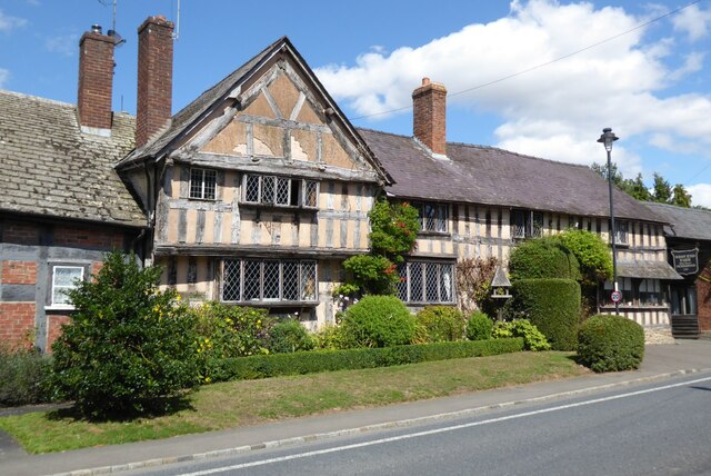
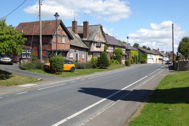
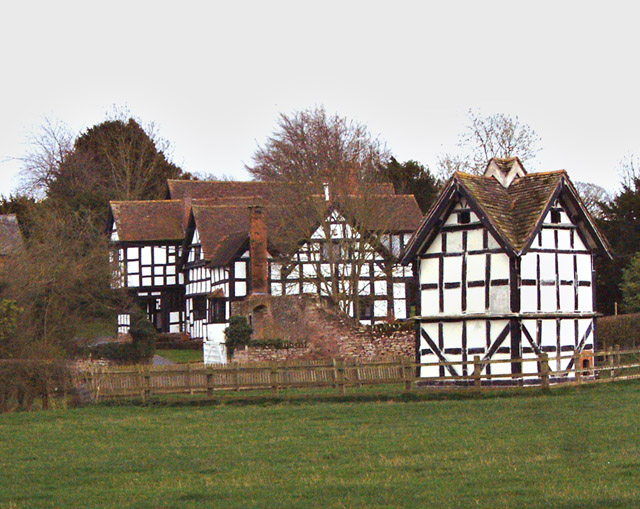
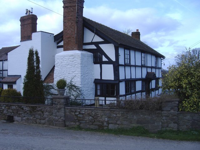
Architecturally, Bearwood is characterized by a mix of traditional and modern buildings. There are several old stone cottages that have been beautifully preserved, adding to the village's charm and character. The local church, St. Leonard's, is a prominent landmark in the area and has a rich history dating back several centuries.

Although Bearwood is a small village, it benefits from a strong sense of community. The villagers often come together for various events and celebrations, fostering a friendly and welcoming atmosphere. The village also has a primary school, providing education to the local children.

In terms of amenities, Bearwood has a village hall that serves as a meeting place for various community groups and events. For shopping and other services, residents typically rely on nearby Leominster, which offers a wider range of facilities including supermarkets, shops, and healthcare services.

Overall, Bearwood offers a peaceful and idyllic rural living experience, making it an attractive place for those seeking a slower pace of life in the heart of Herefordshire's beautiful countryside.

If you have any feedback on the listing, please let us know in the comments section below.

Bearwood Images

Images are sourced within 2km of 52.200852/-2.9060744 or Grid Reference SO3856. Thanks to Geograph Open Source API. All images are credited.
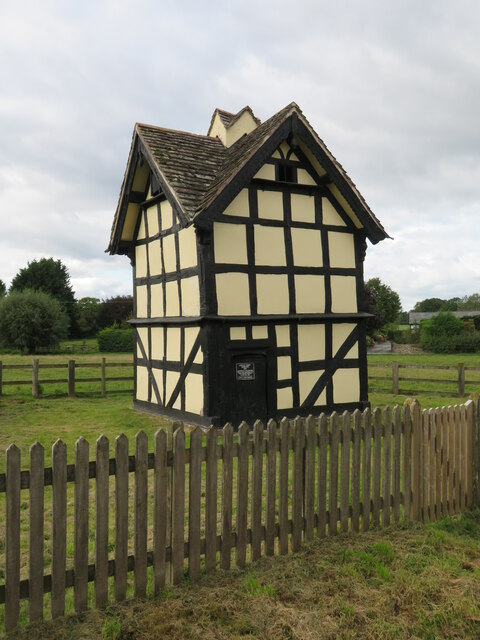
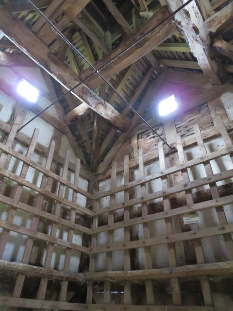
Bottles inside the Bottle Grotto at Westonbury Mill Gardens My maternal grandfather took a series of photographs inside the bottle grotto at Westonbury Mill Gardens, and here is one them. Speaking of which, my most viewed photograph on Geograph is the exterior of the bottle grotto at 723 views <a href="https://www.geograph.org.uk/photo/6432382">SO3656 : Bottle Grotto at Westonbury Mill Gardens</a>, taken on the same day as this photograph.
Bottles inside the Bottle Grotto at Westonbury Mill Gardens
My maternal grandfather took a series of photographs inside the bottle grotto at Westonbury Mill Gardens, and here is one them. Speaking of which, my most viewed photograph on Geograph is the exterior of the bottle grotto at 723 views SO3656 : Bottle Grotto at Westonbury Mill Gardens, taken on the same day as this photograph.
West End Farmhouse West End Farmhouse in Pembridge.  This timber-framed house may date back to the 14th century; the house is Grade II listed, see: <span class="nowrap"><a title="https://historicengland.org.uk/listing/the-list/list-entry/1301087?section=official-list-entry" rel="nofollow ugc noopener" href="https://historicengland.org.uk/listing/the-list/list-entry/1301087?section=official-list-entry">Link</a><img style="margin-left:2px;" alt="External link" title="External link - shift click to open in new window" src="https://s1.geograph.org.uk/img/external.png" width="10" height="10"/></span>
West End Farmhouse
West End Farmhouse in Pembridge. This timber-framed house may date back to the 14th century; the house is Grade II listed, see: LinkExternal link
The A44 entering Pembridge The A44 entering Pembridge from the west.
The A44 entering Pembridge
The A44 entering Pembridge from the west.
Luntley dovecote What a fabulous little building. Timber framed and dating from 1673 with a door from that period. Grade II listed and a little gem.
Luntley dovecote
What a fabulous little building. Timber framed and dating from 1673 with a door from that period. Grade II listed and a little gem.
Luntley dovecote interior An interesting interior to this 17thC dovecote with some original timberwork and some which is obviously much newer.
Luntley dovecote interior
An interesting interior to this 17thC dovecote with some original timberwork and some which is obviously much newer.
Timber Framed Threshing Barn at Court House <span class="nowrap"><a title="https://historicengland.org.uk/listing/the-list/list-entry/1301098?section=official-list-entry" rel="nofollow ugc noopener" href="https://historicengland.org.uk/listing/the-list/list-entry/1301098?section=official-list-entry">Link</a><img style="margin-left:2px;" alt="External link" title="External link - shift click to open in new window" src="https://s1.geograph.org.uk/img/external.png" width="10" height="10"/></span>
Timber Framed Threshing Barn at Court House
Pembridge Church and Belfry from the S
Pembridge Church and Belfry
from the S
Luntley Manor and Dovecote Fans of Watercolour Challenge will recognise the dovecote as the one painted on the programme a few years ago.
Luntley Manor and Dovecote
Fans of Watercolour Challenge will recognise the dovecote as the one painted on the programme a few years ago.
West End Farm, Pembridge, Herefordshire
Bearwood The main street, looking south-east
Bearwood
The main street, looking south-east
Pembridge, Market Hall and New Inn. The New Inn dates from the 1600s and faces onto Pembridge's mediaeval village square.
Pembridge, Market Hall and New Inn.
The New Inn dates from the 1600s and faces onto Pembridge's mediaeval village square.
Pembridge, Church Belfry. This old building dates from the early 13th Century and has low stone walls and a wooden tower. The main posts of the belltower have been tree-ring dated to 1207-16 Detached from the church, it could have seen use as a defensive point for villagers.
[additional date information - thanks, Duncan James].
Pembridge, Church Belfry.
This old building dates from the early 13th Century and has low stone walls and a wooden tower. The main posts of the belltower have been tree-ring dated to 1207-16 Detached from the church, it could have seen use as a defensive point for villagers. [additional date information - thanks, Duncan James].
Dunkertons cider mill Orchard, cider pressing, brewing and shop all on the road south out of Pembridge.
Dunkertons cider mill
Orchard, cider pressing, brewing and shop all on the road south out of Pembridge.
Lower Bearwood Houses East of the crossroad, on the road from Lower Bearwood to Upper Hardwick.
Lower Bearwood
Houses East of the crossroad, on the road from Lower Bearwood to Upper Hardwick.
Barns and sheds Farm buildings on the road from Lower Bearwood to Upper Hardwick.
Barns and sheds
Farm buildings on the road from Lower Bearwood to Upper Hardwick.
Entering Pembridge from the direction of Kington
A typical house within Pembridge
Tibhall farm Located west of Dilwyn.
Tibhall farm
Located west of Dilwyn.
Show me another place!

Bearwood is located at Grid Ref: SO3856 (Lat: 52.200852, Lng: -2.9060744)

Unitary Authority: County of Herefordshire

Police Authority: West Mercia

What 3 Words

///reply.issue.worms. Near Weobley, Herefordshire

Nearby Locations

Bearwood

Related Wikis

Pembridge

Pembridge is a village and civil parish in the Arrow valley in Herefordshire, England. The village is on the A44 road about 6 miles (10 km) east of Kington...

Pembridge railway station

Pembridge railway station was a station in Pembridge, Herefordshire, England. The station was opened in 1856 and closed in 1955. The station was located...

Marston Halt railway station

Marston Halt railway station was a station in Marston, Herefordshire, England. The station was opened in 1856 and closed in 1955. The station was located...

Dilwyn

Dilwyn is a village in Herefordshire, England located about 18 km (11 mi) from the city of Hereford and 9 km (6 mi) from its nearest town, Leominster....

Nearby Amenities

Located within 500m of 52.200852,-2.9060744
Bus Stop
Luntley Turn
Naptan AtcoCode: 2090A140700
Naptan Bearing: NE
Naptan BusStopType: CUS
Naptan CommonName: Luntley Turn
Naptan Indicator: adj
Naptan Landmark: N/K
Naptan NaptanCode: heragdjp
Naptan Street: N/K
Naptan Verified: no
Source: naptan_import
Lat/Long: 52.2009182/-2.9058946
Bus Stop
Luntley Turn
Naptan AtcoCode: 2090A18893
Naptan Bearing: SW
Naptan BusStopType: CUS
Naptan CommonName: Luntley Turn
Naptan Indicator: opp
Naptan Landmark: N/K
Naptan NaptanCode: herajgpa
Naptan Street: N/K
Naptan Verified: no
Source: naptan_import
Lat/Long: 52.2009669/-2.9059601
Bearwood
Is In: Herefordshire,England,UK
Place: village
Lat/Long: 52.2000936/-2.9046255
Public Transport: stop_position
Lat/Long: 52.2009444/-2.905924
The data included in this document is from www.openstreetmap.org. The data is made available under ODbL.

Have you been to Bearwood?

Leave your review of Bearwood below (or comments, questions and feedback).