Black Score
Coastal Feature, Headland, Point in Northumberland
England
Black Score

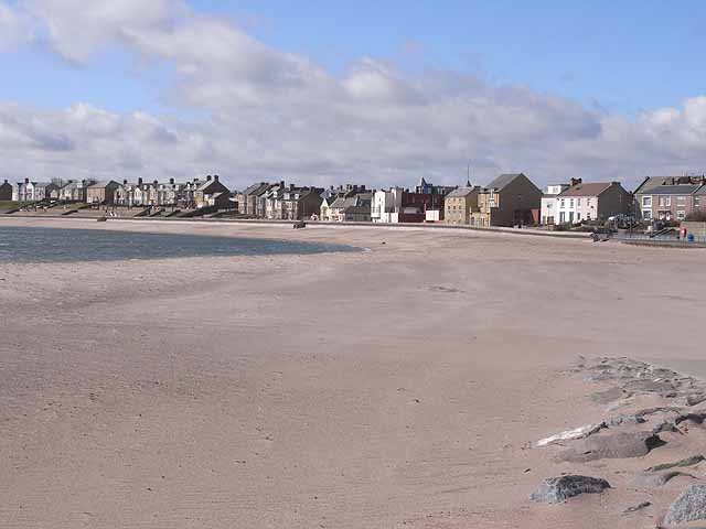
Black Score is a prominent coastal feature located in Northumberland, England. It is a headland that juts out into the North Sea, forming a point of land that extends into the water. The name "Black Score" derives from the Old English words "blæc" meaning black and "scoer" meaning cutting or gully, referring to the dark cliffs and gorges that characterize the area.
The headland is known for its rugged and dramatic landscape, with steep cliffs towering above the sea. These cliffs are composed of sedimentary rocks, such as limestone and sandstone, which have been eroded over thousands of years by the relentless force of waves crashing against them. As a result, the cliffs display a variety of geological features, including caves, arches, and stacks.
The area surrounding Black Score is rich in biodiversity, with a diverse array of flora and fauna. The cliffs provide nesting sites for numerous seabird species, such as guillemots, puffins, and kittiwakes, making it a popular spot for birdwatching enthusiasts. The coastal waters surrounding the headland are also home to a diverse range of marine life, including seals, dolphins, and various species of fish.
Black Score offers breathtaking panoramic views of the North Sea and the surrounding coastline. It is a popular destination for nature lovers, hikers, and photographers, who are drawn to its natural beauty and unique geological formations. The headland is accessible via a footpath that winds along the cliff tops, allowing visitors to explore the area and admire its stunning vistas.
If you have any feedback on the listing, please let us know in the comments section below.
Black Score Images
Images are sourced within 2km of 55.174415/-1.5135075 or Grid Reference NZ3186. Thanks to Geograph Open Source API. All images are credited.


Black Score is located at Grid Ref: NZ3186 (Lat: 55.174415, Lng: -1.5135075)
Unitary Authority: Northumberland
Police Authority: Northumbria
What 3 Words
///twitchy.graph.dusty. Near Newbiggin-by-the-Sea, Northumberland
Nearby Locations
Related Wikis
Newbiggin-by-the-Sea
Newbiggin-by-the-Sea is a seaside town and civil parish in Northumberland, England, located on the North Sea coast. The town is a fishing port and formerly...

Newbiggin-by-the-Sea railway station
Newbiggin-by-the-Sea railway station, also referred to as Newbiggin station, served the town of Newbiggin-by-the-Sea, Northumberland, England from 1872...

St Bartholomew's Church, Newbiggin-by-the-Sea
St Bartholomew's Church, Newbiggin-by-the-sea is the parish church of Newbiggin-by-the-Sea, Tyne and Wear, England. The building is part of the Diocese...
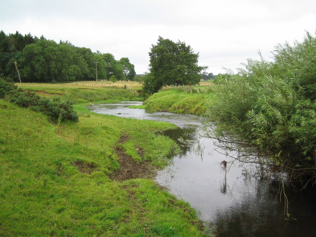
River Wansbeck
The River Wansbeck runs through the county of Northumberland, England. It rises above Sweethope Lough on the edge of Fourlaws Forest in the area known...
NCEA Duke's Secondary School
The NCEA Duke's Secondary School is an 11–19 academy in Ashington, Northumberland, England. It is part of the Northumberland Church of England Trust occupying...

Woodhorn
Woodhorn is a village and former civil parish, now in the parish of Newbiggin by the Sea, in Northumberland, England, about 2 miles (3 km) east of Ashington...
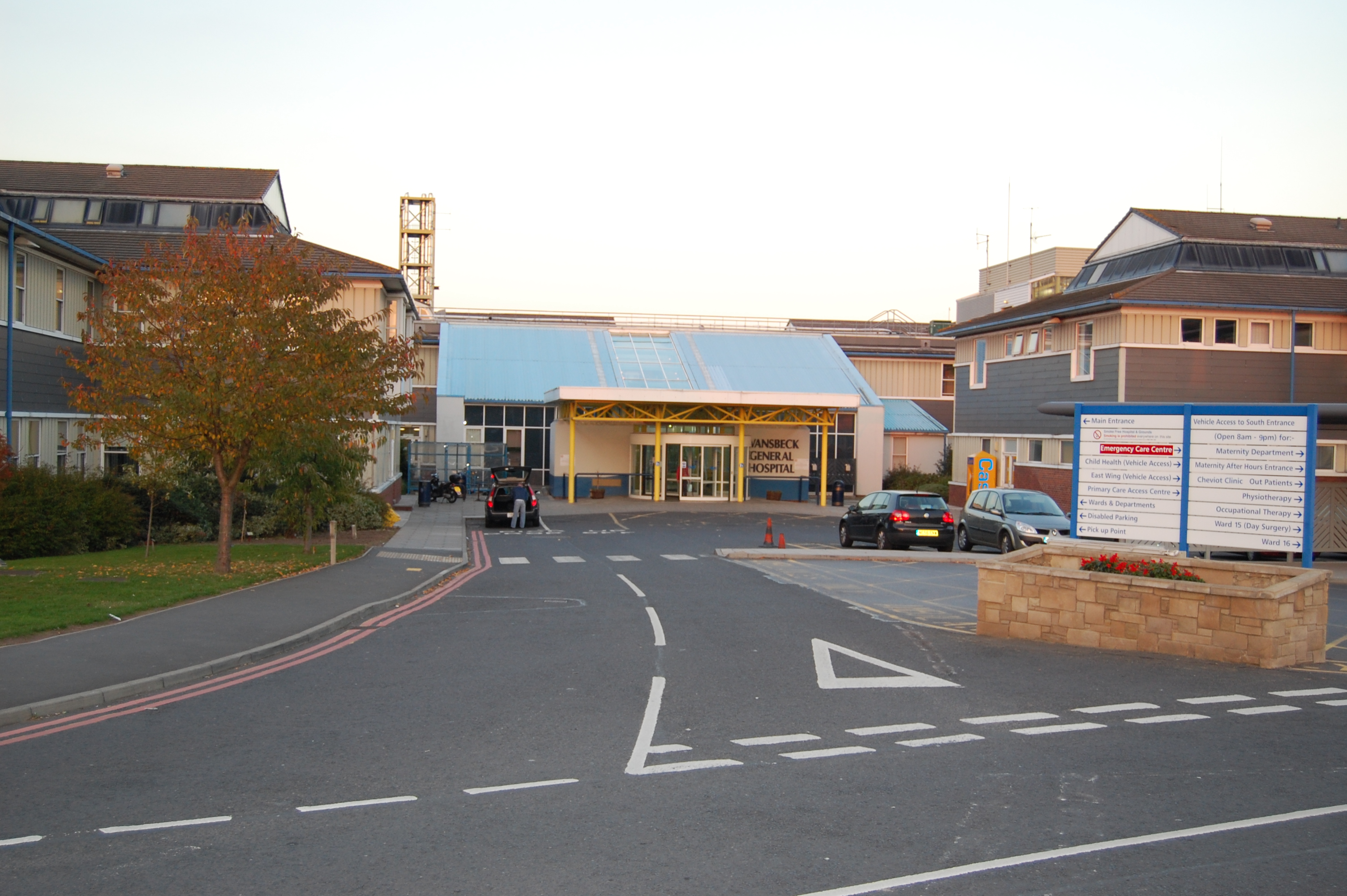
Wansbeck General Hospital
Wansbeck General Hospital is a district general hospital based in Ashington, Northumberland, England. It is managed by Northumbria Healthcare NHS Foundation...
Ashington A.F.C.
Ashington Association Football Club is a football club based in Ashington, Northumberland, England. They are currently members of the Northern Premier...
Nearby Amenities
Located within 500m of 55.174415,-1.5135075Have you been to Black Score?
Leave your review of Black Score below (or comments, questions and feedback).