Big-nev Geo
Coastal Feature, Headland, Point in Shetland
Scotland
Big-nev Geo

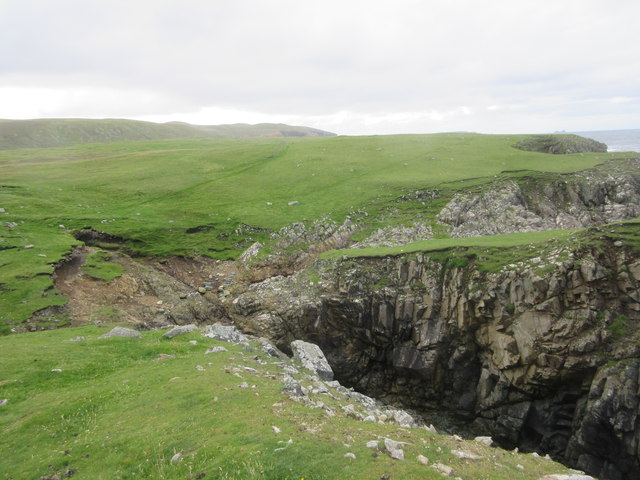
Big-nev Geo is a prominent coastal feature located on the island of Shetland, situated in the northernmost part of Scotland. It is classified as a headland or point due to its distinctive shape and protrusion into the North Sea. The name "geo" is a term used in Shetland to describe narrow inlets or coves along the rugged coastline.
Big-nev Geo is characterized by steep cliffs, rising several meters above sea level, which provide breathtaking panoramic views of the surrounding area. The cliffs are formed from layers of sedimentary rock, showcasing the geological history of the region. The exposed rock formations display a variety of colors, ranging from shades of gray to deep red and brown, adding to the visual appeal of this coastal feature.
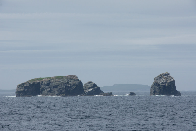
The area surrounding Big-nev Geo is known for its diverse wildlife. Seabirds such as puffins, guillemots, and razorbills can often be spotted nesting and diving in the waters below. The surrounding seas are also home to seals, dolphins, and occasionally even whales, making it a popular spot for wildlife enthusiasts and photographers.
Access to Big-nev Geo is typically gained by foot, as it is not easily reachable by road. Visitors can embark on a scenic coastal hike, following well-marked trails that lead to the headland. The journey offers opportunities to enjoy the untouched natural beauty of Shetland, with stunning views of the rugged coastline and the vast expanse of the North Sea.
Overall, Big-nev Geo is a captivating coastal feature that showcases the dramatic beauty of Shetland's landscape. Its towering cliffs, vibrant rock formations, and abundant wildlife make it a must-visit destination for nature lovers and those seeking a unique coastal experience.
If you have any feedback on the listing, please let us know in the comments section below.
Big-nev Geo Images
Images are sourced within 2km of 60.616646/-1.4356791 or Grid Reference HU3092. Thanks to Geograph Open Source API. All images are credited.


Big-nev Geo is located at Grid Ref: HU3092 (Lat: 60.616646, Lng: -1.4356791)
Unitary Authority: Shetland Islands
Police Authority: Highlands and Islands
What 3 Words
///digit.masterful.indoor. Near Ulsta, Shetland Islands
Nearby Locations
Related Wikis

Uyea, Northmavine
Uyea (Scots: Öya in Shetland dialect spelling) is an uninhabited tidal island located to the northwest of Mainland, Shetland. Uyea lies off the Northmavine...

North Roe
North Roe is a village, and protected area at the northern tip in the large Northmavine peninsula of the Mainland of Shetland, Scotland. It is a small...

Fethaland
Fethaland or Fedeland (pronounced [ˈfeɪdələnd]) is an abandoned settlement at the extreme north end of Mainland, Shetland. It was the site of the largest...

Lang Ayre
The Lang Ayre is a beach on the west side of Ronas Hill, Northmavine, Shetland. At 1 kilometre (0.6 mi) in length it is the archipelago's longest. It is...

Gruney
Gruney is a small, uninhabited island in Shetland, Scotland. It lies north of the Northmavine peninsula of the Shetland Mainland, from which it is separated...
Ramna Stacks
The Ramna Stacks are a group of skerries in the Shetland islands. They are north of the northern tip of Mainland, and along with nearby Gruney they are...

Ronas Hill
Ronas Hill (or Rönies Hill) is a hill in Shetland, Scotland. It is classed as a Marilyn, and is the highest point in the Shetland Islands at an elevation...
Have you been to Big-nev Geo?
Leave your review of Big-nev Geo below (or comments, questions and feedback).