Caversham, Lower

Settlement in Oxfordshire

England

Caversham, Lower

Banksfoot, Church Road, Caversham An 18th century grade II listed building.
Banksfoot, Church Road, Caversham Credit: Robin Webster

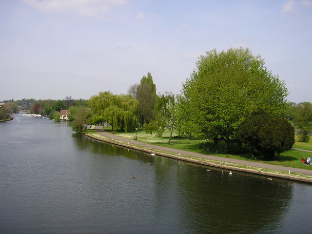
Caversham, Lower is a small village situated in Oxfordshire, England. Located about 4 miles north of the historical town of Oxford, Caversham is situated on the banks of the River Thames. With a population of around 7,000 residents, it is considered a peaceful and picturesque place to live.

The village itself is steeped in history, with records dating back to the Domesday Book of 1086. It was historically part of Berkshire until boundary changes in the 1970s transferred it to Oxfordshire. Caversham is known for its charming old buildings, including St Peter's Church which dates back to the 12th century.

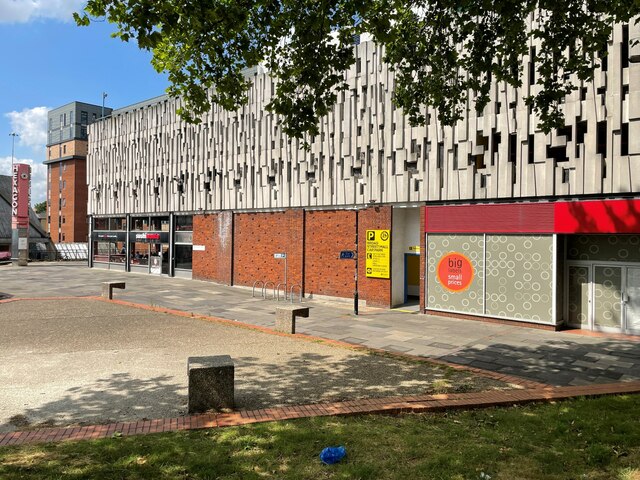
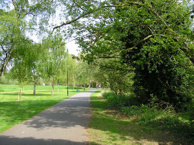
Caversham offers a range of amenities to its residents. The village has a number of local shops, including a grocery store and a post office, providing convenient access to everyday necessities. There are also several pubs and restaurants, offering a variety of dining options. For recreational activities, Caversham is surrounded by beautiful countryside, providing opportunities for walking, cycling, and enjoying the outdoors.

Transport links in Caversham are excellent. The village has its own railway station, which provides regular services to Oxford and London. Additionally, there are several bus routes that connect Caversham to nearby towns and villages.

Overall, Caversham, Lower is a charming and historic village in Oxfordshire, offering a peaceful and picturesque environment for its residents. With its rich history, amenities, and excellent transport links, it is a desirable place to live for those seeking a combination of tranquility and convenience.

If you have any feedback on the listing, please let us know in the comments section below.

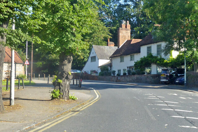
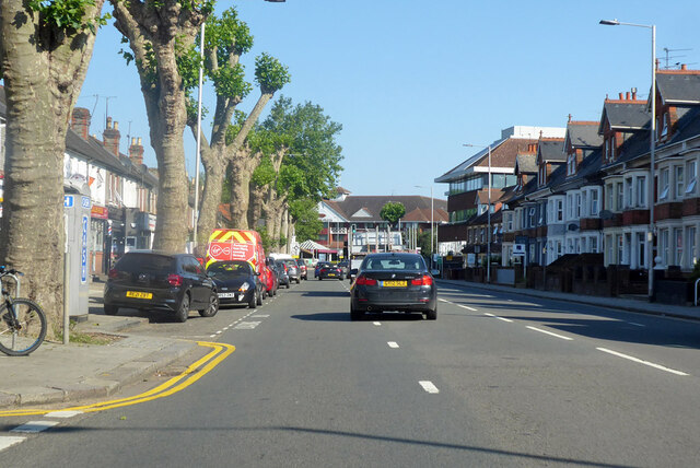
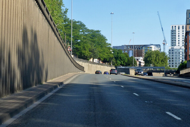
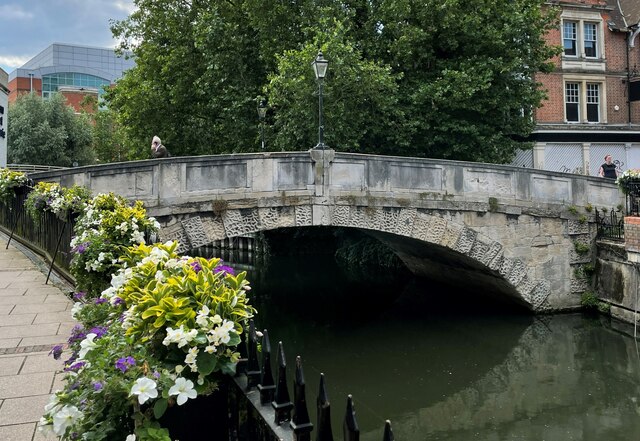
Caversham, Lower Images

Images are sourced within 2km of 51.4654/-0.962252 or Grid Reference SU7274. Thanks to Geograph Open Source API. All images are credited.

Banksfoot, Church Road, Caversham An 18th century grade II listed building.
Banksfoot, Church Road, Caversham
An 18th century grade II listed building.
A4155 Caversham Road, Reading Heading for the bridge over the Thames.
A4155 Caversham Road, Reading
Heading for the bridge over the Thames.
A329 Inner Distributor Road, Reading Heading north through the centre of town.
A329 Inner Distributor Road, Reading
Heading north through the centre of town.
Major road junction, Reading Looking from the A33 from the south, which joins the A329 Inner Distributor Road here.
Major road junction, Reading
Looking from the A33 from the south, which joins the A329 Inner Distributor Road here.
Duke Street bridge This photo was taken as part of a personal project to try and recreate 'Firsts' for the grid squares that I visit. In this case the first image submitted was by Brendan and Ruth McCartney 16 years ago. See <a href="https://www.geograph.org.uk/photo/183">SU7173 : Duke Street Bridge, River Kennet, Reading</a>.
Duke Street bridge
This photo was taken as part of a personal project to try and recreate 'Firsts' for the grid squares that I visit. In this case the first image submitted was by Brendan and Ruth McCartney 16 years ago. See SU7173 : Duke Street Bridge, River Kennet, Reading.
The Boundary - St Mary's Butts Until recently this was known as "The Pavlovs Dog". This was closed permanently, probably due to the restricted trading laws during the Covid-19 pandemic.

The building itself has changed little over the past 55 years, see <a href="https://www.geograph.org.uk/photo/6436560">SU7173 : Reading trolleybus 150 turning in St Mary's Butts, 1966</a>.
The Boundary - St Mary's Butts
Until recently this was known as "The Pavlovs Dog". This was closed permanently, probably due to the restricted trading laws during the Covid-19 pandemic. The building itself has changed little over the past 55 years, see SU7173 : Reading trolleybus 150 turning in St Mary's Butts, 1966.
Hosier Street
Hosier Street
View east along Hosier Street
Once a nightclub Information about this former nightclub on the "Get Reading" website provides a somewhat chequered history. I quote "A nightclub in Reading town centre which closed after years of problems with drugs and violence... The club closed in September (2017) after losing its licence due to two major police incidents and drug problems. The club, which has also been known as Bar Mango, Zeus Bar and Club 20, had a history of problems with crime. One incident was a mass brawl in July (2017) last year where a man was slashed with what police say was a weapon.
The final straw was an incident of mass disorder on in the early hours of Saturday, August 5, (2017) where St Mary's Butts had to be closed due to the trouble."
Once a nightclub
Information about this former nightclub on the "Get Reading" website provides a somewhat chequered history. I quote "A nightclub in Reading town centre which closed after years of problems with drugs and violence... The club closed in September (2017) after losing its licence due to two major police incidents and drug problems. The club, which has also been known as Bar Mango, Zeus Bar and Club 20, had a history of problems with crime. One incident was a mass brawl in July (2017) last year where a man was slashed with what police say was a weapon. The final straw was an incident of mass disorder on in the early hours of Saturday, August 5, (2017) where St Mary's Butts had to be closed due to the trouble."
View east along Hosier Street Note the market stall frames. See also <a href="https://www.geograph.org.uk/photo/1353825">SU7173 : Hosier Street market</a>.
View east along Hosier Street
Note the market stall frames. See also SU7173 : Hosier Street market.
Broad Street Mall (rear entrance)
Eva's and Hosier Street See also <a href="https://www.geograph.org.uk/photo/6923939">SU7173 : Once a nightclub</a>.
Eva's and Hosier Street
Wasteland by Hosier Street
Exterior of Broad Street Mall
Unnamed access road to private car park Note the art work to the right, see <a href="https://www.geograph.org.uk/photo/1163623">SU7173 : Plaque underneath Cartwheeling Boy mural</a>.
Unnamed access road to private car park
Note the art work to the right, see SU7173 : Plaque underneath Cartwheeling Boy mural.
Exterior of Broad Street Mall The path is known as Düsseldorf Way.
Exterior of Broad Street Mall
The path is known as Düsseldorf Way.
Exterior of Broad Street Mall
The Hexagon Theatre
The Hexagon Theatre
Show me another place!

Caversham, Lower is located at Grid Ref: SU7274 (Lat: 51.4654, Lng: -0.962252)

Unitary Authority: Reading

Police Authority: Thames Valley

What 3 Words

///tender.judges.villa. Near Reading, Berkshire

Related Wikis

Lower Caversham

Lower Caversham is an area of the former town of Caversham, in the English county of Berkshire (formerly Oxfordshire). Today this is itself a suburb of...

Heron Island, Berkshire

Heron Island is a small island near Caversham Lock, on the north bank of the River Thames at Reading, Berkshire in England. The island has private riverside...

View Island

View Island is a small island near Caversham Lock, on the River Thames at Reading, Berkshire in England.View Island forms part of a series of riverside...

Hills Meadow

Hills Meadow is a park in Reading, Berkshire, England, located next to the River Thames. It stretches along the north (Caversham) side of the river, to...
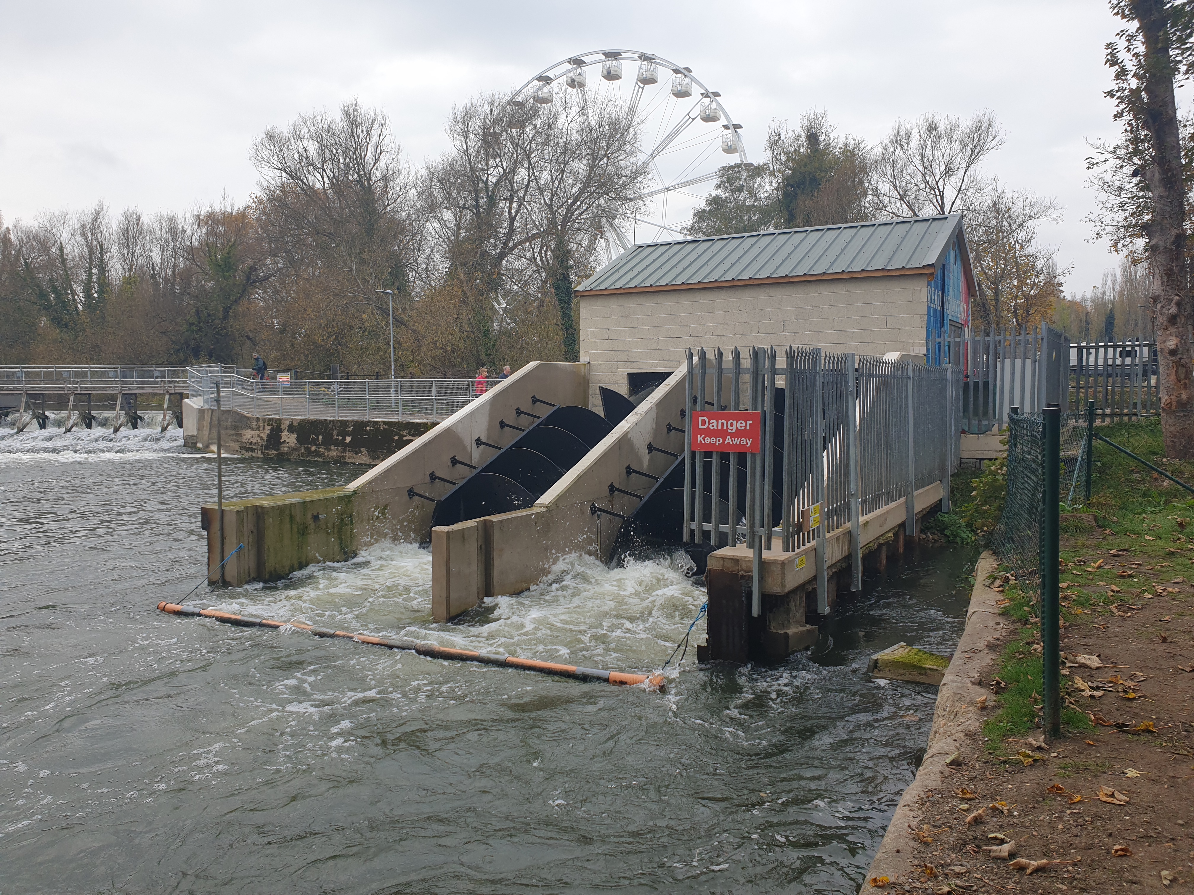
Reading Hydro

Reading Hydro is a micro hydroelectric scheme in Reading, England. It is located on the River Thames, at the upstream end of View Island and using the...

Christchurch Meadows, Reading

Christchurch Meadows is a park in Reading, Berkshire, England, located next to the River Thames. It stretches along the north (Caversham) side of the river...

Caversham Lock

Caversham Lock is a lock and main weir on the River Thames in England at Reading, Berkshire. Both the lock and main weir are connected to De Bohun Island...

King's Meadow, Reading

King's Meadow is a park in Reading, Berkshire, England, located next to the River Thames. It stretches from the Coal Woodland (so-called because it used...

Nearby Amenities

Located within 500m of 51.4654,-0.962252
Mini Roundabout
Direction: clockwise
Lat/Long: 51.4653512/-0.9593004
Traffic Calming: hump
Lat/Long: 51.4682336/-0.9648622
Barrier: bollard
Bicycle: yes
Bollard: fixed
Foot: yes
Motor Vehicle: yes
Lat/Long: 51.4651519/-0.9623274
Give Way
Direction: forward
Lat/Long: 51.4648573/-0.9624133
Caversham
Is In Country: United Kingdom
Is In County: Berkshire
Note: Renamed place tag to stop this appearing on the map in this location
Place Historic-not-current: suburb
Source: npe
Lat/Long: 51.4672572/-0.9611719
Traffic Calming: island
Lat/Long: 51.4684795/-0.9593549
Traffic Calming: island
Lat/Long: 51.4686542/-0.9592271
Turning Circle
Turning Circle: knuckle
Lat/Long: 51.4678488/-0.9563537
Crossing
Crossing: unmarked
Crossing Markings: no
Traffic Calming: table
Lat/Long: 51.4661306/-0.9567719
Turning Circle
Lat/Long: 51.4655087/-0.9552088
Barrier: bollard
Bollard: fixed
Motor Vehicle: no
Lat/Long: 51.4642287/-0.9621683
Turning Circle
Turning Circle: knuckle
Lat/Long: 51.4692406/-0.9599519
Mini Roundabout
Direction: clockwise
Lat/Long: 51.4641418/-0.9578197
Mini Roundabout
Lat/Long: 51.4685506/-0.9591631
The Co-operative Food
Addr City: Reading
Addr Housenumber: 100
Addr Postcode: RG4 5BB
Addr Street: South View Avenue
Brand: The Co-operative Food
Brand Wikidata: Q107617274
Opening Hours: Mo-Su 06:00-22:00
Operator: The Co-operative Group
Operator Wikidata: Q117202
Shop: convenience
Website: https://www.coop.co.uk/store-finder/RG4-5BB/100-south-view-avenue
Lat/Long: 51.4682598/-0.9591717
Barrier: bollard
Bicycle: yes
Foot: yes
Lat/Long: 51.4676784/-0.9587336
Traffic Calming: hump
Lat/Long: 51.4669786/-0.9656362
No Magnolia Productions
Addr City: Reading
Addr Housename: Unit 3A
Addr Housenumber: 1
Addr Postcode: RG4 5BY
Addr Street: Paddock Road
Office: company
Opening Hours: Mo-Fr 09:00-18:00
Phone: +44 118 324 3500
Website: https://nomagnolia.tv/
Lat/Long: 51.4640363/-0.957281
Bus Stop
Star Inn
Bench: yes
Bin: yes
Bus: yes
Lit: yes
Naptan AtcoCode: 039027360001
Naptan NaptanCode: rdgdmwj
Public Transport: platform
Shelter: yes
Tactile Paving: no
Lat/Long: 51.4679741/-0.9594978
Recycling
Recycling Batteries: no
Recycling Books: no
Recycling Cans: no
Recycling Cardboard: no
Recycling Cartons: no
Recycling Clothes: yes
Recycling Electrical Appliances: no
Recycling Glass Bottles: yes
Recycling Green Waste: no
Recycling Magazines: no
Recycling Newspaper: no
Recycling Paper: no
Recycling Paper Packaging: no
Recycling Scrap Metal: no
Recycling Shoes: yes
Recycling Small Appliances: no
Recycling Waste: no
Recycling Wood: no
Recycling Type: container
Lat/Long: 51.4681737/-0.9589468
Post Box
Collection Times: Mo-Fr 09:00, Sa 07:00
Mapillary: 551166456149417
Operator: Royal Mail
Post Box Mounting: brick_pillar
Post Box Type: wall
Ref: RG4 171D
Royal Cypher: GVIR
Royal Cypher Wikidata: Q33102169
Survey Date: 2021-09-08
Lat/Long: 51.4652478/-0.9590638
Alison Hair
Phone: +44 118 947 2540
Shop: hairdresser
Lat/Long: 51.46627/-0.9689319
Corner Store
Addr Housenumber: 228
Addr Street: Gosbrook Road
Shop: convenience
Lat/Long: 51.466082/-0.9657747
Londis
Branch: Gosbrook Road
Brand: Londis
Brand Wikidata: Q21008564
Opening Hours: Mo-Fr 07:30-22:30; Sa 08:00-22:30; Su 08:00-22:00
Shop: convenience
Wheelchair: yes
Lat/Long: 51.4657746/-0.9633416
Bus Stop
Washington Road
Bench: no
Bin: no
Bus: yes
Lit: yes
Naptan AtcoCode: 039027680001
Naptan NaptanCode: rdgdtdt
Public Transport: platform
Shelter: no
Tactile Paving: no
Lat/Long: 51.4658625/-0.9647907
Bus Stop
Westfield Road
Bench: yes
Bin: yes
Bus: yes
Lit: yes
Naptan AtcoCode: 039027770002
Naptan NaptanCode: rdgdtmd
Public Transport: platform
Shelter: yes
Tactile Paving: no
Lat/Long: 51.4664824/-0.9689993
Post Box
Collection Times: Mo-Fr 09:00, Sa 07:00
Operator: Royal Mail
Operator Wikidata: Q638098
Post Box Type: wall
Ref: RG4 429D
Royal Cypher: GR
Royal Cypher Wikidata: Q33102273
Lat/Long: 51.4684671/-0.9620912
Bus Stop
Montague Street
Bench: no
Bin: no
Bus: yes
Lit: yes
Naptan AtcoCode: 039026720001
Naptan NaptanCode: rdgdawm
Public Transport: platform
Shelter: no
Tactile Paving: no
Lat/Long: 51.4658791/-0.9593696
Londis
Brand: Londis
Brand Wikidata: Q21008564
Opening Hours: Mo-Su 06:00-22:00
Operator: Motor Fuel Group
Operator Website: https://www.motorfuelgroup.com/locations/thames-valley-fs378/
Operator Wikidata: Q107271358
Phone: +44 118 947 9156
Shop: convenience
Website: https://www.londis.co.uk/our-stores/shell-thames-valley-service-station
Lat/Long: 51.4639415/-0.9656449
Car Rental
1st Reading Van Hire
Email: info@1streadingvanhire.co.uk
Facebook: https://www.facebook.com/pages/1st-Reading-Van-Hire/229753260545543
Phone: +44 118 9472007
Website: https://www.1streadingvanhire.co.uk/
Lat/Long: 51.4641645/-0.9652747
Fast Food
Good Old Days Hong Kong Cuisine Ltd.
Cuisine: chinese
Phone: 07840 180080
Lat/Long: 51.4648543/-0.9662021
Relax Massage Centre
Shop: massage
Website: http://www.relaxmassagecentre.co.uk/
Lat/Long: 51.465041/-0.9659379
CJ Barbers
Shop: hairdresser
Lat/Long: 51.4651555/-0.9659439
Whitings Buchers
Shop: butcher
Lat/Long: 51.4647227/-0.9622934
Entrance: yes
Lat/Long: 51.4642983/-0.9617051
Berendsen
Phone: +44 118 948 3838
Shop: laundry
Website: https://www.berendsen.co.uk/
Lat/Long: 51.4645123/-0.9663
Power: transformer
Lat/Long: 51.4654658/-0.9599599
Power: transformer
Lat/Long: 51.4660344/-0.9686449
Crossing
Crossing: uncontrolled
Crossing Markings: zebra
Lat/Long: 51.4659023/-0.966304
Caversham Coachworks
Shop: car_repair
Website: https://cavcoach.co.uk/
Lat/Long: 51.4649641/-0.9605058
Waste Basket
Waste: trash
Lat/Long: 51.4614077/-0.9639873
Bench
Backrest: yes
Lat/Long: 51.4613989/-0.9639618
Bench
Backrest: yes
Lat/Long: 51.4613271/-0.9628902
Waste Basket
Waste: trash
Lat/Long: 51.4613212/-0.9629264
Bench
Backrest: yes
Lat/Long: 51.4616558/-0.9623042
Waste Basket
Waste: trash
Lat/Long: 51.4616512/-0.962327
Bench
Backrest: yes
Lat/Long: 51.461786/-0.9626445
Waste Basket
Waste: trash
Lat/Long: 51.46179/-0.9626696
View Island
Information: map
Map Size: site
Map Type: scheme
Tourism: information
Lat/Long: 51.4623228/-0.9631343
Waste Basket
Waste: trash
Lat/Long: 51.4630009/-0.9630076
Bench
Backrest: yes
Lat/Long: 51.4629898/-0.9630116
Bench
Backrest: yes
Lat/Long: 51.4626435/-0.9636533
Bench
Backrest: yes
Lat/Long: 51.4622437/-0.9643494
Waste Basket
Waste: trash
Lat/Long: 51.4620903/-0.9646216
Bench
Backrest: no
Lat/Long: 51.4624325/-0.9655979
Bench
Backrest: no
Lat/Long: 51.4624484/-0.9656449
Bench
Backrest: no
Lat/Long: 51.4624166/-0.9655443
Bench
Backrest: no
Lat/Long: 51.4623665/-0.9654531
Bench
Backrest: no
Lat/Long: 51.4623506/-0.9654169
Shelter
Lat/Long: 51.4623899/-0.9654786
Bench
Backrest: no
Lat/Long: 51.4623381/-0.9653766
Waste Basket
Waste: trash
Lat/Long: 51.4623155/-0.9653029
Car Wash
Hills Meadow Hand Car Wash
Automated: no
Opening Hours: Mo-Su 08:00-17:00+
Self Service: no
Lat/Long: 51.4624423/-0.966057
Waste Basket
Waste: dog_excrement
Lat/Long: 51.4639598/-0.9667808
Bench
Backrest: yes
Lat/Long: 51.4640534/-0.9675291
Bench
Backrest: yes
Lat/Long: 51.4640964/-0.9678664
Waste Basket
Waste: trash
Lat/Long: 51.4640822/-0.9683519
Waste Basket
Waste: trash
Lat/Long: 51.4623582/-0.9593635
Bench
Backrest: yes
Lat/Long: 51.4623502/-0.9594746
Bench
Backrest: yes
Lat/Long: 51.4623659/-0.9600593
Bench
Backrest: yes
Lat/Long: 51.4620851/-0.9607785
Bench
Backrest: yes
Lat/Long: 51.462307/-0.9603251
Bench
Backrest: yes
Lat/Long: 51.4619622/-0.9609366
Bench
Backrest: yes
Lat/Long: 51.4618142/-0.9610403
Waste Basket
Waste: trash
Lat/Long: 51.461756/-0.9611002
Waste Basket
Waste: trash
Lat/Long: 51.4612712/-0.9633876
Bench
Backrest: yes
Lat/Long: 51.4612733/-0.9634253
Bench
Backrest: yes
Lat/Long: 51.4612823/-0.9594624
Crossing
Crossing: marked
Crossing Markings: yes
Lat/Long: 51.4658486/-0.9660546
Cycleway: asl
Direction: forward
Lat/Long: 51.4658616/-0.9661669
Water
Lat/Long: 51.4640831/-0.9655543
Atm
Check Date: 2022-01-16
Lat/Long: 51.4639634/-0.9657649
Compressed Air
Lat/Long: 51.4641048/-0.9655537
Waste Basket
Waste: dog_excrement
Lat/Long: 51.4636733/-0.9659573
Bus Stop
Hills Meadow
Bench: no
Bin: yes
Bus: yes
Lit: yes
Naptan AtcoCode: 039026340002
Naptan Bearing: S
Naptan CommonName: Hills Meadow
Naptan Indicator: adj
Naptan NaptanCode: rdgawga
Naptan PlusbusZoneRef: RDNGSTN
Naptan Street: George Street
Naptan Verified: no
Public Transport: platform
Shelter: no
Tactile Paving: no
Lat/Long: 51.4628676/-0.9664799
Bus Stop
Kings Road
Bus: yes
Naptan AtcoCode: 039026500001
Naptan NaptanCode: rdgawtj
Public Transport: platform
Shelter: yes
Lat/Long: 51.4654457/-0.9659668
Bus Stop
Star Inn
Bench: no
Bin: yes
Bus: yes
Lit: yes
Naptan AtcoCode: 039027360002
Naptan NaptanCode: rdgdmwm
Public Transport: platform
Shelter: no
Tactile Paving: no
Lat/Long: 51.4689376/-0.9593593
Bus Stop
St Johns Road
Bench: no
Bin: yes
Bus: yes
Lit: no
Naptan AtcoCode: 039027300001
Naptan NaptanCode: rdgdmpg
Public Transport: platform
Shelter: no
Tactile Paving: no
Lat/Long: 51.4655188/-0.9628309
Bus Stop
Montague Street
Bench: no
Bin: no
Bus: yes
Lit: yes
Naptan AtcoCode: 039026720002
Naptan NaptanCode: rdgdawp
Public Transport: platform
Shelter: no
Tactile Paving: no
Lat/Long: 51.4662656/-0.9592969
Bus Stop
St Johns Road
Bench: no
Bin: yes
Bus: yes
Lit: yes
Mapillary: 374140444334143
Naptan AtcoCode: 039027300002
Naptan NaptanCode: rdgdmpj
Public Transport: platform
Shelter: no
Survey Date: 2021-09-08
Tactile Paving: no
Lat/Long: 51.4654277/-0.9618527
Bus Stop
Caversham Laundry
Bench: no
Bin: no
Bus: yes
Lit: no
Naptan AtcoCode: 039025450001
Naptan NaptanCode: rdgajaw
Public Transport: platform
Shelter: no
Tactile Paving: no
Lat/Long: 51.4640924/-0.9660531
Turning Circle
Turning Circle: knuckle
Lat/Long: 51.4694721/-0.9635346
Parking
Lat/Long: 51.4663785/-0.9633903
Direction: 180
Generator Method: photovoltaic
Generator Output Electricity: yes
Generator Solar Modules: 6
Generator Source: solar
Generator Type: solar_photovoltaic_panel
Location: roof
Power: generator
Lat/Long: 51.4655429/-0.9579877
Direction: 180
Generator Method: photovoltaic
Generator Output Electricity: yes
Generator Solar Modules: 8
Generator Source: solar
Generator Type: solar_photovoltaic_panel
Location: roof
Power: generator
Lat/Long: 51.4658759/-0.9553771
Direction: 180
Generator Method: photovoltaic
Generator Output Electricity: yes
Generator Solar Modules: 8
Generator Source: solar
Generator Type: solar_photovoltaic_panel
Location: roof
Power: generator
Lat/Long: 51.4658461/-0.9554486
Direction: 185
Generator Method: photovoltaic
Generator Output Electricity: yes
Generator Solar Modules: 8
Generator Source: solar
Generator Type: solar_photovoltaic_panel
Location: roof
Power: generator
Lat/Long: 51.4655178/-0.9559629
Direction: 185
Generator Method: photovoltaic
Generator Output Electricity: yes
Generator Solar Modules: 8
Generator Source: solar
Generator Type: solar_photovoltaic_panel
Location: roof
Power: generator
Lat/Long: 51.4655271/-0.9561152
Direction: 185
Generator Method: photovoltaic
Generator Output Electricity: yes
Generator Solar Modules: 8
Generator Source: solar
Generator Type: solar_photovoltaic_panel
Location: roof
Power: generator
Lat/Long: 51.4655285/-0.9561682
Direction: 185
Generator Method: photovoltaic
Generator Output Electricity: yes
Generator Solar Modules: 8
Generator Source: solar
Generator Type: solar_photovoltaic_panel
Location: roof
Power: generator
Lat/Long: 51.4655285/-0.9562136
Direction: 185
Generator Method: photovoltaic
Generator Output Electricity: yes
Generator Solar Modules: 8
Generator Source: solar
Generator Type: solar_photovoltaic_panel
Location: roof
Power: generator
Lat/Long: 51.4655327/-0.9562605
Traffic Calming: island
Lat/Long: 51.4685805/-0.9589959
Direction: 170
Generator Method: photovoltaic
Generator Output Electricity: yes
Generator Solar Modules: 12
Generator Source: solar
Generator Type: solar_photovoltaic_panel
Location: roof
Power: generator
Lat/Long: 51.4676312/-0.956217
Direction: 170
Generator Method: photovoltaic
Generator Output Electricity: yes
Generator Solar Modules: 8
Generator Source: solar
Generator Type: solar_photovoltaic_panel
Location: roof
Power: generator
Lat/Long: 51.4676426/-0.9560751
Bus Stop
Amersham Road
Bus: yes
Naptan AtcoCode: 039025050001
Naptan NaptanCode: rdgadmp
Public Transport: platform
Survey Date: 2021-10-30
Lat/Long: 51.466191/-0.9564023
Direction: 185
Generator Method: photovoltaic
Generator Output Electricity: yes
Generator Solar Modules: 4
Generator Source: solar
Generator Type: solar_photovoltaic_panel
Location: roof
Power: generator
Lat/Long: 51.4634638/-0.959422
Direction: 180
Generator Method: photovoltaic
Generator Output Electricity: yes
Generator Solar Modules: 12
Generator Source: solar
Generator Type: solar_photovoltaic_panel
Location: roof
Power: generator
Lat/Long: 51.4634809/-0.9600431
Direction: 185
Generator Method: photovoltaic
Generator Output Electricity: yes
Generator Solar Modules: 6
Generator Source: solar
Generator Type: solar_photovoltaic_panel
Location: roof
Power: generator
Lat/Long: 51.4639575/-0.961057
Direction: 95
Generator Method: photovoltaic
Generator Output Electricity: yes
Generator Solar Modules: 5
Generator Source: solar
Generator Type: solar_photovoltaic_panel
Location: roof
Power: generator
Lat/Long: 51.4639744/-0.9610138
Direction: 275
Generator Method: photovoltaic
Generator Output Electricity: yes
Generator Solar Modules: 5
Generator Source: solar
Generator Type: solar_photovoltaic_panel
Location: roof
Power: generator
Lat/Long: 51.4639804/-0.961087
Direction: 200
Generator Method: photovoltaic
Generator Output Electricity: yes
Generator Solar Modules: 15
Generator Source: solar
Generator Type: solar_photovoltaic_panel
Location: roof
Power: generator
Lat/Long: 51.4628302/-0.9615415
Direction: 150
Generator Method: photovoltaic
Generator Output Electricity: yes
Generator Solar Modules: 12
Generator Source: solar
Generator Type: solar_photovoltaic_panel
Location: roof
Power: generator
Lat/Long: 51.4625768/-0.9613368
Direction: 200
Generator Method: photovoltaic
Generator Output Electricity: yes
Generator Solar Modules: 10
Generator Source: solar
Generator Type: solar_photovoltaic_panel
Location: roof
Power: generator
Lat/Long: 51.4624257/-0.9619532
Traffic Calming: island
Lat/Long: 51.4655735/-0.9629619
Crossing
Crossing: marked
Crossing Markings: yes
Lat/Long: 51.4660058/-0.9662709
Crossing
Crossing: marked
Crossing Markings: yes
Lat/Long: 51.4658883/-0.9661726
Crossing
Crossing: traffic_signals
Crossing Island: no
Tactile Paving: yes
Lat/Long: 51.4649324/-0.9660464
Traffic Calming: hump
Lat/Long: 51.4677621/-0.9657327
Direction: 175
Generator Method: photovoltaic
Generator Output Electricity: yes
Generator Solar Modules: 8
Generator Source: solar
Generator Type: solar_photovoltaic_panel
Location: roof
Power: generator
Lat/Long: 51.4663264/-0.9591788
Direction: 175
Generator Method: photovoltaic
Generator Output Electricity: yes
Generator Solar Modules: 8
Generator Source: solar
Generator Type: solar_photovoltaic_panel
Location: roof
Power: generator
Lat/Long: 51.4664314/-0.9605462
Direction: 175
Generator Method: photovoltaic
Generator Output Electricity: yes
Generator Solar Modules: 8
Generator Source: solar
Generator Type: solar_photovoltaic_panel
Location: roof
Power: generator
Lat/Long: 51.4664314/-0.9607265
Direction: 175
Generator Method: photovoltaic
Generator Output Electricity: yes
Generator Solar Modules: 8
Generator Source: solar
Generator Type: solar_photovoltaic_panel
Location: roof
Power: generator
Lat/Long: 51.4663966/-0.9611592
Direction: 175
Fixme: survey for panel conut
Generator Method: photovoltaic
Generator Output Electricity: yes
Generator Solar Modules: 5
Generator Source: solar
Generator Type: solar_photovoltaic_panel
Location: roof
Power: generator
Lat/Long: 51.4670409/-0.960114
Direction: 260
Generator Method: photovoltaic
Generator Output Electricity: yes
Generator Solar Modules: 14
Generator Source: solar
Generator Type: solar_photovoltaic_panel
Location: roof
Power: generator
Lat/Long: 51.4684492/-0.9645602
Turning Circle
Turning Circle: knuckle
Lat/Long: 51.4690414/-0.9605472
Traffic Calming: hump
Lat/Long: 51.4692936/-0.9655367
Direction: 170
Generator Method: photovoltaic
Generator Output Electricity: yes
Generator Solar Modules: 12
Generator Source: solar
Generator Type: solar_photovoltaic_panel
Location: roof
Power: generator
Lat/Long: 51.4689634/-0.9663634
Direction: 180
Generator Method: photovoltaic
Generator Output Electricity: yes
Generator Solar Modules: 16
Generator Source: solar
Generator Type: solar_photovoltaic_panel
Location: roof
Power: generator
Lat/Long: 51.4652764/-0.9690794
Fixme: solar panels?
Lat/Long: 51.4656183/-0.9591635
Bus Stop
Amersham Road
Bus: yes
Naptan AtcoCode: 039025050002
Naptan NaptanCode: rdgadmt
Public Transport: platform
Lat/Long: 51.4663/-0.9567787
Bus Stop
Forge Close
Bench: no
Bin: yes
Lit: no
Naptan AtcoCode: 039026060001
Naptan NaptanCode: rdgapwj
Public Transport: platform
Shelter: no
Tactile Paving: no
Lat/Long: 51.4651805/-0.9585046
Bus Stop
Forge Close
Bench: no
Bin: yes
Lit: no
Naptan AtcoCode: 039026060002
Naptan NaptanCode: rdgapwm
Public Transport: platform
Shelter: no
Tactile Paving: no
Lat/Long: 51.4653413/-0.9587796
Post Box
Collection Times: Mo-Fr 09:00; Sa 07:00
Operator: Royal Mail
Operator Wikidata: Q638098
Post Box Type: pillar
Ref: RG4 420D
Royal Cypher: GR
Royal Cypher Wikidata: Q33102273
Lat/Long: 51.4646359/-0.9659435
Barrier: stile
Lat/Long: 51.4635997/-0.9569612
Bus Stop
Elizabeth House
Bus: yes
Naptan AtcoCode: 039026000001
Naptan NaptanCode: rdgapmw
Public Transport: platform
Lat/Long: 51.4661139/-0.9673718
Traffic Signals
Traffic Signals: signal
Traffic Signals Direction: forward
Lat/Long: 51.4658259/-0.9661534
Traffic Signals
Traffic Signals: signal
Traffic Signals Direction: backward
Lat/Long: 51.4659384/-0.9658284
Traffic Signals
Direction: forward
Traffic Signals: signal
Lat/Long: 51.4660186/-0.9663427
Face carved out of fallen tree
Tourism: artwork
Lat/Long: 51.4623486/-0.9631682
Trees and Plants information
Tourism: information
Lat/Long: 51.4616769/-0.9644422
Turbine House information
Tourism: information
Lat/Long: 51.4616448/-0.9644269
Fish Pass information
Information: board
Tourism: information
Lat/Long: 51.4621797/-0.9636198
Wildlife on View Island
Tourism: information
Lat/Long: 51.4615088/-0.9643722
Hydroelectric Generation
Tourism: information
Lat/Long: 51.4614783/-0.9643484
View Island Archway
Tourism: artwork
Lat/Long: 51.4619184/-0.9633647
Greenways
Shop: charity
Lat/Long: 51.4677286/-0.961259
Library
Reading Library of Things
Opening Hours: Fr 13:00-19:00
Website: https://lotreading.myturn.com/library/
Lat/Long: 51.4676673/-0.9612404
Cycleway: asl
Direction: forward
Lat/Long: 51.4649738/-0.9660471
Traffic Signals
Traffic Signals: pedestrian_crossing
Traffic Signals Direction: forward
Lat/Long: 51.465013/-0.9660477
Cycleway: asl
Direction: backward
Lat/Long: 51.464901/-0.9660459
Traffic Signals
Traffic Signals: pedestrian_crossing
Traffic Signals Direction: backward
Lat/Long: 51.4648674/-0.9660453
Crossing
Crossing: uncontrolled
Crossing Markings: zebra
Lat/Long: 51.4662414/-0.9680343
Give Way
Direction: forward
Lat/Long: 51.4659889/-0.9664587
Toilets
Access: customers
Lat/Long: 51.4624735/-0.9661612
Mill Road Garage
Service Vehicle Car Repair: yes
Service Vehicle Inspection: yes
Shop: car_repair
Lat/Long: 51.4649147/-0.9611382
The data included in this document is from www.openstreetmap.org. The data is made available under ODbL.

Have you been to Caversham, Lower?

Leave your review of Caversham, Lower below (or comments, questions and feedback).