Wellhaugh Point

Coastal Feature, Headland, Point in Northumberland

England

Wellhaugh Point

Coquet Island From Low Hauxley
Coquet Island Credit: Chris Morgan

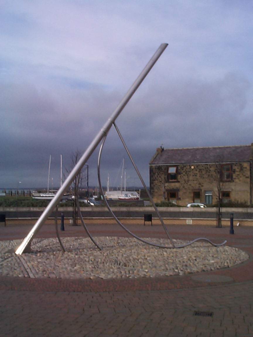
Wellhaugh Point is a prominent coastal feature located in the county of Northumberland, in the northeastern part of England. Situated on the North Sea coast, this headland juts out into the sea, forming a distinct point that is well-known for its natural beauty and rich history.

The point itself is characterized by its rugged cliffs, which rise dramatically from the sea, offering breathtaking views of the surrounding coastline. These cliffs are composed of sedimentary rocks, such as sandstone and limestone, which have been shaped by the relentless forces of wind and water over millions of years.

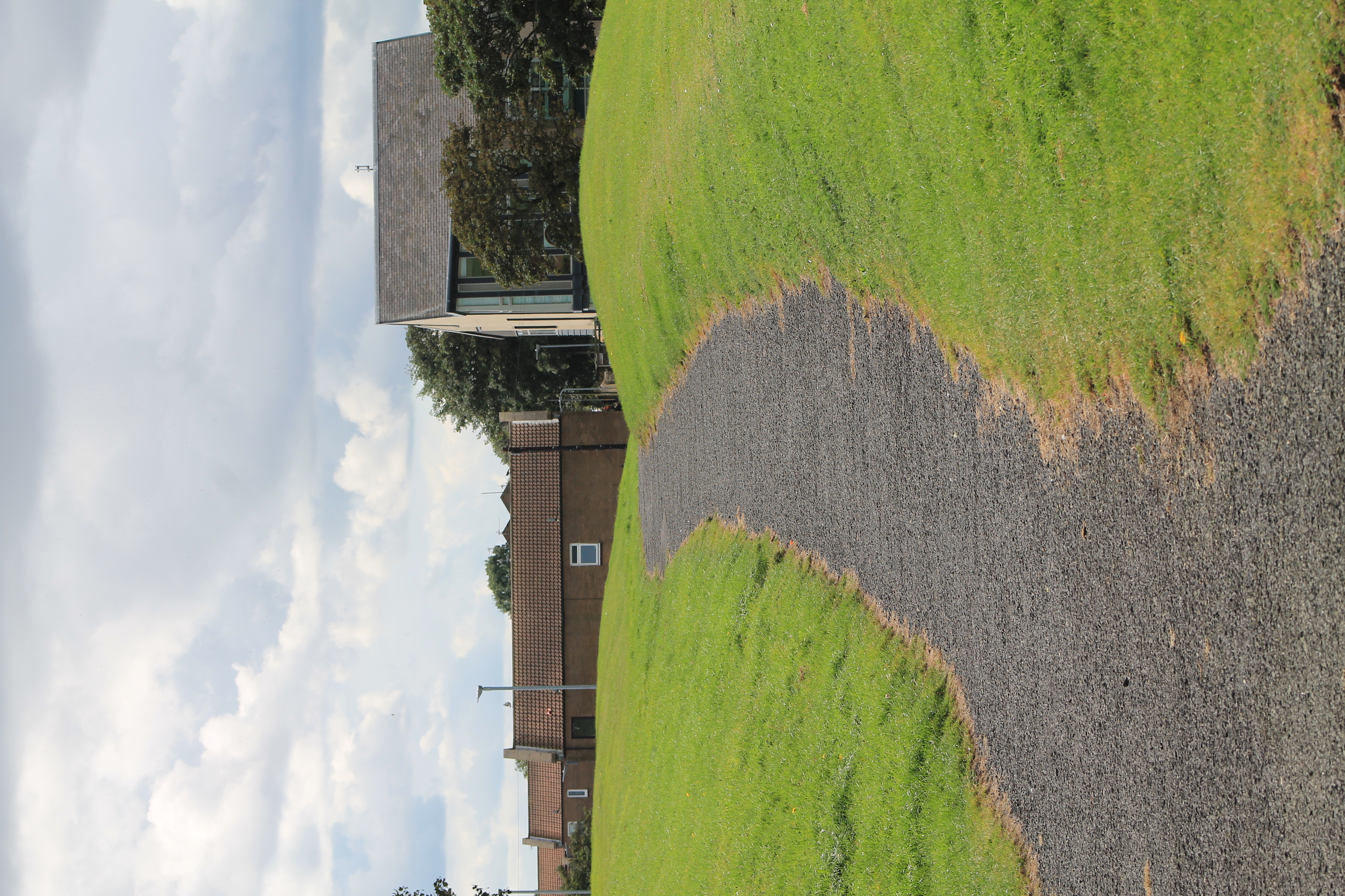
Wellhaugh Point is also known for its diverse wildlife. The surrounding waters are home to a variety of marine species, including seals, dolphins, and various types of seabirds. The nearby grassy areas and heathlands provide habitats for a range of land-dwelling animals and plants, adding to the ecological significance of the area.

In addition to its natural features, Wellhaugh Point has a rich historical background. The headland has witnessed human activity for centuries, with evidence of settlements dating back to prehistoric times. The remains of ancient fortifications and burial sites can still be found in the area, serving as a testament to its historical importance.

Overall, Wellhaugh Point offers visitors a unique combination of natural beauty and historical significance. Whether one is interested in exploring the rugged cliffs, observing the diverse wildlife, or delving into the area's rich history, this coastal feature has something to offer for everyone.

If you have any feedback on the listing, please let us know in the comments section below.

Wellhaugh Point Images

Images are sourced within 2km of 55.332385/-1.562994 or Grid Reference NU2704. Thanks to Geograph Open Source API. All images are credited.

Coquet Island From Low Hauxley
Coquet Island
From Low Hauxley
Rocks at Low Hauxley
Warkworth Harbour, Amble
Warkworth Harbour, Northumberland Fishing boats, lobster pots and new buildings at Warkworth Harbour.
Warkworth Harbour, Northumberland
Fishing boats, lobster pots and new buildings at Warkworth Harbour.
A different way to cross Warkworth Harbour Surfboarding on the River Coquet.
A different way to cross Warkworth Harbour
Surfboarding on the River Coquet.
Pinnace 1386 Memorial In remembrance of those lost when RAF search and rescue craft Pinnace 1386 overturned while approaching Amble harbour in severe weather. One crew member survived after Royal Navy divers managed to create a hole in the upturned hull, from which he managed to escape.
Pinnace 1386 Memorial
In remembrance of those lost when RAF search and rescue craft Pinnace 1386 overturned while approaching Amble harbour in severe weather. One crew member survived after Royal Navy divers managed to create a hole in the upturned hull, from which he managed to escape.
Three Turnstones  On the quay at Warkworth Harbour.
Not afraid of people and happy to scavange on the boats at the quayside.
Three Turnstones
On the quay at Warkworth Harbour. Not afraid of people and happy to scavange on the boats at the quayside.
Trawler restocking at Warkworth Harbour Note the turnstones on the quay edge.
Trawler restocking at Warkworth Harbour
Note the turnstones on the quay edge.
Sign board giving details of coal truck The staithes are visible across the River Coquet from the harbour.
Sign board giving details of coal truck
The staithes are visible across the River Coquet from the harbour.
Coal truck used on the staithes Amble grew in the nineteenth century as collieries were opened; and the newly built railway links to the Northumberland coalfields made the town a centre for the sea transport and export of coal.
The arrival of the railway lead to the construction of coal staithes.
This is an example of the trucks used on the staithes to load coal into ships.
See <a title="https://www.geograph.org.uk/photo/7080285" href="https://www.geograph.org.uk/photo/7080285">Link</a> for details.
Coal truck used on the staithes
Amble grew in the nineteenth century as collieries were opened; and the newly built railway links to the Northumberland coalfields made the town a centre for the sea transport and export of coal. The arrival of the railway lead to the construction of coal staithes. This is an example of the trucks used on the staithes to load coal into ships. See Link for details.
Circa Cafe, Amble Opening out on to a filling station forecourt, the Circa Cafe is a curious combination of café and antiques shop. Inside, the antiques and collectables showroom is surprisingly large with an extensive range of items for sale. To the left of the café is a Londis store.
Circa Cafe, Amble
Opening out on to a filling station forecourt, the Circa Cafe is a curious combination of café and antiques shop. Inside, the antiques and collectables showroom is surprisingly large with an extensive range of items for sale. To the left of the café is a Londis store.
Cottages on the dunes
Exposed rocks at Hauxley Haven
Low tide at Amble Links
South Pier, Amble
South Pier, Amble
Harbour retail units, Amble
High Hauxley
High Hauxley
Northumberland Coast Path Between Warkworth and Amble - the path leaves the tarmac and cuts across the grass as it heads towards Amble beside the River Coquet
Northumberland Coast Path
Between Warkworth and Amble - the path leaves the tarmac and cuts across the grass as it heads towards Amble beside the River Coquet
Show me another place!

Wellhaugh Point is located at Grid Ref: NU2704 (Lat: 55.332385, Lng: -1.562994)

Unitary Authority: Northumberland

Police Authority: Northumbria

What 3 Words

///rant.senses.writing. Near Amble, Northumberland

Related Wikis

River Coquet

The River Coquet runs through the county of Northumberland, England, discharging into the North Sea on the east coast at Amble. It rises in the Cheviot...

Amble

Amble is a town on the North Sea coast of Northumberland, England, at the mouth of the River Coquet; Coquet Island is visible from its beaches and harbour...

Amble railway station

Amble railway station was the terminus of the Amble branch line, which diverged from the East Coast Main Line at Chevington in Northumberland, Northern...
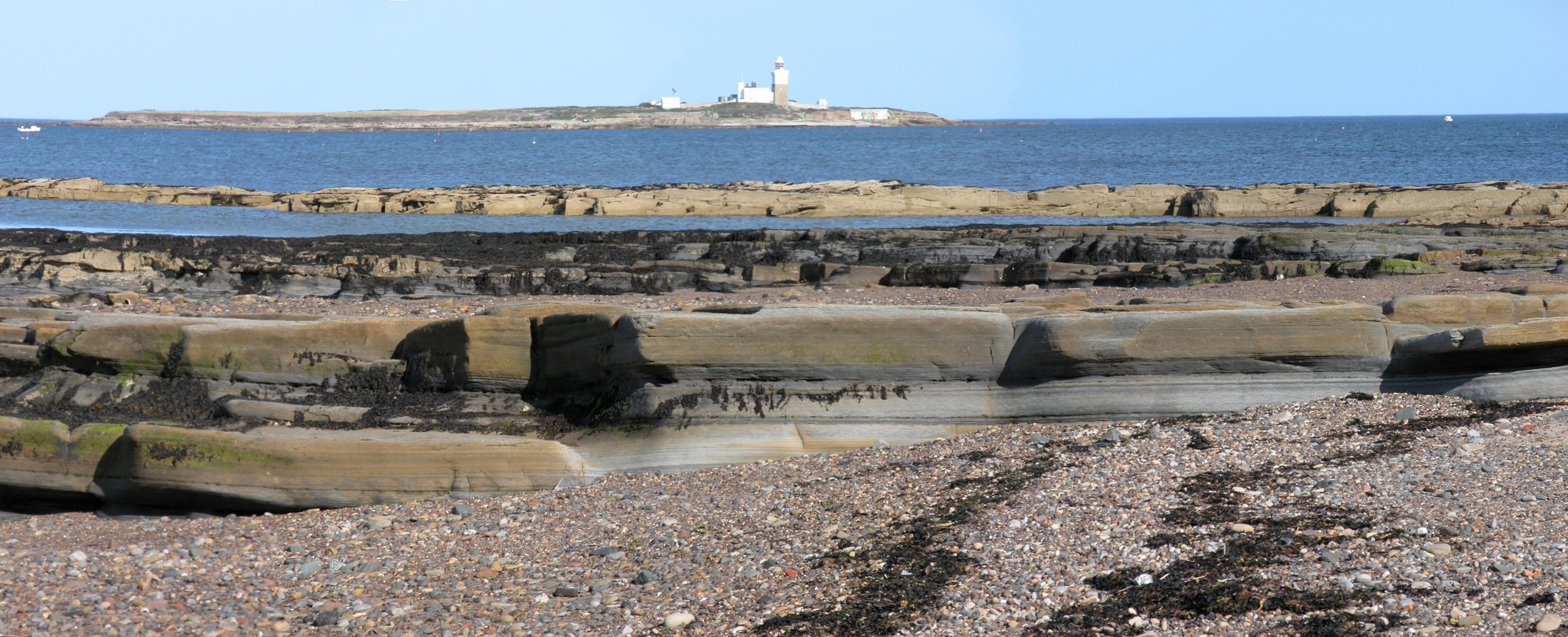
Coquet Island

Coquet Island is a small island of about 6 hectares (15 acres), situated 1.2 kilometres (0.75 mi) off Amble on the Northumberland coast, northeast England...

Nearby Amenities

Located within 500m of 55.332385,-1.562994
Traffic Calming: choker
Lat/Long: 55.3330246/-1.5695311
Traffic Calming: choker
Lat/Long: 55.3318249/-1.5676278
Post Box
Postal Code: NE65
Ref: NE65 73
Source: survey
Lat/Long: 55.3318937/-1.5677904
Bench
Lat/Long: 55.331942/-1.5649097
Noexit: yes
Lat/Long: 55.3293975/-1.5674409
Noexit: yes
Lat/Long: 55.3288787/-1.565102
Noexit: yes
Lat/Long: 55.3309568/-1.5684225
Barrier: lift_gate
Lat/Long: 55.3287136/-1.5632721
Noexit: yes
Lat/Long: 55.3308043/-1.5652039
Noexit: yes
Lat/Long: 55.3305418/-1.5666147
Noexit: yes
Lat/Long: 55.3294982/-1.5687337
Noexit: yes
Lat/Long: 55.3309996/-1.5685459
Noexit: yes
Lat/Long: 55.3295775/-1.5667167
Noexit: yes
Lat/Long: 55.3292541/-1.5671673
Noexit: yes
Lat/Long: 55.3315305/-1.5642211
Noexit: yes
Lat/Long: 55.3295989/-1.5687015
Noexit: yes
Lat/Long: 55.3302153/-1.5655365
Noexit: yes
Lat/Long: 55.3289428/-1.5634873
Noexit: yes
Lat/Long: 55.3297698/-1.5691253
Noexit: yes
Lat/Long: 55.330075/-1.5672746
Noexit: yes
Lat/Long: 55.3294372/-1.5680041
Noexit: yes
Lat/Long: 55.3282074/-1.5640344
Noexit: yes
Lat/Long: 55.3292541/-1.5655848
Noexit: yes
Lat/Long: 55.3296935/-1.563954
Noexit: yes
Lat/Long: 55.3293151/-1.5673604
Noexit: yes
Lat/Long: 55.3297057/-1.5690502
Noexit: yes
Lat/Long: 55.3308081/-1.5698588
Noexit: yes
Lat/Long: 55.330593/-1.5649464
Noexit: yes
Lat/Long: 55.3282959/-1.5633585
Noexit: yes
Lat/Long: 55.3302519/-1.5645454
Noexit: yes
Lat/Long: 55.3288024/-1.5651449
Noexit: yes
Lat/Long: 55.3302703/-1.5656277
Noexit: yes
Lat/Long: 55.3293273/-1.5637126
Noexit: yes
Lat/Long: 55.3305266/-1.5667488
Noexit: yes
Lat/Long: 55.3300872/-1.5641364
Noexit: yes
Lat/Long: 55.3294738/-1.5678861
Noexit: yes
Lat/Long: 55.3285339/-1.5654721
Pub
Addr City: Amble
Lat/Long: 55.3311412/-1.5671096
Generator Method: photovoltaic
Generator Output Electricity: yes
Generator Source: solar
Generator Type: solar_photovoltaic_panel
Location: roof
Power: generator
Lat/Long: 55.3328352/-1.5702751
Sea Salt Cottage
Internet Access: wlan
Tourism: chalet
Website: https://www.northumbria-cottages.co.uk/property/sea-salt-cottage
Lat/Long: 55.3345167/-1.5682146
Entrance: main
Lat/Long: 55.3332387/-1.5697992
Man Made: tower
Tower Construction: freestanding
Tower Type: spire
Lat/Long: 55.3333249/-1.5696234
Barrier: lift_gate
Lat/Long: 55.3317536/-1.5681429
Noexit: yes
Lat/Long: 55.3319934/-1.5688111
Noexit: yes
Lat/Long: 55.3323775/-1.569076
Noexit: yes
Lat/Long: 55.3320494/-1.5685572
Noexit: yes
Lat/Long: 55.329127/-1.5629998
Noexit: yes
Lat/Long: 55.3296035/-1.5632682
Noexit: yes
Lat/Long: 55.3316123/-1.567603
Traffic Calming: choker
Lat/Long: 55.3335502/-1.5704375
Traffic Calming: choker
Lat/Long: 55.3324664/-1.5686549
Give Way
Direction: backward
Lat/Long: 55.330624/-1.5679211
Noexit: yes
Lat/Long: 55.3308029/-1.5667923
Noexit: yes
Lat/Long: 55.3308502/-1.5664704
Noexit: yes
Lat/Long: 55.3296144/-1.5665656
The data included in this document is from www.openstreetmap.org. The data is made available under ODbL.

Have you been to Wellhaugh Point?

Leave your review of Wellhaugh Point below (or comments, questions and feedback).