Bally Carrs

Coastal Feature, Headland, Point in Northumberland

England

Bally Carrs

Seaton Point From north, below Boulmer
Seaton Point Credit: Ray Byrne

Bally Carrs is a prominent headland located on the coast of Northumberland, England. Situated in close proximity to the village of Bamburgh, this coastal feature is known for its breathtaking views and natural beauty. The headland juts out into the North Sea, creating a distinctive point that attracts both locals and tourists alike.

The headland itself is formed by layers of sedimentary rock, which have been shaped by the powerful forces of erosion over millions of years. This geological formation not only adds to the visual appeal of Bally Carrs but also provides valuable insights into the area's ancient history.

Standing on the headland, visitors can enjoy panoramic vistas of the surrounding coastline, including the iconic Bamburgh Castle and the Farne Islands. The rugged cliffs and crashing waves below contribute to the dramatic atmosphere of the site, making it a popular spot for photographers and nature enthusiasts.

Bally Carrs is also home to a diverse range of flora and fauna, with various species of seabirds nesting on the cliffs and marine life thriving in the surrounding waters. The headland is a designated Area of Outstanding Natural Beauty, ensuring its protection and preservation for future generations to enjoy.

Access to Bally Carrs is relatively easy, with a public footpath leading from Bamburgh village to the headland. There are also car parks nearby, making it convenient for visitors arriving by car. Whether it's for a leisurely stroll, birdwatching, or simply taking in the breathtaking coastal scenery, Bally Carrs offers an unforgettable experience for those who venture to this picturesque headland in Northumberland.

If you have any feedback on the listing, please let us know in the comments section below.

Bally Carrs Images

Images are sourced within 2km of 55.405307/-1.5819774 or Grid Reference NU2612. Thanks to Geograph Open Source API. All images are credited.

Seaton Point From north, below Boulmer
Seaton Point
From north, below Boulmer
Seaton Point Beach at Boulmer Haven. Seaton Point in the distance.
Seaton Point
Beach at Boulmer Haven. Seaton Point in the distance.
Seaton Rocks
Seaton
Rocks
Bay south of Seaton Point Looking south west towards Foxton Hall.
Bay south of Seaton Point
Looking south west towards Foxton Hall.
Boulmer Haven The village viewed from the south, taken August 2005.
Boulmer Haven
The village viewed from the south, taken August 2005.
Alnmouth Golf Links Looking South-West towards the town from Alnmouth Common
Alnmouth Golf Links
Looking South-West towards the town from Alnmouth Common
Beach Hut Overlooking the bay at Alnmouth
Beach Hut
Overlooking the bay at Alnmouth
Marden Rocks The northeast tip of the wave-cut platform with Fluke Hole in the foreground.
Note the Eider duck swimming and the three comorants sitting on the rocks.
Marden Rocks
The northeast tip of the wave-cut platform with Fluke Hole in the foreground. Note the Eider duck swimming and the three comorants sitting on the rocks.
Boulmer Haven The entrance to Boulmer Haven from the coast path.
Boulmer Haven
The entrance to Boulmer Haven from the coast path.
Navigation Post, Boulmer One of two navigation posts above the beach at Boulmer;  boatsmen need to line up the two marks to enter Mar Mouth, the narrow entrance of Boulmer Haven.
Navigation Post, Boulmer
One of two navigation posts above the beach at Boulmer; boatsmen need to line up the two marks to enter Mar Mouth, the narrow entrance of Boulmer Haven.
Boulmer Fishing boats drawn up above the beach at Boulmer.
Boulmer
Fishing boats drawn up above the beach at Boulmer.
Boulmer Haven
Boulmer Haven
Road Junction outside Lesbury The junction where the Alnmouth road meets the Lesbury to Boulmer road on Route 1 of the Sustrans Cycle route.  Sign says Craster 8 1/2 (miles)
Road Junction outside Lesbury
The junction where the Alnmouth road meets the Lesbury to Boulmer road on Route 1 of the Sustrans Cycle route. Sign says Craster 8 1/2 (miles)
FBI Smoking Area! This part of the beach is the designated smoking area for the Fishing Boat Inn!
FBI Smoking Area!
This part of the beach is the designated smoking area for the Fishing Boat Inn!
Rocks at Seaton Point Some of the many rocks here at the point, a variety of sizes and types.
Rocks at Seaton Point
Some of the many rocks here at the point, a variety of sizes and types.
Seaton Beach The sun peeking from between the storm clouds gives rise to some interesting patterns.  Some of the rocks here are pinkish though.
Seaton Beach
The sun peeking from between the storm clouds gives rise to some interesting patterns. Some of the rocks here are pinkish though.
Lobster Pots This stack of lobster pots was waiting out of reach of the tide.
Lobster Pots
This stack of lobster pots was waiting out of reach of the tide.
Great Whin Sill The Great Whin Sill formed from molten rock around 300 million years ago. It covers 1,500 square miles, although much of it is below the surface of the land and/or sea. This is the view looking south.
Great Whin Sill
The Great Whin Sill formed from molten rock around 300 million years ago. It covers 1,500 square miles, although much of it is below the surface of the land and/or sea. This is the view looking south.
Show me another place!

Bally Carrs is located at Grid Ref: NU2612 (Lat: 55.405307, Lng: -1.5819774)

Unitary Authority: Northumberland

Police Authority: Northumbria

What 3 Words

///surfacing.hardback.jetted. Near Alnmouth, Northumberland

Related Wikis

Boulmer

Boulmer is a village in Northumberland, England, on the North Sea coast east of Alnwick. It is home to RAF Boulmer. Boulmer has an independent volunteer...
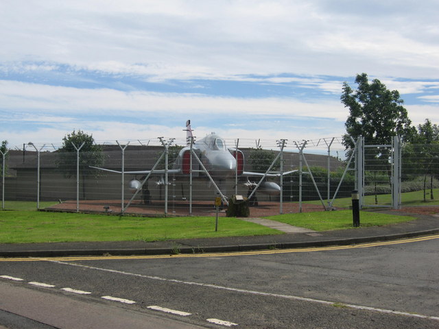
RAF Boulmer

Royal Air Force Boulmer or more simply RAF Boulmer is a Royal Air Force station near Alnwick in Northumberland, England, and is home to Aerospace Surveillance...

St John the Baptist Parish Church, Alnmouth

St John the Baptist Parish Church is an Anglican place of worship situated in the village of Alnmouth in Northumberland, England. It is the parish church...

Alnmouth

Alnmouth () is a coastal village in Northumberland, England, situated 4 miles (6 km) east-south-east of Alnwick. The population of the civil parish at...
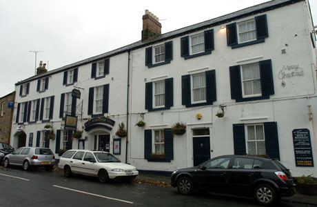
Schooner Hotel

The Schooner Hotel & Bar is a Grade II listed 17th century coaching inn and hotel located at 8 Northumberland Street in the coastal village of Alnmouth...

Lesbury

Lesbury is a small rural village in Northumberland in the north of England. It is built on the main coastal road 3.5 miles (5.6 km) southeast of Alnwick...
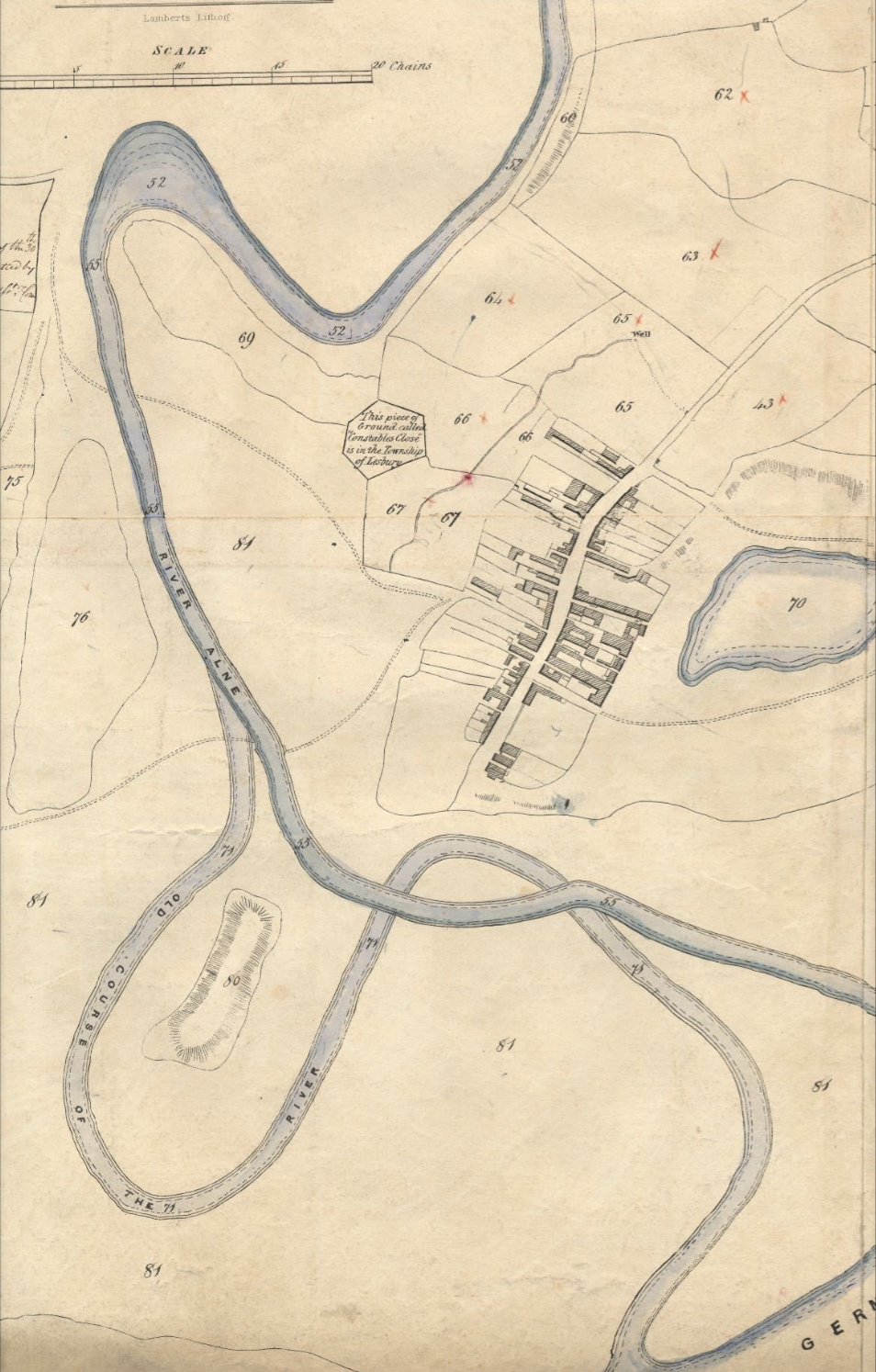
River Aln

The River Aln () runs through the county of Northumberland in England. It rises in Alnham in the Cheviot Hills and discharges into the North Sea at Alnmouth...

Alnmouth Saltmarsh and Dunes

Alnmouth Saltmarsh and Dunes is a Site of Special Scientific Interest (SSSI) in Northumberland, England. It is the largest saltflat on the north-east coast...

Nearby Amenities

Located within 500m of 55.405307,-1.5819774
Created By: almien_coastlines
Lat/Long: 55.405831/-1.58324
Created By: almien_coastlines
Lat/Long: 55.405821/-1.58234
Created By: almien_coastlines
Lat/Long: 55.405946/-1.582111
Created By: almien_coastlines
Lat/Long: 55.406071/-1.581881
Created By: almien_coastlines
Lat/Long: 55.406317/-1.580972
Created By: almien_coastlines
Lat/Long: 55.406563/-1.580062
Created By: almien_coastlines
Lat/Long: 55.406688/-1.579834
Created By: almien_coastlines
Lat/Long: 55.407707/-1.579347
Created By: almien_coastlines
Lat/Long: 55.407832/-1.579117
Created By: almien_coastlines
Lat/Long: 55.407958/-1.578888
Created By: almien_coastlines
Lat/Long: 55.408723/-1.578635
Created By: almien_coastlines
Lat/Long: 55.40893/-1.5781384
Seaton Point
Place: locality
Lat/Long: 55.4051171/-1.5797171
Hiking: yes
Information: guidepost
Source: GPS survey
Tourism: information
Lat/Long: 55.4060378/-1.5879864
Hiking: yes
Information: guidepost
Source: GPS survey
Tourism: information
Lat/Long: 55.4077056/-1.5851681
The data included in this document is from www.openstreetmap.org. The data is made available under ODbL.

Have you been to Bally Carrs?

Leave your review of Bally Carrs below (or comments, questions and feedback).