Calder's Geo

Coastal Feature, Headland, Point in Shetland

Scotland

Calder's Geo

Dore Holm This is the islet of Dore Holm off Tang Wick, Eshaness, Shetland. Papa Stour lies on the horizon.
Dore Holm Credit: Carroll Pierce

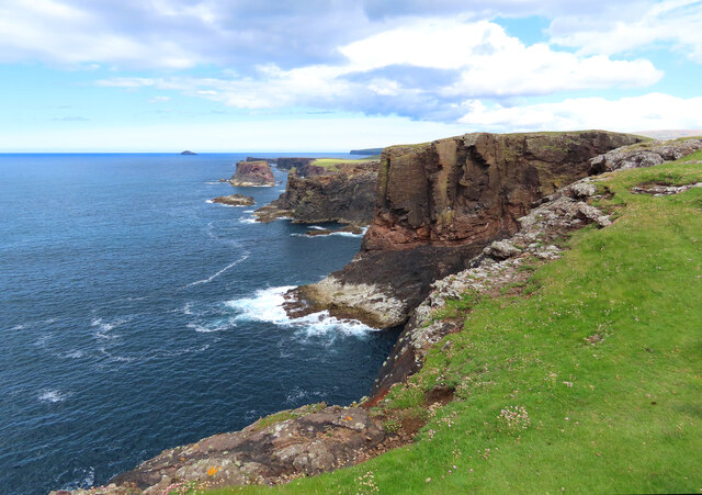
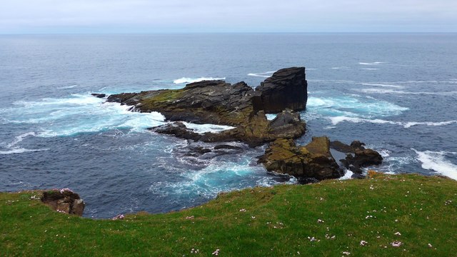
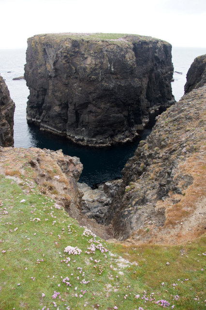
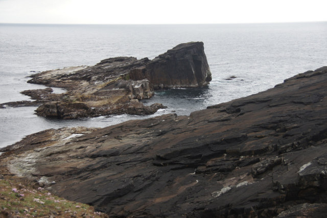
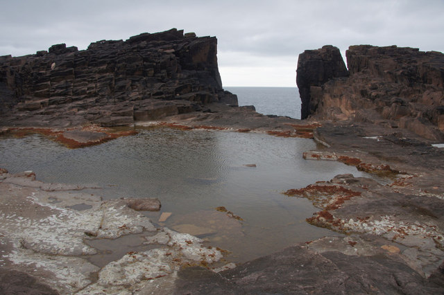
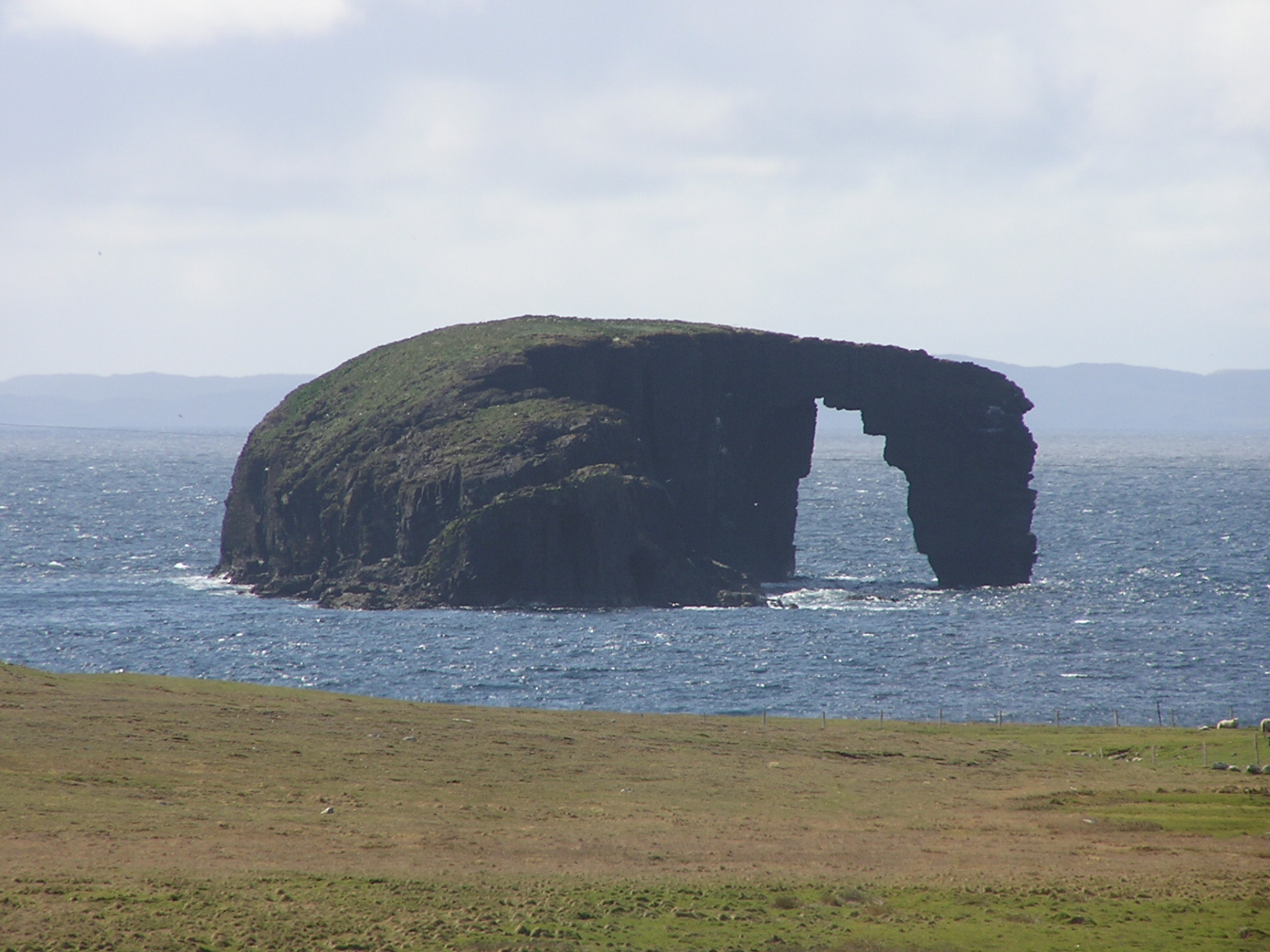
Calder's Geo is a prominent coastal feature located in the Shetland Islands, an archipelago in Scotland. It is classified as a headland, also commonly referred to as a point due to its protrusion into the sea. The geo is positioned along the rugged coastline of the Shetland Mainland, in close proximity to the village of Sandness.

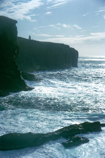
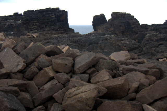
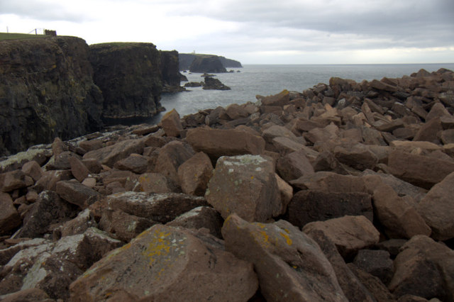
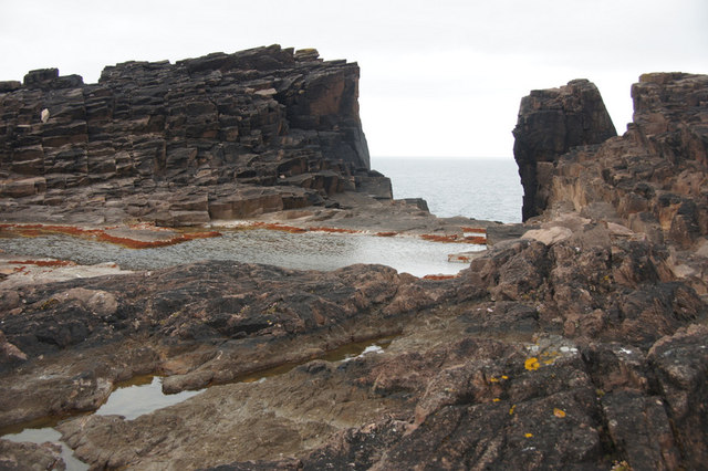
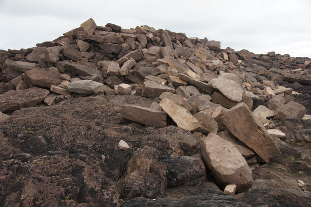
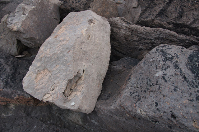
This geologically significant headland is characterized by its steep cliffs that rise dramatically from the sea, reaching heights of up to 100 meters (330 feet) in places. The cliffs are composed of sedimentary rocks, displaying distinct layers that provide valuable insights into the region's geological history.

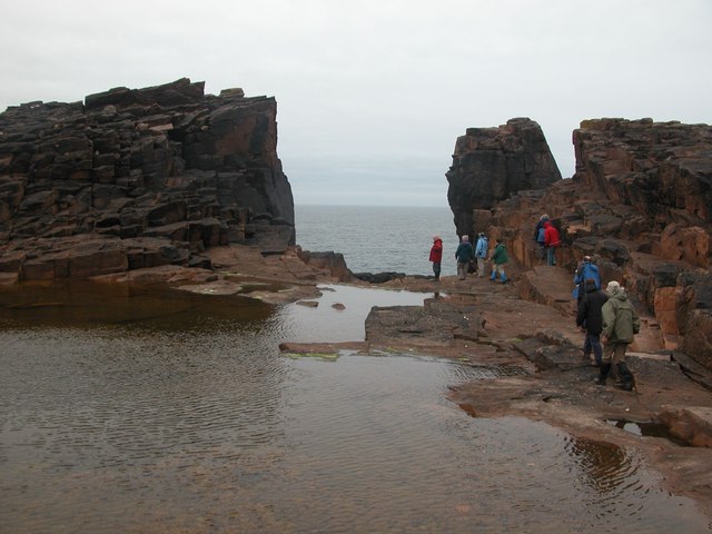
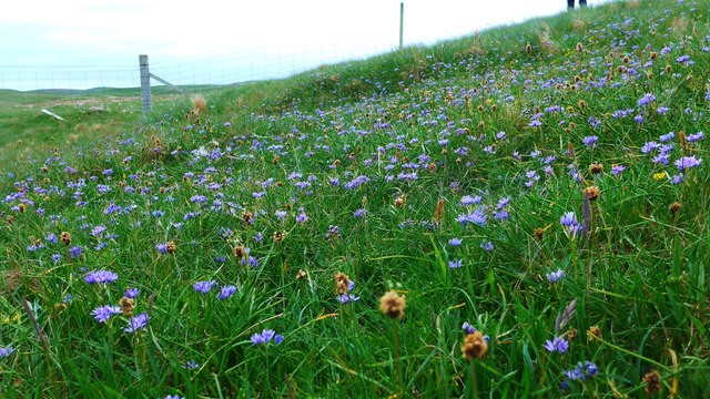
Calder's Geo is a haven for a diverse range of seabird species, including puffins, gannets, and guillemots. These birds nest on the ledges and crevices of the cliffs, taking advantage of the favorable conditions for breeding and feeding. The area is also known for its rich marine life, with seals often spotted basking on nearby rocks and occasional sightings of dolphins and whales.

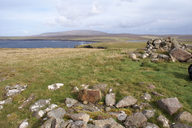
Access to Calder's Geo is possible both by land and sea. Visitors can enjoy panoramic views of the surrounding coastline and the North Atlantic Ocean from the top of the cliffs. The headland offers a perfect vantage point for observing the dramatic waves crashing against the rocks and the interplay between land and sea.

Calder's Geo, with its outstanding natural features and abundant wildlife, is not only a remarkable coastal landmark but also a popular destination for nature enthusiasts and photographers seeking an immersive experience in the stunning Shetland Islands.

If you have any feedback on the listing, please let us know in the comments section below.

Calder's Geo Images

Images are sourced within 2km of 60.490832/-1.6216142 or Grid Reference HU2078. Thanks to Geograph Open Source API. All images are credited.

Dore Holm This is the islet of Dore Holm off Tang Wick, Eshaness, Shetland. Papa Stour lies on the horizon.
Dore Holm
This is the islet of Dore Holm off Tang Wick, Eshaness, Shetland. Papa Stour lies on the horizon.
Eshaness Lighthouse Eshaness Lighthouse, South Head of Caldersgeo, Esha Ness, Shetland.
Eshaness Lighthouse
Eshaness Lighthouse, South Head of Caldersgeo, Esha Ness, Shetland.
The volcanic coastline at Eshaness I am just north of Eshaness Lighthouse and looking up the volcanic coastline to Scraada and Moo Stack. The Grind of the Navir is in the distance. Esha Ness, Shetland.
The volcanic coastline at Eshaness
I am just north of Eshaness Lighthouse and looking up the volcanic coastline to Scraada and Moo Stack. The Grind of the Navir is in the distance. Esha Ness, Shetland.
Coastline at Eshaness A fine summer day to enjoy all that Eshaness offers for cliff scenery and wave action. The top of the lighthouse is visible.
Coastline at Eshaness
A fine summer day to enjoy all that Eshaness offers for cliff scenery and wave action. The top of the lighthouse is visible.
Grind of Navir During big storms, the sea can throw rocks into this area. There is a ring of large rocks inland surrounding the pool.
Grind of Navir
During big storms, the sea can throw rocks into this area. There is a ring of large rocks inland surrounding the pool.
Fence and thrift at Loch of Stow
Gruna Stack At The Grind of the Navir, Shetland
Gruna Stack
At The Grind of the Navir, Shetland
A carpet of blue Scilla verna, commonly known as spring squill, carpets the turf close to the cliff tops.
A carpet of blue
Scilla verna, commonly known as spring squill, carpets the turf close to the cliff tops.
Gruna Stack, Eshaness
Pile of stones at Grind of the Navir This impressive pile of stones, most more than a metre across, has been deposited here by the sea, cast up many metres from the sea through the Grind o' Navir. After a stormy winter, this is a larger than usual pile of stones, resembling a collapsed building.
Pile of stones at Grind of the Navir
This impressive pile of stones, most more than a metre across, has been deposited here by the sea, cast up many metres from the sea through the Grind o' Navir. After a stormy winter, this is a larger than usual pile of stones, resembling a collapsed building.
Skerry at Grind of the Navir
Grind of the Navir The rocks in the foreground have been thrown up by the sea through the gap in the background.
Grind of the Navir
The rocks in the foreground have been thrown up by the sea through the gap in the background.
Rocks at Grind of the Navir Part of the huge pile of rocks, many of which have accumulated over the last winter.
Rocks at Grind of the Navir
Part of the huge pile of rocks, many of which have accumulated over the last winter.
The Grind of the Navir The gap (grind or gate) in the coastline through which storms throw huge boulders during winter storms.
The Grind of the Navir
The gap (grind or gate) in the coastline through which storms throw huge boulders during winter storms.
Rocks at Grind of the Navir From the Grind looking inland. Many of the rocks are a metre or more across and some are as much as 100m from the sea. All have been deposited there by the sea.
Rocks at Grind of the Navir
From the Grind looking inland. Many of the rocks are a metre or more across and some are as much as 100m from the sea. All have been deposited there by the sea.
Grind of the Navir The 'gate' in the coastline.
Grind of the Navir
The 'gate' in the coastline.
Rock at Grind of the Navir The large pale rock has been thrown ashore by one of the storms of the previous winter. The huge dent was probably caused by it hitting the rock to the left (a small pale patch can still be seen at the presumed impact point). There is a 50 p coin on the pale rock for scale.
Rock at Grind of the Navir
The large pale rock has been thrown ashore by one of the storms of the previous winter. The huge dent was probably caused by it hitting the rock to the left (a small pale patch can still be seen at the presumed impact point). There is a 50 p coin on the pale rock for scale.
Hill of Ure, OS bolt and Cairn Looking ENE from the Hill of Ure with OS bolt in close foreground, cairn, and Ness of Ure. Further afield Ronas Hill dominates the view.
Hill of Ure, OS bolt and Cairn
Looking ENE from the Hill of Ure with OS bolt in close foreground, cairn, and Ness of Ure. Further afield Ronas Hill dominates the view.
Show me another place!

Calder's Geo is located at Grid Ref: HU2078 (Lat: 60.490832, Lng: -1.6216142)

Unitary Authority: Shetland Islands

Police Authority: Highlands and Islands

What 3 Words

///guilty.exhaling.treating. Near Brae, Shetland Islands

Related Wikis

Calder's Geo

Calders Geo is an inlet in the western cliffs of Esha Ness in Northmavine on the Mainland, Shetland, Scotland. A cave on the north side of the geo has...

Esha Ness

Esha Ness, also spelled Eshaness, is a peninsula on the west coast of Northmavine, on the island of Mainland, Shetland, Scotland. Esha Ness Lighthouse...

Tangwick Haa

Tangwick Haa is an historic house and museum in Esha Ness, Northmavine, Shetland. The building has two stories in a rectangular layout and along with the...

Dore Holm

The Dore Holm is a small uninhabited islet off the south coast of Esha Ness, located in the north-west of Mainland, Shetland, Scotland. Its natural arch...

Nearby Amenities

Located within 500m of 60.490832,-1.6216142
Passing Place
Lat/Long: 60.4898412/-1.6194306
Esha Ness Lighthouse
Man Made: lighthouse
Seamark Landmark Height: 12
Seamark Light Character: Fl
Seamark Light Colour: white
Seamark Light Height: 61
Seamark Light Period: 12
Seamark Light Range: 25
Seamark Light Reference: A 3838
Seamark Light Sequence: 0.4+(11.6)
Seamark Name: Esha Ness
Seamark Type: light_major
Url: https://www.nlb.org.uk/lighthouses/esha-ness/
Wikidata: Q4313467
Wikipedia: en:Esha Ness Lighthouse
Lat/Long: 60.4893067/-1.6272629
Passing Place
Lat/Long: 60.4881678/-1.6152551
Passing Place
Lat/Long: 60.4887927/-1.6165201
Passing Place
Lat/Long: 60.4899865/-1.6231528
Power: pole
Lat/Long: 60.4885065/-1.6250475
Power: pole
Lat/Long: 60.4882031/-1.6240434
Power: pole
Lat/Long: 60.487856/-1.6228906
Power: pole
Lat/Long: 60.487516/-1.6217498
Power: pole
Lat/Long: 60.4872468/-1.6208534
Power: pole
Lat/Long: 60.4869906/-1.6199882
Power: pole
Lat/Long: 60.4866624/-1.6189097
The data included in this document is from www.openstreetmap.org. The data is made available under ODbL.

Have you been to Calder's Geo?

Leave your review of Calder's Geo below (or comments, questions and feedback).