Bullingham, Lower

Settlement in Herefordshire

England

Bullingham, Lower

High Town, Hereford This open pedestrianised space once lay outside the city's Saxon walls to the north of the cathedral but is now at the heart of the shopping area. The spire belongs to St Peter's Church.
High Town, Hereford Credit: Stephen McKay

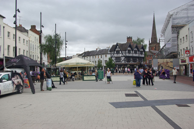
Bullingham is a charming village located in the county of Herefordshire, England. Situated in the Lower region of the county, it lies about 5 miles southwest of the city of Hereford. This picturesque village is surrounded by rolling hills and lush green countryside, adding to its idyllic setting.

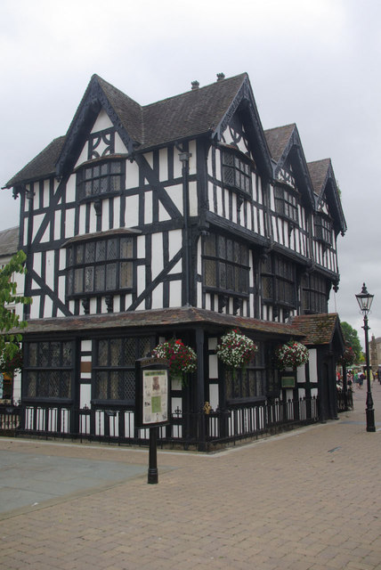
Bullingham is a small village with a close-knit community, providing a peaceful and tranquil environment for its residents. The village is characterized by its quaint cottages and traditional architecture, which give it a timeless appeal. The local church, St. Mary's, stands proudly in the heart of the village, serving as a focal point for both religious and community activities.

Despite its small size, Bullingham offers basic amenities to its residents. It has a local convenience store that caters to daily needs, ensuring that essentials are easily accessible. The village also boasts a cozy pub, The Bull's Head, where locals and visitors can relax and enjoy a pint while soaking in the village atmosphere.

For those seeking outdoor activities, Bullingham is surrounded by picturesque walking trails and scenic cycling routes, providing ample opportunities to explore the beautiful Herefordshire countryside. The village is also in close proximity to the River Wye, offering fishing and boating opportunities.

Bullingham's central location allows for easy access to the nearby city of Hereford, which provides a wider range of amenities including shopping centers, schools, and healthcare facilities. With its serene setting and convenient location, Bullingham offers a desirable lifestyle for those seeking a peaceful village retreat within reach of urban amenities.

If you have any feedback on the listing, please let us know in the comments section below.

Bullingham, Lower Images

Images are sourced within 2km of 52.040679/-2.7023752 or Grid Reference SO5138. Thanks to Geograph Open Source API. All images are credited.

High Town, Hereford This open pedestrianised space once lay outside the city's Saxon walls to the north of the cathedral but is now at the heart of the shopping area. The spire belongs to St Peter's Church.
High Town, Hereford
This open pedestrianised space once lay outside the city's Saxon walls to the north of the cathedral but is now at the heart of the shopping area. The spire belongs to St Peter's Church.
The Old House A Hereford icon. This half-timbered house dates from 1621 and is now a museum.
The Old House
A Hereford icon. This half-timbered house dates from 1621 and is now a museum.
An unusual sight in Commercial Street An attention-seeking 1964 VW Camper with post-Christmas shoppers in Hereford.
An unusual sight in Commercial Street
An attention-seeking 1964 VW Camper with post-Christmas shoppers in Hereford.
Camp Camper 1 1964 VW dolled-up for the Christmas sales.
Camp Camper 1
1964 VW dolled-up for the Christmas sales.
Camp Camper 2 A slightly different angle to <a href="https://www.geograph.org.uk/photo/2745828">SO5140 : Camp Camper 1</a> to show off the eye-shadow!
Camp Camper 2
A slightly different angle to SO5140 : Camp Camper 1 to show off the eye-shadow!
Hereford Baptist Church Located between 62 and 67 Commercial Road, near the Bath Street/Blue School Street junction. 
The church was opened on Good Friday, April 13th 1838.
Hereford Baptist Church
Located between 62 and 67 Commercial Road, near the Bath Street/Blue School Street junction. The church was opened on Good Friday, April 13th 1838.
The Kerry, Hereford Located between Commercial Street and Union Street, viewed from Commercial Road.
The Kerry pub was previously the Kerry Arms Hotel.
The Kerry, Hereford
Located between Commercial Street and Union Street, viewed from Commercial Road. The Kerry pub was previously the Kerry Arms Hotel.
Bye Street Gate plaque, Hereford The plaque on the Kerry <a title="https://www.geograph.org.uk/photo/2765487" href="https://www.geograph.org.uk/photo/2765487">Link</a> marks the location of the gate in the medieval city defences. The gate was demolished in 1798.
Bye Street Gate plaque, Hereford
The plaque on the Kerry Link marks the location of the gate in the medieval city defences. The gate was demolished in 1798.
NE end of Commercial Street, Hereford A view SW along pedestrianised Commercial Street in central Hereford.
NE end of Commercial Street, Hereford
A view SW along pedestrianised Commercial Street in central Hereford.
Hereford Magistrates' Court The Court's address is The Court House, Bath Street, Hereford. 
Magistrates' courts are a key part of the criminal justice system in the United Kingdom. They deal with 97% of all cases. Magistrates' courts also deal with many civil cases such as antisocial behaviour and public health cases. They are also responsible for the enforcement of fines and community punishments.
Cases likely to need a penalty greater than the sentencing powers of magistrates are dealt with by a Crown Court.
Hereford Magistrates' Court
The Court's address is The Court House, Bath Street, Hereford. Magistrates' courts are a key part of the criminal justice system in the United Kingdom. They deal with 97% of all cases. Magistrates' courts also deal with many civil cases such as antisocial behaviour and public health cases. They are also responsible for the enforcement of fines and community punishments. Cases likely to need a penalty greater than the sentencing powers of magistrates are dealt with by a Crown Court.
Roadside cider press, Bath Street, Hereford The cider press is at the edge of Hereford Police Station, <a title="https://www.geograph.org.uk/photo/5175023" href="https://www.geograph.org.uk/photo/5175023">Link</a> Bath Street.
Roadside cider press, Bath Street, Hereford
The cider press is at the edge of Hereford Police Station, Link Bath Street.
Hereford Dental Clinic Located in Florida House, on the corner of Bath Street and Kyrle Street.
Hereford Dental Clinic
Located in Florida House, on the corner of Bath Street and Kyrle Street.
Berrows Business Centre, Hereford The Bath Street building was formerly a flour mill. <a title="https://www.geograph.org.uk/photo/1010665" href="https://www.geograph.org.uk/photo/1010665">Link</a>
Berrows Business Centre, Hereford
The Bath Street building was formerly a flour mill. Link
The Kerry Hereford
The Kerry Hereford
Hereford Street Life 1 The city centre is bustling on this sunny Saturday afternoon in early August.
Hereford Street Life 1
The city centre is bustling on this sunny Saturday afternoon in early August.
Hereford Street Life 2 The city centre is bustling on this sunny Saturday afternoon in early August.
A summer shower is on its way.
Hereford Street Life 2
The city centre is bustling on this sunny Saturday afternoon in early August. A summer shower is on its way.
Hereford Street Life 3 The city centre is bustling on this sunny Saturday afternoon in early August.
A summer shower is on its way.
Hereford Street Life 3
The city centre is bustling on this sunny Saturday afternoon in early August. A summer shower is on its way.
Part of Commercial Street, Hereford The old Chadd's department store stands empty still after closure in 2008 I believe. Such is the plight of the British high street today.

Maybe if Chadd's had launched their own coffee shop brand back in about 2005 they might be trading today. Shoppers will it seems happily pay for caramel lattes and muffins but choice and old fashioned service is not a priority to the average high street Joe / Jo. 

Before long though I'm sure the premises will all be turned over to something new.
Part of Commercial Street, Hereford
The old Chadd's department store stands empty still after closure in 2008 I believe. Such is the plight of the British high street today. Maybe if Chadd's had launched their own coffee shop brand back in about 2005 they might be trading today. Shoppers will it seems happily pay for caramel lattes and muffins but choice and old fashioned service is not a priority to the average high street Joe / Jo. Before long though I'm sure the premises will all be turned over to something new.
Show me another place!

Bullingham, Lower is located at Grid Ref: SO5138 (Lat: 52.040679, Lng: -2.7023752)

Unitary Authority: County of Herefordshire

Police Authority: West Mercia

What 3 Words

///moss.double.soups. Near Lower Bullingham, Herefordshire

Related Wikis

ROF Rotherwas

ROF Rotherwas was a Royal Ordnance Factory filling factory, No 4, located in Rotherwas, Dinedor Parish, Herefordshire, England. == Background == In the...

Herefordshire Archive and Records Centre

Herefordshire Archive and Records Centre holds the archives for the county of Herefordshire. The archives are held at Fir Tree Lane, Rotherwas, Hereford...

Harold Street drill hall, Hereford

The Harold Street drill hall is a former military installation in Hereford, Herefordshire. == History == The building was designed as a local militia barracks...

Lower Bullingham

Lower Bullingham is a village and civil parish in Herefordshire, England. The main village, Lower Bullingham, is a south-eastern suburb of Hereford....

Nearby Amenities

Located within 500m of 52.040679,-2.7023752
Turning Circle
Lat/Long: 52.042352/-2.6962027
Turning Circle
Lat/Long: 52.040305/-2.6973296
Turning Circle
Lat/Long: 52.0412285/-2.6966965
Barrier: stile
Foot: yes
Lat/Long: 52.0423567/-2.6999433
Noexit: yes
Lat/Long: 52.0406709/-2.7081536
Bus Stop
Goodwin Way
Naptan AtcoCode: 2090A027300
Naptan Bearing: E
Naptan CommonName: Goodwin Way
Naptan Indicator: adj
Naptan Landmark: Jc Goodwin Way
Naptan NaptanCode: herapwgj
Naptan PlusbusZoneRef: HEREFRD
Naptan Street: Holme Lacy Road
Naptan Verified: no
Source: naptan_import
Lat/Long: 52.0400408/-2.6977071
Bus Stop
The Wye Inn
Naptan AtcoCode: 2090A028612
Naptan Bearing: SE
Naptan CommonName: The Wye Inn
Naptan Indicator: adj
Naptan Landmark: The Wye Inn
Naptan NaptanCode: heratagp
Naptan PlusbusZoneRef: HEREFRD
Naptan Street: Holme Lacy Road
Naptan Verified: no
Source: naptan_import
Lat/Long: 52.0409321/-2.7035587
St. Clares Court
Naptan AtcoCode: 2090A18439
Naptan Bearing: N
Naptan BusStopType: CUS
Naptan CommonName: St. Clares Court
Naptan Indicator: adj bus shelter
Naptan Landmark: Bus Shelter
Naptan NaptanCode: heragtag
Naptan PlusbusZoneRef: HEREFRD
Naptan Street: Windsor Road
Naptan Verified: no
Source: naptan_import
Lat/Long: 52.0393615/-2.7045781
St. Clares Court
Naptan AtcoCode: 2090A18442
Naptan Bearing: S
Naptan BusStopType: CUS
Naptan CommonName: St. Clares Court
Naptan Indicator: opp Bus Shelter
Naptan Landmark: N/K
Naptan NaptanCode: heragtaj
Naptan PlusbusZoneRef: HEREFRD
Naptan Street: Windsor Road
Naptan Verified: no
Source: naptan_import
Lat/Long: 52.0393451/-2.7043154
Bus Stop
Goodwin Way
Naptan AtcoCode: 2090A18790
Naptan Bearing: NW
Naptan CommonName: Goodwin Way
Naptan Indicator: adj
Naptan Landmark: N/K
Naptan NaptanCode: herajdmw
Naptan PlusbusZoneRef: HEREFRD
Naptan Street: N/K
Naptan Verified: no
Source: naptan_import
Lat/Long: 52.0399584/-2.6979537
Bus Stop
The Wye Inn
Naptan AtcoCode: 2090A19538
Naptan Bearing: W
Naptan CommonName: The Wye Inn
Naptan Indicator: opp
Naptan Landmark: The Wye Inn
Naptan NaptanCode: heramdmj
Naptan PlusbusZoneRef: HEREFRD
Naptan Street: Holme Lacy Road. B4399
Naptan Verified: no
Source: naptan_import
Lat/Long: 52.0408146/-2.7053608
Bus Stop
The Shires
Local Ref: NK
Naptan AtcoCode: 2090A19550
Naptan Bearing: SW
Naptan CommonName: The Shires
Naptan Indicator: NK
Naptan Landmark: opp No 35 The Pastures
Naptan NaptanCode: heramdpa
Naptan PlusbusZoneRef: HEREFRD
Naptan Street: The Pastures
Naptan Verified: no
Source: naptan_import
Lat/Long: 52.0376171/-2.7075977
Bus Stop
The Dales
Naptan AtcoCode: 2090A19552
Naptan Bearing: S
Naptan CommonName: The Dales
Naptan Indicator: o/s No 2
Naptan Landmark: o/s No 2 The Dales
Naptan NaptanCode: heramdpd
Naptan PlusbusZoneRef: HEREFRD
Naptan Street: The Dales
Naptan Verified: no
Source: naptan_import
Lat/Long: 52.0385144/-2.7049001
Bus Stop
Lower Bullingham Lane
Naptan AtcoCode: 2090A19554
Naptan Bearing: E
Naptan CommonName: Lower Bullingham Lane
Naptan Indicator: adj
Naptan Landmark: Grace Church
Naptan NaptanCode: heramdpg
Naptan PlusbusZoneRef: HEREFRD
Naptan Street: Holme Lacy Road. B4399
Naptan Verified: no
Source: naptan_import
Lat/Long: 52.0406167/-2.702163
Turning Circle
Lat/Long: 52.0417728/-2.6962131
Post Box
Lat/Long: 52.0405489/-2.7007094
Generator Method: photovoltaic
Generator Output Electricity: yes
Generator Source: solar
Generator Type: solar_photovoltaic_panel
Location: roof
Power: generator
Lat/Long: 52.0414365/-2.697676
Generator Method: photovoltaic
Generator Output Electricity: yes
Generator Source: solar
Generator Type: solar_photovoltaic_panel
Location: roof
Power: generator
Lat/Long: 52.039394/-2.7013949
Generator Method: photovoltaic
Generator Output Electricity: yes
Generator Source: solar
Generator Type: solar_photovoltaic_panel
Location: roof
Power: generator
Lat/Long: 52.0397702/-2.7045921
Generator Method: photovoltaic
Generator Output Electricity: yes
Generator Source: solar
Generator Type: solar_photovoltaic_panel
Location: roof
Power: generator
Lat/Long: 52.0383257/-2.7052358
Generator Method: photovoltaic
Generator Output Electricity: yes
Generator Source: solar
Generator Type: solar_photovoltaic_panel
Location: roof
Power: generator
Lat/Long: 52.0386021/-2.7052774
Generator Method: photovoltaic
Generator Output Electricity: yes
Generator Source: solar
Generator Type: solar_photovoltaic_panel
Location: roof
Power: generator
Lat/Long: 52.037594/-2.7019501
Generator Method: photovoltaic
Generator Output Electricity: yes
Generator Source: solar
Generator Type: solar_photovoltaic_panel
Location: roof
Power: generator
Lat/Long: 52.0417533/-2.7065393
Generator Method: photovoltaic
Generator Output Electricity: yes
Generator Source: solar
Generator Type: solar_photovoltaic_panel
Location: roof
Power: generator
Lat/Long: 52.0406825/-2.7035782
Generator Method: photovoltaic
Generator Output Electricity: yes
Generator Source: solar
Generator Type: solar_photovoltaic_panel
Location: roof
Power: generator
Lat/Long: 52.0406792/-2.7036439
Generator Method: photovoltaic
Generator Output Electricity: yes
Generator Source: solar
Generator Type: solar_photovoltaic_panel
Location: roof
Power: generator
Lat/Long: 52.0406619/-2.7043574
Generator Method: photovoltaic
Generator Output Electricity: yes
Generator Source: solar
Generator Type: solar_photovoltaic_panel
Location: roof
Power: generator
Lat/Long: 52.0376814/-2.7015129
Generator Method: photovoltaic
Generator Output Electricity: yes
Generator Source: solar
Generator Type: solar_photovoltaic_panel
Location: roof
Power: generator
Lat/Long: 52.0376286/-2.7016684
Generator Method: photovoltaic
Generator Output Electricity: yes
Generator Source: solar
Generator Type: solar_photovoltaic_panel
Location: roof
Power: generator
Lat/Long: 52.037589/-2.7018267
Generator Method: photovoltaic
Generator Output Electricity: yes
Generator Source: solar
Generator Type: solar_photovoltaic_panel
Location: roof
Power: generator
Lat/Long: 52.0382968/-2.7037686
Generator Method: photovoltaic
Generator Output Electricity: yes
Generator Source: solar
Generator Type: solar_photovoltaic_panel
Location: roof
Power: generator
Lat/Long: 52.0385856/-2.7055791
Generator Method: photovoltaic
Generator Output Electricity: yes
Generator Source: solar
Generator Type: solar_photovoltaic_panel
Location: roof
Power: generator
Lat/Long: 52.0391251/-2.7070946
Generator Method: photovoltaic
Generator Output Electricity: yes
Generator Source: solar
Generator Type: solar_photovoltaic_panel
Location: roof
Power: generator
Lat/Long: 52.0391168/-2.7070302
Generator Method: photovoltaic
Generator Output Electricity: yes
Generator Source: solar
Generator Type: solar_photovoltaic_panel
Location: roof
Power: generator
Lat/Long: 52.0378645/-2.7074459
Generator Output Electricity: yes
Generator Source: solar
Location: roof
Power: generator
Lat/Long: 52.0401001/-2.7079985
Generator Output Electricity: yes
Generator Source: solar
Location: roof
Power: generator
Lat/Long: 52.0401117/-2.7081728
Generator Output Electricity: yes
Generator Source: solar
Location: roof
Power: generator
Lat/Long: 52.0416823/-2.6996005
Generator Output Electricity: yes
Generator Source: solar
Location: roof
Power: generator
Lat/Long: 52.0415338/-2.7003622
Generator Output Electricity: yes
Generator Source: solar
Location: roof
Power: generator
Lat/Long: 52.041783/-2.697672
Generator Output Electricity: yes
Generator Source: solar
Location: roof
Power: generator
Lat/Long: 52.0403922/-2.6970738
Generator Output Electricity: yes
Generator Source: solar
Location: roof
Power: generator
Lat/Long: 52.0395309/-2.7054423
Generator Output Electricity: yes
Generator Source: solar
Location: roof
Power: generator
Lat/Long: 52.0394864/-2.7051795
Bicycle Rental
Capacity: 5
Name Signed: no
Network: Beryl - Hereford
Official Name: Holme Lacy Road/St Clares Court
Operator: Beryl
Operator Wikidata: Q106575369
Payment App: yes
Payment App Android: cc.beryl.basis
Payment App Ios: 1386768364
Payment Cash: no
Payment Credit Cards: no
Payment Cryptocurrencies: no
Payment Debit Cards: no
Payment Electronic Purses: no
Ref Gbfs: beryl_hereford:2303
Lat/Long: 52.040997/-2.703932
Defibrillator
Defibrillator Location: On wall by entrance door
Emergency: defibrillator
Indoor: no
Lat/Long: 52.0410894/-2.7043107
The data included in this document is from www.openstreetmap.org. The data is made available under ODbL.

Have you been to Bullingham, Lower?

Leave your review of Bullingham, Lower below (or comments, questions and feedback).